Satellite imagery of the Earth is an image obtained using a satellite orbiting in space. To capture satellite images, a satellite is equipped with a special camera that captures images of the Earth's surface. The image is then transmitted to Earth and processed using computer programs to create a digital map. Satellite images can be used for various purposes such as cartography, geology, ecology, geodesy, agriculture, meteorology, and other scientific fields. They can also be used for defense and security purposes, including monitoring territories, controlling borders, and detecting changes on the Earth's surface, such as natural disasters, land use changes, or population growth. Satellite images are also used in various industries, including construction, mining, and transportation.
Space imagery has become more accessible lately, and some data can be found freely on the Internet. Free satellite images are widely used not only in educational and scientific circles but also in the commercial sector. Free Earth remote sensing (ERS) data include space images with spatial resolutions worse than 10 m, for example, data from satellite programs like Sentinel and Landsat.
Many people still don't know where to find free satellite images. Here is a list of services where anyone can find the necessary satellite images.
Important: Usually, high and very high spatial resolution images are not available for free. Such satellite images are distributed by space mission operators on a commercial basis through their distributors (partners). INNOTER Geospatial Agency has partnership agreements with most satellite operators and is ready to help you select satellite images based on the requirements determined by the nature of your tasks.
What you see on Google Maps, Yandex Maps, Bing Maps are not complete satellite images but images. Such images have no legal force, and they cannot be processed; the original satellite image with all metadata is required. For commercial use of a satellite image, a non-exclusive license from the satellite operator is also required (see usage restrictions for each satellite separately).
In the cartographic base layers of Google Maps, Yandex Maps, Bing Maps, satellite images with a spatial resolution of 0.5 meters per pixel are typically used as a foundation for populated areas. Free images on the Internet have resolutions from 8 to 10 meters per pixel.

Free satellite images have become one of the most interesting and accessible ways to explore the world and its history. Over the past 20-30 years, progress in this area has been enormous, allowing a big step forward in understanding our planet and the universe as a whole. Google Earth, a new authoritative source of information about everything in the world, allows us to see the largest objects and places on Earth and in space.
Photography is a simple response to our need to see and remember the world around us. Greater access to satellite images gives us the opportunity to see new places and add more interesting stories to our home archive. The aerial view of a city or planet can change our perception of time and space.
Fun fact: Jupiter is the largest planet in our solar system. But even Jupiter seems small in satellite images of Earth, where you can see the whole planet in one frame.
Satellite images allow us to see our world from a different perspective, providing an opportunity to learn more about our planet and the universe. Each photo is a new object for exploration and understanding, and each author can add their own story to it.
For practical tasks (processing), you need original satellite images with all accompanying information (metadata), broken down by spectral channels, etc.
Determining the requirements for satellite images to solve your specific task requires special knowledge. Consult with professionals to receive advice.
For up-to-date information on the availability of satellite images of high and very high spatial resolution and their selection for the territory of interest to you, send a technical task or coordinates of the site to the e-mail: innoter@innoter.com. For consultation, please contact by phone: +7 (495) 245-04-24.

United States Geological Survey (USGS)
Has the oldest and largest archive of free spatial data. Access to it can be obtained using the EarthExplorer service. The service provides access to data from USGS-NASA satellites, as well as open data from the Indian Space Research Organization (ISRO) and the European Space Agency (ESA). There are also archival images from high-resolution commercial satellites IKONOS-2, OrbView-3, and Spot. They have incomplete coverage and a very limited period and are more suitable for educational purposes. In the service, you can filter data by date, cloud cover percentage, and the number of sensors, and the data can be downloaded directly from the site with processing levels Level-1, 2, 3. USGS also has an additional portal for downloading materials GloVis.
Pros: no limit on the number of downloads
Cons: no high and very high spatial resolution images; non-specialists may struggle with how to download images
Similar functionality with similar sets of open data is also available on several other U.S. government portals:
NASA Portal for Scientific Research
Another portal of the U.S. Geological Survey
Portal that consolidates data from the entire Sentinel group, also featuring other free data (Landsat, MODIS, etc.).
European Space Agency Portal which also provides access to data from the Sentinel group.
Google Earth
Open Google Earth Pro through your browser or install the app on your device and find the location of interest on the map. To do this, either enter the address in the search bar (top left corner) or rotate the globe until you find what you are looking for. Then click on "View" in the top menu bar, and click on "Historical Imagery." Also, you can click on the clock icon with a green counterclockwise arrow.
Now you see a strip in the upper-left corner of the map image, which represents a timeline of all available satellite images for the selected area of interest. The vertical lines on the timeline are different dates for which there are archival satellite images of the Earth. By default, the slider will be at the far right, corresponding to the most recent image in the service archives for the area of interest. The closer you get to today, the more available satellite and aerial images, as with each passing year, more Earth remote sensing satellites with high spatial resolution for imaging are launched than 10 or 20 years ago. The earlier the required dates, the more difficult it will be to find suitable satellite images.
Sentinel Hub
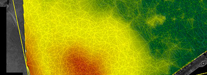
There are two portals for working with free data: EO Browser and Sentinel Playground. EO Browser allows you to view, analyze, and download materials from medium and low-resolution Sentinel satellites, Landsat -5, 6, 7 and 8, Envisat, Meris, MODIS, GIBS, and Proba-V. Sentinel Playground allows you to view and analyze mosaics of images obtained from Sentinel-2, Landsat-8 and MODIS. For each image, you can apply one of eight channel combinations.
Sentinel Collection
Stored on the Copernicus Open Access Hub. The portal provides the ability to search, view, and download materials from the entire group of Sentinel satellites. The service's interface and functionality are quite limited, but it gathers the most recent images from satellites.
INPE Image Database
National Institute for Space Research of Brazil (INPE) has its own catalog of images, especially for South and Central America and Africa. Here, you can use the following data: Aqua, Terra, Suomi-NPP, DEIMOS, UK-DMC 2, CBERS-4 ResourceSat, Landsat-8.

Free Radar Data and Free Digital Terrain Models
In addition to optical-electronic images, there are databases with free radar data and digital terrain models. Some of this information is available on the portals mentioned above (for example, Sentinel-1 radar data on the portal or the SRTM 30m digital model and ASTER DEM 30 v on the portal ), but there are also more specialized web services. Let's consider the main ones.
Canadian Government Portal, where Radar data Radarsat is presented. Part of the Radarsat-1 archive is available to the public.
Japan Aerospace Exploration Agency (JAXA) Portal with access to the global digital terrain model ALOS World 3D - 30m (AW3D30) with a resolution of 30 meters. To access the portal, you need to complete the registration. The freely distributed DTM with a resolution of 30 meters is created based on more detailed DTMs with resolutions of 2.5 and 5 meters, distributed on commercial terms.
Site of the Polar Geospatial Center at the University of Minnesota where the open digital model ArcticDEM with a resolution of 2 meters for the territory north of 60° North latitude is presented.
To obtain up-to-date information on the availability of radar satellite images and digital terrain models and their selection for the territory of interest to you, send a technical task or coordinates of the site to e-mail: innoter@innoter.com. For consultation, contact by phone: +7 (495) 245-04-24