The high demand for space information is due to the rapid development of computing technology and the improvement of geographic information systems, for which remote sensing data are the main source of data. The urgent need for space imagery data has led to the emergence of a whole range of imaging devices with ultra-high spatial resolution. The accuracy of georeferencing and detail of the images obtained made it possible to create large-scale maps and plans on their basis, which was previously possible only with the use of aerial surveys. The high demand for space imagery products has led to the fact that the relevant market segment is increasingly being developed by companies with private capital. This is characteristic not only of the USA, where it has become government policy to support private business and transfer to it a number of data acquisition functions in the interests of government agencies, but also of such countries as Israel, France and India.
It is worth noting the effective scheme of interaction between the state and the private sector developed in the USA. Commercial satellites provide information to government agencies on the basis of guaranteed contracts. At the same time, operators use part of the resource (about 50%) to generate super-resolution space images for sale on the world market.
Unfortunately, Russia has not developed a policy of space systems utilization, and "big business" does not consider this industry as an area of its interests, although the country's information security depends on it. Below we will consider the current ultra-high resolution optical-electronic and radar space systems. And the emphasis will be made not on the use of images obtained by them (there are more than enough such publications), but on technical features and characteristics of the equipment, information about which is extremely scarce and scattered.


Basic parameters of optical-electronic spacecraft
Since 1999, more than 15 civil spacecraft (SC) with optical-electronic equipment have been developed and launched worldwide, providing images with a resolution of 0.4–1.0 m, which have found wide application in land use, during cadastral work, design and construction of engineering structures, exploration of hydrocarbon deposits, creation of topographic maps and plans. The developers of the first ultra-high resolution satellites were exclusively American companies, but since 2006, launches of similar devices have been carried out by: Israel (EROS-B, Russia Resurs-DK, Korea Kompsat-2 and India Cartosat-2. However, the USA still maintains technological leadership , as evidenced by the launch into orbit of such devices as GeoEye-1 , WorldView-1 , WorldView-2 , WorldView-3 , WorldView-4 with a resolution of 0.3–0.5 m.
The main parameters of ultra-high-resolution optoelectronic spacecraft and the characteristics of their on-board imaging equipment are given in Tables 1 and 2:
Table 1. Parameters of ultra-high-resolution optical-electronic spacecraft
|
CA |
A country |
Launch date |
H, km |
i, degree |
TKA , _ min |
Incline, degree |
W, W |
Size, m×m |
Weight, kg |
Term, years |
|||
|
Existing |
|||||||||||||
|
USA |
09.24.99 |
681 |
98.1 |
98.3 |
45 |
600 |
1.8×1.6 |
720 |
5-7 |
||||
|
USA |
10/18/01 |
450 |
97.2 |
93.4 |
50 |
563 |
3.0×1.8 |
1028 |
5-7 |
||||
|
USA |
06/26/03 |
470 |
97.2 |
92.6 |
50 |
625 |
1.9×1.2 |
360 |
5 |
||||
|
Israel |
01.03.06 |
500 |
97.3 |
94.8 |
45 |
800 |
2.3×4.0 |
350 |
10 |
||||
|
Russia |
06/15/06 |
361-604 |
70.4 |
94.0 |
40 |
- |
7.9×- |
6570 |
3 |
||||
|
Korea |
07/28/06 |
685 |
98.1 |
98.5 |
56 |
955 |
2.6×2.0 |
800 |
5 |
||||
|
India |
10.01.07 |
637 |
97.9 |
97.4 |
45 |
900 |
2.5×2.4 |
680 |
7 |
||||
|
USA |
09/18/07 |
496 |
97.2 |
93.0 |
40 |
3200 |
3.6×2.5 |
2500 |
7.25 |
||||
|
India |
04/28/08 |
635 |
97.9 |
97.4 |
45 |
900 |
2.5×2.4 |
690 |
7 |
||||
|
USA |
08.10.08 |
684 |
98.0 |
98.0 |
50 |
3862 |
4.4×2.7 |
1995 |
7 |
||||
|
USA |
08.10.09 |
770 |
97.8 |
100.0 |
40 |
3200 |
4.4×2.5 |
2800 |
7.25 |
||||
|
France |
2011 |
694 |
90.2 |
45 |
45 |
1500 |
1000 |
||||||
|
USA |
2012 |
- |
- |
- |
- |
- |
- |
- |
- |
||||
|
Russia |
2012 |
- |
- |
- |
- |
- |
- |
- |
- |
||||
Table 2. Parameters of on-board imaging equipment and output parameters of the spacecraft
|
CA
|
Optical-electronic camera parameters |
Memory parameters and transmission of information. |
Output parameters of the space system |
|||||||||
|
f, m |
d, cm |
Size p, µm |
Quantity p |
Capacity, Gbit |
Speed, Mbit/s |
Capture, km |
M C |
Resolution, m |
||||
|
PAN |
MS |
PAN |
MS |
PAN |
MS |
|||||||
|
Existing |
||||||||||||
|
IKONOS-2 |
10.0 |
70 |
12 |
48 |
13500 |
3375 |
80 |
320 |
eleven |
68000 |
1.0 |
4.0 |
|
QuickBird-2 |
8.8 |
60 |
12 |
48 |
27568 |
6892 |
128 |
320 |
16.5 |
51000 |
0.6 |
2.4 |
|
OrbView-3 |
3.0 |
45 |
6 |
24 |
8000 |
2000 |
32 |
150 |
8 |
157000 |
1.0 |
4.0 |
|
EROS-B |
5.0 |
50 |
7 |
No |
10000 |
No |
2×120 |
450 |
7 |
100000 |
0.7 |
No |
|
Resurs-DK1 |
4.0 |
50 |
9 |
- |
36000 |
- |
768 |
300 |
28.3 |
90000 |
1.0 |
3.0 |
|
KOMPSAT-2 |
- |
- |
- |
- |
15000 |
3750 |
64 and 96 |
320 |
15 |
137000 |
1.0 |
4.0 |
|
Cartosat-2 |
5.6 |
70 |
7 |
No |
12288 |
No |
64 |
105 |
9.6 |
114000 |
0.8 |
No |
|
WorldView-1 |
8.8 |
60 |
8 |
No |
35000 |
No |
2200 |
800 |
16.4 |
113000 |
0.5 |
No |
|
Cartosat-2A |
5.6 |
70 |
7 |
No |
12288 |
No |
64 |
105 |
9.6 |
56000 |
0.8 |
No |
|
GeoEye-1 |
13.3 |
110 |
8 |
32 |
35000 |
9300 |
1200 |
740 |
15.2 |
51000 |
0.41 |
1.64 |
|
WorldView-2 |
13.3 |
110 |
8 |
32 |
35000 |
9300 |
2200 |
800 |
16.4 |
58000 |
0.46 |
1.8 |
|
Pleiades-1 |
12.9 |
65 |
13 |
52 |
30000 |
7500 |
600 |
465 |
20 |
53800 |
0.5 |
2.0 |
|
GeoEye-2 |
- |
110 |
- |
- |
- |
- |
- |
- |
- |
- |
0.25 |
- |
|
Resurs-P1 |
- |
- |
- |
- |
- |
- |
- |
- |
- |
- |
0.5-1 |
- |
GeoEye-1 allows simultaneous surveying in panchromatic and multispectral modes with spatial resolution of 0.4 and 1.6 m, respectively. An important feature of this spacecraft is the high accuracy of image coordinates, which is ensured through the use of a space platform with high stability and increased accuracy in determining the spatial position and orientation of the satellite.
In accordance with the manufacturer's data, the mean square error in determining the coordinates of terrain points from GeoEye-1 images is 1.5 m in plan without the use of ground control points. With increasing spatial resolution and accuracy of georeferencing of satellite images, it is possible to create maps and plans based on them up to a scale of 1:2000 (i.e., use them at the level of aerial photography materials). It seems that such positioning accuracy and the scale of the final products will distinguish between the areas of application of space and aerial imaging equipment for a long time.
Another technological advantage of the GeoEye-1 spacecraft is the ability of the device to rotate at high speed (4°/s) in any direction to redirect the telescope to a given area of the Earth, which allows you to receive a large number of frames on each orbit and carry out various shooting modes: frame, route , area, and also conduct stereo photography. With a capture width at nadir of 15.2 km and angles of deviation of the camera axis from it up to 40°, the system performance is higher than that of any other existing commercial platform. The characteristics of territory coverage for various survey modes of the GeoEye-1 spacecraft are given in Table. 3.
Table 3. Characteristics of territory coverage for various survey modes of the GeoEye-1 satellite
|
Working width and possible sizes of sections on one turn |
Nominal working width at nadir – 15.2 km Area of one frame – 225 km2 (15×15 km) Maximum area - 15,000 km2 (300×50 km) Square area 1°×1° - 10,000 km2 (100×100 km) Stereo filming area – 6,270 km2 (224×28 km) |
|
Maximum daily output |
Number of frames in panchromatic mode – 2400 Area in panchromatic mode – 700,000 km2 Area in multispectral mode – 350,000 km2 |
A cooperation of companies led by DigitalGlobe (USA) manufactured and launched two spacecraft - WorldView-1 and WorldView-2. The project involved Bell Aerospace (USA; platform), Kodak (USA; optical camera), BAE Systems (UK; processing system).
WorldWiew-1, weighing 2500 kg, is equipped with a telescope with a mirror with a diameter of 60 cm for imaging with a resolution of 0.45 m only in panchromatic mode with a swath width of 16.4 km. WorldView-2, weighing 2800 kg, is equipped with a large telescope with a mirror diameter of 110 cm for imaging with a resolution of 0.45 m in panchromatic mode and 1.8 m in multispectral mode (eight spectral channels). The width of the swath on the ground when shooting at nadir will be 16.4 km at an orbital altitude of 770 km.
To achieve high image quality, an optical system with high contrast and an optimized signal-to-noise ratio is used, as well as time delay and signal accumulation (TDI) technology on multi-line CCD structures (6 accumulation modes from 8 to 64 times). Both spacecraft are equipped with on-board recorders with a capacity of 2.2 Tbit and an ultra-high-speed (800 Mbit/s) radio data link. The period of active existence is 7 years or more. To increase performance, the orientation system uses torque control gyroscopes, which allow the speed of re-aiming the telescope to shooting objects to be increased to 4.5°/s. The equipment can perform shooting in frame, route (including complex configurations, for example, along the coastline, road, oil pipeline or state border), area (60x60 km areas) modes, as well as in the mode of forming stereo pairs.
There is also the possibility of programming the shooting and reception of information at the client station (virtual operator) during one radio communication session. Full commercial operation of the WorldView-2 satellite was scheduled to begin in January 2010.
An important feature of the considered promising spacecraft is the high accuracy of image coordinates, which is achieved through the use of a space platform with high stability and improved accuracy in determining the satellite’s orientation. Thus, the coordinate accuracy of WorldView-1 spacecraft images without the use of ground control points is estimated at 5.8–7.6 m (CE90), with ground control points within the image - 2 m, with control points on adjacent images - 3– 3.5 m (Accuracy Transfer Service - ATS technology). The planned coordinate accuracy of the images will make it possible to create maps at a scale of 1:10,000 without the use of ground control points.
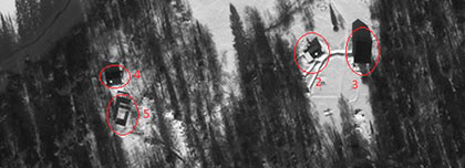
Satellite images of ultra-high spatial resolution will be used in the development of large-scale maps and terrain plans, in various thematic GIS, in urban planning, construction of roads, communication lines, pipelines and other infrastructure facilities. In the case of sustainable market development, millions of people can become consumers of spatial data based on ultra-high resolution satellite images: drivers of cars equipped with navigation computers, GIS users, designers, builders, insurers, etc. A fragment of multispectral imaging from the WorldView-2 satellite is shown in Fig. 1.

Figure 1 - Fragment of multispectral imagery from the WorldView-2 satellite with a spatial resolution of 50 cm

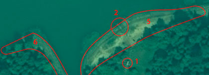
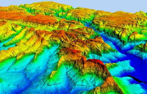
Figure 2 - Fragment of radar survey
Basic parameters of radar spacecraft
Radar images can be obtained regardless of weather conditions and illumination in the target area and allow shooting requests to be completed within several days. In addition, space radar images make it possible to create digital terrain models, and special interferometric imaging technologies make it possible to determine minor ground movements. Considering that the existing radar space systems RADARSAT-1 (Canada), ERS-2, ENVISAT-1 (both ESA) and ALOS ( Japan) provide terrain resolution no better than 8 m, which does not meet modern requirements, we will compare ultra-high resolutions according to main parameters (Table 4).
Table 4. Characteristics of radar spacecraft
|
Name |
Side |
Launch date |
Resolution, m |
Range |
Capture, km |
|
Existing |
|||||
|
SAR-Lupe |
Germany |
12/19/06 |
0.5 |
X |
5x5 |
|
TerraSAR-X |
Germany |
06/15/07 |
1.0 |
X |
10×5 |
|
Italy |
06/08/07 |
1.0 |
X |
10 |
|
|
COSMO-Skymed-2 |
Italy |
09.12.07 |
1.0 |
X |
10 |
|
COSMO-Skymed-3 |
Italy |
10/24/08 |
1.0 |
X |
10 |
|
|
|||||
|
COSMO-Skymed-4 |
Italy |
2010 |
1.0 |
X |
10 |
|
TerraSAR-L |
England |
2010 |
1.0 |
L |
10 |
|
Tandem-X |
Germany |
2010 |
1.0 |
X |
10×5 |
|
TONSILS |
India |
2010 |
1.0 |
WITH |
10 |
On June 15, 2007, the civilian satellite TerraSAR-X was launched , which provided radar imaging with a resolution of 1 m. In terms of its impact on the geoinformatics market, this event can be compared with the appearance in orbit of the IKONOS-2 spacecraft with meter-resolution optical equipment. Radar images with a resolution of up to 1 m are close in quality to highly detailed optical images, but can be obtained under any weather conditions and illumination in the target area.
According to Russian operator companies, customers have to wait from a week to a month for the results of optical surveys of objects in central Russia, while radar equipment will make it possible to fulfill requests within a few days after the order. In addition, space radar images make it possible to generate digital terrain models to create topographic maps of vast territories, which is outdated in the map stock. Radar images complement those obtained in the visible and infrared ranges, increasing the amount of information available and its reliability. With the advent of radar space systems with resolution comparable to systems in the visible range, the possibilities of remote sensing of the Earth from space are increasing manifold.
Launching into space orbital constellations of several satellites, such as SAR-Lupe and COSMO-Skymed, significantly increases the efficiency of surveying. True, SARLupe and COSMO-Skymed spacecraft are not commercial projects.
Special interferometric survey technologies make it possible to determine minor ground movements - this data can be used to monitor the condition of pipelines, detect illegal tappings into oil and gas pipelines and assess seismic hazard. Interferometry combines complex images captured by antennas at different viewing angles or at different times. Based on the results of comparing two photographs of the same area of the terrain, an interferogram is obtained, which is a network of color stripes, the width of which corresponds to the phase difference in both exposures. Due to the high frequency of radiation, movements are recorded with centimeter accuracy.
All data is provided in digital form, which ensures objectivity and unambiguous interpretation. Interferometry can be considered as an alternative to traditional stereophotographic technology for creating topographic maps. The simplest way to estimate displacements is to compare a pair of satellite images from different times. Two interferograms make it possible to identify any changes that have occurred on the Earth's surface (landslides, precursors of earthquakes), and also to track changes in soil moisture (flooding problems) using fluctuations in the characteristics of radio signals. To obtain reliable results, a number of conditions must be met, for example, launching a satellite for repeated exposure to an area of outer space close to the first exposure; one shooting season (albeit in different years) for a similar state of the reflective surface (vegetation cover, hydrogeological conditions).
These problems are largely solved with the help of a tandem of satellites that move in the same orbits with a flight interval of 24 hours. Space information from the TerraSAR-X satellite can be used in mapping, urban planning, disaster relief, and in transport construction , agriculture and forestry. Marketing of TerraSAR-X space information will be carried out by Infoterra GmbH (Germany), which offers foreign clients to receive radar images at their own receiving stations.
The German space agency DLR developed a complementary satellite, Tandem-X , which was launched on 21 June 2010 for a formation flight with TerraSAR-X for operational high-precision interferometric surveys. To summarize, the remote sensing data obtained from these satellites provides:
- Highest spatial resolution for radar systems (up to 1 m);
- Possibility of round-the-clock all-weather observation of any objects on the earth's surface;
- Obtaining high-precision DEMs using interferometric methods;
- Monitoring even minor (up to 1 mm) surface movements;
- High efficiency of order fulfillment.
Equipping the TerraSAR-X satellite with the latest synthetic aperture radar, which allows imaging of the earth's surface with unprecedented spatial resolution, makes the system one of the most advanced Earth remote sensing tools (along with COSMO-Skymed ). The satellite is in a sun-synchronous polar orbit with an altitude of 514 km and an inclination of 97.44°. TerraSAR-X has an estimated orbital lifespan of about five years. The radar surveys the earth's surface in the X-band wavelengths (3.1 cm) with variable polarization of radiation (HH, VH, HV, VV), shooting angles can be varied from 20 to 55°. Technical characteristics of the TerraSAR-X spacecraft are given in table. 5:
Table 5. Technical characteristics of the TerraSAR-X spacecraft
|
Launch date: 06/15/2007 |
||||
|
Spectral range |
3.1 cm – (X-band) |
|||
|
Modes |
High Resolution SpotLight |
SpotLight (High Definition) |
StripMap (High Resolution Broadband) |
ScanSAR (Medium Resolution) |
|
Nominal spatial resolution |
1m |
2 m |
3m |
16 m |
|
Stage size |
5 km X 10 km |
10 km X 10 km |
30 km X 50 km |
100 km X 150 km |
|
Data transfer rate |
300 Mbit/s |
|||
|
Radiometric resolution |
8 pages |
|||
|
File Format |
CEOS |
|||
|
Treatment |
Radiometric, sensory and geometric correction. Reduction to a map projection, creation of DEMs, derivative cartographic products |
|||
|
Frequency of shooting |
Maximum - 4.5 days, in 95% of cases - 2 days |
|||
|
Order completion time |
1-3 days for archived data 1-6 days for custom shooting |
|||
|
Minimum order area |
One standard scene for any of 4 modes |
|||
The high demand for space information and the effective policy of interaction between the state and private business have allowed a number of countries to create commercial space systems with ultra-high resolution (up to 0.4 m), which provide information to government agencies on the basis of guaranteed contracts, while simultaneously generating products for sale on the world market. High competition among developers of space systems has led to a significant improvement in the technical characteristics of equipment, a reduction in the development time of systems and a reduction in the overall parameters of the spacecraft. Among the achievements, noteworthy are the production of telescope mirrors from lightweight materials, the latest technology for polishing them, and the use of more advanced matrices with a pixel size of 6–8 microns, working using the technology of time delay and signal accumulation. The onboard equipment of all considered spacecraft includes stellar and high-precision gyroscopic sensors, GPS signal receivers, which are used to determine the angular and spatial position of the vehicles in orbit. The characteristics of surveying and measuring equipment make it possible to create, using satellite images, topographic maps at a scale of 1:10,000 and smaller without ground control points and topographic plans at a scale of up to 1:2000, if available.
Lavrov Viktor Nikolaevich, Geospatial Agency Innoter