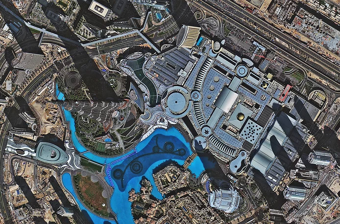
An offer is currently available for imagery captured by SuperView-1 satellites with a spatial resolution of 50 cm.
- The cost of archival imaging* when ordering more than 600 sq. km will be only $6.00 (instead of $10.00).
- The cost of new imaging when ordering more than 500 sq. km will be only $9.50 (instead of $18.00).
The price is per 1 sq. km for L1 data or L2A geometrically corrected data.
SuperView-1 conducts imaging in panchromatic mode with a resolution of 50 cm and in 4-channel multispectral mode with a resolution of 2 m. The imaging swath width is 12 km. The maximum size of the captured scene is 60 km × 70 km. The SuperView-1 satellite constellation allows for data acquisition from an area of up to 700,000 sq. km in a single day.
Order high-resolution satellite images from SuperView satellites starting at $6.00/sq. km!
This offer is valid until June 30, 2021.
To order satellite data, please contact us by phone: +7 (495) 245-04-24 or by email: innoter@innoter.com.
*Archival imaging refers to existing imagery of a specific area that can be obtained in the shortest time.

Burj Khalifa Skyscraper, Dubai, UAE, captured by SuperView-1 satellite, spatial resolution 0.5 m, imaging date 2018.02.06
