Press releases and announcements
-
2025
-
2024
-
2023
-
2022
-
2021
-
2020
-
2019
-
2018

Happy New Year 2026 and Merry Christmas!
Happy New Year 2026 and Merry Christmas!


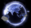
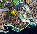
GEO INNOTER at ISPRS Geospatial Week 2025
The company “GEO INNOTER” represented by the Development Director - Felix Fokin, is taking part in the international conference ISPRS Geospatial Week 2025, which will be held from April 8 to 11 in Dubai.

GEO INNOTER team will participate in the the 3rd Joint International Scientific and Technical Conference “DIGITAL REALITY: Space & Geospatial Data, Processing Technologies
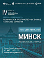
We are pleased to announce that GEO INNOTER team will participate in the the 3rd Joint International Scientific and Technical Conference “DIGITAL REALITY: Space & Geospatial Data, Processing Technologies”, September 16-19, Minsk Belorussia .
The report from GEO Innoter will be presented by the Owner of the company Fokin Felix , the topic of the report is "Legal regulation of the Earth remote sensing market in Russia"


Special price on all images from Chinese satellites!
Innoter offers a special price on both radar and spectral images from Chinese satellites!


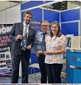
Employees of LTD "GEO INNOTER" from September 6 to 9 in Irkutsk.
Chief Engineer - Evgeny Zazulyak and Director for Corporate and Government Segments - Tatiana Kuleshova will take part in the joint International Conference "DIGITAL REALITY".
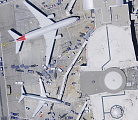
High resolution images at up to 47% off!
For SuperView-1 satellite imagery with spatial resolution of 50 cm there is a special offer till the end of June!
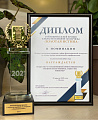
GEO Innoter LTD is the best partner of SI Imaging Services 2020
GEO Innoter was recognized as the best partner in Russia of SI Imaging Services (SIIS) for delivery of space images from KOMPSAT satellites for 2020.

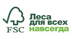
GEO Innoter was included in the register of the Forest Stewardship Council
Geospatial agency Innoter has been included in the list of companies providing digital services in forestry. The register of companies was compiled by the Forest Stewardship Council® (FSC)
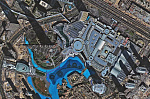
New product - archival UAV imagery
GEO INNOTER LTD together with Hexagon offers a new product for solving geospatial tasks - archival UAV imagery with resolution from 15 cm.
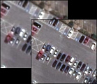
HD technology - improved resolution of space images up to 15 cm
Maxar Technologies has introduced a new technology to improve the visual quality of images (space images) - high-definition technology (HD).
Innoter Takes Orders on Satellite Earth Imagery
Th surveying season is already on! The free-carried order on 2020 satellite imagery is an optimal solution for those planning to use the Earth remote sensing data, but not having the final idea of financial resources yet.
Innoter accepts orders for new space photography of the Earth
The filming season has begun! The Innoter company accepts pre-orders without any obligation to purchase for space photography of the Earth.
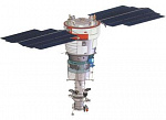
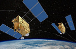
Resource-P 4 Satellite to be Launched Just in 2021
Resource-P 4 – a remote sensing satellite – is delayed in production. That’s why the launch date was corrected. The satellite deployment is currently shifted from the originally scheduled November 2020 to 2021.
BLACK FRIDAY AT THE INNOTER
Until the end of the year buying space images photogrammetric processing (orthophototransformation of digital image: by RPC coefficients and public matrix ALOS with grid spacing of 30 meters, with color correction of the resulting image, in a given coordinate system) as a gift

Satellite images TripleSat cover 95 per cent of 50 countries from around the world
For 2016 and 2019, a constellation of 3 satellites TripleSat Constellation, with a spatial resolution of 0,8 m, almost covered 100 per cent of 50 countries from around the world. We propose special conditions on the order of satellite images from TripleSat.

«Innoter» Ltd.: staff changes
We would like to inform you that since 1st July, 2019 Lavrov Viktor Viktorovich (Deputy Director-General – till 30th June, 2019) no longer works for the company «Innoter» Ltd.
The «Innoter» company is a leading spatial data supplier for 2018 year.
18th -19th July 2019, Barcelona hosted the International Conference ENGAGE 2019, one of the world’s major events in sphere of Land remote sensing.


Special offer for new imagery!
All recent archive imagery from DG's satellites constellation is available at the price of the standard archive!
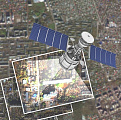
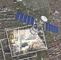
Canopus-B № 3, 4 Satellite successfully flight-tested
As it was announced by the press office of Roscosmos, the Russian outer space apparatus for Earth remote sensing Kanopus-V (a.k.a Canopus-B) №3, 4 launched on 1st February of 2018 had been successfully flight-tested.

Innoter at the 10th International Summit on the Commercial Use of Remote Sensing Data
From September 10 to 14, the delegation of the Innoter company took part in the 10th International Summit on the commercial use of Earth remote sensing data Summit on Earth Observation Business