



A digital elevation or terrain model, a seamless orthomosaic and a 3D model — in the projection and coordinate system per the ToR.
Search the site
What the service is used for
Topographic maps and plans
Compilation of topographic maps and plans from images.
Engineering surveys
Engineering-topographic plans for surveys.
Design and construction
Design and construction of buildings and structures on sites or parts thereof.
Archaeology
Archaeological excavations and studies.
3D models from satellite images
Automation of building spatial object models from satellite images.
Did not find your task?
Describe the territory, survey period and purpose. A specialist will check the archive and processing parameters.
What you will receive as a result of the work
01
3D model from stereo processing
A spatial model of objects from satellite stereo pairs.
Stereo processing of frames in specialised software yields a 3D model and automation of building spatial object models.
What you get
- a 3D model from stereo processing of remote sensing materials
- automation of building spatial models from satellite images
- stereo processing of frames and, if required, DEM and DTM
The 3D model composition is fixed in the terms of reference.
02
DEM and DTM
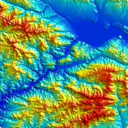
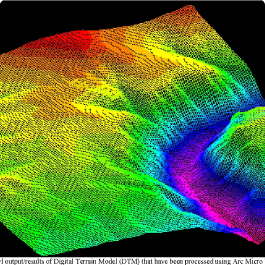
A digital elevation or terrain model in accordance with the ToR.
After orientation of the model or images, relief and contour information is collected and 3D vectorisation is performed in stereoscopic mode.
What you get
- a digital elevation model (DEM)
- a digital terrain model (DTM)
- 3D vectorisation of objects in stereo mode
- delivery in formats, projections and coordinate systems per the ToR
Availability and accuracy of the DEM depend on GCPs and source images.
03
Orthoimagery and orthomosaic
A photo image of the terrain in orthogonal projection and a seamless orthomosaic.
Digital transformation converts the source image into an orthogonal projection onto a horizontal plane. Next come a seamless orthomosaic, colour correction and cloud-cover correction.
What you get
- an orthoimage or orthomosaic (DOFP)
- colour correction and cloud-cover correction
- cutting into nomenclature sheets if required
- export to coordinate systems and projections per the ToR
GEO INNOTER delivers the finished product on electronic media or via FTP.
04
Maps, plans and cadastre data
Cartographic products and spatial data for the real-estate cadastre.
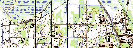
Office photogrammetric processing yields maps and plans, orthophotomaps and spatial data, including for the cadastre.
What you get
- topographic maps and plans from images
- orthophotomaps as a topographic-map backdrop
- spatial data for the real-estate cadastre
- thematic mapping materials for GIS
The accuracy of digital transformation meets the requirements of regulatory documents for maps of the corresponding scale.
How the work goes
Cost and timeline
The cost is made up of the image price and processing complexity: area, number of frames, GCPs, DEM and district category.
- ordering work on the card — from 8,000 ₽
- photogrammetry consultation — free of charge
- photo-image selection and preliminary analysis — free of charge
- ordering remote sensing images per the table — from 0.5 to 100 USD per 1 km² (archive or new survey, mono or stereo, resolution)
- in the order steps images are listed separately — from 8 to 200 USD per 1 km² (archive or new, mono or stereo, resolution)
- stereo processing of remote sensing materials — from 4 USD per 1 km²
- point-cloud processing — from 15 USD per 1 km²
- DTM / DEM creation — from 8 USD per 1 km², individually: volume of remote sensing data, availability of GCPs, DEM used
- orthoimage or orthomosaic (DOFP) — from 1 USD per 1 km², individually: data volume, GCPs, DEM
- timeline in the table — from 1–2 working days (volume, complexity category, availability of archival aerial photography)
- lead time on the work card — from 3 days
- in the timeline block: ToR agreement from 1 to 5 days; contract from 1 to 5 days; receipt of images from 3 days from the date of 100% advance payment; satellite-image processing from 3 days; total from 3 days
- in the order steps — from 5 working days from 100% advance payment for remote sensing materials, payment by bank transfer; remaining payment after completion
- in the FAQ the minimum term is from 5 working days
Order cost — from 8 000 ₽
Lead time on the card — from 3 days; in the FAQ and order steps — from 5 working days
Consultation and preliminary analysis — free of charge
What is needed for a quote
To prepare a preliminary proposal, provide:
- object location: district name, region, shapefile or another convenient form, and area
- requirements for the photography period: archive interval or the need for a new survey
- quality requirements: mono or stereo, aerial-image tilt angles, ground sample distance, cloud cover, sun angle, panchromatic or multispectral imagery
- exact coordinates of the area of interest
- maximum frame tilt angle, minimum sun angle, maximum allowable cloud-cover percentage
- requirements for remote sensing materials and output formats
Did not find a full set of parameters?
Describing the purposes for which the remote sensing materials are needed is enough. Specialists will analyse the requirements and propose an option.
Why Innoter
Archive without aviation approvals
Ultra-high and high-resolution satellite survey data can be obtained faster if the required territory is already in the operator's archives. A new satellite photography survey does not require approvals from competent authorities.
Large area of a single frame
The area of one satellite image greatly exceeds a frame obtained from an aircraft or UAV.
Measurement properties of aerial images
Frames from a lens onboard an aircraft or UAV have high visual informativeness and excellent measurement properties.
Specialised software and staff
Qualified specialists with long experience and specialised software for timely, high-quality execution of the work.
Non-contact measurements
Objects are studied remotely, including when the object is inaccessible or presence in the zone is unsafe.
Objectivity of the photograph
Images are obtained photographically, the survey is performed with precision cameras, and the images are processed by rigorous methods on precise instruments.
Processing stages, accuracy and source data
The composition depends on scale, GCPs, DEM and survey type: archive, new, mono or stereo.
1
Control data for photogrammetric densification are points of the state geodetic network, densification networks and survey geodetic network identified on the images, plus additional information from onboard aerial-survey instruments. Coordinates Xs Ys Zs can be determined by GPS, angular elements by inertial systems; because of cost and possible failures the photogrammetric method from GCPs is used more often.
2
After orientation of the model or images, relief and/or contour information is collected in a sequence set by the character of the mapped area. Then 3D vectorisation in stereoscopic mode and construction of 3D object models are performed.
3
An orthoimage is a photographic image of the terrain in orthogonal projection. Source materials for digital transformation: the digital image of the original photograph; interior and exterior orientation elements; a digital elevation model (DEM). The main domain is topography and cartography: transformed images in the map projection from a single image or from a strip with overlaps. In GIS, thematic mapping (interpretation) is performed from the processing results.
4
Root-mean-square errors and image resolution on the ground Lm from the source:
| Indicator | 1:500 | 1:1000 | 1:2000 | 1:5000 | 1:10000 | 1:25000 | 1:50000 |
|---|---|---|---|---|---|---|---|
| GCP RMSE in plan, m | 0,14 | 0,28 | 0,56 | 1,40 | 2,80 | 7,00 | 14,00 |
| GCP RMSE in height, m | 0,10 | 0,10 | 0,10 | 0,21 | 0,21 | 0,52 | 1,04 |
| Contour RMSE in plan, m | 0,35 | 0,70 | 1,40 | 3,50 | 7,00 | 17,50 | 35,00 |
| Contour RMSE in height, m | 0,18 | 0,18 | 0,18 | 0,35 | 0,35 | 0,88 | 3,76 |
| Image resolution on the ground Lm, m | 0,02 | 0,05 | 0,10 | 0,25 | 0,50 | 1,25 | 2,50 |
5
Ultra-high and high-resolution satellite photography can be obtained faster: it may already be in the operator's archives, and a new survey does not require approvals from competent authorities. The area of one satellite image greatly exceeds a frame from an aircraft or UAV. Frames from an aircraft or UAV have high visual informativeness and excellent measurement properties, but the survey takes longer because of flight-permit approval, relocation of the aircraft or UAV with operators, and a higher data cost per 1 km².
6
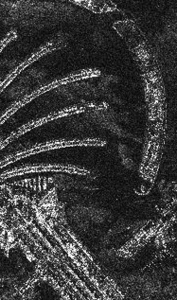
Besides cartography and cadastre, the source also lists military applications (topographic and special maps, photo documents, densification of geodetic control networks, coordinates of targets and own forces, trajectories of projectiles and rockets) and computer games (3D models of objects, realistic landscapes). Map compilation methods: combined — aerial photography only for the contour part of plans; stereotopographic — all processes on universal photogrammetric instruments (UP, AUP, stereoplotters). Instruments: professional digital cameras, television systems, scanning laser units, radar systems; office processing — measurements on stereocomparators.



Frequently asked questions
Answers to key questions about service parameters, timelines, deliverable formats and workflow. If you did not find what you need — contact us and we will help.
Photogrammetric work will require:
- territory of interest (location of the object in any convenient form, and area of the object);
- date or time interval for which archival imagery can be selected or new imagery can be taken;
- survey requirements (angle of the image, sun angle, resolution, type of survey, cloud cover)
The terms of photogrammetric processing (Image Processing) execution depend on the area of the territory, requirements to the survey parameters. The minimum term of photogrammetric works execution is from 5 working days
100% prepayment on the invoice for materials of remote sensing of the earth surface after signing the contract of photogrammetric processing (Image Processing) , the rest of the payment after the photogrammetric processing.
- Objects are studied using a non-contact (remote) method, which is of particular importance in situations where the object is inaccessible or when staying in the object's zone is unsafe for human life.
- The ability to obtain information about the condition of the entire object and its individual parts in a short period, for example, satellite images of the Earth's surface can be obtained within a few days.
- High labor productivity due to the fact that measurements are made not on the objects themselves but on their images.
- Complete objectivity and reliability of measurement results, as images of objects are obtained through imagery means.
- High measurement accuracy, as the imaging of objects is done with precision cameras, and the images are processed using strict methods with the help of precise instruments and electronic digital computers.
Photogrammetry is a scientific discipline that studies the shape, size and position of objects based on images in order to create plans and maps.
The science that allows using imagery, image processing methods and special technologies to obtain images and determine the spatial position of physical objects on the ground and their characteristics is called photogrammetry. In addition, photogrammetry can be considered as a new technology of remote sensing in determining geometric properties of objects, processes, analyzing them and providing information in graphical form on a group of images taken from different camera positions.
The basis of the photogrammetry method is images. The study and measurement of the geometry of the physical image of the images gives this basis a level of scientific approach and practical application
Photogrammetry - Also called metrophotography, phototopography, and topophotography, it is a method of obtaining a ground plan by means of photography. Any photographic image represents a perspective image
Photogrammetry - The use of photographic images to measure distances and areas in geodesy. Photographs taken from airplanes or orbiting satellites
Photogrammetry - A scientific and technical discipline concerned with determining the size, shape, and position in space of various objects from their photographic images.
The technical basis for the formation of photogrammetry was the invention of photography by the Frenchman Daggerome in 1839. In 1851-1859, Frenchman Lassedat developed a graphic version of photogrammetric drawing of plans of constructions based on their ground photographs.
Creation of aeronautics provided an opportunity to move from ground engineering photography to aerial photography. In 1858 Frenchman Nadar took the first photographs from a balloon. This was an important step in the development of photogrammetry - the aerial photo was closer to a terrain plan in its geometry.
The first aerial photographs from a balloon in Russia were taken on May 18, 1886. A.M. Kovanko. St. Petersburg was photographed by V.N. Sreznevsky's aerial camera from altitudes of 800, 1200 and 1350 meters. In 1910 the pilot Gelgar received the first photographs from an airplane in Russia.
At first, aerial photography was used mainly for military reconnaissance purposes.
The emergence and development of electronic computer technology significantly influenced the technology of photogrammetric image processing. Methods of spatial analytical phototriangulation were developed and widely used. There comes a period of creation and use of analytical stereophotogrammetric devices. Transformational functions in them were performed by computers. A device of this class - stereoanagraph - was created in our country. This period (60s - 80s of the XX century) was a transition to the stage of digital photogrammetry.
Digital image processing technologies are currently the main technologies for cartographic and engineering works.
The main application of photogrammetry is considered to be the creation of topographic maps based on photographs taken with specialized cameras. Cameras used to capture images from ground points are called photogrammetric theodolites, and the process of capturing images is referred to as photogrammetric. Cameras utilized in the aerial surveying process from aircraft, helicopters, or unmanned aerial vehicles are simply called aerial cameras, and the corresponding surveying is referred to as aerial photography.
Application of Photogrammetry in Film and Gaming Industry
In recent years, photogrammetry has found its place in the modern film industry, and the 3D technology for generating volumetric images in films has gained special popularity among young audiences. The art of animation has always captivated audiences with its mesmerizing end results in the form of popular animated films.
- Combined Method of Cartography: The main difference between the combined method and the stereotopographic method is that in the combined method, aerial photography is used only for creating the contour part of the maps.
- Stereotopographic Method of Cartography: With the stereotopographic method of cartography, all processes of image processing are carried out on universal photogrammetric instruments (UP, AUP, stereoplotters).
Currently, the coordinates XS YS ZS can be determined using GPS, and angular elements can be determined using inertial systems. However, since these systems can be expensive and may experience malfunctions, they are not always used. Therefore, the photogrammetric method of determining the elements of exterior orientation is employed - based on control points.
Control points are points whose coordinates are determined on the ground, typically in the Gauss geodetic coordinate system, and they are identified on the aerial imagery. By measuring the coordinates of the control points on the operator, a direct or inverse relationship between the points on the iimagery and the corresponding points on the ground can be established.
Photogrammetric processing of the survey is preceded by preparatory work, which includes the following steps:
b) Work technical designing of the operator processing processes;
c) Preparation of necessary materials and source data;
d) Preparation of technical equipment;
e) Preparation of editorial instructions;
f) Training of engineering-technical personnel and operators;
- Preliminary processes:
b) Work technical designing of the operator processing processes;
c) Preparation of necessary materials and source data;
d) Preparation of technical equipment;
e) Preparation of editorial instructions;
f) Training of engineering-technical personnel and operators;
- The preparatory processes are further detailed as follows:
- Collecting, studying, and evaluating the initial shooting and cartographic materials, materials from field topographic-geodetic surveys;
- Work technical designing of the photograph processing processes;
- Preparation of necessary materials and source data;
- Preparation of technical equipment;
- Preparation of editorial instructions (Editorial instructions are developed based on the technical project using all the primary and additional materials and the results of their analysis. Special attention is paid to poorly recognizable features of the terrain/surface, as well as features that cannot be directly identified from the main aerial photographs. For such features, sources are listed from which they can be displayed on the original photographs.);
- Training of specialists for the execution of the work.
Photogrammetry uses all modern surveying tools, including professional digital cameras, television surveying systems, scanner laser systems, radar systems and others.
Photogrammetric cameral processing consists in measuring images on special optical and mechanical devices (stereo comparators), allowing to obtain plan and height (spatial) position of objects on images, to observe them in four-dimensional coordinate system with changes in time and further compilation of topographic plans and maps.
- High measurement accuracy;
- High degree of automation in the measurement process, leading to the objectivity of their results;
- High productivity (as measurements are performed on images of objects rather than the objects themselves);
- Possibility of remote measurements in situations where human presence on the object is unsafe.

Need satellite imagery or help choosing the right data?
Describe your task, area of interest, and desired outcome. We will check data
availability, assess new acquisition options, and propose the optimal solution in terms of timelines, cost,
and quality.
Discuss the project
clients who trust us
25+ years in the geodata market







