



Report on the forest-pathological condition of the forest fund, thematic degradation maps, GeoTIFF and vector layers in Mid/Mif format.
Search the site
What the service is used for
Early detection
Timely observation, detection and diagnosis of pathological processes in forests and forest-fund plots.
Pest forecast
Forecast of pest development, mass weakening and dieback of forest species.
Pollution and damage
Assessment of stand pollution, adverse indicators and potential environmental and economic damage.
Forest-protection decisions
Collection and analysis of information on pathological changes to justify forest-protection and forestry operations.
Status reviews
Continuous observation of stand-stability dynamics and compilation of reviews of the forest-pathological condition of the forest area.
Did not find your task?
Describe the site coordinates, survey period and task — we will assess the RS archive and the scope of work.
What you will receive as monitoring results
01
Forest-fund status report
A written report on the forest-pathological condition of the forest fund and presentation materials.
During a forest pathological survey the causes of damage or death of stands, outbreak boundaries, the current sanitary condition, measures to prevent the spread of pests and hazardous trees are determined.
What you get
- report on the forest-pathological condition of the forest fund
- presentation materials
- text materials in electronic form and in printed form
Report composition and delivery form are fixed in the contract and terms of reference.
02
Forest degradation maps
Thematic maps of the territory with damage and degradation of forest stands.
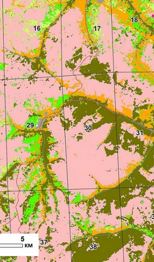
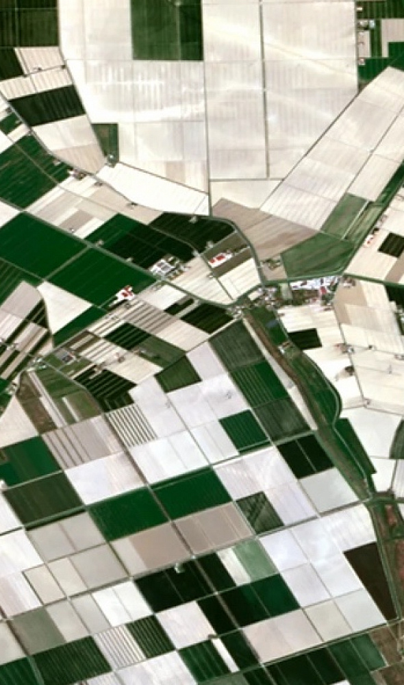
Satellite images are used to detect destructive changes in the foliar canopy by multispectral analysis. Progressive focal dieback indicates disease or pest impact; the archive of past months and years helps estimate the outbreak time.
What you get
- thematic forest-degradation maps
- mapping of damage and degradation of forest stands
- vectorisation of satellite-image classification
As a rule, high-resolution images are used for analysis; layer composition depends on the ToR.
03
GeoTIFF and vector layers
Georeferenced Tiff (Geo TIFF) and vector layers of detected objects in Mid/Mif format.
All required results are delivered on electronic media or via FTP; text materials are duplicated in printed form.
What you get
- georeferenced Tiff (Geo TIFF)
- vector layers of detected objects in Mid/Mif format
- if required — DEM or DTM from RS materials
The coordinate system and file set are agreed in the terms of reference.
04
Forensic imagery analysis
Based on the study, forensic imagery analysis of the forest-pathological condition of the territory can be performed.
The expertise is performed in addition to the monitoring report if needed for procedural purposes.
What you get
- option of forensic imagery analysis of the forest-pathological condition of the territory
The expertise composition is agreed separately from the main monitoring report.
How the work goes
Cost and timeline
The cost depends on the area of forests and stands and is calculated individually according to the terms of reference. The timeline depends on the monitoring area and survey-parameter requirements.
- consultation — free of charge
- image selection — free of charge
- image order — from 300 to 600 US dollars per image (the number of frames depends on the area)
- work of technical specialists — from 70,000 roubles (calculated individually)
- report compilation — from 50,000 roubles (calculated individually)
- total in the table and on the card — from 120,000 roubles (calculated individually)
- timeline on the card — from 20 days; in the FAQ, order steps and timeline block total — from 20 working days
- agreement of questions and imagery used — from 1 to 15 working days; contract signing — from 1 to 3 days
- image delivery — from 1 to 5 days from the date of 100% advance (timelines increase for a new survey)
- photo processing — from 10 to 35 days; interpretation and training-sample polygons — from 1 to 20 days
- classification vectorisation — from 1 to 5 days from the advance date; mapping of damage and degradation — from 1 to 5 days from the advance date
- report compilation — from 2 to 15 days
- in the order steps: 100% advance, payment by bank transfer only; timeline from 20 working days from receipt of 100% advance; imagery is paid separately (very high resolution from 300–600 USD)
- in the FAQ: 100% prepayment on the invoice for RS materials after the contract is signed, the rest after completion
Order cost — from 120 000 ₽
Timeline — from 20 working days
Consultation and image selection — free of charge
What data are needed for a quote
To assess feasibility, cost and timelines, please provide:
- position of the object of interest (coordinates, district or region name, shp file)
- period requirements: archive data or a new survey
- whether forest health monitoring has already been carried out on this territory
- monitoring frequency and dates for which the analysis is needed
- precise geographic coordinates of the object in the required coordinate system
- if available — images by acquisition time, spatial resolution, spectral bands and RPC georeferencing
If the listed information cannot be provided, describe the intended use of RS materials — specialists will analyse the request and propose the optimal option.
Describe the site, survey period and task — we will assess the archive and the scope of work.
Why Innoter
Prompt access to archives
Suitable archive imagery can be obtained faster when the required area and date are already available from operators.
No aviation clearances
A new satellite survey does not require the flight clearances typical of aerial surveys.
Large and remote areas
A single satellite pass covers large areas and makes it possible to work in hard-to-reach regions.
Direct agreements with operators
Distribution agreements help select archive imagery and order new surveys from different providers.
Software and server infrastructure
Modern software and computing capacity for quality control and processing of large data volumes.
Experienced specialist team
Years of experience on complex projects and specialists in cartography, photogrammetry and remote sensing.
Survey requirements, forest-health-survey methods and standards
For remote observations, satellite images with resolution from 1 to 30 m are used; the change-detection threshold depends on resolution.
1
For remote observations of the forest-pathological condition of forests, imagery of spatial resolution from 1 to 30 m inclusive must be used.
With multispectral satellite images of resolution from 1 to 3 m inclusive, changes are recorded on forest plots of 0.1 ha and more.
With multispectral aerospace images of resolution from 3 to 10 m inclusive, changes in sanitary and forest-pathological condition are recorded on plots of 1.0 ha and more (forest health monitoring procedure).
Image selection (resolution, mode, spectral range, frequency and other characteristics) is based on observation tasks. Acquisition time, spatial resolution, spectral bands and source georeferencing by RPC are required.
2
During a forest pathological survey the causes of damage or death of forest stands are determined; the location and boundaries of damaged stands; the current sanitary and forest-pathological condition; measures to prevent the spread of pests are prescribed; hazardous trees are identified.
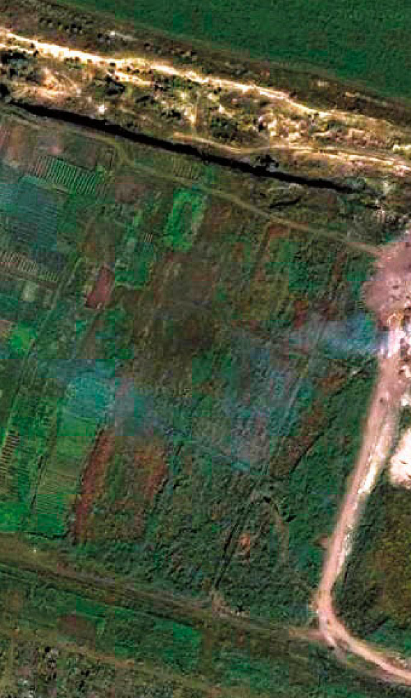
Multispectral analysis of high-resolution satellite images helps detect destructive changes in the foliar canopy. Progressive focal dieback indicates disease or pest impact. Archive images of past months and years show when the outbreak started and help forecast population development.
3
Compared with ground methods, satellite forest health monitoring promptly detects disease foci and the character of forest-fund changes; covers extensive, including hard-to-reach, territories at one moment in time; and tracks dynamics almost continuously.
Using UAVs, foci are detected promptly on small plots and territories are surveyed in minutes instead of several months of a ground expedition.
Aerial photography may be carried out in case of mass forest damage: more than 1 thousand ha in a strong forest-pathological threat zone, 10 thousand ha in a medium zone, 100 thousand ha in a weak zone, and for stands in hard-to-reach and remote territories.
4
The tasks and procedure of state forest health monitoring are defined by:
- Forest Code of the Russian Federation, Article 60.5. State forest health monitoring
- Order of the Ministry of Natural Resources of Russia of 05.04.2017 No. 156 “On approval of the Procedure for state forest health monitoring”
- Decree of the Government of the Russian Federation No. 2047 of 09.12.2020 “On approval of the Rules of sanitary safety in forests”
- Order of the Ministry of Natural Resources of Russia of 09.11.2020 No. 912 “On approval of the Rules for measures to prevent the spread of harmful organisms”
- Order of the Ministry of Natural Resources of Russia of 09.11.2020 No. 910 “On approval of the Procedure for forest pathological surveys and the form of the forest pathological survey report”
5
Forest health monitoring provides early detection of poor stand condition, assessment and forecast of the situation for timely planning of environmental and forest-protection measures, and makes it possible to prevent and reduce damage from pests and diseases.
A forest health survey is costly and labour-intensive, but refusal or untimely detection of diseases and pests can lead to catastrophic financial and environmental consequences. Preparation for the survey reduces costs and provides an overview of hard-to-reach areas where field visits are practically impossible.






Frequently asked questions
Answers to key questions about service parameters, timelines, deliverable formats and workflow. If you did not find what you need — contact us and we will help.
The following data set is required for forest condition assessment:
- Position of the object of interest (coordinates, name of district, region, shp-file, etc.);
- period requirements (period for which archive data can be used or a new survey is required);
- whether forest pathology monitoring has been conducted in the area.
The terms of execution of works on forest health monitoring depend on the area, requirements to the survey parameters. The minimum execution period is from 20 working days.
100% prepayment on the invoice for RS materials after signing the contract, the rest of the payment after execution.
For the organization of forest protection measures it is necessary to conduct a survey of the area of forest plantations and sanitary surveys based on the presence of active pest foci a plan to prevent the spread of pests is drawn up. If the forest fund area is owned by the Russian Federation or a state body, the survey and forecast are carried out by executive authorities or local self-government bodies.
According to the Forest Code of the Russian Federation, forests, including forest crops, are subject to protection from pests: viable plants of any species, varieties or biological types, animals, pathogens of any species and biological types that are capable of causing damage to forests and forest resources. Protection of forest crops is aimed at detection of pests and prevention of their spread, and in case of pest and disease outbreaks - their elimination.
The main forest pests to be monitored are: silkworms, star weaver, common pine sawfly, northern, minimizing and big birch sawfly, leafhoppers, elm red-breasted sawfly, mealybugs, sucker cicada and other populations.
To obtain NDVI (vegetation) index, spacecraft, airplanes, UAVs, multirotor drones equipped with NIR cameras are used. The survey is carried out from space or by air carriers from altitudes of 300-700 m, which allows obtaining the most accurate photo. On average, the productivity of this equipment allows to fulfill 5 thousand hectares per day
Yes, quarantine exists to protect forests, and it is carried out by special environmental security bodies.
Forest quarantine is a legal regime that provides for a system of state measures aimed at preventing the introduction and/or spread of quarantine pests to protect the country's plant resources
Established by the Russian authorities, as well as to ensure official control of pests, established by the executive authority that performs the functions of control and supervision in the field of quarantine and plant protection.
Organization of forest forest health monitoring consists of three stages and includes:
- preparatory works (preliminary system of forest health monitoring organization in the region, methods of its conducting are developed);
- preliminary forest pathology survey (ground methods can be used);
- planning of Forest health monitoring system.
Assessment of forests (assessment of forest plots and assessment of property rights arising from the use of forests) is carried out in accordance with the Federal Law of July 29, 1998 N 135-FZ "On Appraisal Activity in the Russian Federation", is applied by a state or local government body when determining the initial price of a tender for the right to conclude a lease agreement for a state or municipally owned forest plot.
Forest health is worth monitoring for many reasons. Here are just a few, which are the main ones:
- Forests provide climate stability. In particular, forests have a significant impact on one of the major greenhouse gases;
- Provide habitat for numerous species of animals and insects;
- Store water during rainy periods, preventing drought;
- Protect shores from erosion and soil scouring
LPM is the information basis of the state control over the sanitary condition of forests.
Local monitoring - is organized in each lesnichestvo;
Regional monitoring - is conducted on the territory of the subjects of the Russian Federation;
Federal monitoring - conducted on all forest lands of Russia.
This is the name given to activities conducted in order to obtain information on the current sanitary and forest pathological condition of forest areas, as well as to justify and prescribe forest protection measures.
It is carried out by visual, instrumental method, but more often combining one and the other. The ground method is used to accurately determine the boundaries of forest damage.
With the visual method, the condition of plantations and individual trees is assessed by eye.

Need satellite imagery or help choosing the right data?
Describe your task, area of interest, and desired outcome. We will check data
availability, assess new acquisition options, and propose the optimal solution in terms of timelines, cost,
and quality.
Discuss the project
clients who trust us
25+ years in the geodata market







