



A geodetic report with point coordinates, an orthophotomap of the specified scale and source images with RPC.
Search the site
What the service is used for
Georeferencing images to the ground
Georeferencing satellite images to objects with known geographic coordinates in order to determine the position of all objects in the image.
Distortion correction
Removing distortions caused by camera tilt, survey perspective and relief so that the image reflects real sizes and shapes.
Orthophotomaps and maps
Orthophotomaps and maps for interpretation, planimetric coordinates, distance and area measurements without additional distortion accounting.
Integration with GIS and cadastre
Combining satellite images with topographic maps, cadastral data and GIS for comprehensive territory analysis.
Field identification marks
Identification of contours on the ground and GNSS measurements; for a new survey — artificial high-contrast markers.
Need ground control points?
Send the territory, the task and accuracy requirements — we will estimate the number of points, remote sensing data and the timeline.
What you will receive as a result of the work
01
Report on geodetic works
Sketches, photographs of points on the ground and a list of their coordinates.
Control point coordinates are determined by geodetic methods, most often with dual-frequency GPS/GLONASS receivers. The report composition is fixed in the contract and the terms of reference.
What you get
- a list of ground control point coordinates
- sketches and photographs of points on the ground
- a report on geodetic works
The number of points and the layout depend on the project scale, terrain and required accuracy.
02
Orthophotomap of the area
An orthophotomap with the detail and accuracy of the required scale.
Ground control points refine image georeferencing so that the orthophotomap is suitable for interpretation, planimetric coordinates, distance and area measurements without separate distortion accounting.
What you get
- a digital orthophotomap of the required scale
- export to the required formats, projection and coordinate system
Scale, projection and coordinate system are set in the terms of reference.
03
Source satellite images
Images with a metadata file and RPC coefficients of the required spatial resolution — if needed.
Archival or new remote sensing data are purchased separately. The planimetric accuracy of a very high-resolution image from RPC coefficients in the source is from 7 to 30 m depending on the imaging equipment.
What you get
- source satellite images if needed
- a metadata file and RPC coefficients
The image delivery composition is agreed at the terms of reference stage.
04
Technical report
A report on the composition, stages and quality control of the work performed.
Results are transferred on HDD/CD or via FTP; textual materials — in paper form to the client's address.
What you get
- a technical report on the work performed
- materials in the agreed digital and paper formats
The method of transferring media and paper copies is fixed in the contract.
How the work goes
Real projects — real results
We solve complex challenges using advanced technologies and expertise in geospatial data.
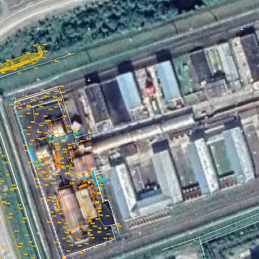

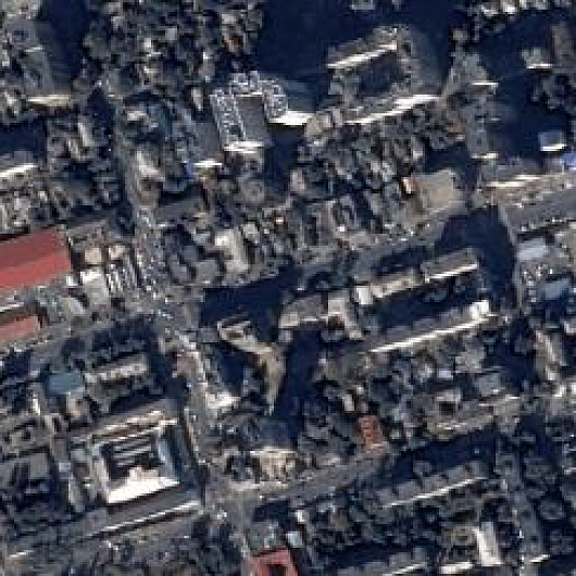

Cost and timeline
Price and timeline depend on the area and configuration of the territory, remoteness and transport accessibility, the number of points, availability of remote sensing materials and whether an orthophotomap is needed.
- consultation — free of charge
- selection of ground control points (if needed), preliminary analysis of source data, additional and reference materials — free of charge
- setting ground control points on the ground — from 4,500 rubles per 1 point; depends on the location of the territory, timelines and the number of points
- digital orthophotomap creation — from $1 USD per 1 km²; calculated individually and depends on the volume of remote sensing data, presence or absence of ground control points and the DEM used
- purchase of remote sensing data (images paid separately) — from $8 to $70 USD per 1 km² depending on the survey (archival or new, mono or stereo, resolution)
- order cost guide on the card — from 30,000 ₽
- timeline on the card and the total in the timeline table — from 10 days; in the cost table — from 10 working days; depends on volume, complexity category, availability of remote sensing materials, additional and reference materials
- timeline stages: alignment and analysis — from 1 to 5 days*; contract — from 1 to 5 days*; image acquisition — from 2 to 10 days**; photogrammetric works design — from 2 to 5 days*; determination of control point coordinates on the ground — from 15 days*; digital orthophotomap creation — from 2 days*; technical report — from 1 to 12 days (* working days; ** from the date of receiving 100% advance for remote sensing materials)
- payment: in the FAQ — 100% prepayment by invoice after signing the contract; in the order steps — 100% advance for remote sensing materials, bank transfer only; start of orthophotomap work — from 5 working days from the date of receiving 100% advance for remote sensing materials
Order guide — from 30 000 ₽
Setting a point on the ground — from 4,500 ₽
Timeline — from 10 working days
What is needed for a quote
To assess feasibility, cost and timeline, please send:
- the area of interest: location or coordinates of the object in any convenient form and the area of the object
- the specific task to be solved using the product to be created
- requirements: scale, detail, creation or update
- requirements for remote sensing data, additional and reference data
- work deadlines
- exact geographic coordinates of the object in the required coordinate and elevation system (specialists will refine coordinates submitted in any convenient form); if there is no information — the intended use of the data
If the listed information cannot be provided, describe the intended use of the data — specialists will analyse the requirements and propose an option.
Describe the territory, the task and the requirements — we will estimate the field work and remote sensing data.
Why Innoter
Sub-metre and centimetre georeferencing
Ground control points provide sub-metre georeferencing accuracy for satellite images and centimetre accuracy for aerial photographs.
Compensation of equipment distortions
Ground control points eliminate systematic distortions of onboard equipment when creating an orthophotomap.
One point instead of 7–30 m from RPC
The planimetric accuracy of a VHR image from RPC is from 7 to 30 m; when one ground control point is measured, orthophotomap georeferencing can reach 1 m.
Clear contours for identification
Power-line pylons, fence and curb corners are confidently interpreted on images of the required resolution.
Dual-frequency GPS/GLONASS
Coordinates are measured with GNSS receivers, most often dual-frequency GPS/GLONASS, with measurement control.
Artificial markers for a new survey
For a new survey, high-contrast artificial identification marks are installed if natural contours are insufficient.
Selection of identification marks, GNSS and orthophotomap accuracy
The composition depends on the area, accessibility of the territory, archive or new survey and the required accuracy.
1
Geodetic control points are points fixed on the ground with a set of planimetric and elevation coordinates. They are used to refine the georeferencing of satellite and aerial images of the Earth's surface: the coordinates of a distinctive object on the ground are measured and this object is identified in the image.
Control points are a basic element of creating accurate orthophotomaps and elevation matrices. They are needed to obtain accurate spatial coordinates of the Earth's surface or objects on it.
2
Ground control points make it possible to achieve sub-metre georeferencing accuracy for satellite images and centimetre accuracy for aerial photographs, and to eliminate systematic distortions of onboard equipment.
The geopositioning accuracy of a satellite image from RPC coefficients is generally lower than the accuracy of creating an orthophotomap of the corresponding scale. The planimetric accuracy of a very high-resolution satellite image from RPC coefficients is from 7 to 30 m depending on the imaging equipment. When one ground control point is measured, orthophotomap georeferencing accuracy can reach up to 1 m.
3
At the preparatory stage a planimetric and elevation control project is drawn up, survey boundaries and zones for identification marks are defined.
On the ground, in the project zones, identification is performed and clear contours that are confidently interpreted on images of the corresponding resolution are selected as marks: power-line pylons, corners of fences, curbs and barriers. In the field, less distinctive objects may be used — solitary trees, large rocks. For a new survey, artificial identification marks with high contrast relative to the terrain may be installed.
Well-visible static objects are selected for control points: building corners, road markings, railway crossings. The more points there are and the more evenly they are distributed, the higher the orthophotomap accuracy; the number depends on the project scale, terrain and required accuracy.
4
Geographic coordinates of the selected objects are determined by geodetic methods and equipment — GNSS receivers. Dual-frequency receivers with GPS/GLONASS navigation systems are used most often. Measurements are performed with high accuracy. The scope of work includes measurement control.
5
Issue alignment, analysis of remote sensing data availability, additional and reference data — from 1 to 5 days*. Contract signing — from 1 to 5 days*. Image acquisition — from 2 to 10 days**. Photogrammetric works design — from 2 to 5 days*. Determination of control point coordinates on the ground — from 15 days*. Digital orthophotomap creation — from 2 days*. Preparation of a technical report — from 1 to 12 days. Total in the table — from 10 days.
* working days. ** from the date of receiving 100% advance for remote sensing materials. Timelines depend on the number of km² and product type, availability of archival remote sensing materials, additional and reference materials, area and configuration of the territory, remoteness and transport accessibility.
6
Using archival and new high and very high-resolution satellite images with high-accuracy orbital georeferencing makes it possible to obtain orthophotomaps with high accuracy and detail without ground topographic and geodetic works to obtain control points. Satellite data are obtained more promptly because they may already be in the operator archive.
Using aerial images and UAV/drone images to create orthophotomaps requires a new survey, which takes more time because of special permits and a site visit. At the same time, orthophotomaps from aerial photographs have high visual informativeness and measuring properties.




Frequently asked questions
Answers to key questions about service parameters, timelines, deliverable formats and workflow. If you did not find what you need — contact us and we will help.
For reference points, clearly visible objects on the ground are selected - such as corners of buildings, road markings, railway crossings, etc. It is important that these objects are static and do not change their position over time.
The coordinates of control points are usually determined using geodetic measurement methods, for example, using GNSS receivers. These measurements must be made with high accuracy.
The more control points there are and the more evenly they are distributed throughout the area, the higher the accuracy and quality of the orthomosaic. However, their number and distribution depend on the scale of the project, the terrain and the required accuracy.
- territory of interest (location/coordinates of the object in any convenient form, and area of the object);
- a specific problem that needs to be solved using the products being created.
The duration of work on a set of reference points varies depending on the area and configuration of the territory of interest, as well as its remoteness and transport accessibility.
100% prepayment of the invoice after signing the contract.

Need satellite imagery or help choosing the right data?
Describe your task, area of interest, and desired outcome. We will check data
availability, assess new acquisition options, and propose the optimal solution in terms of timelines, cost,
and quality.
Discuss the project
clients who trust us
25+ years in the geodata market







