Contact
25+ years
of experience and expertise
150+
specialists on the company's staff
1+ million km2
area of real projects
Certified laboratory
in-house quality control

Who we are and what role we play

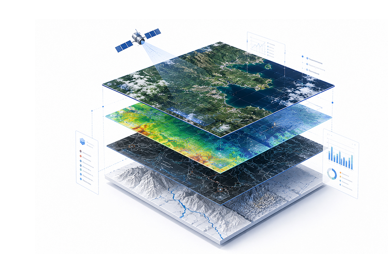
GEO Innoter is a geospatial agency that helps understand the Earth through data, not assumptions. We work with remote sensing, aerial photography, UAVs, photogrammetry, GIS, and analytics to turn complex geodata into clear solutions for those responsible for territories, infrastructure, and resources.

Our role is to be a partner that provides confidence: in what is happening at deposits and linear infrastructure, in forests and farmland, in coastal areas and cities. We help see the big picture across large territories and make decisions based on objective facts.

Why this matters right now

The world is changing rapidly: infrastructure is under growing strain, supply chains are becoming more complex, and natural and man-made risks are intensifying. Geodata has become a critically important resource — without it, it is impossible to manage territories effectively, plan development, or manage risks in real time.

Infrastructure
growing strain on infrastructure
Logistics
supply chains are becoming more complex
Risks
natural and man-made risks are intensifying
Territories
changes must be managed in real time
Satellite, aerial, and UAV data make it possible to see what cannot be seen from the ground: gradual deformations, deforestation, flooding, regulatory violations, unauthorized activity, and changes in land use. GEO Innoter helps translate these observations into the language of manageable metrics, criteria, and decisions.

Who we help

Since the early 2000s, GEO Innoter has been delivering projects for industries where the cost of error is especially high:
Oil and gas sector and geological exploration
Monitoring of fields, pipelines, and remote infrastructure. We help track changes in territories, identify risks, and obtain up-to-date data for exploration and production.
Forestry and agriculture
Monitoring the condition of forests, crops, land plots, and natural resources. Geodata helps assess change dynamics, identify problem areas, and plan work across large areas.
Ecology and nature management
Assessing environmental changes, the impacts of economic activity, and natural processes. We help document violations, monitor risks, and control the condition of territories.
Telecommunications and infrastructure
Support for planning, placement, and monitoring of communications facilities, roads, utility networks, and other infrastructure. Data helps monitor the condition of facilities and changes around them.
Territorial authorities and law enforcement agencies
Geodata for land use control, change monitoring, violation detection, and decision support. We help you see the situation in your territories objectively and in a timely manner.
Each task has its own role for geodata
For some clients, we become their "eyes" in remote areas; for others, a source of evidence in complex land and environmental cases; and for others, a tool for planning and monitoring major investment projects.
clients who trust us
25+ years in the geodata market

What we do: from data to spatial intelligence

We share the approach of the world's leading geodata companies: the value lies not in the images themselves, but in the information and insights extracted from them. Therefore, we are building a complete geodata management technology cycle:
1
Receiving data
space photography, aerial photography, UAVs, ground measurements
2
Processing and binding
Photogrammetry, radiometric and geometric correction, creation of orthophoto plans
3
Modeling
creation of digital elevation models (DEMs) and digital elevation models (DEMs), 3D and 4D terrain models
4
Analytics and monitoring
Thematic interpretation, change detection, risk-oriented monitoring of objects and territories
5
Expert solutions
Land management and environmental assessments, analytical reports, cartographic and GIS products to support management decisions.
From images to solutions
This is how we move from "we have images" to spatial intelligence — the ability to answer specific business and government questions: where change is happening, how critical it is, what the dynamics are, and what needs to be done next.

How we work with clients

Each project is built around the client's task, not around a set of technologies. Together with the client's team, we formulate key questions, select optimal data sources, monitoring frequency, and the format of results.
1
Let's formulate the problem
Together with the client's team, we define key issues, the area of ​​interest, and the expected format of the result.
2
Selecting data sources
We determine the optimal sources: space, air, UAVs, or a combination of these.
3
Configuring project parameters
We agree on the frequency of monitoring, data requirements, deadlines, and format for transmitting results.
4
We collect and process data
We receive materials, process them, check their quality, and prepare the data for analysis.
5
We pass the result on for work
We prepare reports, maps, dashboards, and conclusions that are easy to use in business and management processes. We stay in touch after the results are delivered.
Ready to get started?
Describe the task – we will select the data, format the result, and propose the optimal workflow.

Why they trust us

GEO Innoter is chosen when what is needed is not just information, but an independent, legally significant, and professionally verified view of the territory. This trust is based on several principles:
Comprehensive examination
comprehensive expertise in remote sensing, geoinformatics, photogrammetry, cartography, geology, and industry analytics
Certified laboratory
our own certified laboratory for processing remote sensing data
Licenses and sensitive data
licenses for geodetic and cartographic activities and experience working with data containing information constituting a state secret
Experience in complex projects
many years of experience implementing complex projects for industry, government agencies, and international clients
Materials that can be trusted in the official domain
For the client, this means that our materials and conclusions can be used in the regulatory and legal context: in expert assessments, inspections, approvals, reporting, and court proceedings.

History and development

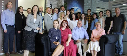
GEO Innoter has been forming as a team of experts for more than two decades. The company started with projects in satellite data and cartography and gradually built a full cycle — from image acquisition to in-depth applied analytics for industry-specific tasks.

Over this time, we have evolved from a geodata supplier to a partner accountable for results at the level of business metrics and management decisions. Today, we continue to develop processing technologies, 3D modeling, monitoring, and integration of geodata into clients' information systems.

Scale and geography

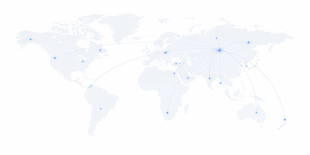
Annually, GEO Innoter supplies and processes 1.5–2 million km² of optical and radar data for projects across various industries. Up to 30% of the company's revenue comes from export projects. The geography of deliveries and completed work covers 40+ countries, and the network of experts and partners has been forming for more than 25 years.
We work with different types of territories — from point objects to vast regions and cross-border infrastructure.
1.5–2 million km2
of optical and radar data annually
40+ countries
geography of deliveries and completed work
up to 30%
of revenue from export projects
25+ years
network of experts and partners
clients who trust us
25+ years in the geodata market
Request a call back
Back to page top
Мы используем Яндекс.Метрика и собственные Сookies для обеспечения наилучшего опыта работы на нашем сайте, персонализации сайта для наших пользователей и аналитики. Продолжая использовать сайт вы соглашаетесь с условиями Пользовательского соглашения.