your companion in the world
of geospatial solutions
Operation mode:
Mon-Fri: 10:00 - 18:00
Sat-Sun: Non-working days

Satellite Imagery evidence in legal proceedings is a procedural action that involves conducting investigations and providing expert opinions on issues that require the use of satellite and/or aerial photographs and specialized knowledge. It is requested by the authority or individual authorized to appoint forensic expertise, in order to establish facts that need to be proven in a specific case.

The basis for conducting forensic expertise is a ruling or decision of the authority or individual authorized to appoint forensic expertise.

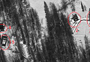
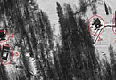
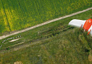
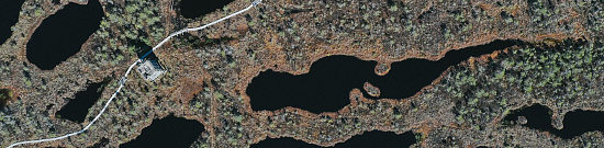
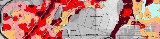
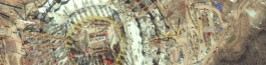
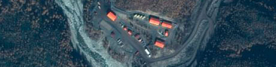
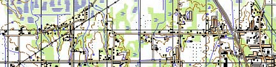
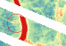
The use of satellite imagery and aerial images, which provide information about the present and the past, georeferenced in space and time, is a relatively new and indispensable method of evidence presentation in judicial practice. These images are valuable for proper verification, investigation of crimes, and presentation of cases in court. Traditional forensic examinations involve the detection, identification, collection, and cataloging of physical evidence for presentation in court, and Earth remote sensing data serves as evidential elements in a wide range of legal proceedings.

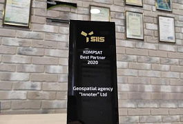
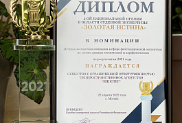
Geo Innoter LTD was recognized as the Best Expert Company in the field of forensic examination based on satellite and aerial imagery data for the year 2021 (Judicial and Expert Chamber of the Russian Federation, dated April 22, 2022).

What is the purpose of satellite imagery evidence in legal proceedings?

The purpose of satellite imagery evidence in legal proceedings is to resolve issues that require evidence in a specific case, using satellite or aerial photographs.

  • Describing the dynamics of changes (or lack thereof) in the condition of objects (crops, forests, quarries, buildings, etc.) on the ground;
  • Establishing the presence and dates of construction of residential, industrial, and other structures;
  • Identifying violations of land use conditions on specific dates;
  • Detecting violations of land boundaries and restricted areas on selected dates.
By using remotely collected imagery from sensors on board aircraft, unmanned aerial vehicles, satellites (traditional video and new digital monitoring images), and mobile-stationary platforms, law enforcement officials have the ability to assess where and when certain types of crimes occurred.

Insurance companies, when an event occurs, need to know the situation before, during, and after the event. The situation before the event can be analyzed using historical imagery, while the development of the situation during and afterwards can be captured through new customized satellite or aerial imagery.

For lawyers and attorneys, satellite imagery allows for the guaranteed presentation of the real situation on the ground on specific dates. For prosecutors and investigators, the use of satellite imagery helps prove the existence of damage and assess its extent during criminal investigations. The use of satellite imagery  evidence in legal and commercial disputes has been developed for over 20 years and is widely practiced worldwide.
Работник

Objectives and tasks of satellite imagery evidence in legal proceedings:

The purpose of geospatial expertise is to establish the truth, specifically the reliability, completeness, and accuracy. Forensic expertise using satellite imagery is required to objectively confirm facts in cases such as:

  • Illegal (or unauthorized) use of land;
  • Unauthorized occupation of land designated for agricultural purposes;
  • Illegal extraction of minerals, quarrying, deforestation, etc.;
  • Illegal construction in protected areas;
  • Evaluation of the accuracy of insurance claims and premiums;
  • Discharge of wastewater into water bodies, soil pollution;
  • Improper waste disposal;
  • And more.

Specific tasks of geospatial expertise include:

  • Locating boundaries and relative localization of objects;
  • Determining the presence, absence, or condition of an object using archival satellite imagery (e.g., determining the date of construction of buildings and structures);
  • Describing the dynamics of changes (or lack thereof) in the condition of an object;
  • Determining object parameters;
  • Identifying violations of land boundaries and land use conditions;
  • Determining the type of object (e.g., natural or man-made) and making assumptions about specific types/species of objects with varying degrees of probability;
  • Documenting the presence and extent of damage (damage assessment);
  • Environmental analysis and detection of illegal dumps;
  • Establishing the fact of crop failure;
  • Evaluating compliance with construction and land work deadlines;
  • Establishing the start date of specific construction work;
  • Establishing the date of building construction;
  • Establishing the date of residential building construction;
  • Establishing the date of waste dumping in a specific area;
  • Establishing the date of mineral extraction;
  • And other tasks.

Implementation Mechanism

The presentation of aerospace imagery (with confirmation of its authenticity) + georeferencing of imagery on the ground + interpretation results related to the subject matter of the investigation, serving as factual evidence during the investigation or in court based on the request for expertise by the parties involved in arbitration, civil, or criminal proceedings, including the detection, identification, collection, and cataloging of physical evidence using remote sensing methods.

Advantages of Remote Sensing Data

  • Availability of detailed and informative satellite imagery in archives dating back to 1999;
  • Source of objective information about the terrain and its changes;
  • Possibility of studying remote and inaccessible areas;
  • According to Article 64 and 89 of the Civil Procedure Code of the Russian Federation and Article 55 of the Criminal Procedure Code of the Russian Federation, expertise using satellite imagery is admissible as evidence in court;
  • Satellite imagery serves as irrefutable objective evidence of the state of an object on the ground on a specific date;

Professionals, through their experience and technical equipment, employ a comprehensive approach to image interpretation using remote sensing in the area of expertise. By creating the values of panchromatic and multispectral interpretation—a multi-purpose index used to measure the spectral quality and spatial detail of generated images—they can significantly improve the quality (realism of objects and territories) compared to the results of classical approaches to interpreting details of generated images.

Systematic monitoring of the Earth's surface using remote sensing methods constitutes the most important archive available in the world for any investigations. These images are stored in archives and can be retrieved at any time. The history of any territory can be reconstructed.

When properly applied, remote sensing methods save time and resources for forensic investigators in search of physical evidence.

Prices for services

Consultation Free of charge
Image search, preliminary analysis Free of charge
Image order From $300 to $600 per image (a minimum of two images is required)*
Work of technical specialists and experts From 15,000 rubles
TOTAL COST From 15,000 rubles

* - free of charge if the Client provides their own materials or if free images can be used.

The price of conducting a forensic expertise depends on the cost of the ordered images and the complexity of the work (including the number of images over the area of interest, the terrain relief, the overall volume, the number and complexity of the questions posed), and is calculated individually for each client.

The cost of execution is calculated on an individual basis, taking into account a specific of task.

After receiving the task description, we calculate the cost and send you a commercial offer.

Period of execution

The deadline for completing the work is 3 (three) business days from the date of receiving a 100% advance payment.

The timeline for conducting a forensic expertise depends on the complexity of the work and is calculated individually for each client.

How to place an order:

  1. STEP 1: Submit an application on the website with the following information:
    • Location of the object of investigation (coordinates, cadastral number, etc.);
    • Questions to be examined (subject of the investigation);
    • Dates for which the analysis is required.
  2. STEP 2: Agreement on technical requirements and cost:
    • Expertise starting from RUB 15,000;
    • Separate payment for the images (one high-resolution image starting from USD 300).
  3. STEP 3: Contract signing and commencement of work

    The work will be completed within 3 business days from the date of receiving a 100% advance payment. Payment is accepted only through non-cash transactions.

We work with individuals, legal entities, individual entrepreneurs, notaries, lawyers, government and municipal authorities, foreign clients, as well as when appointed by the court as an expert organization, etc.

Need for consultation?

Fill the form and we will contact you

By clicking the «Send» button, you give your consent to the processing of your personal data, in accordance with Federal Law No. 152-FZ of July 27, 2006 «On Personal Data», on the conditions and for the purposes specified in the Consent to the processing of personal data.

Stages of service provision

Stage 0 (PRE-Contract):

  • Identification of the research questions
  • Determination of dates (period under investigation)
  • Verification of the availability of archival images of the area
  • Verification of the feasibility of using the pre-selected images for the investigation

RESULT: Possibility (YES/NO) of providing the service

Stage 1 (PRE-Contract):

  • Agreement on the wording of the questions
  • Agreement on the use of archival images
  • Final determination of the workload, material costs, and agreement on the timeline and cost

RESULT: Signed contract

Stage 2 (Contract execution):

  • Receipt of 100% advance payment
  • Ordering of space or aerial imagery
  • Verification of the authenticity of the images, including licensing
  • Initial image processing
  • Orthorectification of the images (georeferencing)
  • Selection of technical solutions for image interpretation, taking into account the actual quality of the images
  • In-depth image processing for the area of expertise
  • Visual and automated image interpretation
  • Conducting the research
  • Legal verification of the obtained results
  • Preparation of the final report

RESULT: Written document (report)

The result of the provision of services

GEO INNOTER provides the person who appointed the judicial expertise with an expert conclusion - a written document (geodynamic study) reflecting the course and results of the conducted research using space or aerial imagery. The result of the research consists of conclusions on the questions posed to the expert. The provided written document by GEO INNOTER LTD holds evidentiary force in court.

In summary, the outcome of the work includes a set of documents and materials related to the expertise:

  • Expert conclusion with the expert's signature and the organization's seal;
  • Certificate confirming the absence of changes in the remote sensing material (metadata verification and anomaly detection due to machine or manual alterations);
  • Copies of the license authorizing the organization to conduct such work;
  • Copy of the expert's diploma;
  • Space and aerial images, maps, and other materials, if they were separately acquired by the client and/or provided by the client to LTD "GEO INNOTER".


Requirements for the Source Data

  • Accurate geographic coordinates of the object in the required coordinate system (GEO INNOTER specialists will clarify the coordinates provided by the client in any convenient form).
  • Images that correspond to the research questions based on criteria such as the time of capture, spatial resolution, and availability of the required spectral channels, with an initial georeferencing using RPC.
  • Orthorectified images (georeferenced on the ground) with the required accuracy.

Related services

Satellite imagery. Satellite data
Find out the price
Orthoimagery (Orthorectification)
Find out the price
Aerial & UAV imagery
Find out the price
Digital Topographic Maps
Find out the price
Thematic mapping
Thematic mapping
Find out the price
Environmental Monitoring
Find out the price
Заказ космической съемки. Космоснимки
Find out the price
Создание ортофотопланов
Find out the price
Создание и обновление цифровых топографических карт
Find out the price
Составление тематических и специальных карт, планов
Find out the price
Экологический мониторинг (экомониторинг)
Find out the price
Аэрофотосъемка (АФС / БПЛА)
Find out the price
Fokin Felix Yurievich
The material was checked by an expert
Fokin Felix Yurievich
Lawyer, work experience of 14 years, Education - Moscow State Law University named after O.E. Kutafin (MGLA)

Customers

Rosneft
Gazprom
Gazprom neft
Lukoil
Transneft

FAQ

  • Question to be investigated using satellite images evidence;
  • Area of interest (location / coordinates of the object in any convenient format, and the object's area);
  • Date or time interval.
This information is required by the specialist to determine the requirements for the images and check their availability in the archives of Earth observation satellite operators.

The terms of preparation of expert conclusions based on space imagery data depend on the volume and complexity of the order. The minimum term - from 3 (three) working days.
100% prepayment by invoice after signing the contract
The organization of such monitoring consists of multi-stage processing of space images of comparative nature for the same area of the terrain for a certain time period (5-10 years) with deciphering the features of changes in urban development, road network, electrical network, telecommunication infrastructure, soil, land, vegetation, water resource
The process of Earth observation expertise consists of six stages, which are summarized as follows:
  • Identification phase.
  • Preservation phase.
  • Collection stage.
  • Verification phase.
  • Analysis phase.
  • Presentation phase.
Yes, of course, if it is required to increase the detail of the object under investigation, to extract structural features from the object image, to create 3D models, 3600 overview, multimedia product, to get oblique imagery and texture of the image.
UAV remote sensing technologies have greatly improved the process of measuring, documenting and presenting physical evidence and crime scenes. The times when individual items were measured with a tape measure and the scene was documented with a few photographs are gone. Technology allows us to measure the entire area of the scene, literally hundreds of millions of points to an accuracy of 3mm using, for example, terrestrial laser scanners. The use of close range photogrammetry, allows us to extract three-dimensional data from photographs and video and document the position of objects and people. All of this helps to create a more complete, accurate, objective and verifiable data set for those who will decide the fate of the parties involved.
Phototechnical expertise is a technical and legal examination of space imagery materials for certain purposes of criminal, civil or arbitration proceedings (including detection of signs of editing and retouching on the images).
Forensic phototechnical expertise is a process of research and analysis of remote sensing imagery to detect forgeries, alterations or manipulations, as well as to determine the authenticity and integrity of the images.
The main aspects of a photographic forensic examination are:
1) Authentication: Determining the authenticity of the image and verifying its integrity to determine if any alterations or manipulations have been made. This may include determining whether retouching, editing, or digital alterations have been made.
2) Identification: Determining where and when the photograph was taken and identifying objects, persons or locations in the photograph. This may include analyzing background information, ground surface, vehicles, and other details.
3) Examination of digital traces: When analyzing aerospace imagery, metadata that contains information about the camera, shooting settings, date and time of creation, and other parameters are examined. Digital traces that may indicate alterations, processing or retouching are also examined.
4) Image Quality Assessment: The examiner analyzes various aspects of image quality such as resolution, sharpness, distortion and noise. They may also check for artifacts caused by spacecraft imagery.
5) Object identification: The expert analyzes the objects depicted in the imagery to determine their type, condition and other characteristics
The practice of using space images by lawyers and attorneys in court as evidence of the fact of an offense or the absence of an offense is widespread throughout the world, both in civil and arbitration proceedings and in criminal practice for the investigation of crimes
The use of space-based imagery in court involves the use of data and information derived from Earth observation satellites to resolve legal disputes and establish facts in legal proceedings. Space images can provide valuable information on changes in the terrain, the results of economic activities, establishing the date of the start of quarry operation, the time of occurrence of illegal dumping, establishing the size of the quarry as of the date, establishing the size of the dumping site as of the date, fixing illegal activities in the territory, and so on.

Space imagery can be used to determine site boundaries and resolve disputes over ownership of land or water resources. Imagery captures the condition of the terrain to determine boundaries.
Space imagery provides information on the state of the environment and can be used to detect violations of environmental regulations, such as illegal logging, illegal mining or pollution. Images allow comparing the current state with previous data and identifying changes.
Space imagery can be used to gather evidence in criminal cases or administrative violation cases. For example, imagery can confirm the presence of structures, land use in violation of laws, or other evidence of crimes.
The satellite imagery should be compared with other available data and evidence to make connections and provide a complete picture of what is happening.
Data collection: a set of satellite images are produced that cover the time period in which you want to study the dynamics of the object. The imagery can be acquired from space-based Earth sensing satellites or from aerial photography Object extraction: image processing algorithms are applied to extract the object whose condition you want to study. This can be individual buildings, urban areas, vegetation, quarries, etc. Object extraction may involve image segmentation, contour detection or pixel classification. Feature extraction: For each image, a set of features that characterize the state of the object is extracted. These can be parameters such as object area, object shape, spectral characteristics, etc. It is important to select features that reflect the changes in the state of the object that you are interested in. Analysis of change: Once the features are extracted, their change over time is analyzed. Statistical methods or machine learning are applied to identify patterns in the changes in the state of the object. Description of object change dynamics on the basis of space images is a common approach. By this method using space images the dates of construction start and completion (determination of construction date), dates of building erection, dates of construction works start, determination of mining start date, determination of quarry operation start date, time of illegal dump occurrence, determination of quarry size as of the date, determination of dump size as of the date, fixation of illegal activities on the territory, etc. are determined.
Satellite imagery has emerged as a vital tool for law enforcement in the pursuit of fugitives. Through the use of high-resolution satellite images, authorities can swiftly and accurately pinpoint the whereabouts of individuals on the run. This technology offers law enforcement a comprehensive view of a fugitive's location. High-resolution images unveil precise details such as the exact position of a fugitive's vehicle, or even their specific location if they are traveling by foot. This information enables law enforcement to swiftly and effectively pinpoint a fugitive's exact whereabouts. Furthermore, satellite imagery enables the tracking of a fugitive's movements over time. By analyzing these images, law enforcement can identify the route taken by the fugitive and the areas they have frequented. This aids in narrowing down the search area and focusing the investigative efforts.
Satellite imagery has emerged as an increasingly crucial instrument for crime scene investigations. Recent progressions in satellite technology have empowered investigators to gain a more holistic perspective of a crime site, aiding in the identification of suspects, evidence localization, and comprehensive scene analysis. In recent years, satellite imagery has served as a pivotal tool in pinpointing suspects across various cases. For instance, it was instrumental in identifying the perpetrators involved in the 2015 Paris attacks and the 2016 Brussels bombings. The detailed view of crime scenes provided by satellite images facilitated the identification of suspects and the evidence they left behind, significantly assisting investigators in their pursuit of justice. Furthermore, satellite imagery has proven pivotal in evidence localization at crime scenes. In one instance, satellite images were pivotal in pinpointing a firearm discarded in a body of water by a suspect. In another case, these images aided in identifying a stolen vehicle concealed in a remote location. In both scenarios, satellite imagery furnished investigators with an intricate view of the terrain, expediting precise and efficient evidence localization. This form of technology has altered the landscape of crime scene investigations, augmenting the precision and depth of investigative processes, ultimately shaping a more comprehensive and efficient approach to solving crimes using aerial perspectives.
You can visit our projects about expertises https://innoter.com/en/projects/otrasl/forensic-expertise/
Satellite imagery can be used as evidence in legal proceedings by providing visual documentation of geographic features, land use changes, or environmental conditions. Legal cases involving property disputes, environmental violations, land use planning, and territorial conflicts commonly benefit from the use of satellite imagery as objective and verifiable evidence.
The admissibility and reliability of satellite imagery in court depend on factors such as the source's credibility, resolution, and date of acquisition. To verify authenticity, experts may testify about the imaging process, and metadata, such as satellite sensor details and acquisition timestamps, can be cross-checked for consistency.
The temporal aspect of satellite imagery is crucial for establishing a timeline of events in legal cases. It allows legal professionals to track changes over time, identify the sequence of actions, and establish causation or patterns relevant to the case, whether it involves land use changes, environmental damage, or other dynamic scenarios.
High-resolution satellite imagery contributes to detailed site analysis by providing clear and detailed views of the terrain, structures, or activities in question. This aids in presenting a comprehensive view of the situation, allowing legal professionals to scrutinize specific features, assess conditions, and make informed judgments based on accurate and up-to-date visual evidence.
Satellite imagery plays a vital role in international legal disputes by providing objective and unbiased evidence across borders. In cases involving border conflicts or environmental violations with transboundary impacts, satellite imagery offers a neutral and verifiable source of information, aiding in the resolution of disputes and supporting evidence-based decision-making in international legal proceedings.

Licenses

License for implementation of geodetic and cartographic activities (page 1)
License for implementation of geodetic and cartographic activities (page 2)
Application for the license for implementation of geodetic and cartographic activities
ISO 9001:2015 Certificate of Conformity №СДС.ФР.СМ.00813.19 (page 1)
ISO 9001:2015 Certificate of Conformity №СДС.ФР.СМ.00813.19 (page 2)

Warranty

We guarantee 100% quality of service provision. By collaborating with GEO Innoter specialists, you eliminate risks and losses!

We ensure that the work is carried out in accordance with the following requirements:

Federal Law dated May 31, 2001, No. 73-FZ "On State Judicial and Expert Activities"
Order of the Ministry of Justice of the Russian Federation dated December 20, 2002, No. 346 "On Approval of Methodological Recommendations for Conducting Judicial Expertise in State Judicial Expert Institutions of the Ministry of Justice of the Russian Federation."

The presence of experienced qualified personnel who are skilled in working with specialized software is the solid foundation of our guarantees!

Our partners

Request a call back
Back to page top