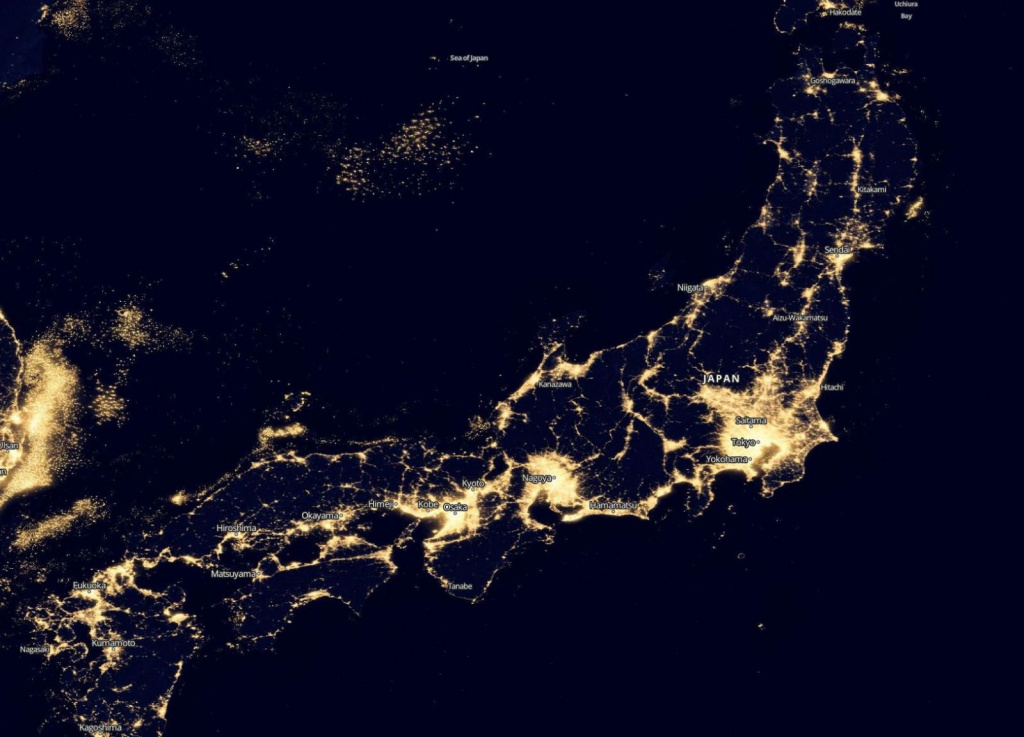
Nighttime Satellite Imagery are an exceptional source of geographical data about human activity and resources in dark, nocturnal conditions. The registered artificial light from space, including "dim lighting" and moonlight, highlights human activity in a way that is not possible during the daytime. Satellites equipped with sensors such as VIIRS (Visible Infrared Imaging Radiometer Suite) and DNB (Visible Infrared Imaging Radiometer Suite Day-Night Band) are capable of capturing images of the Earth at night, automatically transmitting data in the DNB. In recent years, there has been an increase in the number of low-orbit and geostationary satellites equipped with multispectral cameras in the visible (0.4–1 μm) and near-infrared to far-infrared (1–20 μm) ranges, capable of observing the Earth's surface at night. In the 1970s, the United States Department of Defense initiated the Defense Meteorological Satellite Program (DMSP) for nighttime Earth remote sensing, which was used by meteorologists in the USA to detect ice and snow clouds in the visible range under moonlight and to detect clouds in the infrared range without moonlight. The Operational Linescan System (OLS), an optical telescope with night vision capabilities, and the DMSP-OLS database were created, which is still used by both the military and civilians under the management of the National Oceanic and Atmospheric Administration (NOAA). Modern high-resolution satellite sensors (0.5-1 meter) allow detailed nighttime imaging using both still images and video streams. The combination of infrared imaging from various satellites at night provides good analytical results after processing, both for military and civilian applications. There is also development in night imaging capabilities on small satellites. For example, a highly sensitive video camera (sensor) for night imaging with a passband of 0.319 μm is already flying on Earth observation satellites with a resolution of 3 meters and a weight of only 20 kg.

Uses of nighttime satellite imaging:

Nighttime satellite imagery is created by detecting emissions from human activity on the planet, including infrastructure (city lights, villages, towns, industrial and agricultural facilities, mining, gas flares, fishing vessels, etc.) and natural lights such as fires, lightning, moonlight, microorganisms, and animals.

Satellite images of nighttime lighting have been used for decades as a global data source to study a wide range of socio-economic factors.

Nighttime Satellite Imagery has a wide range of applications in the following areas:

  • Defense and reconnaissance.
  • Protection of national borders.
  • Economic development and infrastructure.
  • Energy sector. Malfunctions and outages.
  • Distribution and population density of cities and rural areas.
  • Night search and rescue operations during emergencies. Fire outbreaks. Gas leaks.
  • Vessel detection.
  • Airports.
  • Fishing industry.
  • Geology.
  • Light pollution monitoring.
  • Analysis of urban areas' illumination and growth. Municipal services.

Geo Innoter is a leader in the CIS and Eastern Europe in the processing of aerial and space imagery and the creation of derived products. They have been repeatedly recognized as the best partner of leading global remote sensing satellite operators.

Работник

Purposes and Objectives of Nighttime Satellite Imagery

The purpose of nighttime Satellite Imagery to create a picture of the Earth's nighttime environment, specific regions, territories, and objects. This involves creating "night maps," photos, and video images that reflect the constant light emissions on the Earth's surface. Nighttime remote sensing data, statistics, cartographic information, and text provide access to territorial and object-based information anywhere on Earth, complementing and enhancing daytime satellite imaging.

Detailed objectives based on the purpose include real work in:

  • Creating topographic maps and plans, as well as other cartographic products based on nighttime imaging data;
  • Compiling thematic maps related to issues such as economic growth, poverty, and inequality, especially where data is lacking;
  • Developing a geospatial index of household prosperity calculated within the framework of demographic and medical surveys, which places individual households on a continuous scale of relative prosperity from poorer to wealthier;
  • Creating engineering-topographic maps for engineering-geodetic surveys using nighttime imaging;
  • Evaluating the situation on the ground during specific nighttime periods, including changes over time (military tactical level, traffic on roads and railways, fishing, power supply);
  • Monitoring changes on the ground using nighttime imaging over the years;
  • Creating a remote sensing basis for thematic geological and infrastructure exploration maps using infrared (IR) spectrum nighttime imaging;
  • Monitoring emergency situations and their consequences during nighttime, controlling and conducting emergency recovery work;
  • Monitoring light pollution of the environment;
  • Creating fire photomaps;
  • Improving existing approaches to mapping urban areas by integrating nighttime light (NTL) data with satellite images from other satellites (Landsat, Sentinel, WorldView, JL1-3B, Aster, Modis, etc.).


Advantages of Using Nighttime Remote Sensing Satellite Data

Mid-resolution nighttime imaging data can be obtained from open sources and combined with high-resolution images (if required by the Client), acquired rapidly from Geo Innoter (resolution of 0.5 – 3 meters), specifically designed for nighttime imaging.

For nighttime monitoring, the images may already be available in the archives of the satellite operator, and new imaging does not require any approvals from governmental bodies. The coverage area of nighttime satellite images significantly exceeds the area covered by images obtained from aircraft or UAVs.

Materials acquired from aircraft or UAVs have high visual informativeness and excellent measurement properties but require a longer time for nighttime imaging, as it involves time for approval of the flight, transportation of aircraft (UAV with operators) to the imaging area, and higher (multiplicative) cost of data per 1 km2.

The resolution of nighttime satellite imagery eliminates the need to engage aircraft and UAVs in nighttime conditions, which, according to existing flight regulations, presents special and often impractical conditions.

Another undeniable advantage of satellite imaging is its objectivity (minimizing human factors).

Prices for services

Events Free / cost per unit
Consultation Free
Selection of images, preliminary analysis Free
Ordering pictures

From $5 to $40 per 1 km2 depending on the imaging type (archive or new) and resolution*

Period of execution From 5 working days (depends on the volume, complexity category, and availability of archive images)

* - if the Client does not provide their materials or it is not possible to use free images.

The price of nighttime satellite imaging is calculated individually for each Client.

The cost of execution is calculated on an individual basis, taking into account a specific of task.

After receiving the task description, we calculate the cost and send you a commercial offer.

Period of execution

The timeframe for nighttime satellite imagery depends on the following factors:

  • Work execution period - from 5 (five) working days, calculated individually for each client.
  • Work execution period depends on the total area of imaging, the number of processed images, and their type (mono-stereo), calculated individually for each client.

How to place an order:

  • Step 1: Submit a request for nighttime satellite imaging on the website with the following information:
    • Description of the task requiring the use of nighttime satellite imaging materials.
    • Location of the area of interest (coordinates, name of the region, district, SHP-file, etc.).
    • Requirements for the imaging period (whether archival data can be used or new imaging is required).
    • Quality requirements for the imaging (mono-stereo, image tilt angles, resolution on the ground, cloud cover, sun angle, panchromatic or multispectral imaging, etc.).
  • Step 2: Agreement on technical specifications and cost:
    • The cost of the service is negotiated in each specific case.
    • Images are paid separately (ranging from $7 to $40 USD per 1 km2 depending on the type of imaging, whether it's archival or new, and the resolution).
  • Step 3: Signing the contract and commencing the work:
    • The timeframe is approximately 5 working days from the date of receiving 100% advance payment for the nighttime satellite imaging materials. Payment is accepted only via non-cash transactions. The remaining payment is made after the completion of the work.

We provide services to individuals, legal entities, individual entrepreneurs, government and municipal authorities, foreign clients, etc.

Need for consultation?

Fill the form and we will contact you

By clicking the «Send» button, you give your consent to the processing of your personal data, in accordance with Federal Law No. 152-FZ of July 27, 2006 «On Personal Data», on the conditions and for the purposes specified in the Consent to the processing of personal data.

Stages of service provision

Stage №0 (Before Contract Conclusion):

  • Agreement on the task requiring the use of satellite imaging materials.
  • Assessment of the technical feasibility of solving the Client's task using remote sensing methods.
  • Determination of dates and parameters for the desired imaging (imaging period, type of imaging, etc.).
  • Verification of the availability of archival nighttime satellite imaging materials for the area of interest.
  • Verification of selected archival images for compliance with the Client's requirements.
  • Submission of a request to the operator(s) for new or speculative imaging (if necessary).

RESULT: Possibility (YES/NO) of providing the service

Stage №1 (Before Contract Conclusion):

  • Agreement with the client on the satellite imaging data available in the operators' archives.
  • Agreement with the client, if necessary, on the satellite platform from which new or speculative imaging will be performed, as well as the timeframe and parameters for the new imaging.
  • Final determination of the required labor and material costs, agreement on delivery timelines and costs.

RESULT: Signed Contract

Stage №2 (Contract Execution):

  • Receipt of 100% advance payment.
  • Ordering nighttime satellite imaging materials.
  • Incoming quality control of satellite images.
  • Processing of satellite images using specialized software.
  • Preparation of reports and other documents, the list of which is specified in the Contract.

RESULT: Completed work delivered to the client in electronic format in pre-agreed formats according to the Technical Specifications.

The result of the provision of services

Creation of the final product based on nighttime satellite imaging materials:

  • Nighttime satellite images of various types: black and white, color, multi-zone, synthesized;
  • Thematic nighttime satellite imaging materials of various types, according to the specified directions above;
  • Nighttime radar satellite imaging materials (by agreement with the Client) for comparative analysis with IR nighttime imaging;
  • Maps, topographic and thematic, according to the tasks set by the Client;
  • Analytical and statistical reports describing the obtained nighttime imaging data and providing useful recommendations for decision-making for the Client.

GEO INNOTER provides the Client who requested satellite imaging materials with the finished product according to the Technical Specifications on electronic media or through the Internet via FTP servers.


Requirements for Source Data

Accurate coordinates of the area of interest, requirements for satellite imaging materials (resolution on the ground, type of imaging, maximum angle of the image, maximum allowable percentage of cloud cover, nighttime period for imaging).

If it is not possible to provide the specified information, provide information about the purpose of using remote sensing materials, and the specialists of GEO INNOTER will analyze the requirements and suggest an optimal solution to the problem

Related services

Satellite Imagery as evidence in legal proceedings
Find out the price
Satellite & UAV Monitoring
Find out the price
Thematic mapping
Thematic mapping
Find out the price
Environmental Monitoring
Find out the price
MSW landfill sites Monitoring
Find out the price
Remote sensing of the earth (RS)
Find out the price
Космический мониторинг территории
Find out the price
Судебная экспертиза
Судебная экспертиза
Find out the price
Составление тематических и специальных карт, планов
Find out the price
Мониторинг мест складирования ТБО
Find out the price
Экологический мониторинг (экомониторинг)
Find out the price
Zazulyak Evgeny Leonidovich
The material was checked by an expert
Zazulyak Evgeny Leonidovich
Engineer, 28 years of experience, Education - Moscow Topographic Polytechnic Technical School, St. Petersburg Higher Military Topographic Command School named after Army General A.I. Antonov, Military Engineering University named after V.V. Kuibyshev. Kuibyshev Military Engineering University.

Customers

Rosneft
Gazprom
Gazprom neft
Lukoil
Transneft

FAQ

Remote sensing satellites with Visible Infrared Imaging Radiometer Suite Day-Night Band (VIIRS DNB) sensors, are equipped with infrared equipment and are capable of taking pictures of the Earth at night.
As of 2024, the best group of satellites for tasking night images is Jilin 1 Video 04/05/06/07/08
Visible nighttime Satellite Imagery
The satellites uses 0.55 to 0.75 micrometer (um) channel to detect this reflected sunlight, it cannot be used during night.
As of 2024, the best group of satellites for tasking night images is Jilin 1 Video 04/05/06/07/08

Traditional optical satellites primarily rely on sunlight to capture images, so they are not capable of capturing detailed images during the night when there is no natural light. However, there are other types of satellites and imaging technologies that can be used for nighttime observations:
  • Synthetic Aperture Radar (SAR): SAR is an active sensor that emits microwave pulses and measures their reflections. It can operate day and night, regardless of natural light conditions. SAR is particularly useful for capturing images in low light or complete darkness.
  • Infrared Imaging: Some satellites are equipped with infrared sensors that can detect heat emitted by objects on the Earth's surface. These sensors can capture images during the night since they do not rely on visible light.
  • Day/Night Band (DNB): Some Earth observation satellites have a day/night band that can capture low-light imagery using available moonlight and ambient light sources such as city lights.
While these technologies allow for nighttime observations, they may not provide the same level of detail or resolution as daytime optical imagery. Additionally, cloud cover and atmospheric conditions can still affect the quality of images captured during the night.
Yes, it is possible to view satellite images on Google Earth at night. Google Earth offers a feature called "Night Mode" or "Dark Mode" that allows you to see the Earth's surface as it appears at night. But good quality high resolution images (new tasking & archive) is possible to order only from companies like Geospatial Agency Innoter.
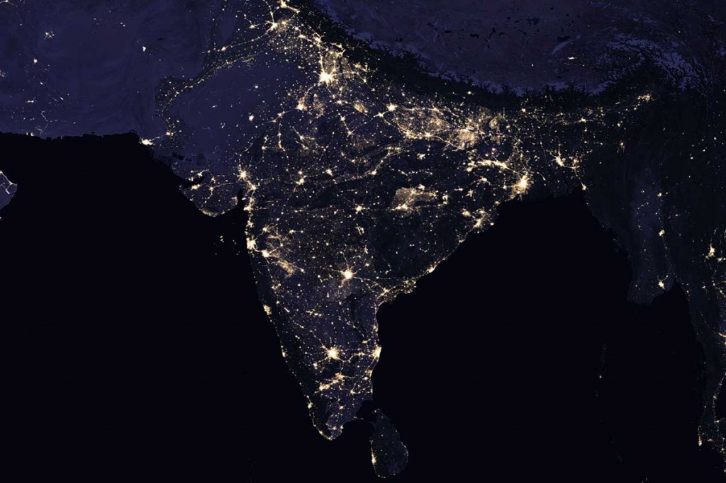
The view of Earth at night from space is a stunning display of human activity, city lights, and natural phenomena. The primary source of light visible from space during the night is city lights, which appear as bright clusters in urban areas. Here are some key features visible in nighttime satellite imagery:
  • City Lights: Urban areas are illuminated by streetlights, buildings, and other artificial lighting sources, creating distinct patterns and clusters of light. Major cities around the world stand out prominently.
  • Coastlines: The outlines of coastlines and islands are often visible due to the lights from populated areas along the shores.
  • Airports: Airports are recognizable by the arrangement of runway lights, apron lights, and the patterns created by the movement of aircraft.
  • Road Networks: Highways and major roads are visible as linear patterns of light, connecting cities and regions.
  • Oil and Gas Infrastructure: Lights from offshore oil rigs and gas platforms can be observed in certain regions.
  • Auroras: In polar regions, particularly near the North and South Poles, the auroras (aurora borealis in the Northern Hemisphere and aurora australis in the Southern Hemisphere) can be seen as colorful displays of light caused by interactions between charged particles and the Earth's atmosphere.

Wildfires: Intense wildfires can produce significant light sources that are visible from space.
While the human eye can't pick up the difference in a daylight image of dark spots, and automatic panchrome decoding doesn't pick up darkness at all, the infrared sensor on the VIIRS is more perceptive, and this variability shows up in the dataset. Those dark areas that you see can actually still be quite active and can be classified.
  • It is critical that users use a cloud-free nighttime observation file and do not assume that a value of zero in the mean brightness image means that no light has been observed. Cloud detection for nighttime panchromatic satellite images in the visible and near-infrared (VNIR) is typically performed based on the
  • synchronized thermal infrared (TIR) observations, therefore cloud detection is
  • cloud detection based on VNIR alone is analyzed. To classify clouds compared to clear images are focused, e.g., in urban areas, describe:
  • cloud scattering, especially over urban areas with their inhomogeneous light emission;
  • normalized differences between the albedo of the ground surface and clouds, especially in the presence of lunar illumination.
  • Research on nighttime lights has shown that they are a reliable indicator of urbanization patterns and socio-economic indicators, such as population density and poverty, as well as the economic consequences of natural disasters and social conflicts. For instance, nighttime satellite imagery has been used in China to understand past epidemics and the COVID-19 pandemic in different regions of the country. Nighttime imagery has also been combined with daytime imagery to build statistical models for various analyses.
  • These studies have utilized nighttime satellite imagery to gain insights into the dynamics of Asian cities' urbanization and its socio-economic implications. They have also explored the relationships between nighttime lights and population density, poverty, natural disasters, and social conflicts, providing valuable information for various research and decision-making purposes.
  • References:
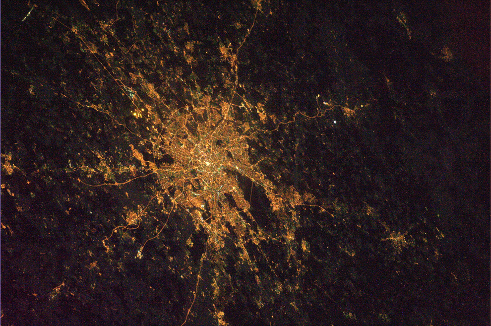
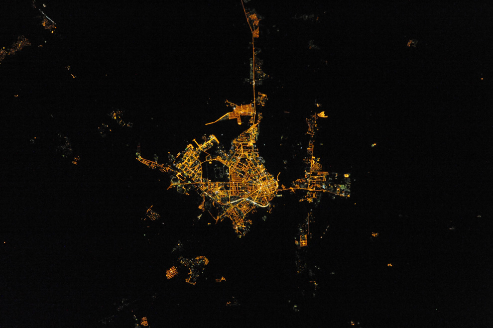
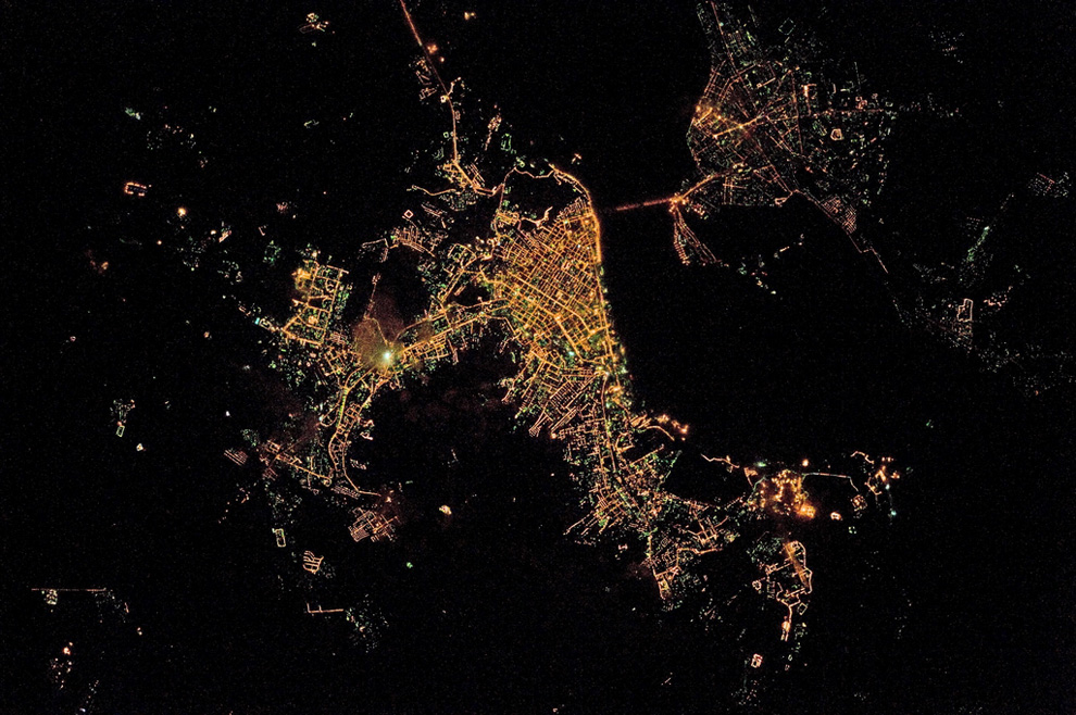
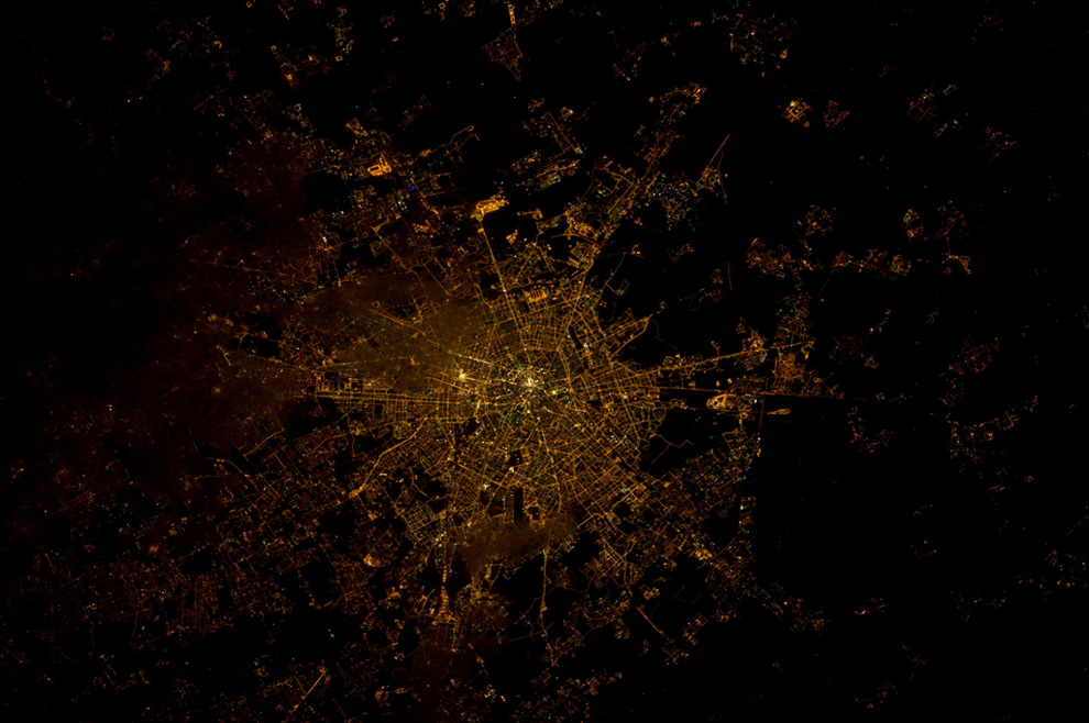
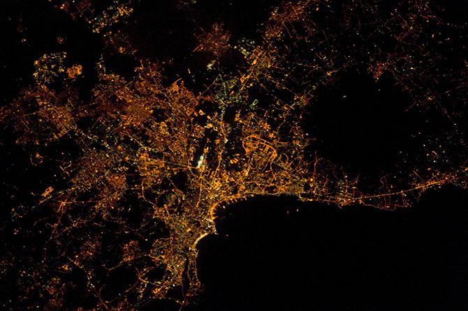
Nighttime satellite imagery can be obtained not only in Europe, Asia, Africa, and America but also worldwide.

Russia. Bright city of Moscow photo: Moscow at night from space

оренбург ночью из космоса.jpg


Russia. City of Saratov photo: Saratov at night from space

Europe. Milan, a city in northern Italy photo: Milan, city in northern Italy

Italy. City of Naples on the seashore. The largest city in Southern Italy photo: Naples, Italy

Africa, cities at night photo: Africa from space

Asia, Tokyo city in Japan photo: Asia, Japan
Yes, Remote sensing satellites with Visible Infrared Imaging Radiometer Suite (VIIRS) sensors, are equipped with infrared equipment and are capable of taking pictures of the Earth at night.
The Visible Infrared Imaging Radiometer Suite (VIIRS) is an instrument that is part of several Earth-observing satellites. VIIRS is designed to capture a wide range of data related to Earth's atmosphere, land, and oceans. It is known for its ability to observe both visible and infrared wavelengths, making it versatile for various applications, including monitoring weather, climate, and environmental changes.

Key features and capabilities of VIIRS include:
  • Day/Night Band (DNB): VIIRS includes a day/night band, allowing it to capture low-light observations, making it particularly useful for nighttime imaging. This feature enables the instrument to detect city lights, wildfires, and other sources of light during the night.
  • Imaging Spectroradiometer: VIIRS is capable of capturing imagery in multiple spectral bands, ranging from visible light to infrared. This enables the instrument to provide information about various Earth features, including vegetation, clouds, and sea surface temperatures.
  • Moderate Resolution: VIIRS has a moderate spatial resolution, meaning it can capture detailed images of large areas on Earth while still maintaining a reasonable level of detail.
  • Global Coverage: VIIRS is typically installed on polar-orbiting satellites, providing global coverage as the satellite orbits the Earth.
  • Applications: VIIRS data is used for a variety of applications, including weather monitoring, climate studies, environmental monitoring, and disaster response. The day/night band is particularly valuable for studying urbanization, energy consumption, and natural phenomena that are visible during low-light conditions
The VIIRS Nighttime Imagery (Day/Night Band, Enhanced Near Constant Contrast) layer shows the Earth's surface and atmosphere using a sensor designed to capture low-light emission sources, under varying illumination conditions.

Licenses

License for implementation of geodetic and cartographic activities (page 1)
License for implementation of geodetic and cartographic activities (page 2)
Application for the license for implementation of geodetic and cartographic activities
ISO 9001:2015 Certificate of Conformity №СДС.ФР.СМ.00813.19 (page 1)
ISO 9001:2015 Certificate of Conformity №СДС.ФР.СМ.00813.19 (page 2)

Warranty

We guarantee 100% quality of services. Cooperating with GEO Innoter specialists, you eliminate risks and losses! The presence of qualified personnel with extensive experience in working with specialized software makes it possible to ensure timely and high-quality performance of work!

Our partners