



A DTM of the specified type: clutter, vector, obstacle heights, address database, orthophotomap and technical report.
Search the site
What the service is used for
Maps and cartometry
An up-to-date digital map of any scale and purpose for cartometric tasks; creation and updating of digital topographic maps and plans.
GIS and cadastre
Information support for GIS and a cartographic base for cadastres of various purposes.
Navigation and positioning
Cartographic base for navigation and positioning systems.
Mobile network planning
Information support for mobile telephone network planning systems.
Surveys and land allotment
Spatial referencing of thematic databases: engineering surveys, land-cadastral works, land allotment, statistics and surveys.
Did not find your task?
Describe the territory, DTM type and purpose. A specialist will check the remote sensing archive, funds and the feasibility of a new survey.
What you will receive as a result of the work
01
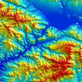
Digital terrain model
A DTM of the specified type for applied tasks: obstacle height model, clutter and vector models, address database.
Independent layers are derived from the model in topographic plan symbols: relief, communications, buildings and structures, hydrography, soil and vegetation cover.
What you get
- a digital terrain model of the specified type
- relief, object and semantic layers per the terms of reference
- projection, sheet layout, coordinate and elevation system per the ToR
The type and object composition of the project are fixed in the terms of reference.
02
Orthophotomap and report
Orthophotomaps, additional and reference materials and a technical report are included in the delivery together with the DTM.
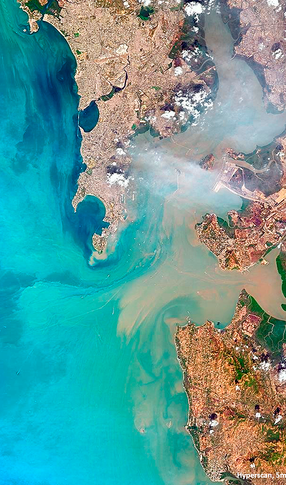
Orthophotomaps are needed for interpretation and vectorisation of terrain objects when creating and updating the model.
What you get
- digital orthophotomaps for creating or updating the DTM
- additional and reference materials
- technical report
The composition of orthophotomaps depends on the volume of remote sensing data, ground control points and the DEM used.
03
Delivery formats
Data are delivered in formats compatible with ASSET, ATOLL, Mapinfo and others — as required by the terms of reference.
Results are transferred on electronic media or via FTP; textual materials are also duplicated in printed form.
What you get
- the project in the required formats, projection and coordinate system
- compatibility with ASSET, ATOLL, Mapinfo and the client's formats
- delivery on media or via FTP
The data delivery format is defined by the client's terms of reference.
04
Creation or off-the-shelf DTMs
A DTM can be created to individual requirements or an off-the-shelf model can be supplied from manufacturer funds and catalogues.
For updating, cartographic products from public and private funds or the client's materials are used. Off-the-shelf models are supplied in the manufacturer's formats and to the manufacturer's requirements.
What you get
- a created or updated DTM per the ToR
- or an off-the-shelf DTM after verification of the received data
- editorial and technical instructions upon approval
Off-the-shelf DTM timelines in the source differ: from 10, 15 and 25 working days — see the cost block.
How the work goes
Cost and timeline
The price depends on the cost of imagery, the number of frames covering the territory, the availability of ground control points and the complexity category of the work area.
- order guide on the card and table total — from 50,000 ₽
- consultation — free of charge; selection of imagery / off-the-shelf DTMs and preliminary analysis of source, additional and reference materials — free of charge
- creation: ordering imagery — from $0.5 to $200 USD per 1 km² (archive or new survey, mono or stereo, resolution); in the order steps — from $8 to $200 USD per 1 km², imagery paid separately
- creation of a digital orthophotomap — from $1 USD per 1 km² (volume of remote sensing data, presence or absence of ground control points, DEM used)
- DTM creation — from 50,000 ₽, individually (complexity category, timeline, area); updating — not more than 50% of the creation cost
- off-the-shelf DTM supply: order — from $0.5 to $100 USD per 1 km² (work area); updating — from $1 USD per 1 km²; in the table the updating wording is truncated: “depends on the degree of obsolescence of the previously created project,”
- timeline on the card (WORK_TIME) and FAQ: creation — from 25 working days; off-the-shelf supply in the FAQ — from 25 working days
- in the timeline block: creation — from 25 working days from the advance date; off-the-shelf supply — from 10 working days from the advance date
- FAQ: off-the-shelf DTMs in manufacturer formats — within 15 working days from the contract date; archival imagery for creation — 10–15 working days, new imagery — 20–60 working days
- off-the-shelf delivery conditions: after 100% advance payment; receipt from the supplier — from 1 to 10 working days; verification — from 1 to 5 days (area of the district)
- order steps: orthophotomap creation — from 5 working days from the date of 100% advance for remote sensing materials, bank transfer only; interpretation and vectorisation — from 3 working days after orthophotomap creation starts
- payment: FAQ — 100% prepayment by invoice after signing the contract; execution stage — 100% prepayment for the purchase of remote sensing materials
Order cost — from 50 000 ₽
Creation timeline — from 25 working days (off-the-shelf in the timeline block — from 10 working days)
Consultation and preliminary selection — free of charge
What is needed for a quote
To assess feasibility, cost and timeline, please send:
- coordinates of the mapping area (in any convenient form)
- type of DTM project to be created or updated, format, sheet layout, projection, coordinate and elevation system
- availability of source map materials, additional and reference data
- availability of ground control point coordinate lists for photogrammetric processing of remote sensing data
- requirements for the object composition and thematic information of the project
- whether editorial and technical instructions need to be developed and approved
- requirements for remote sensing data and work deadlines
If exact parameters are unknown, describe the task for which the DTM is needed — specialists will check the archive, funds and the feasibility of a new survey.
Specify the territory contour, model type and format requirements.
Why Innoter
Prompt access to archives
Suitable archival materials can be obtained faster if the required territory and date are already held by operators.
No aviation clearances
A new satellite survey does not require flight clearances typical of aerial surveys.
Large and remote territories
A single satellite pass covers significant areas and makes it possible to work with hard-to-reach districts.
Direct agreements with operators
Distribution agreements help select archival imagery and order new surveys from different suppliers.
Software and server infrastructure
Modern software and capacity for quality control and processing of large data volumes.
Experienced specialised staff
Years of experience on complex projects and specialists in cartography, photogrammetry and remote sensing.
DTM composition, survey and source data
The composition depends on the model type, archive or new survey, control points and the terms of reference.
1
A digital terrain model (DTM) is a cartographic model with a logical-mathematical description of terrain objects and data about their characteristics. It is created in the projections, sheet layout, coordinate and elevation systems adopted for maps, taking generalisation and topological relations between objects into account.
A DTM includes digital layers: relief, vector (objects with semantic characteristics), population distribution (administrative boundaries, settlement boundaries with inhabitant numbers from the last census), obstacles (heights of buildings, vegetation and engineering structures).
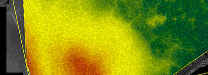
A DEM contains the height of the true relief only, without vegetation, buildings and other anthropogenic objects. A DSM contains all irregularities of the Earth's surface, including vegetation and anthropogenic objects.
2
The purpose of creating a DTM is the graphic transfer of spatial and coordinate information and a description of code designations for a given area.
The model is needed for mapping and site arrangement when designing landscaping, buildings, structures, roads, highways and interchanges, as well as for territory protection and scientific research. Independent models of relief, communications, buildings and structures, hydrography and soil-vegetation cover are derived from the DTM.
3
Very high and high resolution images from the operator archive are obtained faster; a new satellite survey does not require clearances from competent authorities.
Aerial photography provides resolution down to 1 cm/pixel, RMSE of point coordinates of less than 10 cm, and can be performed below continuous cloud cover. It is advisable for high-accuracy DTMs.
UAV survey makes it possible to obtain a realistic model in a short time, with quality comparable to laser scanning but more affordable.
LiDAR: high measurement speed and accuracy; data for maps, topographic plans, drawings and cross-sections; survey of hard-to-reach and hazardous objects. Laser scanner range — from 1 to 2,500 metres depending on the instrument and conditions. A high-resolution camera yields a coordinate array together with real images.
The difference between DTMs from satellite imagery, aerial photography and laser scanning is accuracy per the ToR, timeline (archive or new survey) and budget.
4
Before the contract, the task, area of interest, accuracy, archival images or a new survey, and availability of cartographic products from the client or in public and private funds are assessed. Result — service feasibility (yes/no).
Then the remote sensing data, technology and timelines, projection and coordinate and elevation systems, volume of additional data, terms of reference and full cost are agreed. Result — a signed contract.
Execution: 100% prepayment for the purchase of remote sensing materials; ordering of imagery and funds; editorial and technical instructions; incoming RS data control; orthophotomap creation; interpretation and vectorisation; visual and automated quality control; export to the required formats; technical report.
The main material is the operator archive for the most current date or a new survey; additionally — descriptions, maps and atlases, directories and the client's data.
5
The client can receive off-the-shelf DTMs in the manufacturer's formats and to the manufacturer's requirements within 15 working days from contract signing. Delivery is after 100% advance payment: receipt from the supplier from 1 to 10 working days, verification from 1 to 5 days depending on the area, then handover to the client. In the timeline block off-the-shelf supply is from 10 working days from the advance date; in the FAQ on timelines — from 25 working days.
Creation to individual requirements includes ordering archival imagery (10–15 working days) or new imagery (20–60 working days), collecting reference information and agreeing the methodology. The minimum creation timeline in the FAQ is from 25 working days.





Frequently asked questions
Answers to key questions about service parameters, timelines, deliverable formats and workflow. If you did not find what you need — contact us and we will help.
- Location of interest (location/coordinates of the object in any convenient format, and the area of the object);
- Specific task that needs to be addressed using the DTM.
- The main source of data for creating or updating the data project is the existing remote sensing data materials available in the archives of satellite operators, up to the most current date. Alternatively, new imaging can be commissioned.
- Additional and reference materials such as geographical descriptions, maps, atlases of larger or smaller scales, directories, and any data available to the client are utilized in the creation or updating of the data project.
- Existing cartographic products from public and private archives or cartographic products provided by the client can be used as the basis for updating the DTM.
Data shall be provided in the Customer's formats according to the requirements of the terms of reference
- The timeframe for creating a digital terrain model based on satellite or aerial imagery data depends on the volume and complexity of the order. The minimum timeframe is 25 (twenty-five) working days.
- The delivery timeframe for the completed digital terrain models is 25 (twenty-five) working days.
100% prepayment by invoice after signing the contract
Completed digital terrain models, in the formats and according to the requirements of the manufacturer, can be obtained within 15 working days from the date of contract signing.
The creation of custom digital terrain models, based on the individual requirements of the client, involves ordering and obtaining archival imagery (10-15 working days) or ordering and obtaining new imagery (20-60 working days), gathering additional and reference information, creating and coordinating the methodology for the project, and so on.
The difference between the creation of DTM on space imagery, aerial imagery and laser scanning, is the accuracy according to the requirements of the terms of reference, the wishes of the customer, the term of execution (the use of archival data, the order of a new survey), the budget of the customer.

Need satellite imagery or help choosing the right data?
Describe your task, area of interest, and desired outcome. We will check data
availability, assess new acquisition options, and propose the optimal solution in terms of timelines, cost,
and quality.
Discuss the project
clients who trust us
25+ years in the geodata market







