Thematic analysis — is the process of extracting information about the characteristics of various objects on the Earth's surface based on the analysis of spectral, spatial, and temporal data obtained using satellites, aerial photography, or other remote sensing sources.
Under thematic decoding, one should understand the decoding of anthropogenic and natural objects and their properties in order to create thematic maps. Thematic decoding is a very extensive and promising direction that covers the entire spectrum of geographical sciences (geology, geomorphology, geobotany, soil science, etc.).
Remote sensing thematic analysis has over 250 directions (updated annually), the basics are established by the UN division (UN Office for Outer Space Affairs (UNOOSA) and the "Principles relating to remote sensing of the Earth from space" Declaration (Adopted by resolution 41/65 of the General Assembly dated December 3, 1986).
Analysis of data obtained using remote sensing is widely used in areas such as geography, ecology, agriculture, urban planning, geology, geodesy, as well as in disaster monitoring, resource planning, and other areas. This method becomes an effective decision-making tool and provides important information about the Earth from space.
The content and purpose of decoding are to obtain a certain amount of qualitative and quantitative information about the state, composition, structure, sizes, interrelationships, and dynamics of processes, phenomena, and objects using decoding features.
There are three main methods of decoding remote sensing data:
- visual decoding (visual image interpretation);
- measuring decoding (image measuring);
- automatic decoding.
Given that modern technologies for using satellite imagery involve digital data processing, measuring decoding is now partially reduced to calculations of the geometric properties of decoded objects. Thus, there are still two main decoding methods - visual (expert) and automatic (automated). The latter includes tasks of image classification with or without training (image classification), pattern recognition, computer vision, and ultimately, machine learning as a promising direction that ensures the self-learning process of recognition algorithms. However, a significant part of decoding work is still done manually.
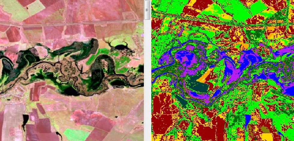
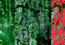
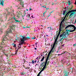
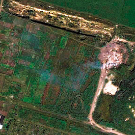
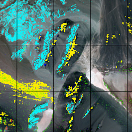
Fig. 2 Thematic analysis of a satellite image using unsupervised classification
By content, decoding can be general geographic (topographic), thematic (e.g., geological, geobotanical, soil), or special (land improvement, forestry, etc.).
The process of image decoding and the techniques used always have a subject-oriented character, i.e., depend on the type of decoded objects. In particular, topographic, landscape, geomorphological, hydrological, and other types of decoding are distinguished. Accordingly, optimal shooting materials are selected for each type, mainly based on the level of detail (spatial resolution), the presence of visible and IR channels (NIR, SWIR) (spectral resolution) that provide the best differentiation of decoded objects. The analysis and consideration of change dynamics also require various temporal images.
Typical shooting material is characterized by both redundancy and lack of information, for the replenishment of which it is necessary to attract knowledge from other sources.
In general, the decoding methodology includes the following stages:
- studying the experience and recommendations for this type of decoding and for a specific area;
- identification of a set of decoding objects (objects of interest) and their inherent decoding features;
- selection of shooting materials and computational means (computer programs) that allow using the identified decoding features of objects of interest;
- image decoding and evaluation of the reliability of the results;
- documentation of decoding results.
You can order from us

Problems to be solved
The main task of thematic analysis is the classification and identification of required terrain objects in images obtained through ground, aerial, and space photography of the surface, to create corresponding thematic maps for various tasks, such as:
- Creating digital topographic maps and topographic maps of the entire scale range
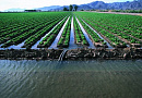
- Studying the composition and changes of agricultural fields, urban infrastructure;
- Determining the composition of water bodies;
- Exploration of mineral deposits;
- Forest inventory;
- Exploration of oil and natural gas deposits;
- Identification of local sources of pollution;
- Studying the structure and dynamics of natural territorial complexes;
- Creating thematic and special maps;
- Determining the dynamics of glacier melting;
- Creating thematic ice situation maps;
- Determining the degradation of agricultural lands;
- Determining disturbances in forest cover
- Planning and development of cities and regions
- Business analysis to determine optimal locations for opening branches and other commercial purposes
- Other tasks.
Currently, thematic analysis is keeping pace with the development of the entire remote sensing data market; aerial and space images themselves can be useless for ordinary people without their decoding, whose eyes are not accustomed to this type of information acquisition.
Thematic decoding provides users with valuable information to solve an incredible number of tasks.
Need for consultation?
Fill the form and we will contact you
Implementation examples
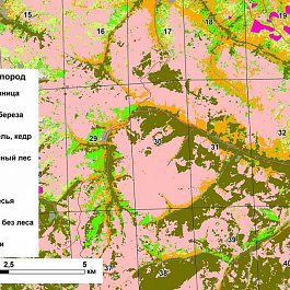
Creation of a forestry breed map
Creating digital cartographic material at a scale of 1:25000 (map-scheme of forests by predominant species) for the territory of the district forestry
Solution:
- Using visual decoding, we determined the boundaries of lands occupied by forests.
- Using visual decoding and automatic classification methods with accuracy corresponding to the spatial resolution of satellite images, we determined the species composition of the forest (larch, aspen, birch, spruce, fir, cedar, mixed forest, pine, sparse forest).
- We delineated objects: hydrography (area and polygonal), contours and blocks of settlements, lands not occupied by woody vegetation, forest clearings, power lines, and logging roads.
- We created a quarter-based database in the form of a table indicating the area of the territory and the species composition.

Result:
List of materials provided to the customer:
- Digital cartographic material scale 1:25,000 in JPEG format in electronic form.
- Quarter-based database in EXL and Shape format indicating the area of the territory and the species composition (deciduous or coniferous trees).
- Shape-files of polygonal and linear objects created during the preparation of digital cartographic material.
- Coordinate system - WGS 84, projection - UTM.
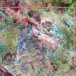
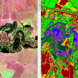
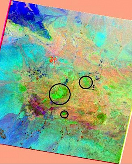
Conducting remote geological exploration of a gold ore deposit
Task:
- Selection of satellite imagery materials for the Customer's area of interest;
- Preliminary processing of remote sensing data in specialized software;
- Creation of a map base at a scale of 1:50,000.
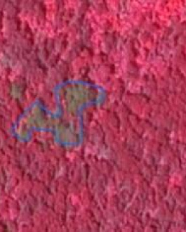
- Spectral analysis of high and medium resolution satellite images using mineral indices;
- Interpretation of the data obtained from the spectral analysis of satellite images.
Solution:
Selection of satellite images with medium spatial resolution, having SWIR shooting range. This allows for mapping of rock formations and minerals.
Extraction of the image area based on the boundaries marked by the Customer. Atmospheric and radiometric correction of the obtained data. Normalization of pixel values in the image fragment. Subtracting vegetation and cloud masks from the raster fragment;
The next key step is the selection of a spectral library and calculation of mineral indices for the analysis of images. For this project, the standard USGS mineral library and the proprietary library of GEO Innovator LLC were chosen. Mineral indices such as kaolinite, phengite, muscovite, quartz, iron, and others were calculated as indicators of copper-porphyry deposits.
Result:
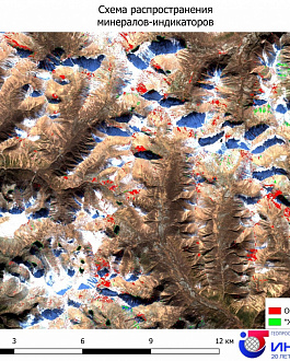
Prospective areas of gold-copper mineralization were identified, some of which were also identified based on the results of previous studies by other performers. Distribution maps of indicator minerals.
The results obtained using remote sensing methods were compared by the Customer with the early results of other works (including geophysics and field studies): the coincidence rate is 76%.
Two areas were considered unpromising, 6 areas were identified as new prospective ones, and 16 areas coincided with previously identified prospective ones. Prioritization of areas for further research was carried out.
The area of the allocated areas ranges from 74 hectares (0.74 km2) to 473 hectares (4.73 km2).
The Customer will continue to work with GEO Innovator LLC on this project, acquiring new ultra-high-resolution visible range and high-resolution SWIR range imagery, as well as Chinese hyperspectral satellite imagery for the next stage of work.
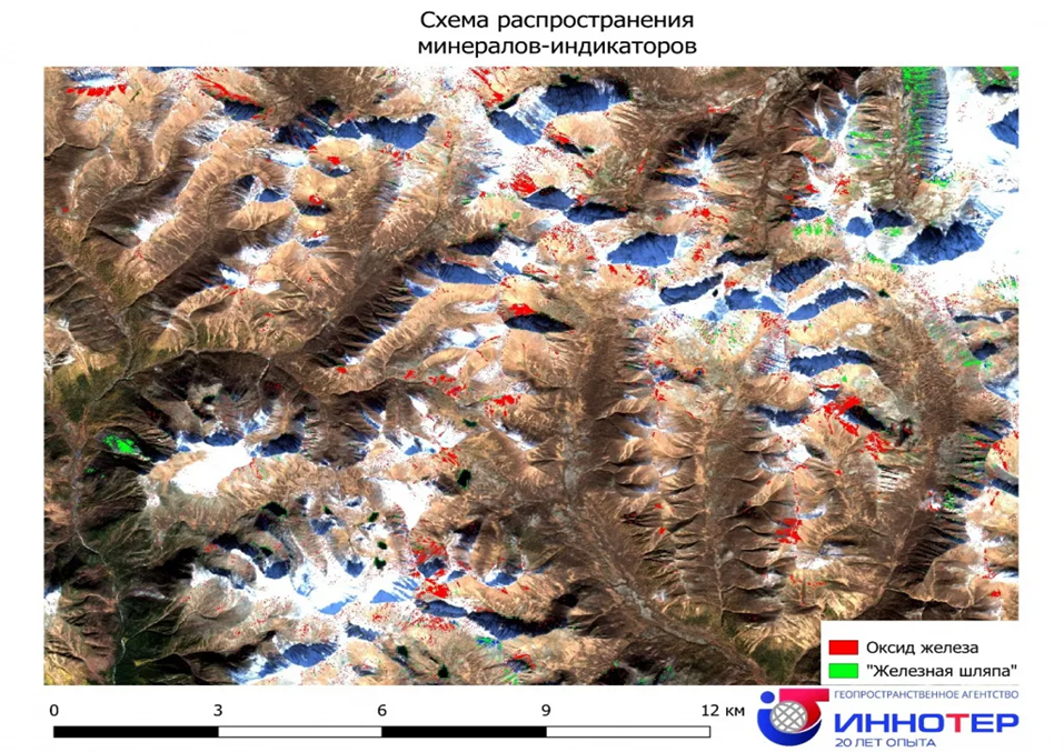
Fig. 3. Project conducted by GEO Innovator LTD specialists on geological exploration of mineral deposits
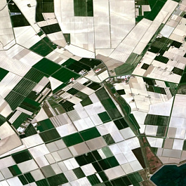
Assessment of agricultural land condition
Task:
Assess the condition of agricultural lands, classify them by type of agricultural land or landscape complex, and create a thematic map.
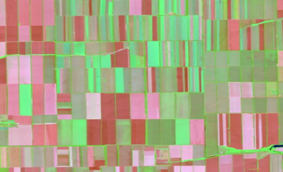
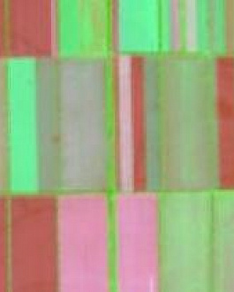
Fig. 4. Cloud-free mosaic in the combination of channels 7-5-3
Solution:
- Acquisition of Landsat-8 satellite images with cloud cover less than 10%.
- Processing of satellite images, including:
- Orthorectification of satellite images to obtain accurate boundaries of agricultural lands;
- Formation of a cloud-free mosaic.
- Classification of the cloud-free mosaic into a fixed number of classes, close in spectral signature.
- Vectorization of classification results for area assessment.
- Grouping of vector objects of satellite imagery according to the values in the attribute table, resulting from the classification.
- On the basis of topographic maps, objects were compared using the interpretation of Landsat 8 channel combinations, which provide an image close to natural colors:
- dry vegetation - orange;
- open soil - bright pink;
- healthy vegetation - bright green;
- herbaceous communities - green;
- sparse vegetation - brown and orange tones.
- Classification according to the colors obtained from the channel combination.
- Vectorization of classification results based on channel combination.
- Formation of NDVI, NDMI, ARI1 indices to assess vegetation condition using the cloud-free mosaic.
- Comparison of index values with vectorization results.
- Compilation of thematic maps.
Result:
1) Thematic map with 6 classes:
- wet vegetation cover;
- areas with diverse herbaceous vegetation;
- open soil areas;
- arable land;
- unused lands;
- anthropogenic areas (bare areas).
2) Vector layer with areas of each class.
3) Thematic maps of vegetation condition according to NDVI, NDMI, ARI1 indices.
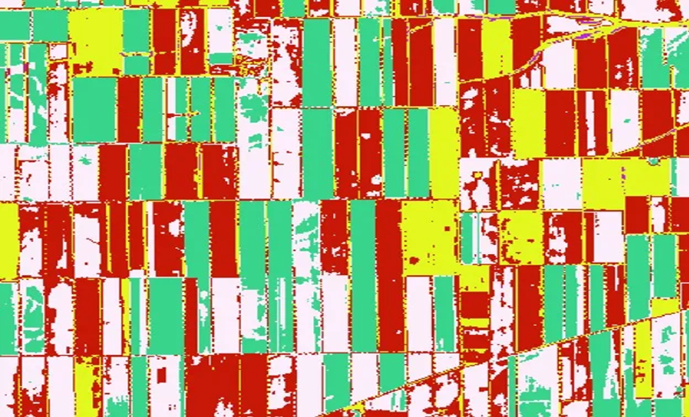
Fig. 5. Classification of the cloud-free mosaic into 6 classes
Completed projects


Our clients


FAQ
Licenses


Our partners