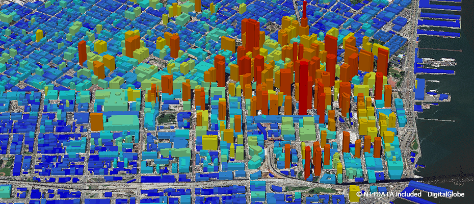
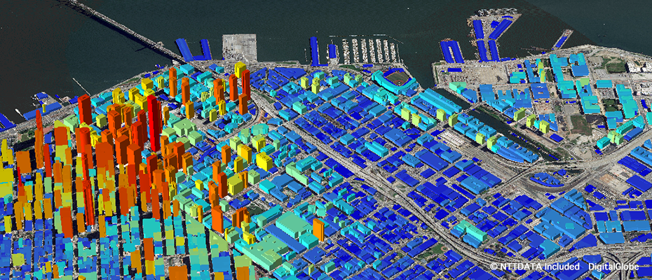
AW3D Building - 3 D data with building footprints and heights
3D map with the shape and height of building by using the latest images. Building dataset includes shape and building footprint. These dataset is for many simulations such as telecommunication, asset planning, analysis of the view.
Utilizing automatic building extraction from satellite imagery with machine leaning
Since machine learning enables to extract massive amount of building 3D data from satellite imagery within a short period of time , we can provide build data from anywhere in the world.
Data product specialized for various simulations
Data product that is suited for radio propagation analysis, LOS (Line of Sight) analysis, and other simulations. This vector data is compatible with various GIS engines.
Details
| Product Type | 3D Vector (Digital Height Data, Polygon Type) |
|---|---|
| Satellite | DigitalGlobe - WorldView |
| Area | On demand |
| Horizontal Accuracy | 2 m RMSE |
| Vertical Accuracy | 2 m RMSE |
| Minimum Order Size | 25 km² |
| Delivery Formats | Shape format (.shp), Tab format (.TAB) |
| Delivery Method | Online or Media (DVD) |
Regarding the purchase of the highest precision DEM AW3D Building and data from satellites WorldView-3, WorldView-4 and much more, please contact “Innoter” Ltd., the official distributor of Maxar Technologies Inc, by phone number: +7 (495) 245-04-24 or by sending a message on email: innoter@innoter.com