Photogrammetry is a scientific and technical discipline that deals with determining the dimensions, shape, and spatial position of objects from their photographic images. Literally translated, photogrammetry is measurements by light recording, i.e., by photo imaging (photographs).
Photogrammetric work - in the classical understanding, this is the process of establishing a mathematical relationship between the coordinates of objects and their images obtained by various imaging systems (photographic, television, radar, optoelectronic, etc.), as well as studying the features of processing the corresponding images based on classical photogrammetric methods.
In photogrammetric work, 2 classic methods are distinguished:
- photogrammetric - based on measurements of objects from a single image;
- stereophotogrammetric - a method of measurements from two overlapping photographs (stereo pair).
Photogrammetry is closely related to geodesy, aviation, astronautics, precision instrument engineering, physics, chemistry, electronics, mathematics, cartography, and other areas, knowledge, and branches of the economy.
Currently, photogrammetry is divided into two parts of photogrammetric science - general and applied.
General photogrammetry includes all theoretical foundations, the study of methods and means of application, classical three-dimensional photogrammetry and dynamic four-dimensional, where time is used as the fourth coordinate.
Applied photogrammetry includes all other areas of application of photogrammetry - geodetic, scientific and technical, topographic, space, underwater, application in the use of natural resources, in mining and industry, in geographical and geophysical research, in engineering photogrammetry in surveys, design, construction, and operation of engineering structures.
In photogrammetry, three directions of research are distinguished:
- the first is the study and development of methods for mapping the earth's surface from photographs;
- the second is related to solving applied problems in various fields of science and technology;
- the third is the development of technology for obtaining information about objects on Earth, the Moon, and planets of the solar system.
You can order from us
Problems to be solved
The main task of modern photogrammetry is to obtain metric information about the state of objects depicted in photographs and to transform this information into a specified form with a specified accuracy.
The main task of photogrammetry is to transform images obtained from ground, aerial, and space photography of the Earth's surface into a specified projection, eliminating distortions of photographs caused by terrain relief, deviations of the photographic axis from the vertical during photography (off-nadir deviation), atmospheric correction, and other distortions that occur during photography. This is applied to create products to solve the following tasks:
- In construction, photogrammetry methods are used for control measurements during building construction and for studying deformations of various structures and building materials;
- In military engineering, topographic and special maps are created, digital terrain models are compiled, photodocuments are used for densification of reference geodetic networks, determination of target coordinates and own troops, research on trajectories and speeds of projectiles, missiles, etc.
Need for consultation?
Fill the form and we will contact you
Implementation examples
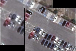
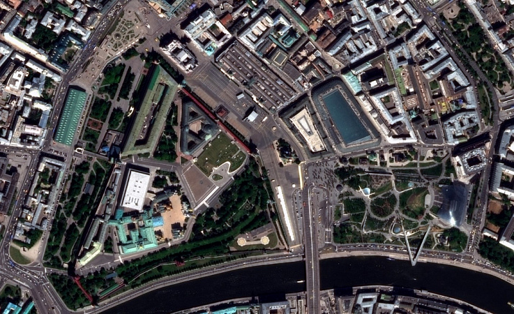
Delivery of new ultra-high resolution space imagery and creation of a 1:10,000 scale orthophoto map of Moscow
- Supply of new ultra-high-resolution space imagery according to the boundaries of the work area;
- Creation of a digital orthomosaic based on the obtained RS materials;
- Performing color correction of photos, stitching, and issuing products in the specified format;
- Partitioning into trapezoids according to the coordinate systems used;
- Compilation of a layout scheme for the arrangement of sheets in the work area.
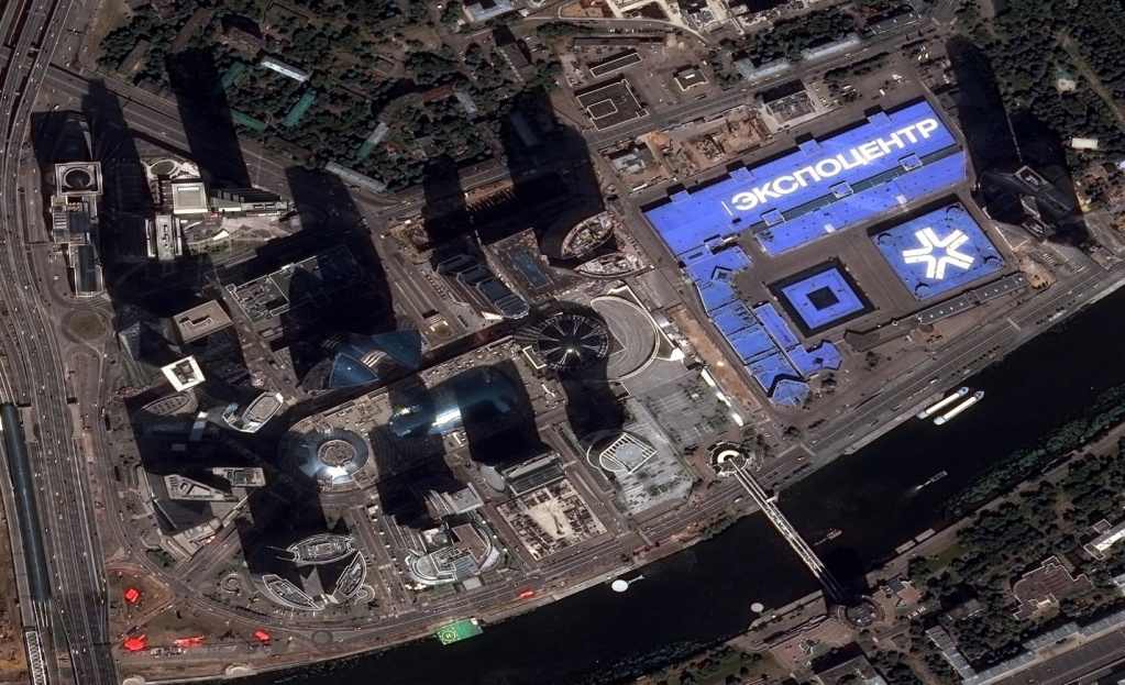
- Digital orthomosaic within "trapezoids" in two coordinate systems;
- Space images in natural color and in false-color with near-infrared channel;
- "Coarse" ortho-images with spatial resolution of 3–5 m;
- Map-scheme of the arrangement of sheets of space photos.
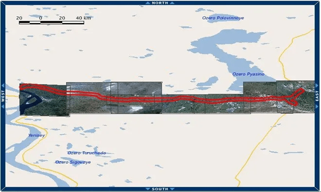
Creation of 1:10,000 scale orthophotomaps of the pipeline design route from Russia to China
Creating orthophotoplans using RS data for the pipeline route area in accordance with the requirements of current regulatory documents.
Data collection on the terrain's condition, development of an action methodology.
Viewing, selecting, and processing digital information from satellites with a spatial resolution of 0.5 m nadir.
Archived images were selected in compliance with the required mode - a set of images - panchromatic channel and 4 multispectral ranges (RGB+NIR). Projection - UTM, ellipsoid and coordinate system WGS84.
The procedure and technology for creating digital orthophotoplans with the preparation and approval of the "Work Execution Methodology" by the Customer were determined.
Then orthophotoplans were created based on the obtained data in accordance with the technical task requirements. Orthotransformation of materials was performed in the projection UTM, WGS-84 using RPC coefficients and the publicly available digital elevation model SRTM-90. The finished orthophotoplan was provided as a single array (without cutting) with 8-bit color depth in natural colors (RGB).
The customer received the necessary RS data, orthophotoplan with the specified accuracy for the pipeline area.
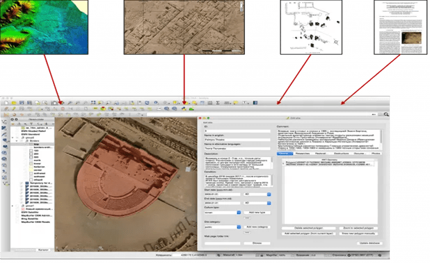
Creation of a 3D model of Palmyra (Syria)
The goal was to apply photogrammetry methods and create a virtual 3D model of the ruins of an ancient city.
After the ancient city was liberated from ISIS terrorists, who almost completely destroyed it, two expeditions were organized involving Russian and Syrian specialists.
As a result of these expeditions, detailed aerial photography of the entire territory of the ancient city of Palmyra and the adjacent necropolises was carried out to obtain a unified three-dimensional model of the entire monument, recognized as a UNESCO World Heritage Site.

Aerial photography was performed from three different heights: at an altitude of 320 meters with a resolution of 7 cm/pixel, at an altitude of 200 meters with a resolution of 4 cm/pixel, and the central part was photographed at an altitude of 120 meters with a resolution of 2.4 cm/pixel.
As a result, more than 20,000 photos were obtained covering a total area of about 20 km2.

In addition, ground photography of three destroyed objects of the ancient city was carried out with the aim of subsequently creating three-dimensional models of the destroyed sections for detailed modeling of the monument in its ruined state and creating a basis for planning the reconstruction of the architectural object.

As a result of the photogrammetric processing of all materials, a digital orthophotoplan of ultra-high resolution of the entire territory of Palmyra was created, a detailed three-dimensional landscape-architectural model of the entire territory of the UNESCO World Heritage Site was built, a high-precision relief model of the entire territory of the ancient city was created, high-precision 3D models of sections of the city's destruction were created, which became the basis for architect-restorers. The obtained results were uploaded to the GIS, which includes excavation plans, historical and modern photographs, bibliography, historical descriptions, restoration work, etc.
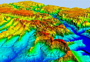
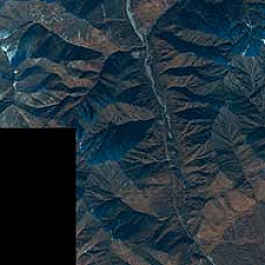
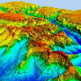
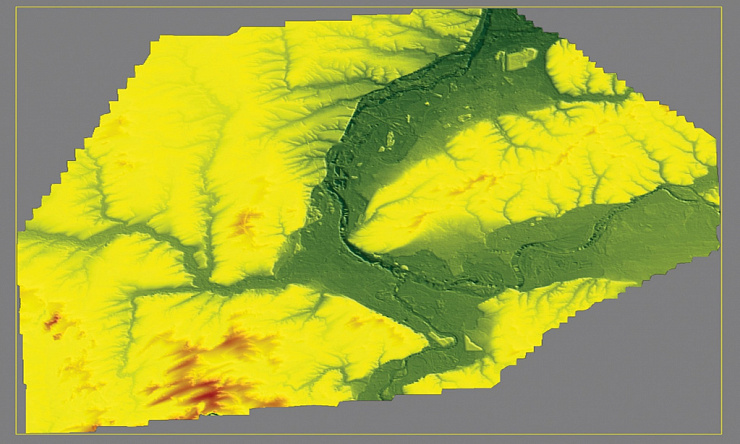
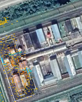
Creation of a digital elevation model (DEM) based on ultra-high resolution stereo imagery at a scale of 1:5000
- Ordering of ultra-high-resolution stereo imagery for the area of interest with a resolution of 0.3;
- Creation of a digital elevation model corresponding to a scale of 1:5000 in accuracy.
The first stage involved performing stereo photogrammetric processing of a block of ultra-high-resolution images.

Achieving a scale of 1:5000 for the orthophotoplan with a resolution of 0.3 m can sometimes be challenging due to accuracy issues. Reference points need to be measured. 20 such points were measured. The connecting points were automatically measured. Image stitching technology from a single roll was used to increase processing efficiency. Then, a digital elevation model with a resolution of 3 m was created. Some areas, such as road junctions, require manual refinement. The height matrix was converted into pickets, manually edited in complex areas. Then, vector objects were converted back into a height matrix through a TIN triangle network.
- The color balance of the output orthophotoplan was performed automatically. The final products were rectangular sheets measuring 1×1 km on the ground, obtained as a result of automatic cutting of the orthophotoplan;
- A digital elevation model with a resolution of 3 m on the ground was delivered to the customer.
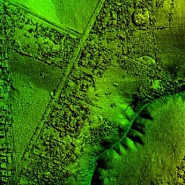
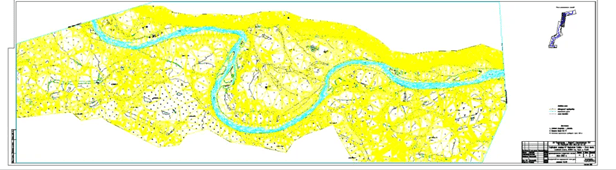
Creation of a digital terrain model (DTM) and creation of a digital topographic plan (DTP) at a scale of 1:5000 using space stereo images
Creating a digital terrain model (DTM) and generating a digital topographic plan (DTP) at a scale of 1:5000 using spaceborne stereo imagery for the area of interest, for carrying out planned work on underwater crossings of major pipelines and communication cable lines.

- Selection and ordering of spaceborne stereo imagery that meets the requirements of the Technical Task, control of the received data;
- Fotogrammetric processing of stereo imagery using reference points provided by the customer;

- Performing stereo vectorization of the terrain relief;
- Creation of a DTM in the form of a TIN model. Export, conversion, and reprojection of data;
- Generation of a digital orthophoto plan of the terrain;
- Conducting office decoding of objects based on digital orthophoto plans;
- Creation of a digital topographic plan, control of completed work.
- Analysis of coverage. Selection of data according to the parameters of the imagery specified in the technical task. Ordering of source data. Obtaining spaceborne stereo imagery, checking, and transferring for photogrammetric processing.
- Fotogrammetric processing of spaceborne stereo imagery. Performing the complete cycle of photogrammetric processing using outlines and catalogs of reference points in a conditional coordinate system and WGS.
Spaceborne stereo imagery, TIN model, and a digital topographic plan (DTP) at a scale of 1:5000 in a conditional coordinate system in AutoCAD format (*.dwg)
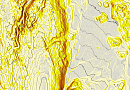
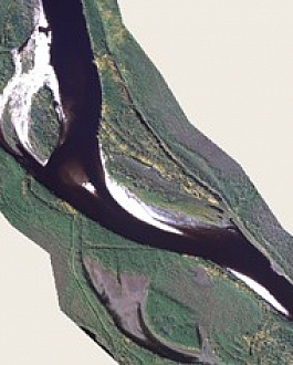
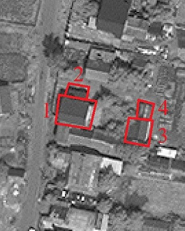
Extraction of iceberg contour features and their detection using neural network
Automatic detection of icebergs and extraction of spatial characteristics of objects.
Obtaining radar data from publicly available sources. Primary processing of radar data. Training of neural network. Throughout the training process, the system constantly refines its predictions, adjusting parameters based on the difference between manually obtained structure and predicted results. Training stops automatically when the system achieves optimal performance, ensuring its adaptability and success on new examples.

Polygons of detected icebergs and their spatial characteristics.

Our clients


FAQ
- High measurement accuracy;
- High degree of automation of the measurement process and the objectivity of their results associated with it;
- High productivity (since only their images are measured, not the objects themselves);
- Possibility of remote measurements in conditions where it is unsafe for a person to be on the object.
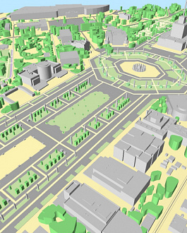
Photogrammetry plays an important role in the process of 3D modeling, allowing for the creation of realistic three-dimensional models of objects and scenes based on photographs. The application of photogrammetry in 3D modeling involves several steps:
- Photographing: Multiple photographs of the object or scene are taken from various angles and positions. The time required for shooting depends on the complexity of the object or scene and the accuracy desired in the final model.
- Import and calibration of photographs: Photographs are imported into specialized photogrammetry software, which analyzes the images and determines their parameters, such as focal length, distortion, and common feature points.
- Matching and tracing points: Using the software, common feature points are identified on different images and corresponding points on the model of the object or scene. This process is called "matching points" or "tracing points".
- Triangulation and model creation: Based on the traced points, the software constructs a three-dimensional model of the object or scene. It connects the tracing points, creating a triangulated mesh representing the surface of the object.
- Texture mapping and final processing: The resulting three-dimensional model can be textured, meaning color information or textures obtained from the original photographs can be applied to it. The model can then be optimized and subjected to final processing using specialized programs to enhance its appearance and readiness for use.
The use of photogrammetry in 3D modeling allows for the creation of very accurate and realistic models of objects and scenes based on photographs. This method has a wide range of applications in various fields such as architecture, gaming industry, cinema, visualization, and others. It enables the creation of models with a high degree of detail and fairly quickly and efficiently. Photogrammetry software offers various tools and functions that facilitate the process of creating 3D models. They allow for interaction with a large number of images, automatic detection of common feature points, precise tracing of points, and creation of detailed three-dimensional models.
One of the advantages of using photogrammetry is the ability to create models of objects that reproduce their real geometry and appearance with high accuracy. This is particularly useful in architecture and design, where an exact replica of an object or scene is required. Additionally, photogrammetry allows for the preservation of photorealism in models, as they are based on real images.
In conclusion, photogrammetry is a powerful tool in 3D modeling that allows for the creation of high-quality three-dimensional models based on photographs. It enables achieving realism and detail while maintaining the simplicity and efficiency of the modeling process.
Licenses


Our partners