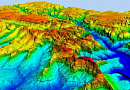
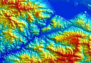
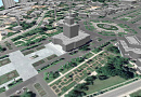
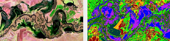
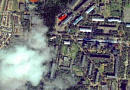
Digital terrain models (DTM) is a cartographic model that includes a logical-mathematical description of the terrain objects in digital form and contains data about their characteristics. DTM is created in the established map projections, scale, coordinate systems, and elevation systems, taking into account the principles of cartographic generalization and establishing necessary topological relationships between objects.
Digital Terrain Model (DTM) is a digital cartographic model that contains data about terrain objects and their characteristics.
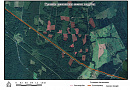
The digital terrain model should be constructed in a way that independent models can be derived from it using established symbolic conventions for topographic maps, including:
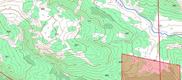
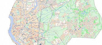
- terrain relief;
- communication networks;
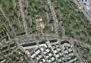
- buildings and structures;
- hydrography;
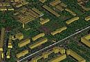
- soil and vegetation cover.

You can order from us


Prices for services
Creation of DTM:
| Consultation | Free of charge |
|---|---|
| Selection of images, preliminary analysis of the availability of source data, additional and reference materials | Free of charge |
| Ordering of images | From $0.5 to $200 per square kilometer depending on the type of imagery (archive or new, mono or stereo, resolution)* |
| Cost of DTM creation | From $1 per square kilometer, calculated individually for each specific order, depending on the amount of remote sensing data to be processed, the availability (or absence) of ground control points, and the type of DTM used |
| Cost of creating (updating) digital terrain models (individually calculated for each client) | Starting from 50,000 rubles. The cost of creation depends on the complexity category, execution time, and the area in square kilometers. The cost of updating depends on the degree of obsolescence of the previously created project, but not exceeding 50% of the creation cost. |
| TOTAL COST | From 50,000 rubles |
The price of creating a DTM depends on the cost of ordering images and the complexity of the work (including the number of images covering the area of interest, the availability of ground control points, and the complexity category of the work). The price is calculated individually for each customer.
Delivery of Finished DTM:
| Consultation | Free of charge |
|---|---|
| Selection of DTM, preliminary analysis of the availability of source data, additional and reference materials | Free of charge |
| Ordering of DTM | From $0.5 to $100 per square kilometer depending on the area of work |
| Cost of DTM update | From $1 per square kilometer, calculated individually for each specific order, depending on the amount of data to be processed |
| Cost of updating digital terrain models (individually calculated for each client) | The cost of updating depends on the degree of obsolescence of the previously created project |
| TOTAL COST | From 50,000 rubles |
Delivery Conditions for Finished DTM:
- Delivery of finished DTM is made after 100% advance payment
- Receiving DTM from the supplier (1 to 10 working days)
- Verification of received data (1 to 5 days depending on the area of work)
- Handover to the client
The cost of execution is calculated on an individual basis, taking into account a specific of task.
After receiving the task description, we calculate the cost and send you a commercial offer.
Period of execution
Creation of DTM
The deadline for completion of work is from 25 (twenty-five) working days from the date of receiving the advance payment, calculated individually for each customer.
The timeframe for completing the work depends on the total area, the amount of remote sensing materials to be processed, their type, and is calculated individually for each customer.
Delivery of Finished DTM
The timeframe for providing the service is from 10 (ten) working days from the date of receiving the advance payment, calculated individually for each customer.
How to place an order:
Need for consultation?
Fill the form and we will contact you
Stages of service provision
The result of the provision of services
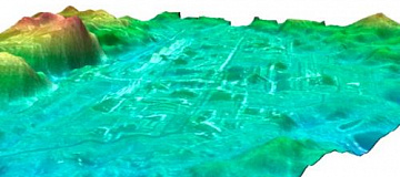
As a result, the client receives a digital terrain model (DTM) of the specified type to solve their specific tasks.
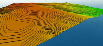
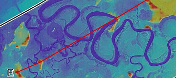
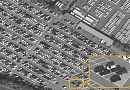
The most common types of digital terrain models include the Digital Elevation Model (DEM), Clutter Model, Vector Model, Address Database, orthophotoplans, additional reference materials, and a technical report.
The digital terrain models are provided in formats compatible with software such as ASSET, ATOLL, Mapinfo, etc. (according to the client's requirements specified in the technical task).
All deliverables are provided on electronic media or via the Internet through FTP servers, and textual materials are also duplicated in printed form.
Requirements for Source Data
In order to perform the preliminary work effectively, the following information needs to be provided:
- Coordinates of the mapping area (in any convenient format);
- Type of digital terrain model to be created or updated, format of representation, desired scale, projection, coordinate system, and height system;
- Availability of source cartographic materials, additional reference data;
- List of coordinate points for photogrammetric processing of remote sensing data;
- Requirements for the object composition and thematic information of the data project to be created or updated;
- The need for the development and approval of Editorial and Technical Instructions for the creation or update of the data project.
Related services


Completed projects
Customers


FAQ
- Location of interest (location/coordinates of the object in any convenient format, and the area of the object);
- Specific task that needs to be addressed using the DTM.
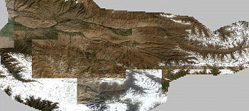
- The main source of data for creating or updating the data project is the existing remote sensing data materials available in the archives of satellite operators, up to the most current date. Alternatively, new imaging can be commissioned.
- Additional and reference materials such as geographical descriptions, maps, atlases of larger or smaller scales, directories, and any data available to the client are utilized in the creation or updating of the data project.
- Existing cartographic products from public and private archives or cartographic products provided by the client can be used as the basis for updating the DTM.
- The timeframe for creating a digital terrain model based on satellite or aerial imagery data depends on the volume and complexity of the order. The minimum timeframe is 25 (twenty-five) working days.
- The delivery timeframe for the completed digital terrain models is 25 (twenty-five) working days.
Licenses


Our partners


")


")

Articles
Sat-Sun: Non-working days