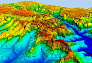
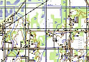
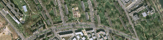
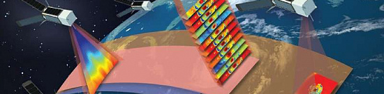
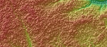
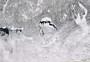
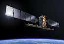
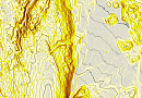
Land displacement monitoring (InSAR Ground Deformation Monitoring) is carried out through the implementation of interferometric processing of multi-pass radar images of the same area, acquired with the same technical parameters and imaging geometry.

Radar interferometry allows for the detection of surface displacement and objects located on it with centimeter-level accuracy (for the Earth's surface) and millimeter-level accuracy (for buildings and structures), using spaceborne radar images as input data.

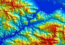
Geodetic monitoring aims to detect deformational changes, determine the causes of their occurrence, and provide forecasts for their future development and changes.

The Purpose of Land displacement monitoring (InSAR Ground Deformation Monitoring)

To detect and assess ground displacements above areas of underground mining, map the deformation of quarry walls and benches, or identify deformations of structures, expensive GPS monitoring is not necessary. Radar interferometry allows achieving millimeter-accuracy measurements over large areas, comparable to the precision of GPS monitoring, without the need for costly field infrastructure.

Radar interferometry is indispensable for:

  • Timely detection of ground displacements above areas of underground mining;
  • Mapping deformations of quarry walls and benches;
  • Monitoring natural and man-made displacements and deformations of buildings and structures;
  • Monitoring critical industrial facilities, pipelines, roads, railways, and other objects.
Работник

Goals and Objectives of Land displacement monitoring (InSAR Ground Deformation Monitoring)

Geodetic monitoring. Monitoring the deformation of the Earth's surface using satellite radar data allows for the achievement of the following objectives:

  • Monitoring deformation and displacement of the Earth's surface in mineral deposits;
  • Observing deformations of structures in urban areas;
  • Monitoring critical industrial facilities;
  • Pipeline monitoring;
  • Monitoring of roads, railways, and other objects.
The monitoring of deformation processes of the Earth's surface is conducted with the following purposes:

  • Fulfilling the requirements of Russian legislation in the field of industrial safety and subsoil protection;

  • Forecasting the extent of possible deformations of the Earth's surface;

  • Identifying the influence of mining operations on vertical and horizontal movements of the Earth's crust.

Prices for services

Consultation Free
Selection of images, preliminary analysis, preparation of technical task Free
Ordering radar images The cost of satellite imagery is calculated individually for each order and may vary:
- Use of free satellite images
- And/or use of commercial satellite images (minimum cost of $1000 per scene (minimum 5 scenes)) *
Work of technical specialists and expert(s) From 1,000,000 rubles
TOTAL COST From 1,000,000 rubles

* - if the Client does not provide their own imagery or it is not possible to use free images

The cost depends on:

  • Area of the project site (work area);
  • Type of imagery - archival / new, free images / paid images;
  • Number of images;
  • Quality characteristics of the images;
  • Terrain complexity;
  • Seasonality of the work;
  • Advance payment amount;
  • Whether it is necessary to purchase imagery or it is provided by the Client;
  • And more.

The cost of execution is calculated on an individual basis, taking into account a specific of task.

After receiving the task description, we calculate the cost and send you a commercial offer.

Period of execution

The completion time of the work is from 20 business days from the date of receiving the advance payment and is calculated individually for each client.

The completion time of the work depends on:

  • Total area of the project site;
  • Availability of archival satellite imagery, the need for new imaging;
  • Requirements for satellite imagery, the final deliverable.

The turnaround time for the service depends on the complexity of the work and is calculated individually for each client.

How to place an order:

Step 1: Submit an application on the website, providing the following:

  • Location of the research object (coordinates);
  • Questions;
  • Dates for the analysis.

Step 2: Agreement on technical specifications and cost:

  • Research cost starts from 1,000,000 RUB;
  • Satellite imagery is paid separately (one radar image starts from 1000 USD).

Step 3: Contract signing and commencement of work:

  • Completion time is 20 business days from the date of receiving the advance payment - payment is accepted only via bank transfer.

Need for consultation?

Fill the form and we will contact you

By clicking the «Send» button, you give your consent to the processing of your personal data, in accordance with Federal Law No. 152-FZ of July 27, 2006 «On Personal Data», on the conditions and for the purposes specified in the Consent to the processing of personal data.

Stages of service provision

Stage 0 (Before contract signing):

  • Receiving and validating data from the Client. It is necessary to agree on the task requiring a solution, the size and nature of the area, and the requirements for the production to calculate the cost and timeline of the work.

RESULT: Possibility (YES/NO) of providing the service

Stage 1 (Before contract signing):

  • Agreement on technical specifications
  • Planning the survey. The optimal survey geometry is calculated, and a sequential series of radar images of the designated monitoring area is acquired. The monitoring period can range from a couple of images (Differential Synthetic Aperture Radar - DInSAR) to several months or even years (Permanent Scatterer Interferometry).
  • Final determination of labor and material costs, agreement on timelines and costs

RESULT: Signed contract

Stage 2 (Contract execution):

  • Performing the radar survey, preliminary processing, and delivery of remote sensing data from radar satellites to the Client's areas of interest.
  • Processing the materials to generate models of vertical and horizontal (east-west direction) displacements of the Earth's surface, as well as objects and structures, using radar differential interferometry on the Client's areas of interest.
  • RESULT: Delivery of materials to the Client.

The result of the provision of services

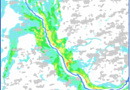
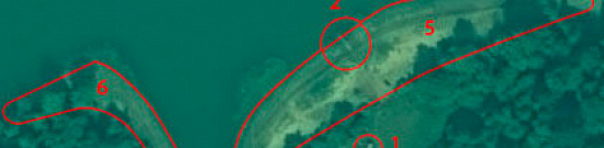
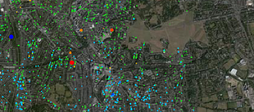
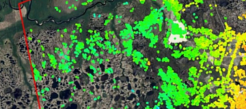
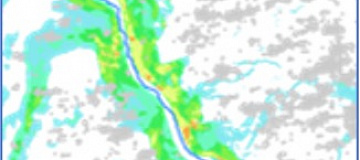
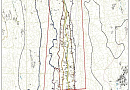
The Client receives a map of ground surface displacements, which visually and numerically displays the displacements of the Earth's surface and structures as of each survey date, accompanied by a technical report. Additionally, displacement maps can be generated for each direction (including horizontal component), along with a technical report.

  • Digital models of vertical and horizontal displacements of the Earth's surface, as well as objects and structures, occurring during the period of radar satellite imaging over the Client's areas of interest;
  • Results of interferometric processing of radar satellite images to create displacement models of the Earth's surface, objects, and structures during the period of these surveys.
  • Proposals for organizing targeted regular radar satellite monitoring of ground surface displacements over the Client's areas of interest, as well as objects and structures, using radar differential interferometry.

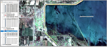
Maps are provided in PDF, GeoTIFF, and contour lines (shp format).

Possible uses of the results

  • Enhancement and validation of traditional geodynamic and geodetic monitoring technologies;
  • Risk monitoring and control of extensive objects (bridges, pipelines, underwater crossings, etc.);
  • Calibration of deposit models;
  • Control of underground gas storages;
  • Ensuring the safety of mineral extraction;
  • Assessment of infrastructure stability;
  • Evaluation of territories in the design of new objects, including using archival satellite images;
  • Monitoring the impact of new construction on existing infrastructure;
  • And more.

Requirements for source data

Exact geographical coordinates of the object in the required coordinate system (the specialists of GEO INNOTER will clarify the coordinates provided by the Client in any convenient form).

A set of multi-temporal images (at least 12 depending on the task)

Software:

  • GIS - QGIS, ArcGIS, etc.
  • Processing - ERDAS, ENVI SARscape, SNAP, etc.

Related services

Satellite Imagery as evidence in legal proceedings
Find out the price
Satellite & UAV Monitoring
Find out the price
Aerial & UAV imagery
Find out the price
Thematic mapping
Thematic mapping
Find out the price
Remote sensing of the earth (RS)
Find out the price
Космический мониторинг территории
Find out the price
Судебная экспертиза
Судебная экспертиза
Find out the price
Составление тематических и специальных карт, планов
Find out the price
Zazulyak Evgeny Leonidovich
The material was checked by an expert
Zazulyak Evgeny Leonidovich
Engineer, 28 years of experience, Education - Moscow Topographic Polytechnic Technical School, St. Petersburg Higher Military Topographic Command School named after Army General A.I. Antonov, Military Engineering University named after V.V. Kuibyshev. Kuibyshev Military Engineering University.

Customers

Rosneft
Gazprom
Gazprom neft
Lukoil
Transneft

FAQ

Seismic monitoring provides information that is a short-term precursor to the oncoming deformation of rocks at local sites. Space monitoring provides information in the long term about the processes occurring both in local observation sites and over a large area. Thus, these methods do not exclude, but complement each other.
The main advantage is that space monitoring can cover large areas. At medium and large fields, there are long geodetic lines with thousands of reference points. As a rule, they are surveyed once or twice a year at each point where a reference is laid. Thus, information on displacements is available at intervals of once a year or once in a week. During this time, deformation may develop outside of the Customer's control. Space radar monitoring allows the site to be evaluated on a monthly basis.
The main data extracted from a radar survey are amplitude and phase. Repeated radar survey allows to determine phase differences caused, for example, by shifts of the earth's surface. Such shifts can be identified when processing radar survey data in specialized software products using various methods. The principal advantage of radar interferometry over other methods of monitoring vertical and lateral deformations is the direct measurement of differences in relief that occurred between two (three, five) surveys. The resulting interferometric displacement file usually shows an integral picture of displacements.

On the present day, there is no method that can guarantee the prediction of ground surface collapse. There are criteria for the occurrence of such catastrophes, some of which (such as ground surface displacement rate, its spatial gradient, displacement acceleration) can be assessed using data from spaceborne radar imaging. In combination with other methods (repeated leveling, satellite geodesy, seismic monitoring), radar imaging allows for obtaining comprehensive and systematic information about ground surface displacements, evaluating the mentioned criteria, and spatially identifying hazardous areas.

The number of satellites, the quality and variety of the data received are increasing, the technical characteristics of imaging systems and methods of processing the data received are being improved, and new software for processing data from remote sensing radar satellites is constantly being updated and developed.
Geodetic monitoring is a system of permanent and/or continuous observations, analysis and forecasting of the current geodynamic state of the geological environment, carried out within the specified regulations within the considered natural-technical system.

Geodetic monitoring is required in the following cases:

  • During the construction, reconstruction, and restoration of buildings and structures;
  • When using industrial, hydro, or energy technical facilities;
  • When intervening in the geological or hydrological conditions of a site.

Geodetic monitoring is conducted during the construction of new structures or the restoration of existing ones to monitor settlement, deformation, and tilt. Permissible limits for these parameters are specified in construction codes, standards, regulations, and building rules. These limits should not be exceeded. The goal of geodetic monitoring is to track these values and prevent their exceedance.

Geodetic monitoring is performed throughout the year following the completion of construction or reconstruction works. During the observations, the following processes are monitored:

  • Settlement - vertical displacement;
  • Shifts - horizontal displacement;
  • Tilts - deviations from the vertical.

This helps to prevent deformations, collapses, and other adverse events. If the changes do not stabilize, monitoring is extended and continued beyond the initial year.

The frequency depends on the construction and erection cycles. After completion of construction works on the site, monitoring is usually carried out until the settlement stabilizes. Geodetic monitoring cycles are usually conducted once per calendar month, in case of intensive growth of settlement the frequency of cycles can be increased up to 3 times per month (and more).
The purpose of geodetic monitoring is to obtain data on critical deviations of buildings and structures from those specified in the project, with the determination of the time interval of occurrence of these changes. Geodetic monitoring of buildings is a periodic check for deformations, which is carried out by geodetic methods, through inspection and calculations, during the construction of buildings and structures.
  • Regular monitoring of the current natural and man-made geodynamic state of the subsurface within the territory of deposits using modern high-tech equipment and efficient measurement techniques.
  • Identification of patterns of occurrence and spatial-temporal development of various manifestations of natural and man-made subsurface geodynamics, including establishing the nature and mechanism of relationships between these manifestations and spatial-temporal changes in the parameters of deposit development. Conduct and systematically update the geodynamic zoning of the deposit territory (with necessary revisions as new geodynamic information is obtained), identifying potential areas of increased geodynamic risk within the deposit territory.
  • Providing recommendations for optimizing the prospective placement of systems and facilities on the deposit territory to avoid potential emergency situations related to geodynamic factors.
  • Systematically compile information and annual comprehensive reports with necessary attachments, recommendations, and programs for subsequent monitoring cycles.
Methods of remote sensing of the deposit territory from space (InSAR) allow for:
  • Quantitative assessment of the degree of modern activity of faults within the developed hydrocarbon deposit territory and adjacent areas, as well as the temporal changes in fault activity.
  • Monitoring possible ground subsidence associated with deposit development (fluid extraction, reservoir pressure depletion) in the early stages of their development.
  • Detection of local variations in gravity reflecting deformation processes and fluid dynamics within the geological environment occurring in the geological intervals, including potential compaction of reservoir rocks due to hydrocarbon extraction, temporal changes in reservoir pressure, and fluid withdrawal/injection balance.
  • Identification of local areas with anomalous deformation processes and estimation of parameters of sources of local anomalous movements.
  • Development of possible prognostic signs of hazardous geodynamic processes.
  • Prediction of areas with increased geodynamic risk within the deposit territory.
InSAR Ground Deformation Monitoring is a technique that uses radar images from satellites to measure ground displacement over time. It contributes to land displacement monitoring by providing precise and detailed information on surface movements, including subsidence, uplift, and other deformations.
The InSAR process involves comparing radar images acquired at different times to detect changes in the phase of the radar signal. Key steps include data acquisition, image processing, interferogram generation, and phase unwrapping. These steps result in ground deformation maps that display changes in elevation.
InSAR has diverse applications, including monitoring natural processes such as volcanic activity, landslides, and tectonic movements. It also aids in infrastructure monitoring, detecting subsidence in urban areas, and supporting environmental management by assessing the impact of ground deformations on ecosystems.
InSAR technology addresses challenges by providing a wide-area coverage and high precision without the need for direct physical contact with the ground. Unlike traditional methods, it offers continuous monitoring, high accuracy, and the ability to detect small-scale deformations over large areas, enhancing efficiency in land displacement monitoring.
InSAR contributes to early warning systems by detecting ground deformations that may precede natural hazards such as landslides or volcanic eruptions. This early detection enables timely warnings, allowing for the implementation of risk mitigation strategies, evacuation plans, and the protection of infrastructure and communities in vulnerable areas.

Licenses

License for implementation of geodetic and cartographic activities (page 1)
License for implementation of geodetic and cartographic activities (page 2)
Application for the license for implementation of geodetic and cartographic activities
ISO 9001:2015 Certificate of Conformity №СДС.ФР.СМ.00813.19 (page 1)
ISO 9001:2015 Certificate of Conformity №СДС.ФР.СМ.00813.19 (page 2)

Warranty

Guaranteed execution of work in accordance with building codes, standards, and regulations, using advanced methodologies and the most up-to-date software.
  • Federal Law "On Subsoil" dated February 21, 1992
  • Federal Law "On Industrial Safety of Hazardous Production Facilities" dated July 21, 1997
  • "Instructions for the Approval of Measures to Protect Buildings, Structures, and Natural Objects from the Harmful Effects of Mining Operations," RD 07-113-96, State Technical Supervision
  • Client's internal regulations and requirements

We guarantee 100% quality of service provision. By collaborating with GEO INNOTER specialists, you eliminate risks and losses.
The presence of qualified personnel experienced in working with specialized software ensures these guarantees!

Our partners