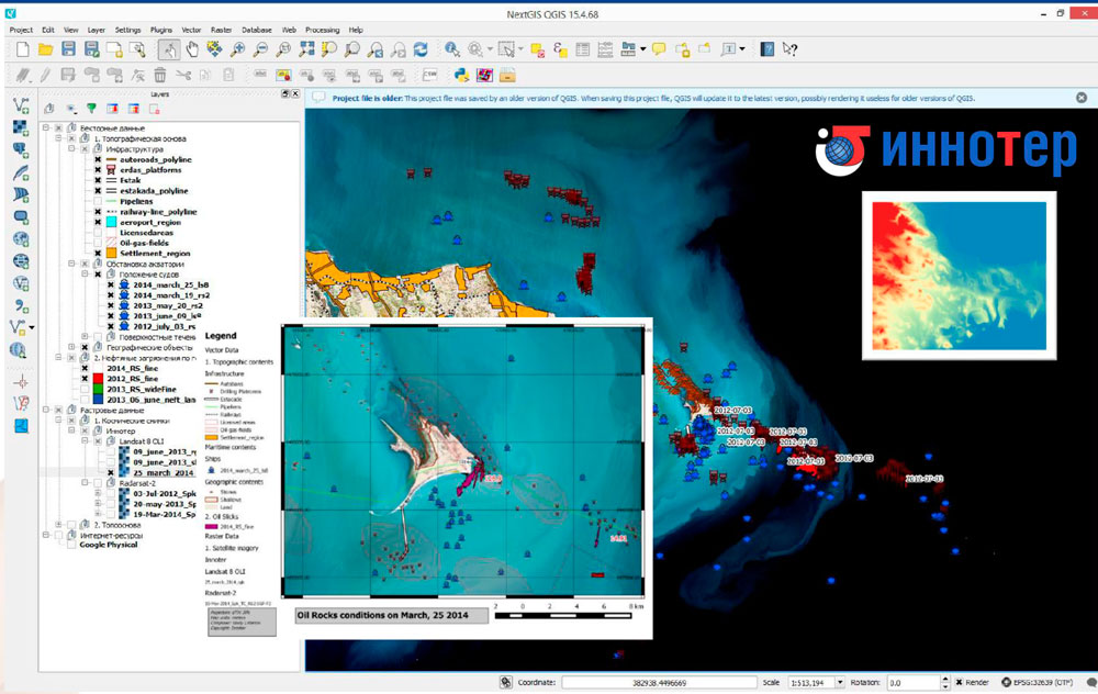
Geographic information systems (GIS) are systems for the keeping and processing of geospatial data. The earth's surface remote sensing methods allow to get relevant and reliable information for GIS development.
GIS can be helpful for:
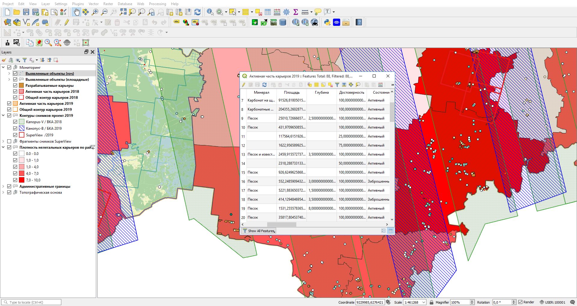
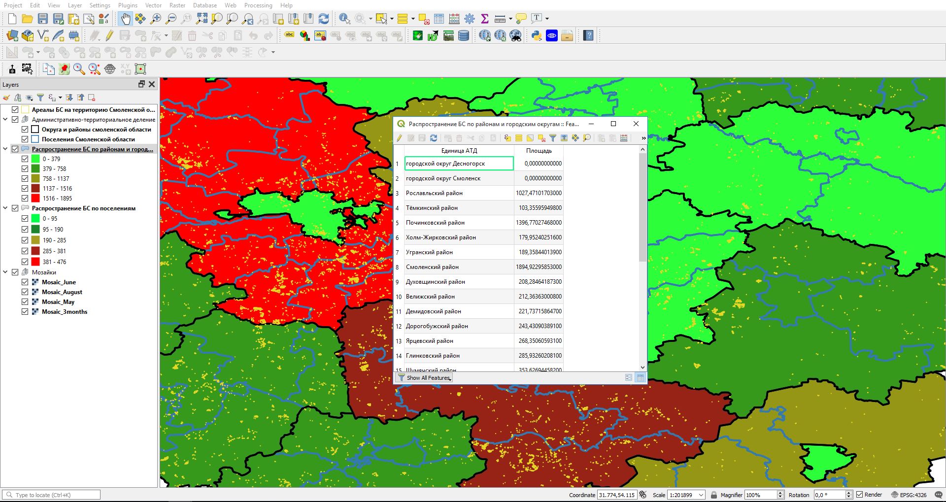
Various researches showed that approximately 80% of all the information we use is distributed in space and has a spatial referencing. Today GIS technologies allow specialists to work with vector and raster data, make complex calculations, visualize results of the analysis.
Step by step process of GIS development:
Depending on the purpose of the GIS, these programms can be classified in several categories:
GIS is widely used by state bodies, oil and gas producing companies, agricultural and forestry companies, ecological organizations, transport organizations, cartographic bureaus.
- spatial data acquisition;
- spatial data processing;
- terrain's surface monitoring;
- forecasting the possible development of the current situation.
Various researches showed that approximately 80% of all the information we use is distributed in space and has a spatial referencing. Today GIS technologies allow specialists to work with vector and raster data, make complex calculations, visualize results of the analysis.
Step by step process of GIS development:
- preliminary study of tasks, which will be solved with GIS;
- preparation of cartographic materials, city plans, DTMs and DSMs;
- remote sensing data processing;
- software development and final GIS implementation.
Depending on the purpose of the GIS, these programms can be classified in several categories:
- desktop;
- web – for online-usage;
- corporate – for usage within one company;
- mobile – for smartphones and tablets;
- spatial data banks (databases);
- GIS for the government.
GIS is widely used by state bodies, oil and gas producing companies, agricultural and forestry companies, ecological organizations, transport organizations, cartographic bureaus.