



Raster base, vector layers of pollution sources and a report per the agreed terms of reference.
Search the site
What the service is used for
Environmental assessment
Assessment of the environmental situation in the region.
Subsoil-use violations
Detection of violations of subsoil-use rules.
Emergency facilities
Identification of emergency facilities or special structures.
Oil spills
Prevention and response to emergency oil spills.
Emissions and MSW landfills
Detection of discharges into water bodies, oil spills on land and water, unauthorised MSW landfills and a retrospective of their condition.
Did not find your task?
Describe the area and pollution type — we will assess the RS archive and the scope of work.
What you will receive as a result of the work
01
Raster ortho base
Orthorectified satellite images ready for GIS loading.
If required, image orthorectification, a seamless orthomosaic, colour correction and cloud-cover correction, and export to the agreed coordinate systems and projections are performed.
What you get
- raster base as orthorectified satellite images
- seamless orthomosaic with colour correction and cloud-cover correction
- export to various coordinate systems and projections
Processing composition and projection are fixed in the terms of reference.
02
Pollution vector layers
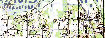
Object interpretation, identification of pollution and potential sources, vector GIS layers with semantics.
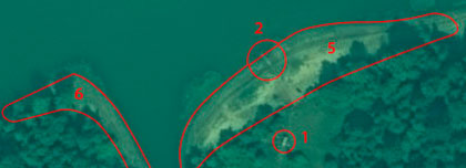
Layers are created using a generally accepted classifier or the customer’s classifier: discharges into water bodies, oil spills on land and water, MSW landfills, gas emissions, forest sites in unsatisfactory condition.
What you get
- vector GIS layers of identified pollution and potential sources
- semantic information per the agreed classifier
- for an MSW landfill retrospective — analysis of condition over the period; in some cases the predominant stored material (plastic, metal)
Object composition and classifier are agreed in the terms of reference.
03
Technical report
A clear analytical report on the results of pollution-source identification — if required.
Analysis of the obtained information and a summary technical report are prepared to the customer’s requirements: report contents are agreed before the contract is signed.
What you get
- summary technical report if required
- analysis results of identified pollution and potential sources
- materials ready for GIS loading together with the raster and vector layers
Whether a report is needed and its contents are fixed in the contract.
04
Spectral analysis
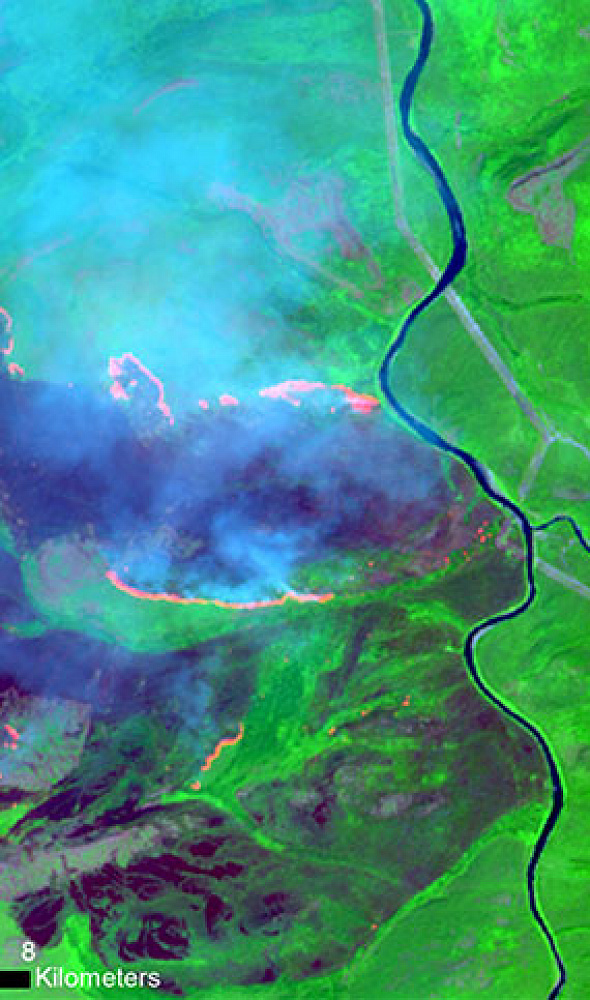
Survey in spectral channels, including SWIR, expands the options for analysing territory condition.
The SWIR channel is used to determine plastic content in stored materials. The area of a water-body oil-product spill depends on the spatial resolution of the image and processing accuracy; the shape of an oil slick changes quickly because of water-mass movement.
What you get
- analysis in the spectral channels available for the task
- with SWIR available — assessment of plastic content in stored materials
- area metric of petroleum products on water, taking image resolution into account
SWIR availability and resolution depend on the selected spacecraft and archive.
How the work goes
Cost and timeline
Cost depends on the study-site area, the price of suitable satellite imagery, the accuracy of result georeferencing and the required processing of satellite images.
- consultation — free of charge
- ordering satellite images — from 300 USD per image depending on spatial resolution and satellite-operator requirements for the placed order
- image processing, vectorisation, preparation of the technical report — calculated individually depending on site area and terms-of-reference requirements
- on the service card — from 300 $
- timeline on the card — from 10 days; final timeline — from 10 working days
- alignment of the terms of reference — from 1 to 5 working days; contract signing and receipt of the advance — from 1 to 5 working days
- contract delivery — from 8 days from the date the 100% advance is received
- satellite images are paid separately
- payment by bank transfer only; contract delivery starts immediately after the advance is received
Imagery — from 300 USD per frame
Timeline — from 10 working days
Consultation — free of charge
What is needed for a quote
To estimate feasibility, cost and timeline, please provide:
- exact location of the area of interest (coordinates, district name, region, shp file, etc.)
- requirements for the satellite-image acquisition period (archive or new survey)
- assumed or existing type of pollution
- requirements for result accuracy
- requirements for the technical report contents
- required final product format
- other available supporting information
If the listed information cannot be provided, describe the intended use of the RS materials — specialists will analyse the requirements and propose an optimal option.
Describe the area and pollution type — we will assess the archive and the scope of work.
Why Innoter
Prompt access to archives
Suitable archive imagery can be obtained faster when the required area and date are already available from operators.
No aviation clearances
A new satellite survey does not require the flight clearances typical of aerial surveys.
Large and remote areas
A single satellite pass covers large areas and makes it possible to work in hard-to-reach regions.
Direct agreements with operators
Distribution agreements help select archive imagery and order new surveys from different providers.
Software and server infrastructure
Modern software and computing capacity for quality control and processing of large data volumes.
Experienced specialist team
Years of experience on complex projects and specialists in cartography, photogrammetry and remote sensing.
RS data, spectrum and timeline
Composition depends on the pollution type, archive or new survey, resolution and spectral channels.
1
Identification of local pollution sources is determination of new, generally uncharacteristic physical, chemical or biological agents introduced into the environment or arising in it. This is detection of pollutants, their concentration and origin.
By type, pollution is divided into anthropogenic and natural; by scale — into local, regional and global.
2
According to statistics, in 2015 some 9 million people worldwide died as a result of pollution of some kind (Wikipedia). The environmental state of the planet has been placed under the control of states implementing environmental programmes, for example Presidential Decree of the Russian Federation No. 176 of 19.04.2017 “On the Strategy of Environmental Security of the Russian Federation for the period until 2025”.
Organisations that violate environmental protection are subject to large fines and other restrictions, up to a ban on activity. Timely detection of harmful leaks helps preserve environmental condition and the enterprise budget: it is simpler and cheaper to eliminate a leak before the scale becomes catastrophic.
3
Satellite images are used to identify discharges of harmful substances into water bodies and facilities that may cause them; oil spills on land and on the water surface; unauthorised MSW landfills and their condition in retrospect — in some cases the predominant stored material (plastic, metal, etc.); the degree of gas emissions into the atmosphere; forest-stand sites in unsatisfactory condition so that measures can be taken to save the forest.
4
Territory condition is assessed remotely, without a field visit. The study does not depend on the configuration or geographic location of the site. Archive materials are available worldwide from 1999. A large or linearly extended territory is obtained in a short time; with a suitable archive image the entire territory may be on a single frame.
Survey in various spectral channels expands the analysis. Satellite images are substantially cheaper than UAV flights, especially for a geographically remote site. UAV or aerial photography is indispensable under prolonged high cloud cover over the area of interest.
5
Alignment of the terms of reference — from 1 to 5 working days. Contract signing and receipt of the advance — from 1 to 5 working days. Contract delivery — from 8 days from the date the 100% advance is received. Final timeline — from 10 working days; on the card — from 10 days.
After the advance, RS materials are ordered, incoming inspection is performed, if required orthorectification and an orthomosaic, interpretation of pollution and sources, semantics, export to the required coordinate systems and a technical report. Work is done for individuals and legal entities, sole traders, state and municipal authorities and foreign customers.
6
Qualified staff with extensive experience in specialised software makes it possible to deliver the work on time and to the required quality.





Frequently asked questions
Answers to key questions about service parameters, timelines, deliverable formats and workflow. If you did not find what you need — contact us and we will help.
Yes. This requires spectral analysis of space images using the SWIR infrared channel. At the moment satellites capable of SWIR data acquisition have been put into orbit and are successfully operating.
Yes. The accuracy of this metric will be influenced by the spatial resolution of the image used, as well as the degree and accuracy of its processing. It should also be taken into account that any oil slick on the surface of a water body changes its shape rather quickly due to the natural process - constant movement of water mass.

Need satellite imagery or help choosing the right data?
Describe your task, area of interest, and desired outcome. We will check data
availability, assess new acquisition options, and propose the optimal solution in terms of timelines, cost,
and quality.
Discuss the project
clients who trust us
25+ years in the geodata market







