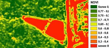
MSW landfill sites Monitoring is a system of observations of the state and pollution of the environment at waste disposal areas, as well as at unauthorized sites.

Municipal solid waste (MSW) is biological or artificial food products that are unusable as a result of loss of their consumer properties. It can also be household items or similar goods that have lost their appearance or become unusable.

Why MSW landfill sites Monitoring is needed

Decomposition products of solid household waste, when released into the natural environment, have a negative impact on landscape components and the surrounding environment. Therefore, the task of identifying landfills and determining the characteristics of solid household waste disposal sites is relevant to timely prevent their negative ecological impact.

Periodic monitoring of landfills allows to:

  • Assess their growth rate,
  • Create a plan for liquidation,
  • Apply measures to prevent the appearance of new contaminations.
Работник

Goals and Objectives of MSW landfill sites Monitoring:

The goal of monitoring solid household waste disposal is systematic control over the state of natural objects in the studied area for analytical assessment of their condition in terms of environmental safety and resource availability, and subsequent prediction of negative changes in the parameters of the natural environment.

  • Preliminary assessment of the adverse impact of solid household waste landfills on the environment;
  • Reducing the negative impact of waste on people and the environment;
  • Identification and monitoring of unauthorized landfills;
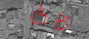
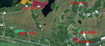
  • Mapping of various types of waste disposal sites.


Advantages of Using Remote Sensing Data

  • Archived data is already available to the operator!
  • Current and up-to-date information that minimizes your financial, time, and labor costs!
  • Coverage of extensive, including hard-to-reach, territories at a single moment in time;
  • It allows practically continuous monitoring of changes and dynamics in solid household waste disposal sites.

Prices for services

Activities Free / cost per unit of measurement
Consultation Free
Selection of images, preliminary analysis Free
Ordering images From $300 to $600 USD per image (number of images depends on the area of the territory)
Work of technical specialists From 70,000 rubles (calculated individually)
Report preparation From 50,000 rubles (calculated individually)
TOTAL COST From 120,000 rubles (calculated individually) *

*The price depends on the area of the surveyed territory and is calculated individually for each customer.

The cost of execution is calculated on an individual basis, taking into account a specific of task.

After receiving the task description, we calculate the cost and send you a commercial offer.

Period of execution

Harmonization of issues and applied images: from 1 to 15 days*
Contract conclusion: from 1 to 3 days
Receipt of images: from 1 to 5 days **
Image processing: from 10 to 35 days
Space image interpretation, creation of training sample polygons for space image classification: from 1 to 20 days
Vectorization of the obtained classification: from 1 to 5 days **
Detection of MSW storage sites: from 1 to 5 days **
Report writing: from 2 to 15 days
TOTAL TIME: from 20 days **

** working days
** from the date of receipt of 100% advance payment, when ordering a new survey the terms will increase

Lead time from 20 days depends on the area of the surveyed territory, calculated individually for each customer.

Need for consultation?

Fill the form and we will contact you

By clicking the «Send» button, you give your consent to the processing of your personal data, in accordance with Federal Law No. 152-FZ of July 27, 2006 «On Personal Data», on the conditions and for the purposes specified in the Consent to the processing of personal data.

Stages of service provision

Stage № 0 (Before Contract Conclusion):

  • Determination of the observation object;
  • Definition of dates and parameters for the desired imaging (imaging period, type of imaging);
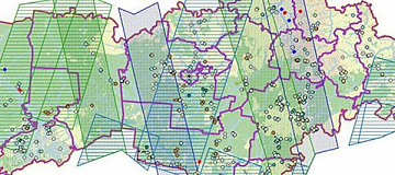
  • Checking the availability of archive remote sensing data for the area of interest;
  • Verification of selected archive images to meet the customer's requirements;
  • Submitting a request to the operator(s) for new imaging (if necessary).

RESULT: possibility (YES/NO) of providing services


Stage № 1 (Before Contract Conclusion):

  • Agreement with the customer on archive remote sensing data available from operators;
  • Agreement with the customer, if needed, on the satellite from which the new imaging will be acquired, as well as the timing and parameters of the new imaging;
  • Agreement on the parameters required for the analysis;
  • Final determination of labor and material costs, agreement on delivery times and costs.

RESULT: concluded contract


Stage № 2 (Contract Execution):

  1. Receipt of 100% advance payment;
  2. Ordering of materials for satellite imaging;
  3. Incoming inspection of remote sensing data;
  4. Processing of remote sensing data, obtaining orthophoto maps (if necessary);
  5. Interpretation of the satellite image, creation of training sample polygons for satellite image classification;
  6. Detection of solid waste disposal sites;
  7. Mapping of the territory with locations of solid waste disposal sites;
  8. Preparation of the report.

RESULT: report on the detection of solid waste disposal sites, presentation materials, thematic maps.

The result of the provision of services

GEO INNOTER provides a report on the results of the analysis of the territory for the presence of solid waste disposal sites, presentation materials, thematic maps, georeferenced TIFF (Geo TIFF), and vector layers of detected objects in Mid/Mif format. All results are delivered on electronic media or through the Internet via FTP servers, and text materials are also duplicated in printed form.

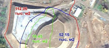
Based on the research conducted by GEO INNOTER specialists, it is also possible to perform forensic expertise on the presence of solid waste disposal sites and interpretation of geometric characteristics (area, shape, perimeter).


Requirements for Source Data

To detect solid waste disposal sites and obtain geometric parameters (perimeter, coverage area, etc.), it is necessary to use multispectral images with high and very high spatial resolution.

To obtain geometric parameters in 3D space (relief, volume, etc.), radar data or stereoscopic images are required.

If it is not possible to provide the specified information, please provide details about the intended use of the remote sensing data, and GEO INNOTER specialists will analyze the requirements and propose the optimal solution for the problem.

Related services

Digital terrain models (DTM)
Find out the price
Orthoimagery (Orthorectification)
Find out the price
Aerial & UAV imagery
Find out the price
Topographic Site Plan
Find out the price
Pollution determination using remote sensing data
Find out the price
Remote sensing of the earth (RS)
Find out the price
Zazulyak Evgeny Leonidovich
The material was checked by an expert
Zazulyak Evgeny Leonidovich
Engineer, 28 years of experience, Education - Moscow Topographic Polytechnic Technical School, St. Petersburg Higher Military Topographic Command School named after Army General A.I. Antonov, Military Engineering University named after V.V. Kuibyshev. Kuibyshev Military Engineering University.

Customers

Rosneft
Gazprom
Gazprom neft
Lukoil
Transneft

FAQ

  • location of the object of interest (coordinates, name of the area, region, shp-file, etc.);
  • survey period requirements (period for which archive data can be used or a new survey is required).
The terms of work execution depend on the area of the territory, requirements to the survey parameters, what parameters should be obtained during the survey. The minimum period of work execution is from 10 working days.
  • The minimum order of archived super-resolution space images under the terms of suppliers is from 25 square kilometers.
  • The minimum order of new ultra-high resolution space images according to suppliers' conditions is from 100 square kilometers.

Licenses

License for implementation of geodetic and cartographic activities (page 1)
License for implementation of geodetic and cartographic activities (page 2)
Application for the license for implementation of geodetic and cartographic activities
ISO 9001:2015 Certificate of Conformity №СДС.ФР.СМ.00813.19 (page 1)
ISO 9001:2015 Certificate of Conformity №СДС.ФР.СМ.00813.19 (page 2)

Warranty

The main regulatory legal documents defining the tasks and procedure for monitoring solid waste disposal sites are:

  • Federal Law dated 10.01.2002 No. 7-FZ (as of 30.12.2021) "On Environmental Protection".
  • Resolution of the Government of the Russian Federation dated 06.06.2013 No. 477 (as of 03.08.2020) "On the Implementation of State Monitoring of the State and Pollution of the Environment" (together with the "Regulation on State Monitoring of the State and Pollution of the Environment").

We guarantee 100% quality of service provision. By collaborating with GEO INNOTER specialists, you eliminate risks and losses!

The presence of qualified personnel with extensive experience in working with specialized software allows us to guarantee timely and high-quality execution of the work!

Our partners