of geospatial solutions
Sat-Sun: Non-working days
Customer
Department of architecture and urban planning of the city of Rostov-on-Don
Project's objective
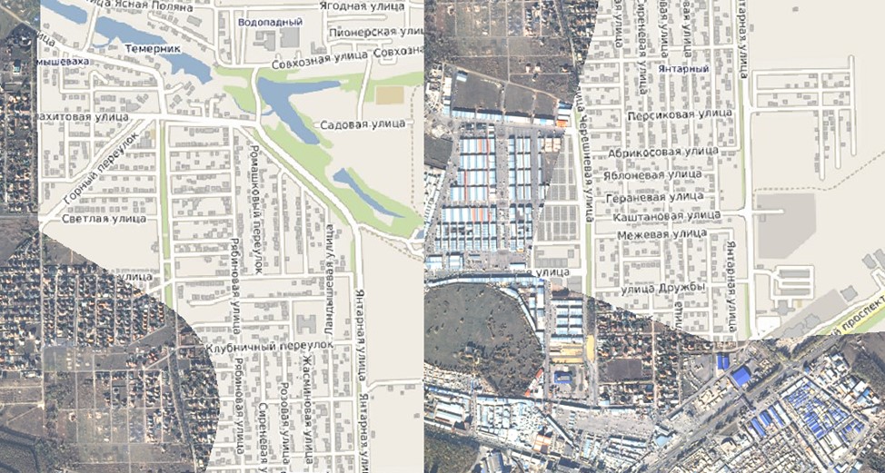
Obtaining remote sensing data (high-resolution satellite images) on the territory of the city district "City of Rostov-on-Don" for use as source data in the development of urban planning documentation, as well as for assessing the current state of the territory and monitoring its development on the basis of urban planning documentation, for monitoring compliance with the requirements of legislation in the field of urban planning activities.
Completed work
Work description
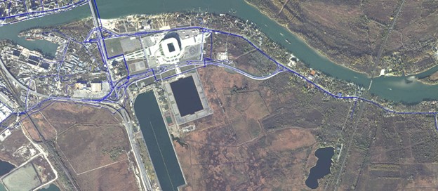
1) Conducting a new satellite survey with ultra-high resolution of 0.5 m on the territory of the city district "City of Rostov-on-Don»;
2) Receipt and verification of Earth remote sensing materials for compliance with the technical specification;
3) Creation of orthophotos:
a. The working technical design of treatment processes;
b. Preparation of planned altitude information for the work area;
c. Search and preparation of a digital elevation model (digital elevation matrix, CMV);
d. Performing the pansharpening procedure (increasing the resolution of a multispectral image (RGB) by merging it with a panchromatic one);
e. The creation of a swivel mounting;
f. Performing internal orientation of images;
g. Performing mutual orientation of images (the process of measuring the connecting points in the images-the mutual location and binding of images in the block relative to each other);
h. Performing external orientation of images (the process of clarifying the spatial position of data based on reference points received from the customer, if possible, identifying them in the images, characteristic objects of the area according to Open Street Map and Rosreestr data, and rpc coefficients)
i. Loading, stitching, and reprojecting the CMV into the project coordinate systems
j. Data orthotransformation (the process of converting data into an orthogonal projection with automatic correction of distortions caused by the angle of the survey and the terrain);
k. Creating a seamless mosaic;
l. Alignment of the color characteristics of the mosaic;
4) Splitting into sheets and exporting the received materials in the coordinate system of the city of Rostov-on-Don, MSK-61 and in WGS 84 UTM 37N in the *.GeoTIFF and *.tab formats
Results
As a result of the work performed, orthorectified mosaics of a given area were obtained in three coordinate systems (the coordinate system of the city of Rostov-on-Don in 1965, MSK-61 and WGS 84 UTM 37 N) with a spatial resolution of 0.4 m.In the form of a three-channel color-synthesized (in natural colors) orthorectified image, radiometric resolution of 16 bits per pixel. Radiometric, geometric, atmospheric and color corrections were performed, the colors were balanced and brought to natural tones, the cloud cover was corrected by changing the cut lines and the cloud cover filter.
Need for consultation?
Fill the form and we will contact you
Sat-Sun: Non-working days