your companion in the world
of geospatial solutions
Operation mode:
Mon-Fri: 10:00 - 18:00
Sat-Sun: Non-working days

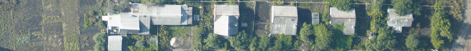
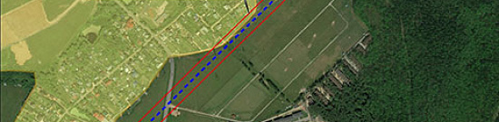
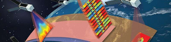
Aerial & UAV imagery is a method of capturing imagrs of the Earth's surface from a certain height using an aerial camera (e.g., unmanned aerial vehicle) mounted on an aircraft, with the aim of obtaining, studying, and presenting objective spatial data of the captured areas.

Aerial surveying is the process of obtaining images (aerial images) of the Earth's surface from a specific altitude. The survey is conducted using a camera installed on a manned or unmanned aerial vehicle (UAV).

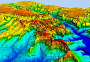
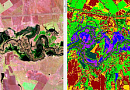
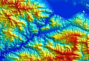
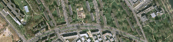
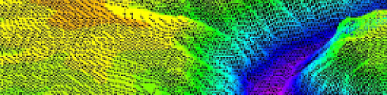
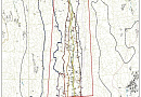
Topographic aerial surveying is the process of obtaining aerial images of the Earth's surface and using them to create topographic maps. These maps depict the physical features of the terrain, including elevation, the location of natural and man-made objects, and the distribution of vegetation. Topographic aerial surveying is typically conducted using specialized cameras mounted on aircraft or unmanned aerial vehicles. The captured images are then processed to create accurate and detailed topographic maps, which can be used for various purposes, including urban planning, infrastructure development, and natural resource management.

What is Aerial & UAV imagery used for?

Aerial & UAV imagery allows for obtaining images of the terrain with high spatial resolution and a full spectrum of necessary information in a compressed timeframe and at reasonable costs.

Additional services offered in conjunction with aerial imagery

In addition to aerial imagery, we also offer the following services:

  • Selection and ordering of aerospace materials
  • Orthorectification and creation of digital orthophotoplans
  • Forensic expertise
  • Creation of cartographic materials
  • Aerospace monitoring
  • Creation of digital maps and topographic plans
Работник

Purposes and Objectives of Aerial & UAV imagery

The main objective of aerial & UAV imagery is to obtain high-quality images of the terrain, both in panchromatic and multispectral modes (R, G, B, NIR, SWIR), to effectively solve a wide range of tasks, including:

  • Geodesy and cartography - creating and updating digital topographic and special maps and plans;
  • Cadastral services - obtaining detailed plans of land plots (cartographic base of real estate cadastre);
  • Surveying investigations to obtain accurate information about sampling, the location of valuable mineral deposits, and the placement of large underground facilities;
  • Environmental conservation - tracking population development and movement, monitoring the quality of vegetation growth, controlling fires, and assessing the ecological condition of natural objects;
  • Agriculture - monitoring crop development and storage of root crops;
  • Military - surveying training grounds and identifying locations.

The capabilities and demand for aerial photography are not limited to this list. The materials can be used for monitoring various types of objects, including transportation infrastructure, creating 3D models of terrain and relief, archaeological purposes, and more.

Advantages of Using aerial & UAV imagery

Aerial & UAV imagery allows for obtaining images with high spatial resolution (up to 1 cm/pixel) and provides a higher level of detail in the resulting orthophotoplans and models. It achieves a root mean square error (RMSE) of point coordinate determination of less than 10 cm and can be performed below cloud cover. Aerial photography is suitable for creating large-scale plans (1:500 - 1:5000), highly accurate CMM (Coordinate Measuring Machine) and CMR (Coordinate Measuring Robot) on small territories (up to 50 km2).

Aerial Photography Parameters

Scale of Aerial Images

1:5000

1:2000

1:1000

1:500

Spatial Resolution

25 cm/pixel

10 cm/pixel

5 cm/pixel

2.5 cm/pixel

Plan Accuracy, m

2 m

0.8 m

0.4 m

0.2 m

Height Accuracy, m

0.33-0.66 m

0.16-0.33 m

0.16 m

0.16 m

Relief Cross-Section, m

1 or 2 m

0.5 or 1 m

0.5 m

0.5 m

Prices for services

Consultation

Free

Preliminary Analysis

Free

Aerial Images Execution

The cost of Aerial & UAV imagery is calculated individually for each order and may vary:

Minimum price for new imagery: 16,000 RUB per 1 km2 (up to 25 km2), and 8,000 RUB per 1 km2 (from 25 km2 to 100 km2). Prices for areas over 100 km2 are determined individually.

Archival imagery: Starting from $5 per 1 km2.

Execution Time

The execution time for aerial photography is approximately 30 days from the prepayment. The duration depends on the time required for coordination with competent authorities, the time required for a representative of the military district headquarters to review the information that constitutes state secrets, and may be extended for significant volumes of work and remote locations.

The cost of aerial photography depends on the area and location of the site, the quality requirements, and the type of photography (final product) - orthophotoplan, dense point cloud, CMM, CMR, 3D model, etc.

The cost of execution is calculated on an individual basis, taking into account a specific of task.

After receiving the task description, we calculate the cost and send you a commercial offer.

Period of execution

Aerial & UAV imagery execution takes approximately 30 working days and is calculated individually for each project.

Delivery of archival aerial images takes around 10 working days (depending on the area).

The execution of aerial imagery depends on the total area of the territory, its remoteness, the time required to obtain flight permits, and the time for a control review. It also depends on the requirements for the imagery parameters and the final product. The timelines and costs are determined individually for each project.

How to place an order:

STEP 1: Submit a request for aerial imagery on the website, providing the following information:

  • Location of the area of interest (coordinates, district or region name, shapefile, etc.)
  • Period of imagery
  • imagery quality requirements (resolution on the ground, positional accuracy of objects, need for laser scanning, type of imagery solar angle)
  • Deadline for delivering the final materials

STEP 2: Technical task approval and cost estimation:

  • The type of aerial apparatus and camera to be used
  • Data presentation formats for aerial images
  • Technical requirements for aerial imagery materials
  • Additional requirements for the output data (if applicable)
  • Final price and timeline

STEP 3: Contract signing and commencement of work:

  • The timeframe is approximately 30 days from the date of receiving a 50% advance payment. Only non-cash payment is accepted. The remaining payment is made after delivering the materials and signing the acceptance certificates.

We work with individuals, legal entities, individual entrepreneurs, government and municipal authorities, foreign clients, and others.

You can also submit your request via email: innoter@innoter.com, or contact us by phone: +7 495 245-0424, or through the online chat on the website.


Need for consultation?

Fill the form and we will contact you

By clicking the «Send» button, you give your consent to the processing of your personal data, in accordance with Federal Law No. 152-FZ of July 27, 2006 «On Personal Data», on the conditions and for the purposes specified in the Consent to the processing of personal data.

Stages of service provision

Stage 0 (Pre-contract)

  • Determination of the aerial imagery area, parameters, and date
  • Selection of the aerial apparatus
  • Identification of the work schedule

RESULT: Feasibility (YES/NO) of providing the service

Stage 1 (Pre-contract)

  • Agreement on the aerial imagery parameters
  • Agreement on additional requirements for the results of aerial imagery
  • Agreement on the format of the data to be delivered
  • Final determination of the workload, material costs, agreement on the timeline and cost of the work

RESULT: Signed contract between the parties

Stage 2 (Contract execution)

  • Receipt of advance payment (50%)
  • Obtaining permits for aerial imagery from the competent authorities
  • Fieldwork (site visit)

- Creation of routes and selection of starting points

- Execution of a plan-altitude justification with the establishment and marking of control points

- Conducting aerial images with compliance to the necessary permissions, image overlap, and flight altitude

  • Office work

- Post-processing of the acquired aerial imagery materials

- Verification of the aerial imagery materials at the military district headquarters

- Creation of orthophotoplans, digital elevation models (DEM), digital surface models (DSM) (if specified in the technical requirements), creation of 3D models, creation of base layers for spatial data infrastructure.

  • Delivery of materials

RESULT: A set of data obtained from field and office work, depending on the buyer's requirements (images, orthophotoplans, point clouds, DSM, DEM)

The result of the provision of services

Results of Aerial & UAV imagerys

GEO INNOTER provides the buyer with the results of aerial imagery in the form of tiles or individual files in any convenient format. In addition to the classic options such as JPEG, PNG, and TIFF, we can also provide data in GeoTIFF format (which includes various types of geotags) and Google Earth KML/KMZ format (allowing the data to be opened in Google Maps, Google Earth, and ArcMap). Depending on the requirements of the technical specifications, orthophotoplans, point clouds, DSM, and DEM can be provided.

Requirements for Source Data

Accurate coordinates of the area of interest, specific requirements for aerial imagery (ground resolution, type of imagery, longitudinal and latitudinal overlap, minimum sun angle, time period for imagery), requirements for point cloud density (if needed), output data formats.

Additional Services

  • Selection and ordering of aerospace materials
  • Orthorectification and creation of digital orthophotoplans
  • Forensic expertise
  • Creation of cartographic materials
  • Aerospace monitoring
  • Creation of digital maps and topographic plans

Related services

Digital terrain models (DTM)
Find out the price
Satellite & UAV Monitoring
Find out the price
Infrastructure Change Detection (PIPELINE Monitoring)
Find out the price
Photogrammetric processing (Image Processing)
Find out the price
Structures and Construction Monitoring
Find out the price
Remote sensing data
Remote sensing data
Find out the price
Космический мониторинг территории
Find out the price
Космическая съемка земли
Find out the price
Фотограмметрические работы
Find out the price
Мониторинг нарушения охранных зон. Дистанционный контроль соблюдения минимальных расстояний с помощью ДЗЗ.
Find out the price
Мониторинг строительства зданий и сооружений
Find out the price
Цифровые модели местности (ЦММ)
Find out the price
Zazulyak Evgeny Leonidovich
The material was checked by an expert
Zazulyak Evgeny Leonidovich
Engineer, 28 years of experience, Education - Moscow Topographic Polytechnic Technical School, St. Petersburg Higher Military Topographic Command School named after Army General A.I. Antonov, Military Engineering University named after V.V. Kuibyshev. Kuibyshev Military Engineering University.

Customers

Rosneft
Gazprom
Gazprom neft
Lukoil
Transneft

FAQ

The provision of Aerial & UAV imagery services depends on a number of factors, with weather being the most important one. In spring, with the snow melting, the "hot" season begins, as it marks the peak of construction activities, advertising campaigns, large-scale earthworks, and extensive land surveys of various areas including forests and agricultural lands.


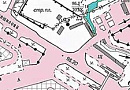
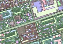
Over the past 5 years, aerial imagery has become closely integrated into the urban planning and updating of situational plans for urban and rural areas, where remote monitoring is required to identify illegal or non-compliant construction, update cadastral maps, and establish actual land use boundaries, thereby detecting unauthorized use.


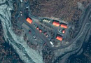
Materials obtained through Aerial & UAV imagery are used in a wide range of fields, including:

  • Geodesy for creating situational and topographic plans;
  • Surveying to obtain accurate information on mining samples, the location of valuable minerals, and the placement of large underground objects;
  • Cadastre services for obtaining detailed plot plans;
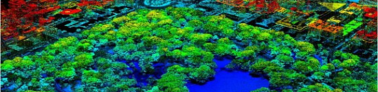
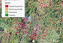
  • Nature conservation to monitor the development and movement of populations, the quality of green vegetation growth, fire control, and the ecological status of natural objects;
  • Agriculture for monitoring crop development and root vegetable storage;
  • Construction, where aerial images with unmanned aerial vehicles (UAVs) allows for effective land planning and visualizing how constructed objects fit into the surrounding landscape;
  • Military purposes for capturing images of training grounds, identifying suitable locations, and more.
Filming can be carried out both with the help of a specially equipped controlled aircraft (airplane, helicopter), as well as with the help of an unmanned aerial vehicle of various types (multicopter drone, fixed-wing UAV, unmanned helicopter, hybrid drone), balloons, paragliders.
AFS can be performed with a resolution of 1 cm/pixel.
Aerial & UAV imagery is understood as imagery the surface of a certain area with reference to coordinate data and creating a series of relief images that are formed with a small overlap. Depending on the perspective used, aerial images is divided into two types: Planned - with the direction of the camera strictly vertically down in relation to the earth's surface. As a result of planned aerial imagery, images are obtained with a flat picture made in an orthogonal projection, which makes it possible to determine the relative position of various objects on a plane without regard to heights. Perspective or panoramic aerial images. The camera in this case is set at an angle to the horizon. Carrying out this type of survey allows you to get three-dimensional images in axonometric projection, where the user can see not only the roofs of buildings, but also their side surfaces. Thanks to this, it is possible to determine the exact shape of objects and the height of terrain irregularities. Such frames are used for advertising and informational purposes, allowing you to view the area, the beauty of the city or nature. Panoramic - Comparatively low bird's-eye heights are used to create panoramas. In this case, the carrier itself may not perform movements in the horizontal plane, but only rise to the required height. For such purposes, small drones or balloons are more often used. From a technical point of view, it is of no interest, because does not have clear boundaries and, accordingly, it is not possible to carry out spatial measurements.
Aerial & UAV imagery can be carried out even in overcast conditions if the clouds are above the drone. In such weather, frames with softened shadows are obtained - this makes it possible to study forest plantations in more detail, to see shaded areas. The location does not affect the cost. Shooting can take place in almost any conditions.

The use of Aerial & UAV imagery offers several distinct advantages that greatly simplify the process of creating orthophotoplans, digital models, and topographic maps, while making the obtained material more visually appealing and informative. One significant advantage of aerial images is the reduction in costs associated with solving various tasks. This is particularly evident when capturing large areas, as the cost of the work will be significantly lower compared to obtaining similar resolution and quality images from space.

In addition to the mentioned benefits, aerialimagery has other equally important advantages:

  • Increased level of detail with a resolution of up to 1 cm per pixel.

  • Ease of capturing images without the need for the client's presence on-site.

  • High productivity, covering up to 2 square kilometers in a single UAV flight.

  • Simultaneous collection of information in different spectral ranges.

  • High speed of post-processing the results of aerial imagery

When infrared images are used in geological studies, they are based on the fact that rocks of similar age and composition should have similar thermal contrasts, other things being equal, such as humidity, etc. This means that their image has a similar structure.

Thermal aerial & UAV imagery data are used to solve a number of problems in geology. When mapping and searching for minerals, its materials make it possible to study intrusive massifs, find ancient volcanic apparatuses and domed uplifts in buried granite massifs. The method makes it possible to identify lithological differences in rocks, systems of discontinuous faults, and to record hydrothermal activity.

The possibilities of IR imaging are best manifested when studying areas characterized by high volcanic and hydrothermal activity. Anomalous, high-temperature heat sources are located on the surface, appearing on the frames as a distribution of the thermal field. Thermal anomalies are displayed as bright spots and indicate the location of the volcano crater, thermal water and gas outlets.
The first attempts at Aerial & UAV imagery were made in the middle of the 19th century after the invention of hot air balloons. In 1858, Gaspard Tournachon received footage of Paris from the board of this aircraft, being at an altitude of several hundred meters. The creation of airships, airplanes and other devices became the impetus for a fairly rapid development of this method of obtaining information about the area. Aerial images of the area was most widely used during the First World War. It was with the development of aircraft construction that it became possible to obtain objective information about the deployment of enemy forces.
The capabilities of unmanned vehicles and equipment make it possible to obtain a wide range of aerial imagery products, including: Orthophotomap of the area - This is a plan of the area that recreates the real image of the earth's surface on an accurate geodetic basis. NDVI survey - Orthophotomap of the area, showing the degree of health of plants and crops. Digital terrain model - Represents a three-dimensional terrain model, taking into account all the objects located on it. Digital elevation model - It is a map of the heights of the earth's surface without taking into account the objects located on it. 3D Terrain Model - Realistic 3D model of the terrain or objects with precise geodetic reference.
Surveying from UAV includes the following types of work carried out in strict sequence: 1. Obtaining permits for flights in the specified areas. 2. Creation of routes and selection of starting points. 3. Implementation of a planned-altitude substantiation with fixing and marking points of the support system. 4. Carrying out aerial imagery in compliance with the required resolution, image overlap and flight altitude. 5. Creation of the final survey product of a given scale and in accordance with the coordinate system chosen by the customer, by fully processing the results using special programs.
This approach can be used to predict weather conditions. Since the satellites are constantly in motion, the information they collect can be analyzed to form an idea of climate change. Such shooting expands the coverage area, and thanks to its integration with software, it is possible to simplify the processing of frames. Satellite imagery is understood as the acquisition of digital images from satellites orbiting the planet. These personnel are necessary for conducting scientific, including archaeological research, monitoring the state of the environment, and compiling weather forecasts.
Panoramic aerial imagery involves combining multiple route photos into a single image.
Route aerial imagery involves overlapping several route photos, with up to 60% of the photo areas overlapping.
Frame-based aerial imagery utilizes vertical, planar, and perspective shots from the air to create a single image.
The most promising at the moment method of obtaining aerial imagery when it is not necessary to shoot large area arrays (where airplanes and satellite images are still out of competition. Modern multicopters (quadcopters, hexacopters, octocopters) have very complex modern stabilization systems that allow you to keep the aircraft at a point with an error of 0.5 meters in height and 1 meter horizontally, they are capable of autonomous flights at predetermined coordinates, can perform automatic return to the starting point and auto-landing on command, or in case of loss of control signal or in other emergency situations.
When choosing among the available methods, it is important to consider the goals of aerial imagery, such as:
  • Planning and cartography
  • Panoramic imageryy for site inspection
  • Advertising and informational video and imagery. Modern technologies allow for virtual tours of objects in real-time using unmanned aerial vehicles and professional digital optics.
DJI quadcopters and their mavic and phantom models are very popular.
These powerful flagship camera drones are equipped with a Hasselblad 4/3 CMOS sensor camera for easy professional-level imaging

Aerial & UAV imagery from a drone is the process of capturing images or videos using an unmanned aerial vehicle (UAV), also known as a quadcopter or drone. Drones can be equipped with cameras of various types and resolutions, including regular cameras, high-resolution cameras, infrared cameras, and even thermal cameras.

Aerial & UAV imagery from a drone can be utilized in various industries such as geodesy, construction, agriculture, tourism, marketing, film, and television. Drones can fly at different altitudes and angles, allowing for images and videos to be captured from unique perspectives that are inaccessible from the ground.

However, it is important to consider the limitations and safety requirements associated with using drones for aerial imagery. Some of them include compliance with rules and restrictions on airspace, operating drones only by qualified and licensed operators, and ensuring the safety of pedestrians and other objects around the shooting location.

Quadcopter filming time can vary greatly depending on many factors, such as the duration of filming, the complexity of the flight route, the number and type of objects to be filmed, weather conditions, and other factors. For small projects, such as shooting short video clips, the time taken can be from a few minutes to several hours. However, for larger projects, such as full-length films, the time involved can be days, weeks, or even months. In addition, it is necessary to take into account the time spent on preparation for filming, such as checking equipment, setting up the camera, choosing a flight route, permits and permits, as well as processing and editing the received video material. In any case, the exact time spent on shooting video from a quadcopter depends on many factors and can only be determined individually in each specific case.
For shooting from the air, you can use a variety of equipment, depending on the purpose and objectives of the shooting. Here are some of the more common types of quadcopter imagery equipment:

A quadcopter is an unmanned aerial vehicle that is used for controlled flights. Quadcopters can be equipped with various types of cameras, including high-definition cameras, infrared cameras, and thermal cameras.

Cameras - Quadcopter cameras can vary in resolution, optical zoom, sensitivity, and other parameters. Some of the most common quadcopter cameras are GoPro cameras, DJI cameras, and Sony cameras.

Communication Devices - To transmit images and video in real time from the quadcopter to the ground, data transmission devices such as video transmitters are used.

Controller - the controller controls the quadcopter and allows the operator to select altitude, speed, flight direction and other parameters.

Additional equipment - depending on the purpose of shooting, additional equipment may be required, such as lights or filters for the camera.

The need to use certain equipment for shooting from a quadcopter may vary depending on the purpose of the survey and the requirements of the customer.
Aerial imagery is captured using aircraft or satellites, while UAV (Unmanned Aerial Vehicle) imagery is acquired by drones. Both contribute to remote sensing by providing high-resolution, spatially accurate images for various applications, including mapping, environmental monitoring, and infrastructure assessment.
UAV imagery offers advantages such as flexibility in flight paths, high spatial resolution, and cost-effectiveness for small-scale projects. It is particularly beneficial in scenarios where detailed, real-time, or localized data is required, such as precision agriculture, disaster response, and infrastructure inspection.
Orthorectification and georeferencing involve correcting distortions and aligning images with geographic coordinates. These processes are essential for accurate spatial representation, enabling precise measurements and spatial analysis in applications like cartography, urban planning, and environmental monitoring.
Multispectral imaging captures data in multiple bands of the electromagnetic spectrum. In both aerial and UAV imagery, it enhances information by providing insights into vegetation health, land cover classification, and environmental changes, supporting applications in agriculture, forestry, and ecological studies.
GPS technology integrated with aerial and UAV imagery provides accurate geolocation information for each pixel in the image. This integration is crucial for remote sensing applications as it ensures precise spatial referencing, allowing for accurate mapping, change detection, and geospatial analysis in diverse fields such as surveying, environmental monitoring, and disaster management.

Licenses

License for implementation of geodetic and cartographic activities (page 1)
License for implementation of geodetic and cartographic activities (page 2)
Application for the license for implementation of geodetic and cartographic activities
ISO 9001:2015 Certificate of Conformity №СДС.ФР.СМ.00813.19 (page 1)
ISO 9001:2015 Certificate of Conformity №СДС.ФР.СМ.00813.19 (page 2)

Warranty

We guarantee 100% quality of services. Cooperating with GEO Innoter specialists, you exclude risks and losses!

The availability of qualified personnel with extensive experience in working with specialized software allows us to ensure timely and quality work! Our team works not only throughout Russia, but also in CIS countries.

Our partners

Request a call back
Back to page top