Sat-Sun: Non-working days
The presented results of the survey of the Buzuluksky Bor National Park essentially represent the first stage of work necessary for conducting comprehensive modern forest management. In Russia, there are already many examples of modern forest management in national parks, which are carried out in accordance with the Basic Provisions on Forest Management in National Parks of 1993. The main task of national parks is to preserve natural complexes, unique and exemplary natural areas and objects, and to create conditions for tourism and recreation. This task fundamentally differs from the tasks solved in commercially managed forests and requires non-standard solutions because all forests in national parks belong to the first group, a single category of protection. This is especially relevant for the forests of Buzuluksky Bor.
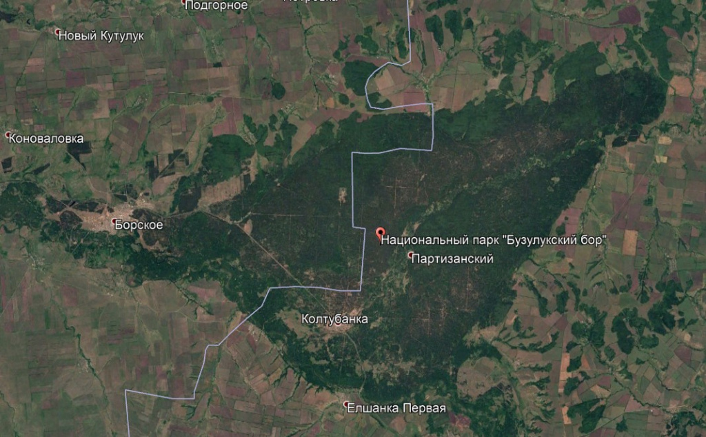
Fig. 1. Buzuluksky Bor National Park - view from space
Buzuluksky Bor is an isolated massif of predominantly pine forest on the border of the Samara and Orenburg regions of Russia, amidst the steppes of the Trans-Volga and Pre-Urals regions, with unique natural features - located in a natural depression among the steppes, intersected by a dune relief with a huge mosaic of habitats, high demand and visitation by residents of the surrounding steppe regions. It is part of the Buzuluksky Bor National Park.
Innother employees conducted work to update the forest management materials of 2002 and modern forest inventory of the Buzuluksky Bor National Park based on decoding of very high and high-resolution satellite images taken in 2013.
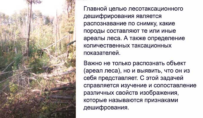
Fig. 2. Decoding method for forest inventory
The main materials for decoding the forests of the Buzuluksky Bor National Park territory were very high-resolution satellite images. They are represented by multi-zone images of the 2013 Pleiades system with on-site resolutions of 0.5 meters. QGIS geographic information software was used for decoding satellite images. In addition to remote sensing materials, which were the main source of information for forest inventory decoding, topographic maps at scales of 1:50,000 and partially 1:25,000, georeferenced tablets with materials from the last (2002) forest inventory of the Buzuluksky Bor territory, maps of the boundaries of the national park with subdivision into forestries, and materials of aerial photography from 2002 were also used. Furthermore, ground-based research was conducted during the summer of 2014 from May to September to study the inventory characteristics of the forests. Observation checkpoints were also georeferenced in QGIS. Many of the original data were initially in paper form, requiring extensive work on digitization and georeferencing.
The decoding process is preceded by a review of satellite images to identify the main features of forest division based on inventory characteristics and verification through field research control points. Subsequently, the results are compared with materials from the previous forest management (2002). This identifies the main principles of forest division by species composition, density, height, and age of the stand.
Each area is characterized by its color (shade), structure and grain size, pattern, and additional features. All decoding features are determined for the most typical forest plantations, and together with the image fragment, they are placed in a special album of forest inventory decoding standards, specifying forestries and block numbers. For one forestry, from one to fifteen standard plots with decoding samples are selected.
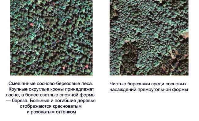
Fig. 3. Examples of decoding standards.
When assessing the species composition of the forest, such image properties as color, shade (tone in the case of panchromatic image), and grain shape that characterizes the crowns of individual trees come to the forefront. Color and shade are determined by the spectral brightness of various tree species, making them objective indicators of species diversity.
Field control was carried out during the decoding process.
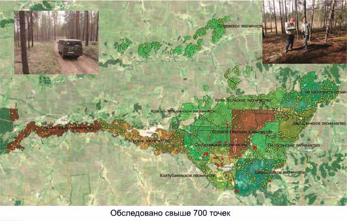
Fig. 4. Field control.
Natural pine forests cover a significant area of the national park's territory, but their area decreases annually. The cause of the decrease is fires, which occur quite regularly here. The last major fire occurred in June 2013. Smaller but more frequent fires also cause significant damage to pine forests. Such areas are almost ubiquitous in pine forests and are relatively easily identified by color and shape on images.
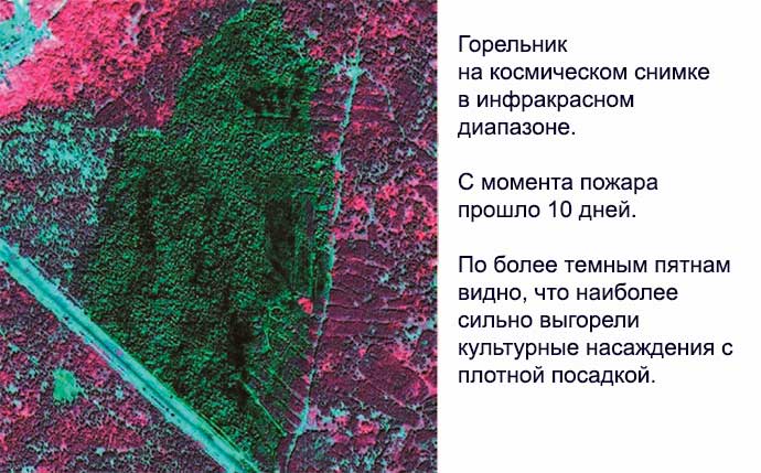
Fig. 5. Major fire.
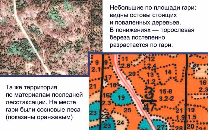
Fig. 6. Burns.
An important factor in stability loss is irregular logging. Irregular logging in the territory of Buzuluksky Bor is caused by improper or non-compliance with the requirements for its conduct, as well as by the annual underfunding of the operational tasks of the park's administration. This leads to the absence of a concept of development and to non-compliance with the main and branch rules of the Russian Forest Code in the national parks. The only conclusion is the deliberate non-compliance of the Russian legislation, and the lack of clear ideas for the development of the Buzuluksky Bor National Park.

Fig. 7. Logging.
The coniferous part is well preserved in the national park. Although part of the forest is located in the land of steppe dunes, there is a problem of open dry sand dunes that affect the forest's stability. The current conditions are a result of degradation.

Fig. 8. Coniferous part.
Trees with red trunks grow well. There is no one better for the coniferous trees to retain a branch. The

Fig. Most useful, what learn
