Research on a New Deep Learning-Based Decoding Method Using GaoFen-2 Images for Aquaculture Zones
Coastal aquaculture zones are among the primary areas for harvesting marine fishery resources, vulnerable to storm disasters. Rapid and accurate information retrieval about coastal aquaculture zones can aid in scientific management and resource planning of aquaculture. Increasingly, researchers are focusing on the use of remote sensing technologies and machine learning for immediate extraction of territory information. However, fragmented aquaculture zones after natural disasters are difficult to recognize in satellite images with moderate spatial resolution. Therefore, it is crucial to extract aquaculture zones using high-resolution images.
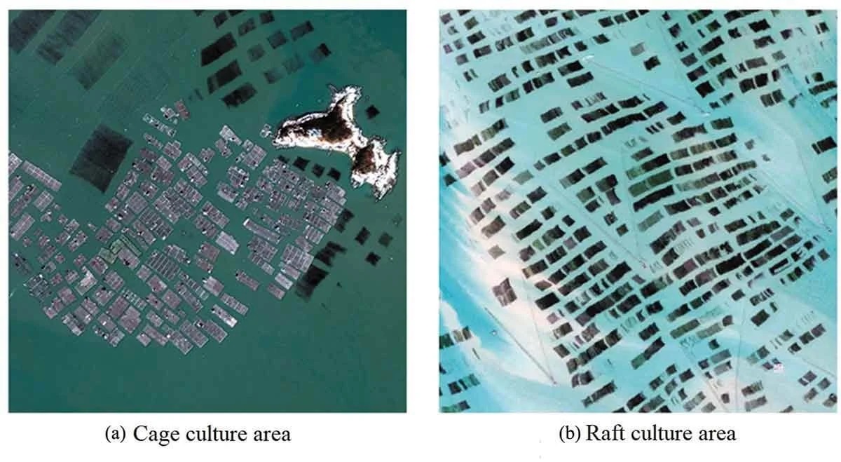
In this article, we distinguish two main types of aquaculture zones: cage culture zones and raft culture zones (Fig. 1). In high-resolution remote sensing images, the cage culture area, made of plastic, appears brighter and resembles an irregular rectangle with clearly visible small mesh cells within the cage culture zone. Optical images show small bright spots at the edge of the raft culture area. The reflectivity of the raft culture zone is lower compared to the seawater. Typically, this type of aquaculture zone is clustered together and appears as a dark and more uniform rectangle.
Currently, there are numerous methods for extracting these types of aquaculture areas based on moderate-resolution remote sensing images. Some researchers identify aquaculture areas based on expert experience, while others automatically extract coastal aquaculture zones using coefficients of reflection from optical images, backscattering coefficients from synthetic aperture radar (SAR) images, and the geometry of aquaculture zones. Recent studies have also utilized ZiYuan-3 data with threshold segmentation methods to extract cage aquaculture areas based on gradient transformation.
However, it is challenging to observe aquaculture areas destroyed by storm tides in moderate-resolution remote sensing images, which cannot meet the needs of emergency response. Therefore, some researchers have explored methods based on high-resolution remote sensing images. They have used textural features and high-frequency information of aquaculture areas and applied threshold detection primarily for high-resolution remote sensing images to recognize targets.
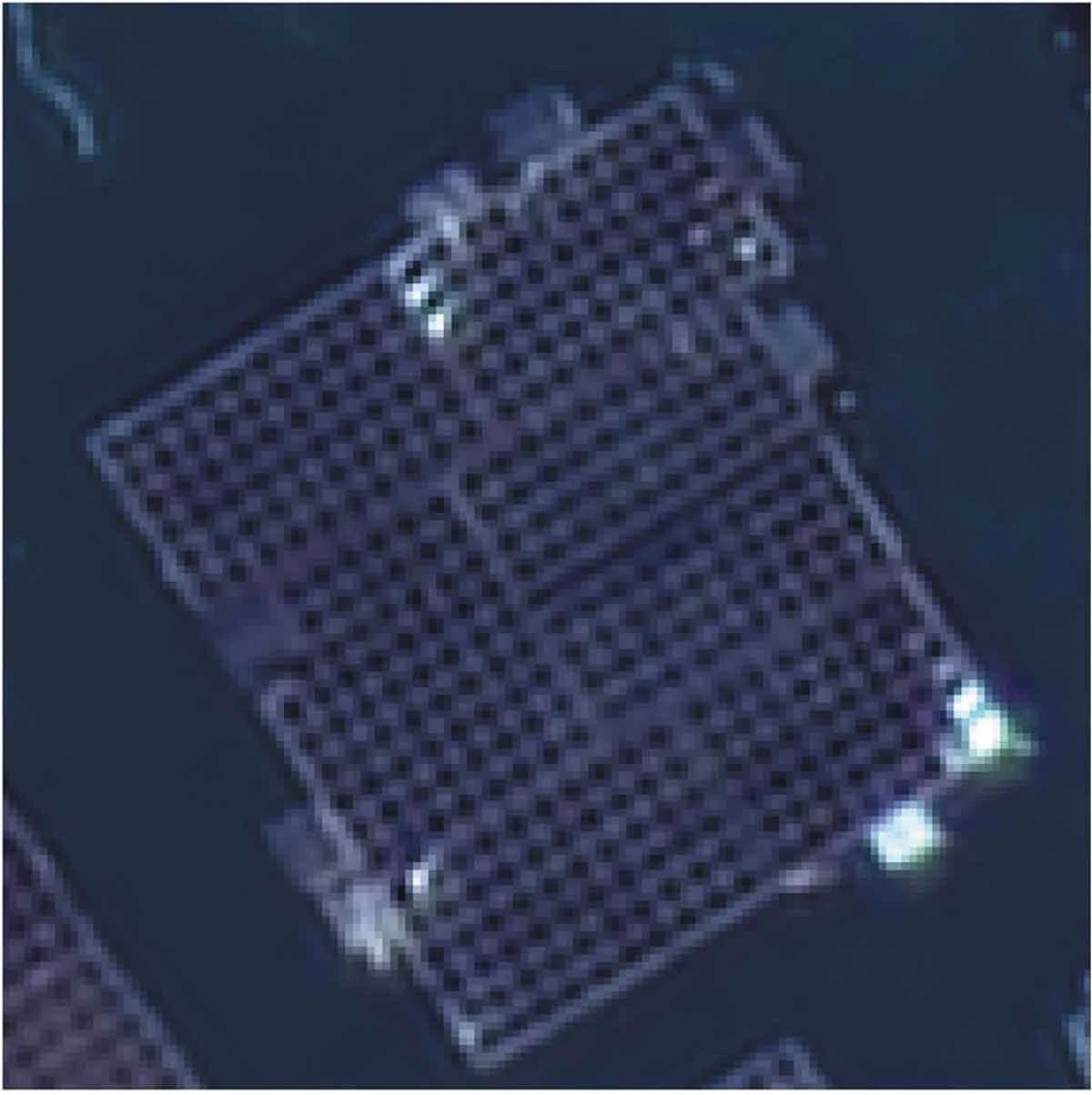
Other researchers have extracted aquaculture areas through mathematical transformations of images, such as principal component analysis (PCA), matching transformation, and ratio transformation. However, traditional pixel-level classification methods often result in unclear boundaries of aquaculture extraction and can easily mistake ships and other floating objects for aquaculture areas. Additionally, if there are more deposits in the seawater, the extraction results will be disrupted. Meanwhile, due to the structure of the cage culture area and its high spatial resolution, its internal gap can be incorrectly identified (Fig. 2).