your companion in the world
of geospatial solutions
of geospatial solutions
Operation mode:
Mon-Fri: 10:00 - 18:00
Sat-Sun: Non-working days
In this projection, maps covering the entire territory of the Islamic Republic of Iran are created (for example, a geological map of Iran). In QGIS, simply copy the projection parameters string to "Settings → Custom Projections..." and save it under any name:
+proj=poly +lat_0=0 +lon_0=54 +x_0=0 +y_0=0 +ellps=WGS84 +datum=WGS84 +units=m +no_defs
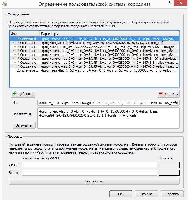

Fig. Geological map of Iran
Operation mode:
Mon-Fri: 10:00 - 18:00
Sat-Sun: Non-working days