of geospatial solutions
Sat-Sun: Non-working days
In July, 21AT celebrated the 2nd anniversary of the successful launch of the TripleSat Satellite Group TripleSat (TSC). TSC consists of three 0.8m satellites in a synchronized constellation, orbiting 1200 and 33 minutes apart from each other. This configuration will be maintained throughout the satellites' operational lifetime, ensuring daily revisit capabilities.
Over the past two years, TSC has covered approximately 60 million square kilometers of the Earth's surface with cloud cover less than 15% globally. Beginning in 2017, TSC initiated surface coverage for countries such as India, Queensland (Australia), and within the domestic market of China, shifting imaging direction from 2016 data. Monthly coverage supported operational urbanization and agricultural monitoring processes in the Netherlands and several cities in China, including Beijing.
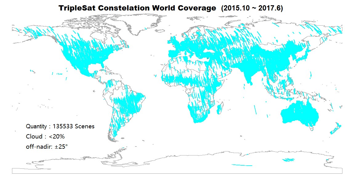 Coverage by TripleSat Satellite Group (October 2015 – June 2017)
For the first time in history, TripleSat with its 24 km swath width and three-satellite constellation provides large area coverage with satellite imagery resolution below 1 meter. The unique significance of this new very high-resolution satellite data source from the TripleSat Group underscores its suitability for:
- Annual update of high-resolution base maps over large areas, providing high information content for governmental structures on the current status of land resources and land use. This information supports informed decision-making in governance and regional management.
- Country-wide mapping updates at a scale of 1:5,000 based on annually acquired data that objectively capture event statuses within a specific year. This enhances the accuracy of various surveys, statistical reports, and trend analysis, such as population changes.
To meet the requirements of Queensland Department of Natural Resources and Mines (DNRM), 21AT organized a Web Map Service (WMS) and Web Map Tile Service (WMTS) for Queensland state clients to access 2016 mosaic images covering approximately 2 million sq. km. The company is currently researching the expansion of this service to other clients, particularly those in North America.
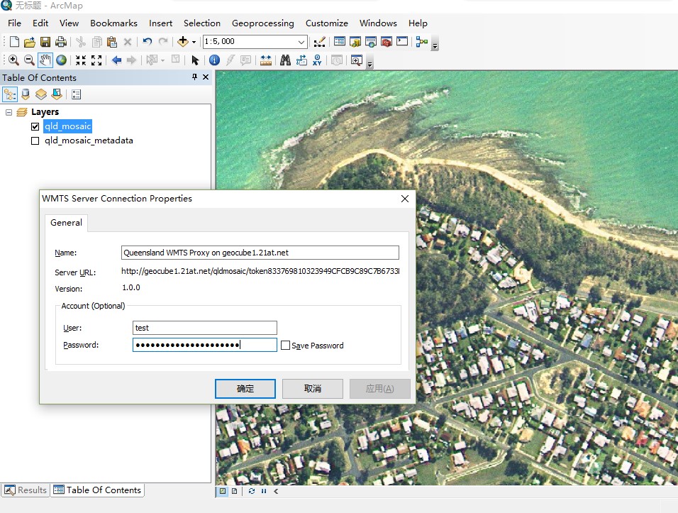
Data Access via WMTS
Over the past two years, 21AT has provided data to numerous clients. According to consumer feedback, the data quality is excellent for this class of satellite imagery due to top-tier Modulation Transfer Function (MTF) and Signal-to-Noise Ratio (SNR) values. The table below summarizes key characteristics verified by the satellite manufacturer and assessed by three cartographic and topographic organizations.
|
MTF (PAN) |
SNR (PAN) |
||
| TripleSat-1 | Root Mean Square Error 24.147 m | 21.0% | 170 |
| TripleSat-2 | Root Mean Square Error 24.147 m | 20.0% | 170 |
| TripleSat-3 | Root Mean Square Error 24.147 m | 17.5% | 170 |
Note: MTF and SNR significantly improve in the Multispectral Channel.
Since TSC's launch, 21AT's international sales division has also shared its success in "using remote sensing technologies to support intelligent management in Beijing" with international partners and clients, generating significant interest, particularly in rapidly developing economies and associated urbanization.
With these capabilities, 21AT confirms its commitment to continue collaborating with partners to deliver the benefits of the "Beijing Model," based on reliable data sources from the TripleSat Satellite Group, to clients worldwide.
About 21AT
Twenty First Century Aerospace Technology Co., Ltd. (21AT) is China's first commercial Earth observation satellite operator. Headquartered in Beijing, 21AT employs over 400 staff members. Since the launch of its first satellite, Beijing-1, in 2005, 21AT has provided remote sensing services in China. Beijing-1 was one of five satellites in the Disaster Monitoring Constellation (DMC), providing emergency response measures. Building on the success of Beijing-1, 21AT expanded capabilities with the launch of a new high-resolution satellite constellation.
About Innoter
Innoter is the official distributor of 21AT in the Russian Federation. You can purchase images of any resolution by contacting us at +7 495 245 0424 or emailing us at innoter@innoter.com.
Sat-Sun: Non-working days