of geospatial solutions
Sat-Sun: Non-working days
You can order from us
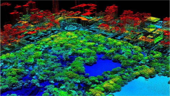
Three-dimensional modeling is widely used for monitoring and managing objects. Information collection about the object can be carried out:
- regularly (at certain intervals);
- in real-time mode, when information is constantly available;
- temporarily, i.e., with a large frequency in a long-term perspective.
In addition, monitoring results can be presented in 3D models, demonstrating the dynamics of the process development in the area.
The logical continuation of real-time monitoring is interactive (presuming feedback) spatial process management systems based on the use of three-dimensional object models.
Graphic representation of management objects in the form of 3D models presents information in the most convenient and natural way for humans, positively affecting the quality and timeliness of decision-making. This property of 3D models can be widely used in creating situational management centers for territories (crisis centers, emergency services, units for tracking the use of bioresources, for real estate object accounting and control, etc.).
Implemented Projects
Agricultural Farms Design in Angola
Designing agricultural farms in Africa under the International Bank for Reconstruction and Development program. The main goal of the "Angola" project was to create a topographic map and 3D model of the terrain on the farm site in Vaku Kungo.
The following tasks were completed:
- planning and ordering new color satellite imagery from GeoEye-1 with a spatial resolution of 0.5 m;
- photogrammetric processing and orthotransformation of the obtained images using rational function coefficients (RPC polynomials);
- creating a photo map and digital topographic map based on orthotransformed images;
- creating a 3D model of the farm based on a single GeoEye-1 image and a prepared topographic map with an accuracy of up to 3 m in height.
The project was characterized by record-short completion times: from ordering new imagery to receiving maps and a 3D model took less than a month.
Orthotransformation and radiometric correction were performed in Geomatica 10.2 (PCI Geomatics, Canada). Mapping was done in MapInfo Professional 10.0 (Pitney Bowes Business Insight, USA); point, linear, and areal objects were deciphered and drawn. MicroStation V8 software environment (Bentley Systems, USA) was used to create the farm's 3D model.
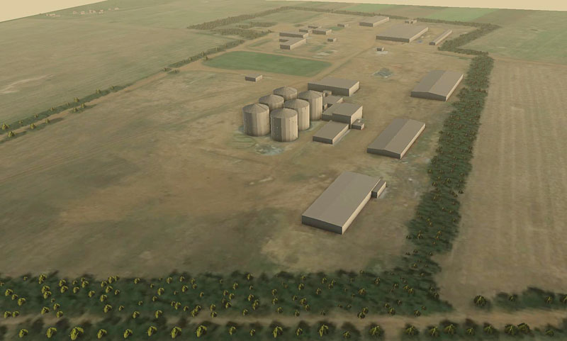
3D model of an agricultural farm, Angola.
Customs Terminals Design for Russian Railways
A program was implemented to create several dozen customs terminals to solve logistics tasks for Russian Railways. In particular, a 3D model was created for the design purposes of one such terminal in the village of Bely Rast, Dmitrovsky district, Moscow region.
Tasks to be solved during the project implementation included:
- building a 3D model of the terminal based on design documentation;
- terrain modeling based on satellite remote sensing data;
- determining the optimal composition and location of infrastructure objects.
The management and visualization system of such a model allows the user to perform measurement operations in three-dimensional space, make changes promptly, and evaluate them from various perspectives, model the movement of vehicles, and solve other tasks.
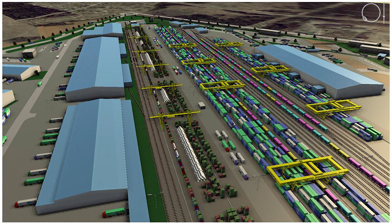
3D model of a customs terminal in Bely Rast village.
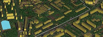
Telecommunication Networks Design
Three-dimensional modeling was used as information support for designing telecommunication networks in Bucharest, Romania.
Effective design of telecommunication networks is impossible without performing analytical calculations based on three-dimensional models of territories. Urban infrastructure is characterized by the interdependence of all objects. It is impossible to change the spatial characteristics of one object without considering the consequences for others.
A simplified model of Bucharest was created using automatic technologies in MicroStation V8 software and was used for analytical calculations of relay station locations.
The initial data were provided by IKONOS satellite images with a spatial resolution of 0.8 m. The level of detail and accuracy of the urban territory model obtained from a single image meets the requirements for initial data for conducting analytical calculations. The model was created using 2.5-D technology, which allows obtaining results promptly at the most competitive cost.
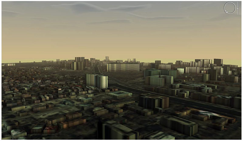
3D model of Bucharest city.
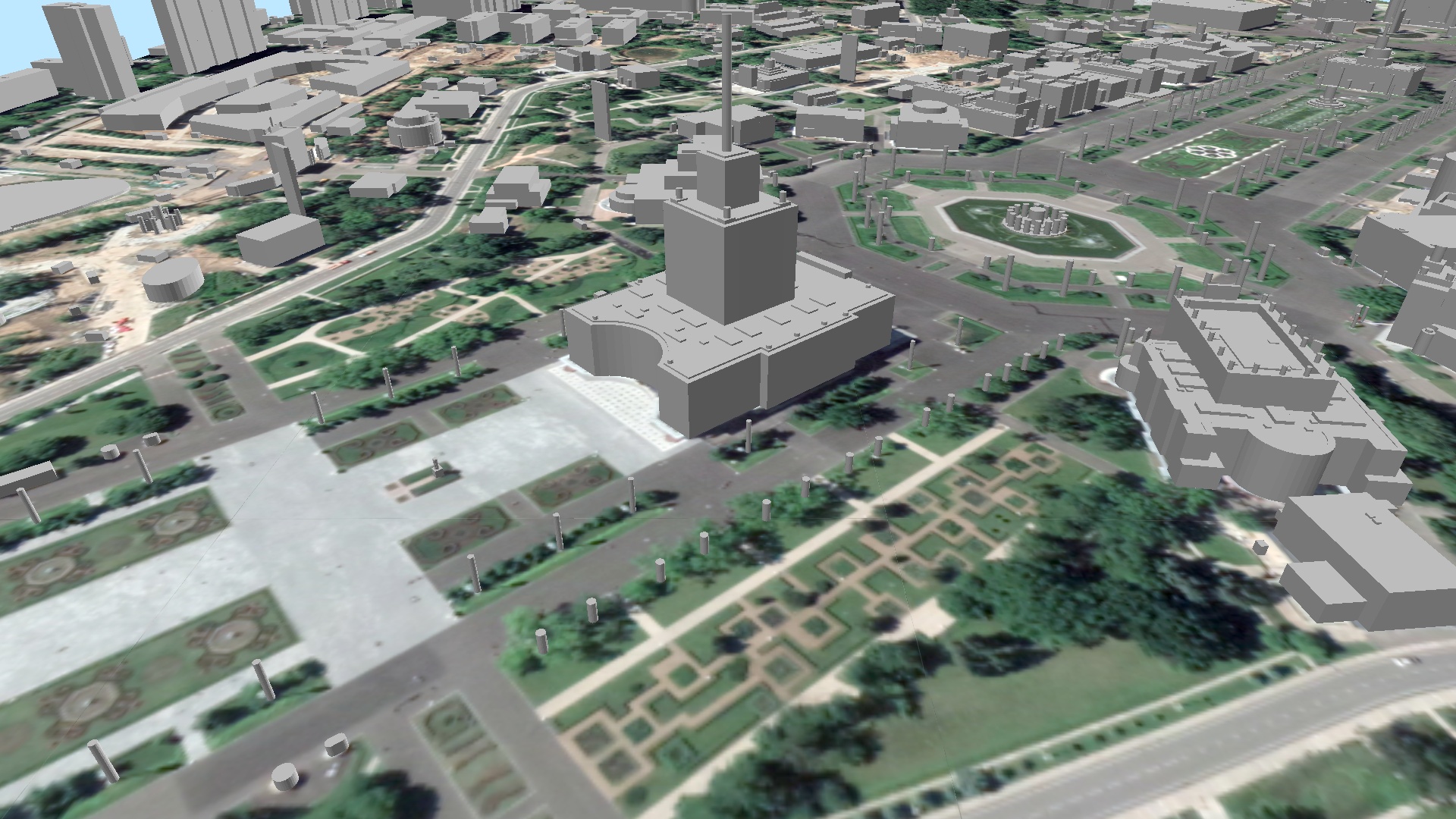
Monitoring and Management of Vnukovo Airport Area Objects
Annually, on the order of Vnukovo Airport management, satellite imagery is conducted, allowing to monitor changes in object parameters over time and compliance of construction work with the project solution.
Tasks to be solved during the project implementation included:
- building a simplified model of the airport, road, railway infrastructure, and adjacent area covering an area of approximately 100 km²;
- visualization of terrain condition changes on a 3D model;
- monitoring and modeling the movement of aircraft and ground transport.
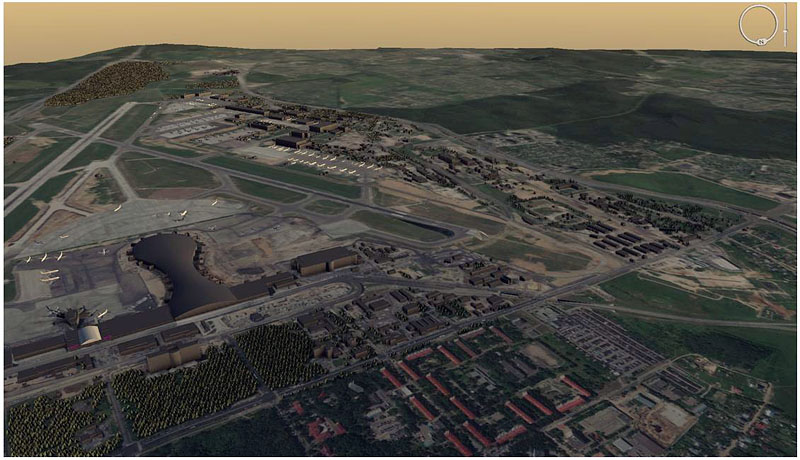
3D model of Vnukovo airport.
Modern technical means allow building 3D models of various complexity for objects such as highways and railways, elements of transport infrastructure (bridges, tunnels, etc.), power transmission lines and elements of energy infrastructure (substations, transformers, etc.); gas and oil pipelines and elements of their infrastructure, urban and rural development (streets, houses, buildings, structures); industrial sites (internal infrastructure of enterprises, workshops, territories, etc.). The use of 3D modeling can completely replace the physical modeling stage of an object or territory. The quality, detail, and complexity of 3D models depend on the specific tasks of users, the volume of additional spatial information, and a number of other features.
There is no doubt that a three-dimensional model becomes an important and practically indispensable tool for any management system designed to solve a wide range of practical tasks.
Senatorova M.A., "GEO Innoter"


Sat-Sun: Non-working days