of geospatial solutions
Sat-Sun: Non-working days
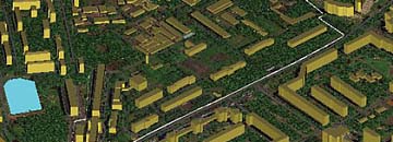
Types of web maps
The advent of web mapping has been an important development for the entire mapping industry. Previously, mapping was limited to a few agencies, institutes and companies that used expensive equipment and sophisticated software. Now web mapping has made it possible to use many datasets, including free ones. Some services allow you to create your own maps.The first classification of web maps was made by Kraak in 2001. He put dynamic, static web maps in separate groups, and then added interactive ones. Now the number of sources of static web maps has increased.
You can order from us


Cloud Web GIS
Many companies are now able to offer web mapping as one of their software services. The idea is that the implementer gives the user the ability to create and save maps themselves. If necessary, they can be shared and uploaded to their servers. To create maps, a special editor in the browser is used. They can also apply a method based on writing scripts that apply the API of the service.Web Cartography Technologies
Digital cartography cannot function without specialized server-side and client-side applications. Spatial databases are essential for these applications whenever they work with dynamic data. Spatial databases facilitate queries, subselections, and various methods of export and import.
A prominent example of this is POST GIS, which is open source. Individual spatial functions are also implemented using MySQL.
Mosaic web maps display visualized data composed of individual raster images.
Vector tiles are also becoming popular. Google and Apple have fully transitioned to them. Mapbox.com also allows the use of vector tiles. This is a new style of web mapping that is resolution-independent. It enables the transmission of high-quality dynamic images.
WMS servers enable the generation of maps with user-defined parameters such as layer order, symbology, data volume, projections, format, and so on.
Analytical Web Maps
Analytical maps allow GIS analysis. The geospatial data obtained can be static and require periodic updates. There is no clear boundary between web GIS and analytical maps.
Collaborative Web Maps
Collaborative mapping is rapidly developing. Users can work together in proprietary or open-source software environments. Some common projects in this type of mapping include Google Map Maker, WikiMapia, Here Map Creator, among others.
One of the most notable projects in this category is OPEN Street Maps. It was created in 2004 and continues to evolve, becoming quite popular in GPS mapping.
One of the main features of OPEN Street Maps is a large set of tools for automated data entry, allowing for the rapid updating of maps for various regions worldwide.
Real-Time Animated Maps
These maps transmit data with minimal delay and are usually animated. Special sensors collect information, and maps are generated or updated at specific intervals or upon request.
Animated maps convey changes through one of the temporal or graphical variables. Technologies now enable client-side display of animated maps, including scalable vector graphics. Such maps can convey road congestion levels, weather, and enable monitoring of vehicle movements.
Static Web Maps
Static maps can only be viewed without animation or additional interactivity. Typically, they are created once, often manually, and updated infrequently. Common formats for such maps include PNG, JPEG, SWF.
This category also includes scanned data not intended for screen maps. They usually have high resolution and information density that typical computer screens may not display adequately. Thus, they can be unreadable when displayed on screens with inappropriate resolutions.
Modern Distributed Web Mapping Services
Practically every Internet user today has used mapping services. Among the top ones are Google Maps, Yahoo Maps, and Yandex Maps. These services offer the most comprehensive range of functional capabilities, including coverage area and ease of use. Features like zooming, special resources (real-time traffic, detailed road and building maps), are also available.
All the above-mentioned mapping services support the most popular browsers. Google Maps remains the most popular, chosen by the largest number of users, including those using older browser versions. It first appeared in 2005 and quickly gained popularity due to its cross-browser design, which was initially embedded in client software.
Now let's talk about the sources of cartographic data. All the services listed above collaborate with specific organizations that provide data.
These services certainly differ in functionality. For example, Microsoft's mapping service offers navigation through 3D street maps of major US cities and some other states. Google Maps allows developers to embed application-specific information through the Maps API.
There are differences in coverage region and data timeliness among these services. For instance, Yandex maps reflect the territory of CIS countries in an updated form, whereas the relevance of Google Maps and MS Live for individual regions can range from 1 to 3 years. Yahoo, however, lags behind with data that may be up to 5 years old. There are also significant drawbacks concerning the representation of Ukraine; even the information about streets in cities like Kyiv is presented inaccurately.
The equipment for web maps is affordable, and there's a wide range of open-source tools available. However, obtaining geodata itself can be quite expensive.
Compared to traditional methods, cartographic software has many advantages. Web maps provide up-to-date data, especially when maps are automatically created through special databases, transmitting information almost in real-time. Examples of such maps include those that provide results as soon as they become known or those that convey current vehicle locations, reducing waiting times for passengers.


Sat-Sun: Non-working days