Sat-Sun: Non-working days
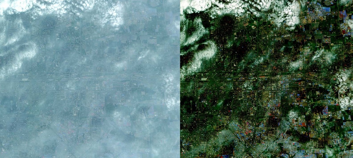
Compensation of Atmospheric Disturbances by DigitalGlobe (AComp) is a proven proprietary algorithm that mitigates the presence of haze and atmospheric effects on satellite images. AComp enhances image quality and significantly increases the reliability of information collection and access to the archive. This remarkable new tool improves image clarity and usability under various atmospheric conditions. High-quality images provide us with answers and confidence when facing critical questions.

With the most advanced commercial satellite constellation in orbit, DigitalGlobe creates the world's most accurate images, ensuring confidence even in the most complex decision-making processes.
Advantages of using the algorithm:
Image Clarity
AComp reduces the effects of light wave scattering caused by haze, water vapor, and solid particles in the atmosphere.
Acquisition Stability
Atmospheric conditions can diminish image utility—sometimes rendering them unusable. AComp significantly increases the number of usable images obtained during new information collection.
Enhanced Understanding
By retaining only Earth surface reflectance values, the AComp algorithm enables precise analysis and rapid information extraction. For example, pixel normalization allows for higher definition of changes, distinguishing spatial and temporal changes in spectral zone images.

How does AComp help?
If you use satellite imagery as a primary tool for problem-solving, resource conservation, or even life-saving efforts, you need sharply defined, high-quality visual control for comparison and analysis under varying atmospheric conditions.
Key areas for scheduled satellite imaging include:
- Oil and gas
- Environment and agriculture
- Defense and intelligence
- Mining
- Disaster relief
- Geographically linked services
Ultra-high-resolution images from DigitalGlobe and other operators are available for purchase. Contact us at +7 495 245 0424 or submit a request on our website.
