Sat-Sun: Non-working days
Abstract
Russia was the first country to open the global market for detailed remote sensing data (2-10 meter ground resolution) in 1991. The government authorized the sale of satellite imagery from the "Resource-F" and "Kometa" satellites on the international market through the company "Sovinformsputnik" JSC.
One of the founders of Sovinformsputnik, and later the founder of the INNOTER group of companies, as well as the General Director of "Geospatial Agency INNOTER" LLC, was Viktor Nikolaevich Lavrov (1941–2022).
Russian Satellites in Orbit
Resource-P Type Satellites
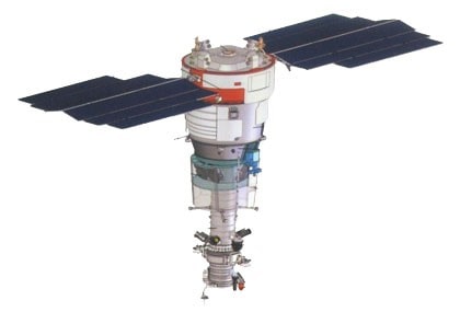
The target equipment complex includes:
- Multispectral high-resolution equipment:
- Swath width (at nadir) — 38 km;
- Activation duration from 2 to 300 seconds;
- Ground resolution:
- 1 m or better (panchromatic mode);
- 2–3 m (multispectral mode).
- Spectral bands (µm):
- Panchromatic (0.60–0.79);
- Blue (0.48–0.52);
- Green (0.54–0.60);
- Red + Near Red (0.62–0.68; 0.66–0.69; 0.70–0.74);
- Near Infrared (0.72–0.80; 0.80–0.90).
- Wide-swath high-resolution multispectral camera:
- Swath width (at nadir) — 97 km;
- Ground resolution (pixel projection):
- 12 m or better (panchromatic mode);
- 23.8 m (multispectral mode).
- Spectral bands (µm):
- 0.43–0.90 (panchromatic);
- 0.43–0.51 (blue);
- 0.51–0.58 (green);
- 0.60–0.70 (red);
- 0.70–0.90 (near infrared).
- Wide-swath medium-resolution multispectral camera:
- Swath width (at nadir) — 441 km;
- Ground resolution (pixel projection):
- 60 m or better (panchromatic mode);
- 120 m (multispectral mode).
- Spectral bands (µm):
- 0.43–0.70 (panchromatic);
- 0.43–0.51 (blue);
- 0.51–0.58 (green);
- 0.60–0.70 (red);
- 0.70–0.90 (near infrared).
- Hyperspectral imaging equipment:
- Swath width (at nadir) — 25 km;
- Ground resolution (pixel projection) — 30 m or better:
- Spectral bands (µm): 0.40–1.10;
- At least 96 spectral channels;
- Spectral resolution of 5–10 nm.
The "Resource-P" satellite system with the "Resource-P" №3 satellite is designed for detailed wide-swath and hyperspectral optical-electronic Earth observation. It transmits data via radio channels to ground stations for information reception, planning satellite imaging tasks, processing, and archiving the received data, while considering consumer requests from organizations such as the Ministry of Natural Resources, Ministry of Emergency Situations, Ministry of Agriculture, Rosreestr, Roshydromet, Rosrybolovstvo, etc.
Examples of satellite imagery:
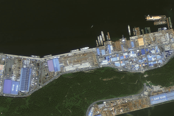
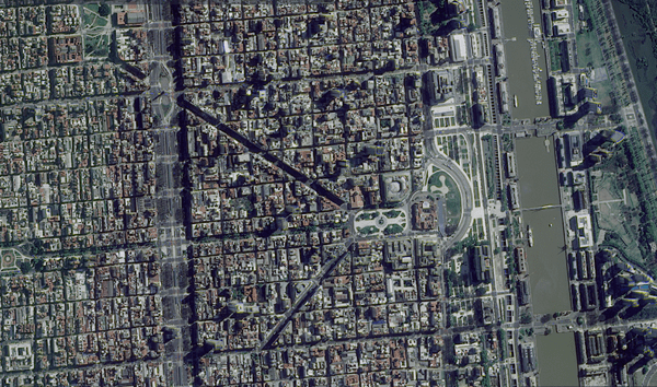
Resource-P is currently the only detailed dual-purpose civilian remote sensing satellite in Russia.
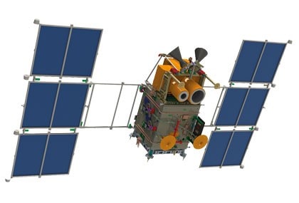
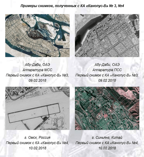
Canopus-V Type Satellite (5 satellites)
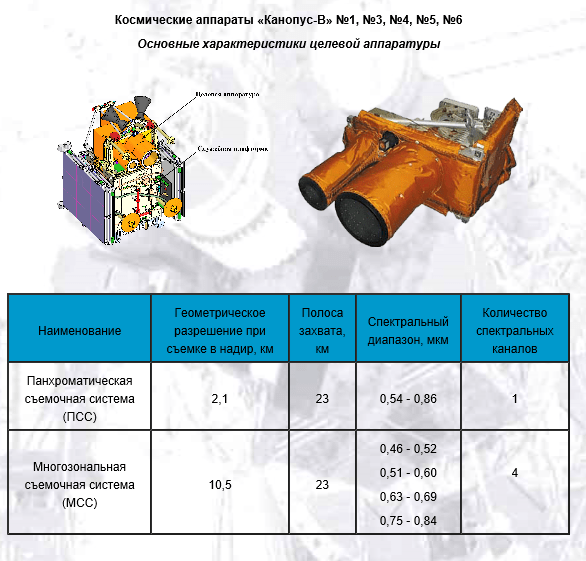
Purpose
The Canopus-V satellites for operational monitoring of man-made and natural emergencies are designed for:
- Monitoring man-made and natural emergencies, including hydrometeorological disasters;
- Detecting forest fire outbreaks and major pollution discharges into the environment;
- Monitoring agricultural activities, natural resources (including water and coastal areas);
- Land use monitoring;
- Operational observation of specific areas of the Earth's surface for various sectors of the economy, ministries, and agencies of the Russian Federation;
- Cartography.
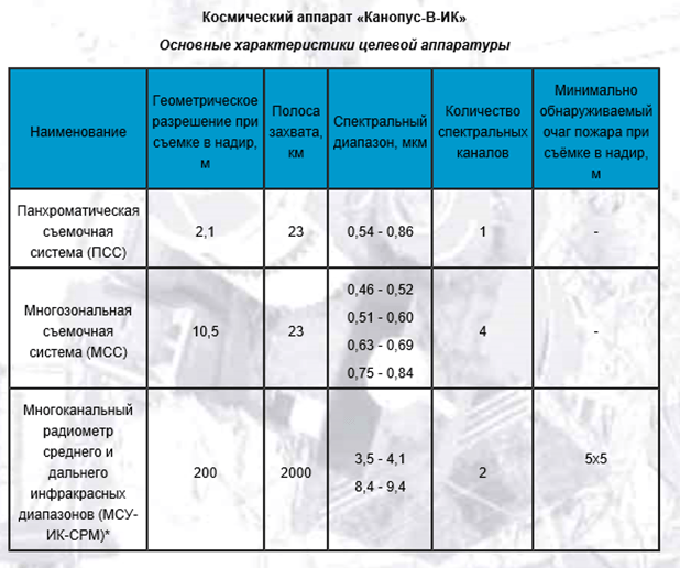
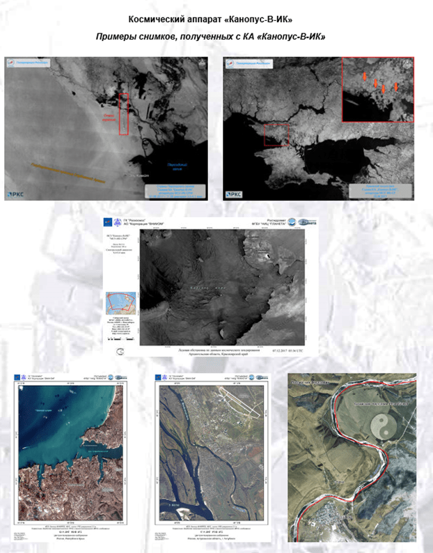
Purpose
The Canopus-V-IK satellite is designed to address the following operational monitoring tasks:
- Monitoring man-made and natural emergencies, including hydrometeorological disasters;
- Detecting forest fire outbreaks with an area of 25m2 and major pollution discharges into the environment;
- Monitoring agricultural activities, natural resources (including water and coastal areas);
- Land use monitoring;
- Operational observation of specific areas of the Earth's surface;
- Cartography.
Condor-FKA Type Satellite
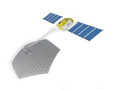
Specifications
- Imaging coverage: from 85° North latitude to 85° South latitude.
- Imaging resolution: from 1 to 12 meters, depending on the imaging mode.
- Swath width: 10x10 km to 20x500 km.
- Maximum daily data volume processed per satellite: 96 GB.
- Maximum data volume transmitted to ground stations per communication session per satellite: 16 GB.
- Antenna type: mirror.
- Antenna size (effective mirror diameter): 6 meters.
- Satellite mass: approximately 1000 kg.
- Lifespan: 5 years.
-
With a full constellation of two satellites, the space system ensures radar imaging of Earth's surface within latitudes 85°N to 85°S in spotlight (SPR), stripmap (SMR), and wide-area (WMR) modes, with the ability to perform interferometric imaging in each mode, including:
- Spotlight radar imaging of Earth's surface with high-resolution images (SPR);
- Stripmap radar imaging of Earth's surface with high-resolution images (SMR);
- Wide-swath radar imaging of Earth's surface with medium-resolution images (WMR);
- Imaging within the ground station visibility zone in quasi-real-time transmission mode;
- Interferometric imaging of Earth's surface.
Target data accumulation in long-term onboard storage and subsequent transmission within the ground station visibility zone;
- With a full constellation of two satellites, the system ensures an average observation interval of arbitrary Earth surface objects at 30° latitude of no more than 12–14 hours with a probability of 0.9, or no more than 24–26 hours with a probability of 0.9 when performing single-pass interferometric imaging with two satellites.
-
With a full constellation of two satellites, the system ensures a daily productivity:
- - At least 200 standard frames of 10x10 km captured in SPR with a resolution of 1–2 m;
- - At least 200,000 km2 captured in SMR with a resolution of 2–3 m;
- - At least 1,000,000 km2 captured in WMR with a resolution of 6–12 m.
Imaging Mode Polarization Spatial Resolution (m) Frame/Path Size Daily Productivity (km²) Daily Productivity (frames/paths) Spotlight (SPR) HH 1–2 (10x10) – (30x15) 10,000–45,000 100 Stripmap (SMR) HH/VV 1–3 (10–30)x100
Maximum path length – 500 kmAt least 100,000 15 paths/day (500 km) Wide-area (WMR) VV 6–12 (20–100)x100 At least 500,000 15 paths/day (500 km)
Tasks
- Forecasting, monitoring, and providing information support for mitigating the consequences of floods, forest fires, avalanches, and other natural emergencies;
- Timely detection, area estimation, and monitoring of oil spills on water surfaces, tracking the dynamics of aquatic pollution by oil products and wastewater;
- Evaluating geological, geodynamic, and neotectonic conditions, identifying potentially hazardous geological processes, objects, and phenomena in construction and operation areas of critical infrastructure;
- Identifying signs of developing catastrophic processes, operational specification and localization of areas, damage assessment, and dynamic situation mapping during technological emergencies (including current and forecast state assessments of main pipelines, large-scale engineering structures, and other high-risk facilities), supporting search and rescue operations;
- Monitoring forest ecosystems and agricultural lands, controlling the results of agricultural technologies, and forecasting yields;
- Creating, maintaining, and updating agricultural land cadastres.
Examples of images obtained from the Condor-FKA satellite
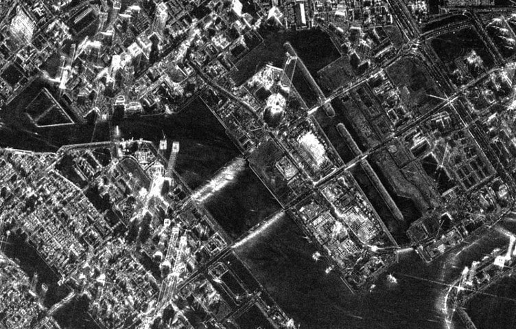
Currently, you can order up-to-date satellite imaging (or archive data from 2014–2021) from Russian satellites or request thematic data and remote sensing projects through GEO "Innoter".
Decommissioned Russian Remote Sensing Satellites (Archive Imaging Only)
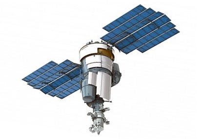
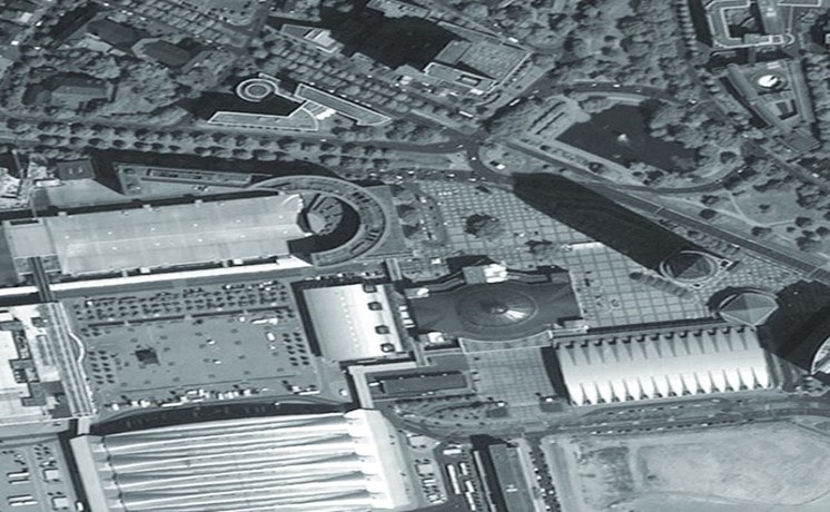
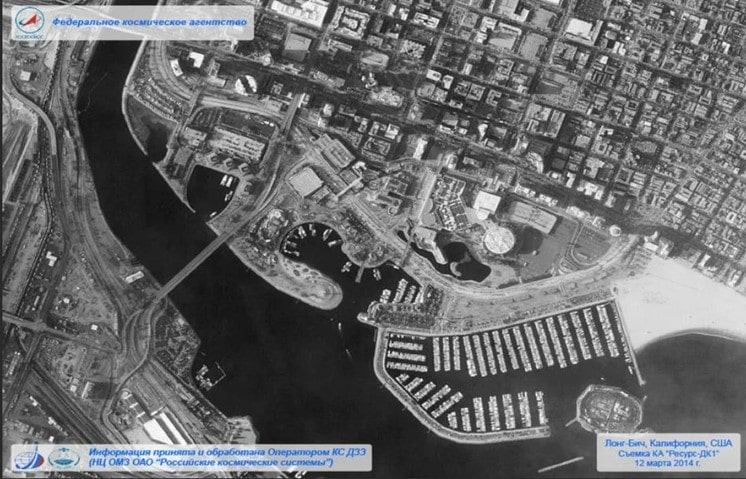
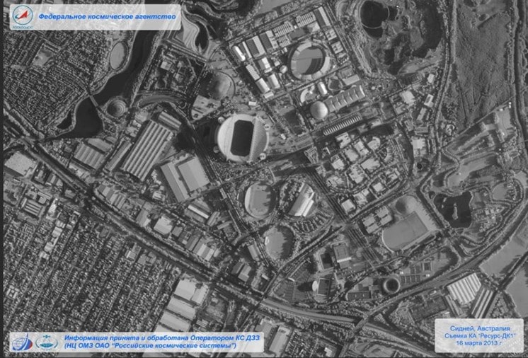
Resource-DK Type Satellite
Purpose
Multispectral remote sensing of the Earth's surface to obtain high-informative images in the visible spectrum in near-real-time.
Tasks
The data obtained by the "Resource-DK" satellite system are used for the following tasks:
- Providing information for rational use of natural resources and economic activities (natural resource cadastre creation, topographic and thematic mapping);
- Monitoring pollution sources of air, water, and soil to supply federal and regional environmental authorities with information for decision-making;
- Operational monitoring of natural and man-made emergencies for effective planning and timely response to mitigate their consequences;
- Providing data to domestic and international consumers on a commercial basis;
- Scientific research.
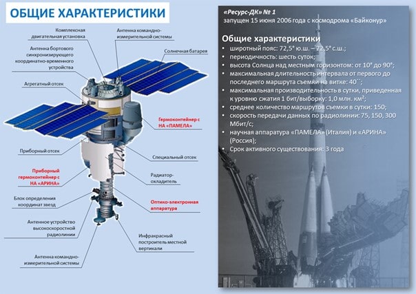
Ground Resolution (m):
- 1 / 2.8 (panchromatic mode);
- 2–3 / 3–5 (multispectral mode)
* Before/after September 2011
Spectral Bands (µm):
- Panchromatic (0.58–0.8);
- Green (0.5–0.6);
- Red (0.6–0.7);
- Near infrared (0.7–0.8)
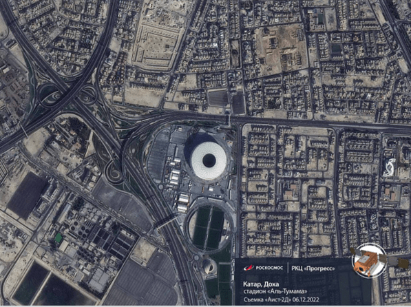
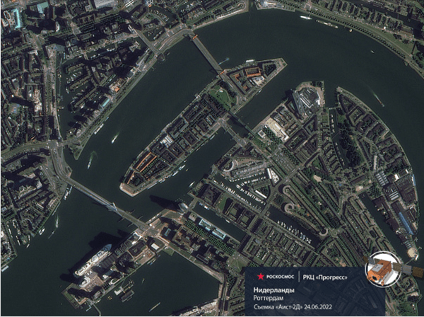
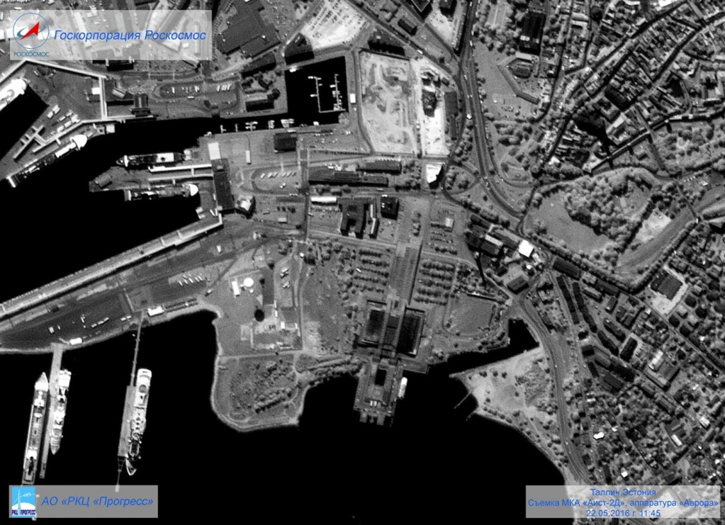
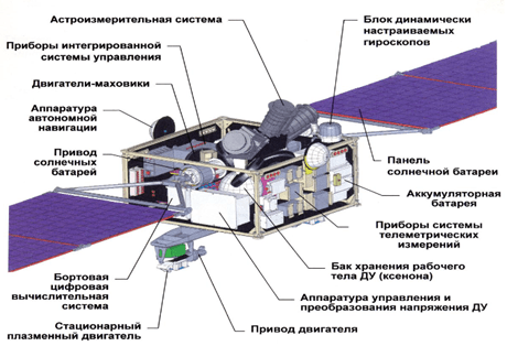
Experimental Small Satellite "Aist-2D"
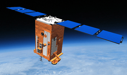
The "Aist-2D" small satellite is designed to capture images of Earth's surface in panchromatic, multispectral, and infrared modes, as well as to conduct various scientific experiments.
Target Equipment of the "Aist-2" Small Satellite
The primary target equipment of the "Aist-2" satellite is the "Aurora" wide-swath multispectral optical-electronic system (OES) in the visible range. It combines high resolution with an extended swath width while maintaining minimal weight and size characteristics. From an orbit at an altitude of 490 km, the system is designed to provide a resolution of 1.48 m in panchromatic mode and 4.5 m in multispectral mode, with a swath width of 39.6 km.
The thermal infrared equipment of the "Aist-2" satellite, using microbolometric photodetectors that do not require cooling, enables not only nighttime imaging but also testing the technology for detecting small fire outbreaks.
The target equipment includes an innovative radar designed for passive Earth observation in a new R-frequency band (432–438 MHz). With its help, scientists aim to test the ability to observe not only visible surfaces but also subsurface and vegetation-covered structures and objects from space. When used with ground-based equipment, the radar can observe objects concealed by foliage or other vegetation with a spatial resolution of up to 5 meters. The penetration depth beneath Earth's surface is significantly greater than that of current orbital radars and depends on soil moisture and structure. It ranges from several tens of centimeters in typical soil to tens of meters in deserts.
Currently, the radar on "Aist-2D" depends on ground receiving stations. However, scientists hope to use it to develop new Earth remote sensing technologies, aiming to eventually create an independent (monostatic) space radar with better resolution. The main advantage of the "Aist-2D" small satellite's optical-electronic equipment is its high spatial resolution combined with a significant swath width for capturing Earth's surface.
Remote Sensing Satellite "Monitor-E"

Purpose
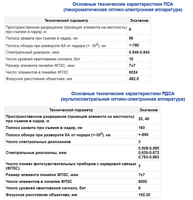
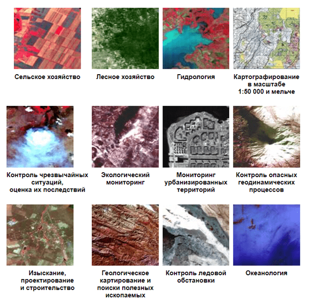
The satellite provides real-time remote sensing (RS) data for environmental monitoring, disaster management, Earth resource studies, cartography, and economic activities. It is designed for operational observation of the Earth's surface with a swath width of 90 to 160 km and a spatial resolution of 8 to 20 meters. The satellite's target equipment enables both panchromatic and multispectral imaging and data transmission in near real-time.
Tasks
As part of the "Integrated Satellite System for Natural Resource Management," the satellite addresses the following tasks:
- Creation of land resource cadastres;
- Thematic mapping of territories;
- Disaster management;
- Geological mapping and mineral exploration;
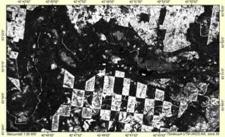
- Monitoring forest conditions, agricultural crops, and yield prediction;
- Monitoring reclamation and irrigation;
- Environmental monitoring.
Main Specifications:
- Panchromatic imaging of the Earth's surface with a spatial resolution of 8 m and a swath width of at least 90 km (PSA equipment);
- Multispectral imaging of the Earth's surface with a spatial resolution of 20–40 m and a swath width of at least 160 km (RDSA equipment).
Resource-F Satellites
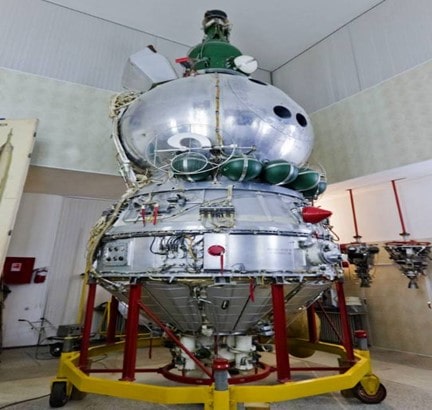
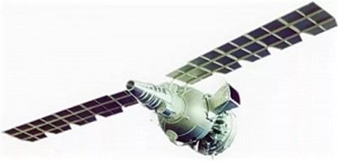
Regular launches of satellites to support economic development, rational resource use, and environmental protection began in 1974. Initially, special-purpose satellites were used, followed by adapted satellite systems for economic purposes. The first such system, "Fram," operated from September 1975 to September 1985.
In 1981, the "Resource-F1" system entered service, followed by "Resource-F2" in 1988.
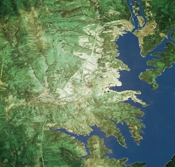
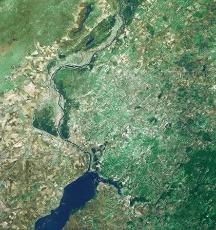
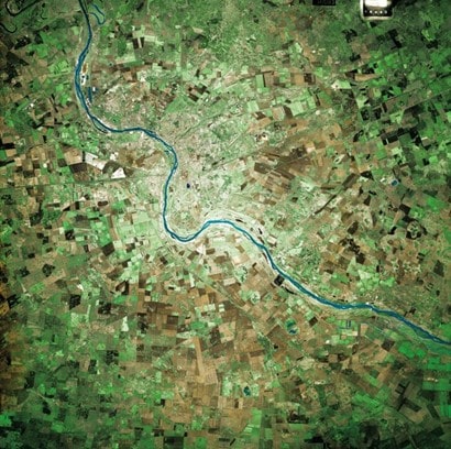
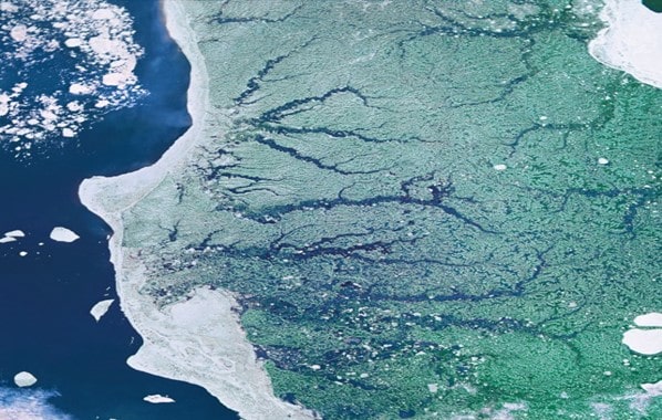
By the 1990s, "Resource-F3" satellites, equipped with the KFA-3000 camera providing a spatial resolution of 2–3 meters, became operational, utilizing high-resolution imaging resources for economic needs.
The optical systems of this satellite series operate in the optical range and capture multi-scale information on negative films with spatial resolutions of 2 to 30 meters from near-circular orbits at altitudes between 220 and 275 km.
Experts regard the "Resource-F" series as the most successful project in remote sensing (RS) in the USSR and Russia, particularly for natural resource research.
The satellite systems supported multi-band and integrated photography on black-and-white, spectral, and color films, allowing enlargements up to 15x or more, depending on the film type and imaging conditions:
- Original negatives scaled 1:1,200,000–1:1,375,000 (achieved with the KATE-200 camera);
- Black-and-white photography with resolutions of 18–30 m on isopanchromatic films (Types 22, 27, etc.);
- Color photography on dual-layer spectral films (CH-8, CH-10) with resolutions of 25–30 m;
- Tricolor photography on triple-layer films (CN-3, CN-4) with resolutions exceeding 30 m;
- High-resolution imaging with the KFA-3000 camera on ultra-thin isopanchromatic film (Type 38T) with resolutions of 2–4 m.
Satellite and Imaging Equipment Specifications
| Characteristics | Resource-F1M | Resource-F2 | Resource-F3 | |
|---|---|---|---|---|
| Imaging Altitude (km) | 240–355 | 180–355 | 275–420 | |
| Orbital Inclination (°) | 82.3 | 82.3 | 82.3 | |
| Camera Type | KFA-1000 (3 cameras) | KATE-200 (1 camera) | MK-4 (1 camera) | KFA-3000 (2 cameras) |
| Focal Length (mm) | 1000 | 200 | 300 | 3000 |
| Frame Size (cm) | 30x30 | 18x18 | 18x18 | 30x30 |
| Resolution (m) | 3.5–7.0 | 15.0–30.0 | 6.0–11.0 | 2.0–3.0 |
The modernization of the "Resource-F1" satellite culminated in the launches of "Resource-F1M" №1 and №2 in December 1997 and October 1999, respectively. The updates improved the tactical, technical, and operational characteristics, such as increasing the imaging swath width to 205 km, extending operational life to 25 days, and achieving resolutions of 3.5–5 m by lowering orbit altitudes.
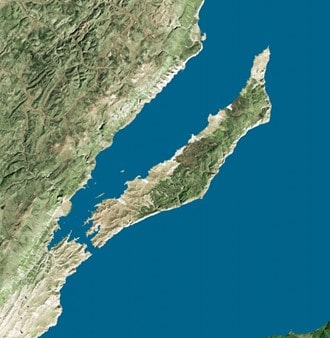
The accumulated archive of imaging data is widely used to analyze various dynamics, including urban development, deforestation and reforestation, water body changes, shoreline erosion, and agricultural conditions. Overlapping images enable terrain change detection through stereo analysis, while spectral imaging supports vegetation and crop classification.
Space Mapping System "Kometa"
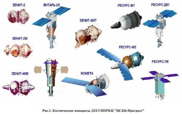
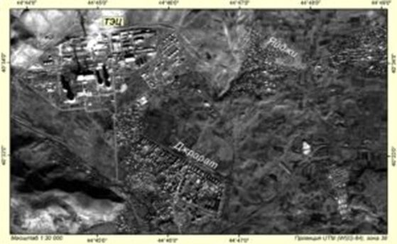
Conversion Images from Defense Satellites In the 1990s, a unique archive of photographic space imagery in Russia was augmented by images from defense satellites made available for civilian use through conversion activities. This archive includes images from reconnaissance satellites and the "Kometa" satellites in a subpolar orbit at 220 km altitude. For example, the "Kometa-20" satellite was launched in late 2000. Images are captured using two cameras.
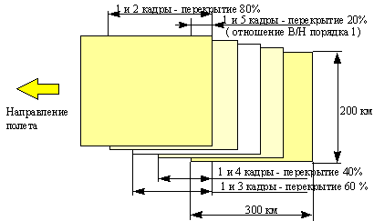
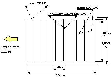
The topographic camera TK-350 with a focal length of 350 mm and a large frame format of 30 x 45 cm provides 1:660,000 scale images, covering 200 x 300 km with a resolution of 10 m. The imaging process includes 60–80% overlap for subsequent stereo processing with enlargements to a scale of 1:50,000.
The high-resolution panoramic camera KVR-1000 with a focal length of 1000 mm and a frame width of 18 cm performs panoramic imaging (with image shift compensation) within the TK-350 frame. Seven panoramic frames measuring 18x72 cm cover the entire TK-350 frame; each panoramic frame is divided into 4 images covering 40x40 km at a scale of 1:220,000 with a resolution of 2 m. These images, captured without overlap, are intended for detailed interpretation with enlargements to a scale of 1:10,000.
The photographic system of the "Kometa" provides the creation of topographic maps at a 1:50,000 scale, photomaps, digital models, and thematic maps at a 1:25,000 scale. Without ground control points, accuracy is 20 m horizontally and 10 m vertically, which improves to 10 m horizontally and 3–5 m vertically with additional ground-based control points, typically determined using OR8 systems. At the turn of the century, the "Kometa" imaging equipment was essentially the only system specifically designed for large-scale topographic mapping.
Topographic Camera TK-350
Accuracy in determining terrain elevations during stereophotogrammetric processing of images significantly depends on the ratio of the photographic baseline (B) to the imaging altitude (H). Given that H is typically no less than 200 km in space imaging, increasing the B/H ratio necessitated a larger frame format, leading to the development of the large-format TK-350 camera. Its key characteristics are listed in the table below:
Technical Specifications of the TK-350 Camera
| Focal Length | 350 mm |
| Frame Format | 300 x 450 mm |
| Relative Aperture | 1:5.6 |
| Resolving Power | 80 lp/mm at center 35 lp/mm at edge |
| Distortion | 20 µm maximum 2.5 µm RMS calibration error |
| Reference Crosses | 10 mm intervals |
| Image Shift Compensation | Available |
| Longitudinal Overlap | 20%, 40%, 60%, 80% |
Development of the TK-350 focused on increasing the photographic baseline and enhancing image accuracy. A rectangular format was chosen, aligning the longer frame side along the flight path. An 80% overlap achieves a B/H ratio of 1.1.
Across the entire frame, reference crosses are placed at 10 mm intervals on the alignment glass (1305 crosses in total), with calibrated coordinates and an RMS error of 2.0–2.5 µm. This ensures the highest accuracy in accounting for film deformation.
Calibration of the TK-350 camera involves determining its internal orientation and distortion using a high-precision spatial comparator. Calibration also includes the window glass of the spacecraft, gas composition inside the spacecraft, and in-flight measurements of temperature and pressure. These adjustments account for refraction and allow corrections to the camera's focal length. Combined with in-flight calibrations, the TK-350 achieves an RMS error of 5 µm.
Panoramic Camera KVR-1000
The panoramic camera KVR-1000 is integral to the Kometa space system, designed to provide high-resolution imagery of Earth's surface with a wide swath width. This capability supports detailed interpretation tasks. The KVR-1000 achieves consistent high resolution across the entire frame through a panoramic design that maintains optical center sharpness throughout the field of view. The main specifications of the KVR-1000 panoramic camera are shown below:
Specifications of the Panoramic Camera KVR-1000
| Focal Length | 1000 mm |
| Frame Format | 180 x 720 mm |
| Field of View Angle | 11° 40′ |
| Relative Aperture | 1:5 |
| Resolving Power | 60 lp/mm |
| Distortion Along the Slit | 16 µm (max) |
| Panoramic Scanning Method | Mirror Rotation |
| Panoramic Angle | 20° 40′ |
| Image Shift Compensation | By decentering the mirror rotation axis |
| Image Shift Compensation Error | ≤ 1% |
| Slit Width | 0.3–15 mm |
| Longitudinal Overlap | 6–12% |
The KVR-1000 provides 2 m ground resolution at an imaging altitude of 220 km, with a swath width of 160 km. A single TK-350 frame area corresponds to seven KVR-1000 frames when both cameras operate simultaneously, as shown below:
The diagram below shows the KVR-1000 camera's structure:
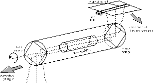
The KVR-1000 delivers high-quality panoramic images suitable for creating large-scale photoplans and orthophotoplans. These applications require a geometric model of the panoramic image that accounts for calibration parameters.
Capabilities of the Kometa Space Mapping System
The Kometa space mapping system, comprising the TK-350 topographic camera, KVR-1000 panoramic camera, and onboard orientation determination equipment, supports the creation of large-scale topographic and digital maps. The onboard equipment includes two star cameras, a laser altimeter, navigation sensors, and synchronization instruments. The mapping capabilities of the system are summarized below:
Mapping Capabilities of the Kometa System
| Camera Type | TK-350 | KVR-1000 |
| Average Imaging Altitude | 220 km | 220 km |
| Imaging Scale | 1:630,000 | 1:220,000 |
| Frame Coverage Area | 284 x 189 km | 158 x 40 km |
| Mapping Accuracy Without Ground Control | 20–25 m (planar) | - |
| Height Determination Accuracy | 10 m | - |
| Mapping Accuracy With Ground Control | 15–20 m (planar) | 7–10 m (planar) |
| Height Determination Accuracy | 5–7 m | - |
To date, an extensive archive of images has been accumulated over 20 launches of the Kometa system, covering vast areas of the Earth.
Images captured by TK-350 and KVR-1000 allow the production of topographic maps at a scale of 1:50,000, as well as digital and thematic maps with specified accuracy without ground control points. KVR-1000 imagery supports the creation of photoplans and orthophotoplans at scales up to 1:10,000. Accuracy can be further improved by integrating GPS-based control points.
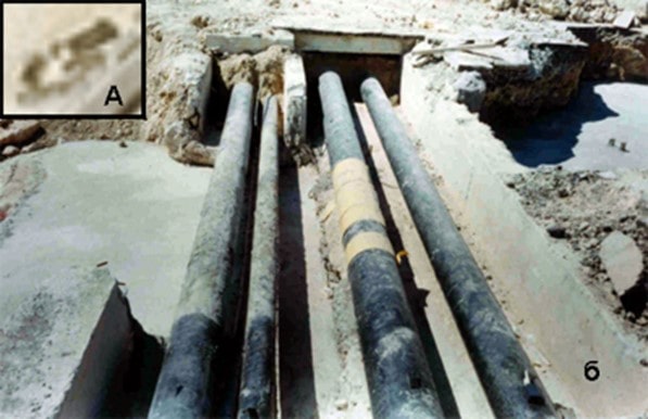
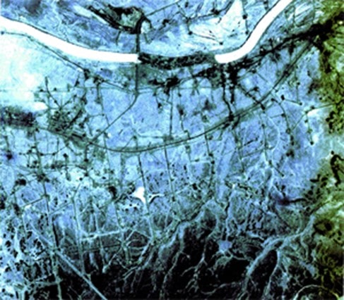
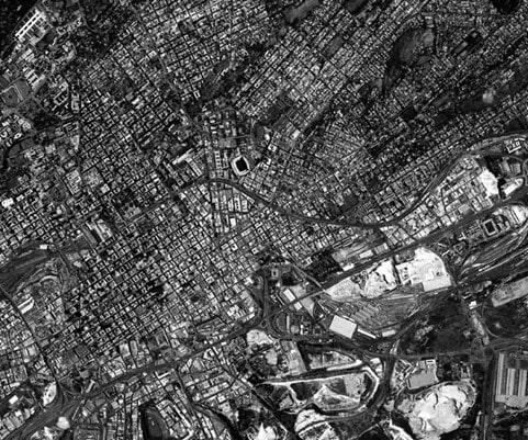
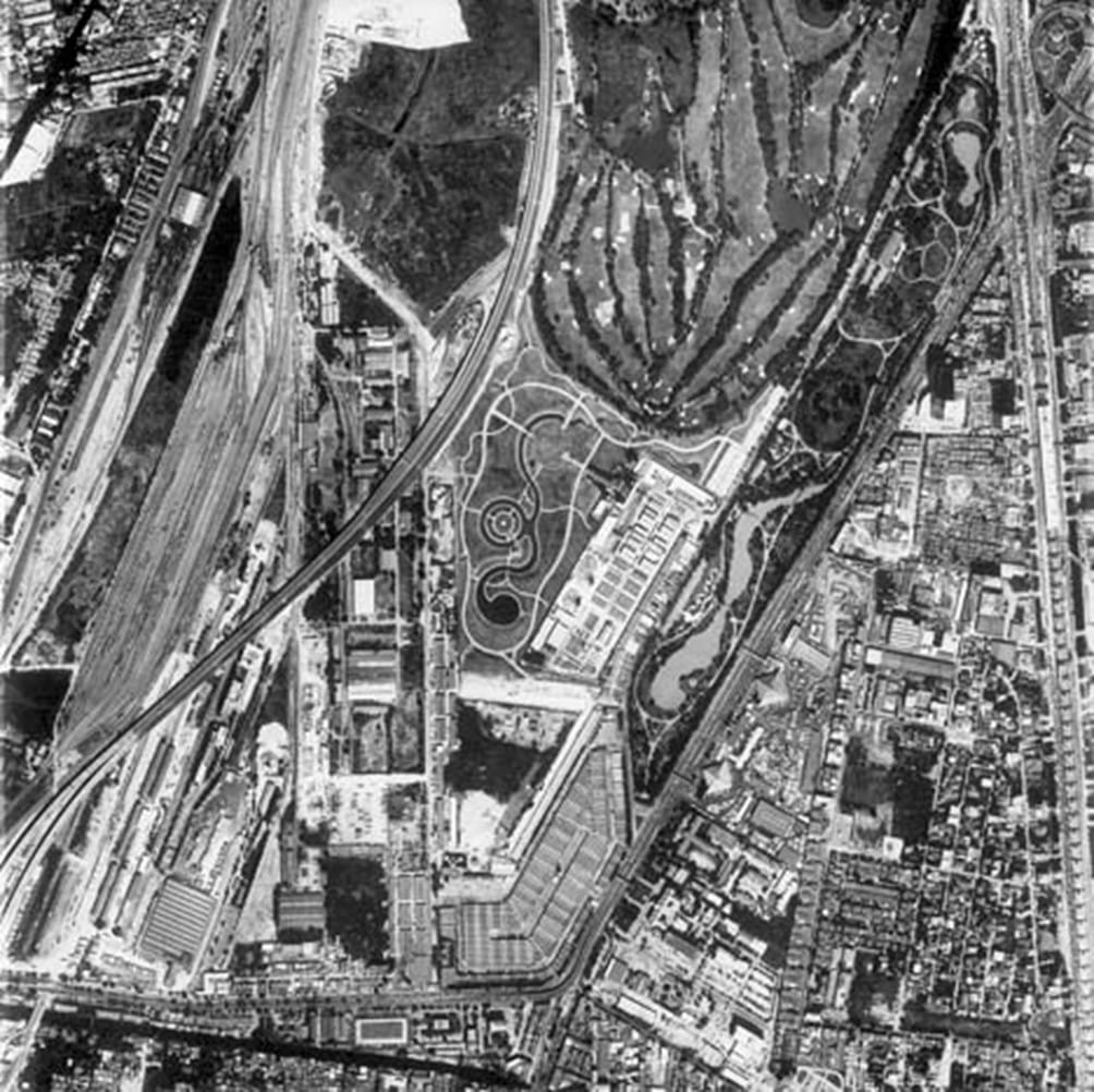
Historical satellite imagery from Russian and Soviet systems offers significant value for long-term thematic monitoring. Such RS research is crucial for informed decision-making in agriculture, forestry, water resource assessment, geology, urban planning, and infrastructure development.
Archived space imagery from the above-mentioned Russian (Soviet) RS satellites is available for order through Geo Innoter LLC without restrictions on areas or imaging periods. To place an order, contact Geo Innoter LLC's sales department by phone at +7 495 245-0424, email at innoter@innoter.com, via chat on the website, or through WhatsApp +7 916 352-3941 or Telegram.
