The trail of the criminal has disappeared, the special services have no chance to find him in the abyss of the city. But here, someone gets the idea to search for the lawbreaker from outer space. Three minutes and the target is found. In the smallest detail with the help of satellite we were able to examine the car of the criminal, license plate number, and his head to toe.
Sound familiar? No wonder! More and more often we can see such a plot in Hollywood movies.
But is it true? Is it really true that in the modern world a man can no longer be alone with himself, and wherever he goes, he will be watched from space? You're probably already guessing that there's a catch to this whole story.
Usually when it comes to space, to the prospect of seeing anything on Earth, one thinks of an endless dark universe and a big blue-green ball shrouded in a white veil. "How can you even see anything out here? What Chinese Wall?" - most likely flashes through his mind. WorldView-3 satellite image
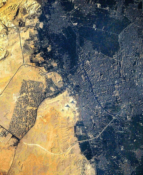
The International Space Station (ISS) flies above the Earth at an altitude of just over 400 kilometers. In real life, it is difficult to imagine what exactly can be seen from such a distance. The limitations are made up of the capabilities of our body, namely human vision. The astronaut will distinguish cities, fields, mountains. To see more, he can use a camera. With its help it is possible not only to see the Earth ten times better, but also to imagine what it is like to observe the Earth being in space. With a camera, it is easy to see large man-made objects like the Pyramid of Giza from space.Image from Kompsat-3A satellite
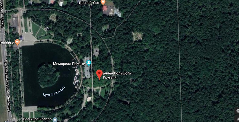
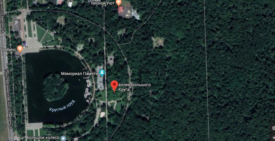
We all realize that the images used in the Google Maps and Yandex.Maps services were not taken by astronauts. These images were taken by space satellites.Izmailovsky Park
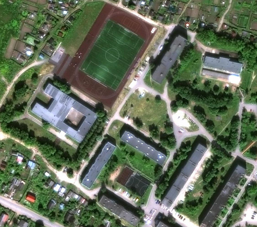
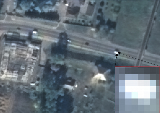
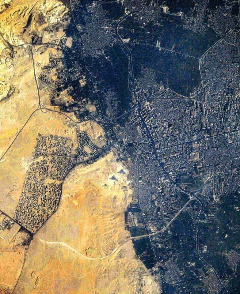
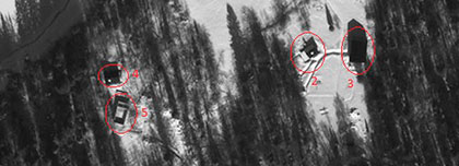
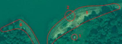
Satellites, like cameras, are different. One has better image resolution, the other worse. The highest spatial resolution of a space image that can be obtained today is 31 cm. It means that one pixel on the image will be like 31 cm on the Earth. Naturally, in length and width. A space image consists of many such pixels, each of which has its own color and shade.Pyramids of Giza
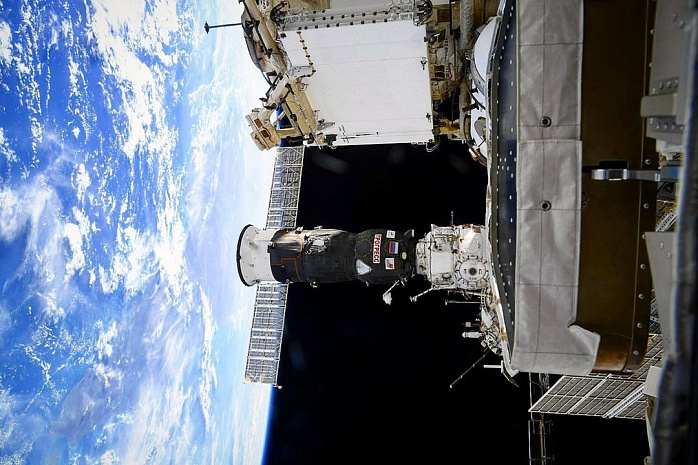
Suppose there is a table 90 cm long and 60 cm wide. You would need 6 pixels to display this table in the image. The same goes for the rest of the objects. We can see bushes, houses, cars, roads, ships, even the markings on a soccer field even though they are no more than 10 cm wide (it's all about contrast). But we cannot see a dog, a person, a fire hydrant, a bicycle.Image taken from Instagram account @tsniimash_official
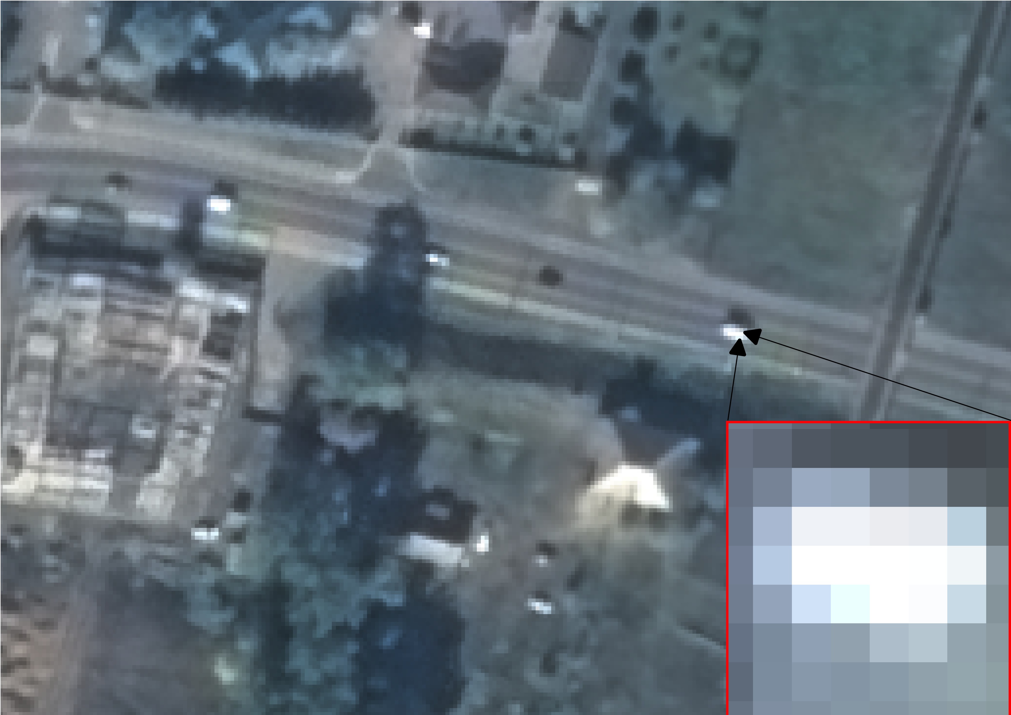
Of course, there are nuances here as well. There are various situations when some objects can be recognized by indirect decoding signs. For example, if the shooting from space was carried out at a high angle, it is quite possible to determine by the presence of a shadow that several people are running cross-country in the stadium. Recognizing people on the image is also easy in case of a large number of them. But to recognize a human face on a satellite image is an unreal task. The color of the object is also of great importance. If the object merges with the surrounding background and does not cast a shadow, it will be almost impossible to see it on the space image.
With the objects sorted out, it remains to be seen whether a satellite can show us what is happening on Earth in real time. Before we get the familiar image with gray roads, blue water and green trees, what we call a space image has to go through several processing stages: from receiving data from a satellite by a station to merging individual channels into a color image. Such a chain of data reception is far from the principle of obtaining information online. Well, is it worth mentioning that no spacecraft can simply change its direction of motion and "fly" to shoot that piece of the Earth that we need. One and the same satellite always takes pictures along approximately the same trajectory.
Despite this, if necessary, you can always order a new space satellite imagery, but you need to schedule the imagery in advance. If the weather conditions are good, you can get a new satellite image of the desired area in a couple of days, but cloudless weather is not always the case, so it may take weeks or even months to get successful images.
Space images can also be purchased from the archive of space imagery. More and more often people seek help in settling various land conflicts. Suppose we need to prove that a building had no roof in 2013. We have no photos of the building at that time, and no witnesses either. This is where space imagery can come to the rescue.
If you are faced with such a situation, write to us at innoter@innoter.com. We will select all possible options of space imagery coverage for you, inform you about the cost and delivery time.