The history of the creation of old satellite images
History of the Creation of Old Satellite Images
The first-ever space photograph was taken on 24.10.1946, and the first satellite under the corresponding name "Sputnik-1" was launched into space on 04.10.1957. The first photos of Earth were taken using the V-2 rocket. These were the world's first long-range ballistic missiles, produced in Germany during World War II. However, after the defeat, they were confiscated, and more than 100 units in disassembled form were sent to the United States, where they began to be re-equipped with instruments for studying the atmosphere.
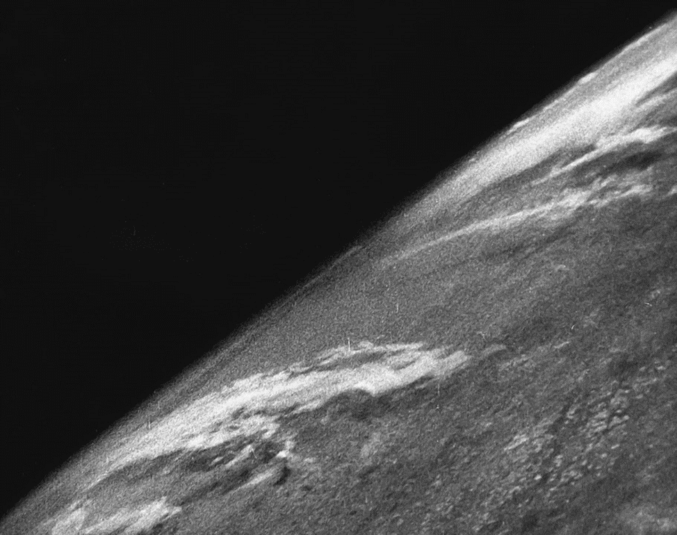
Fig.1. Photograph of the planet taken by the V-2 rocket. 24.10.1946
The rocket launched in October 1946 was equipped with a black-and-white 35-millimeter movie camera. The rocket reached an altitude of approximately 105 kilometers and took a picture every one and a half seconds.
From 1946 to 1950, over a thousand images of Earth were obtained from space, some of which were taken at altitudes exceeding 160 km. During this time, the USA launched 63 V-2 rockets for research purposes. The first photographs of our planet published in newspapers and magazines were described as "How Earth will look to visitors from another planet arriving on a spaceship".
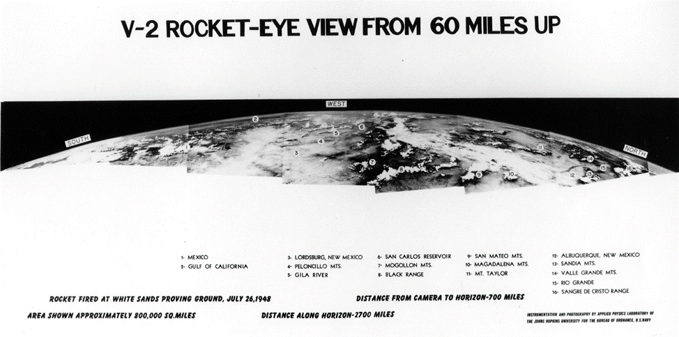
Fig.2. First space panorama of Earth, created from photos taken by the V-2. 26.07.1948
The history of creating old satellite images dates back to the 1950s when the USA and the USSR began launching the first artificial Earth satellites. One of the first satellites launched into space was the USSR's "Sputnik-1", launched in 1957. This satellite used radar equipment to measure the height and distance to the Earth's surface.
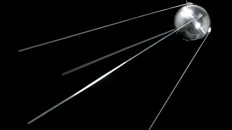
Fig.3. Image of satellite "Sputnik - 1"
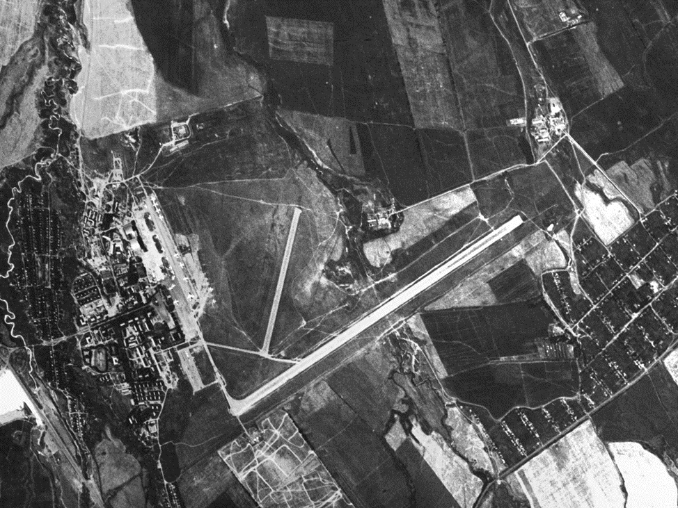
The next step in satellite imaging was taken in 1960 when the first satellite equipped with a camera was launched - the "CORONA" satellite, publicly known as "Discoverer". The satellites had the code names KH - KeyHole It had to conduct reconnaissance primarily over the USSR and China. The camera was specially developed to take pictures of the Earth from space and had a high resolution, allowing to see objects the size of 12 meters. Later missions significantly improved on this parameter, reducing it to only 1.5m. One launch was performed with a resolution capability of up to 0.30m, but the limited field of view was deemed ineffective. However, the first photographs taken with this camera were unsuccessful, and only a few years later were high-quality satellite images obtained.
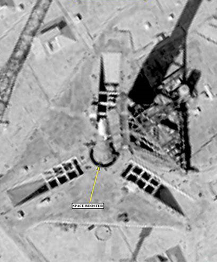
Fig.4. Image of the Soviet "lunar" rocket N-1, obtained by the KN-8 device 19.09.1968
The last launch of the satellite under the Corona program was made on 25.05.1972.
The project was suspended due to the detection of a Soviet submarine waiting in the area of capsule landing in the Pacific Ocean.
The most successful period of filming was 1966—1971, when 32 successful launches returned usable photofilm.
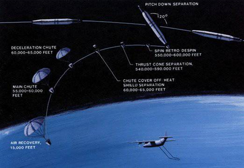
Fig.5. Diagram showing the process of separating the descent vehicle from the satellite, entering the atmosphere, and catching the parachute capsule with a special aircraft.
In 1972, the first Landsat satellite system was launched for monitoring the Earth and collecting environmental data. The Landsat system used a special multispectral camera capable of registering various spectral characteristics of objects on Earth. This improved the quality of satellite images and expanded their range of applications.
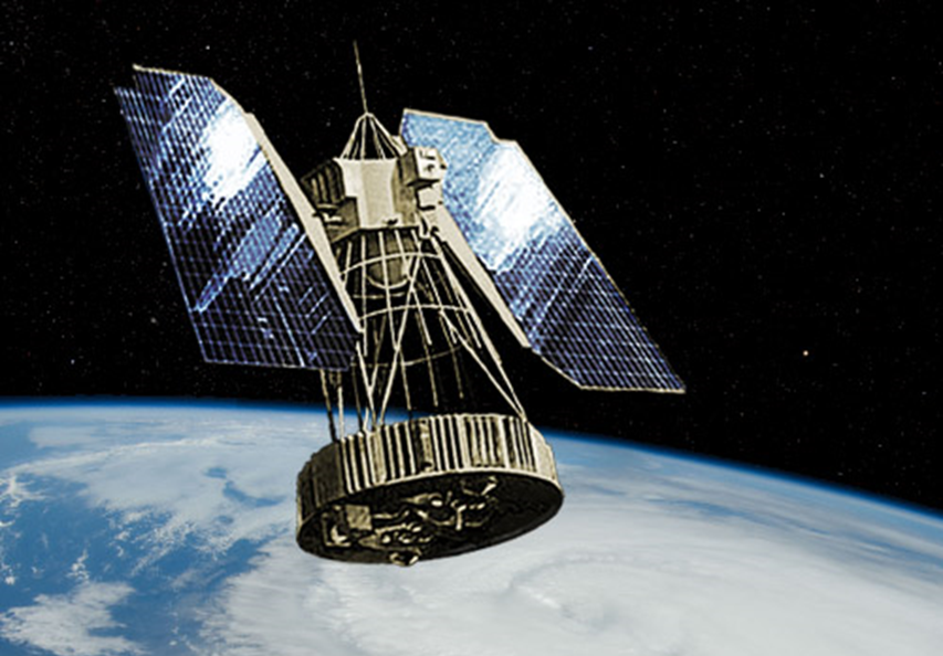
Fig. 6. Image of Landsat 1 satellite
In subsequent years, other satellite systems were launched, such as the NOAA satellite system for weather monitoring and the Terra satellite system used for studying climate and the environment.
Today, satellite images are widely used in various fields such as geography, ecology, agriculture, forestry, geology, archaeology, and many others. Furthermore, old satellite images obtained decades ago can also be used to study changes in Earth's environment and climate, as well as the history of land use.
Until 2000, a number of satellites with different characteristics were launched by various countries:
- Landsat - a series of American medium-resolution satellites (30 meters), launched since 1972. They created multispectral images in the visible and infrared spectrum used for mapping, studying forests, agriculture, and geology.
- SPOT (Satellite Pour l'Observation de la Terre) - a series of French satellites launched in 1986. They had high resolution (up to 2.5 meters) and were used to create detailed images of cities, transportation networks, and other objects.
- NOAA (National Oceanic and Atmospheric Administration) - an American satellite launched in 1972. It was used to obtain information about cloud cover, ocean currents, and other meteorological data. Image resolution ranged from 1.1 km to 4 km.
- Kosmos - a Soviet satellite launched in 1985. It was used to create panoramic images of Earth and had a resolution up to 500 meters.
- ИСЗ "Электрон" - a Russian satellite launched in 1994. It was used to create panoramic images and had a resolution up to 1 km.
- Landsat-7 - an enhanced version of the American Landsat satellite, launched in 1999. Image resolution was 15 meters.
- IRS (Indian Remote Sensing) - a series of Indian satellites launched since 1988. They had resolutions ranging from 5.8 to 70 meters and were used for mapping, agriculture, and other applications.
- Ресурс-Ф - a series of Soviet (Russian) remote sensing spacecraft. Used for national economy and natural resource management from 1973. Multi-spectral data with a resolution of 6–8 meters was collected using the MK-4 sensor.
- KeyHole satellites — the general name for the American military reconnaissance satellite series of the “Corona” program. The spacecraft in this series were used for detailed optical reconnaissance of the territory of the USSR, China, and other potential adversaries of the USA. A total of 13+ types of KeyHole satellites were developed and launched from 1959.