Recent months have been the driest in the history of rainfall measurements in Europe, and satellite images show the extent of the problem. Recent storms caused local flooding, but did not affect much deeper layers of soil: large volumes of rainfall simply flowed into rivers and drainage ditches, wetting only the surface layer of the ground.
The UK had its driest May in 124 years. According to historical records, the average temperature was 0.5 degrees Celsius higher than in 1990, which was considered the warmest year on record.
Fires caused by drought are devouring forests, grasslands and fields. Water levels in many rivers have dropped to record lows. As a result, soil moisture in the fields was well below the required value, which will have a serious impact on crop yields. According to climate scientists, global warming is having an increasingly devastating effect on the environment and unfortunately, it may be our new reality.
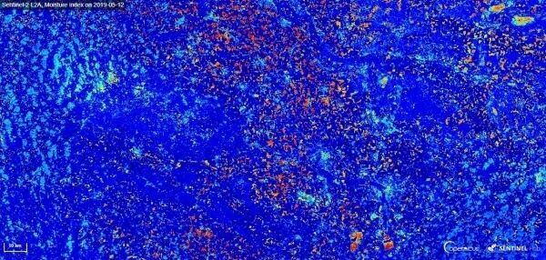
Germany faced dry weather unusually early this year, in April, when forest fires broke out in North Rhine-Westphalia. According to the National Meteorological Office, only 5% of rainfall was recorded in July, and the whole of 2020 could be another period of severe drought in Germany, perhaps even more difficult than 2018 and 2019.Sentinel-2 L2A, May 2019 humidity index, southern Germany
In the image above, the signs of another dry year are visible everywhere. In East Dresden, the water level in the Elbe is only 95 centimeters, while its average depth is twice that. The Elbe is one of many rivers in Germany where shipping has been halted for the past two years due to low water levels.
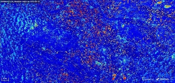
"A winter without snow and a spring without rain are all very well known. The difficult drought situation in Germany can be seen in Sentinel-2 (L2A) satellite images," said Sybrand Van Beyma, an Earth observation specialist at CloudFerro (companies develop and operate cloud computing platforms, providing large collections of Earth observation satellite imagery). "The moisture index is a simple method to visually compare data from different periods and identify differences in soil moisture. In this example, a sharp decrease in soil moisture can be observed between May 2019 and May 2020. This is very valuable information, especially in the context of regional water management. If an area is experiencing alarmingly low moisture levels, the local administration must have the right data to take the necessary measures," added Van Beyma.
German farmers fear that after two years of drought, a third year could be even more difficult. Although the problems in 2018 led to record compensation payments to farmers from the state, almost 292 million euros, they did not cover all the losses. In 2020, the drought promises even more trouble. Sentinel-2 L2 A, May 2020 moisture index, Southern Germany
Drought in Europe extends from Northern France through Central and Northern Europe to the eastern borders of Poland. In France, wheat and barley crops have had the driest soil conditions for five years. Other major European cereal producers, such as Romania and Ukraine, say their water supplies are at high risk. According to Poland's Institute of Agricultural and Food Economics, grain yields could fall by as much as 8% this year. The drought hitting the eastern part of the European Union is destroying crops and intensifying the economic downturn caused by a coronavirus pandemic, already considered the deepest crisis since the fall of communism.
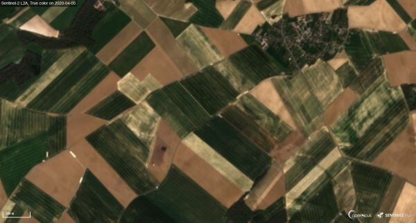
"By comparing satellite images of the following years, we will be able to see the drying up of the continent. We will see shrinking water bodies, increasingly shallow rivers and the disappearance of even smaller rivers and lakes. The situation is really serious and must be carefully monitored," commented Sibrand Van Beyma. It is worth noting that a huge amount of information about changing climatic conditions has been obtained thanks to the European Copernicus Earth Observation Program. Information products based on satellite images show the current situation as well as the changes occurring over time. They can be used by academic institutions and researchers, as well as by companies creating applications that support water management or simulate the environmental impact of drought.Sentinel-2 L2A, image in natural colors, April 2020, Pisselot, France
According to the Helmholtz Center for Environmental Research. According to the Helmholtz Center for Environmental Research, global warming is having a major impact on the drought situation in Europe. If the Earth's temperature rises by 3 degrees Celsius, the area of drought in Europe will double and cover more than one fifth of our continent. The duration of the drought would also increase 3-4 times, affecting up to 400 million people. If the increase in global warming can be limited to 1.5 degrees, as agreed in the Paris Treaty, both the area and duration of drought should decrease.
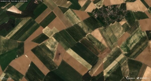
Europe is committed to actively combating climate change and counteracting its negative effects. Mechanisms for climate governance and disaster response need to be developed. Detailed data on the Earth's climate situation must be collected and analyzed.Sentinel-2 L2A, image in natural colors, April 2019, Pisselot, France
Source: Gim international
The company "GEO INNOTER" specializes in supplying satellite images to the Earth's surface and performs thematic analysis of satellite images tailored to the Customer's tasks. Send your requests for image selection and technical specifications for work to the email: innoter@innoter.com.