Sat-Sun: Non-working days
The goal of the project is to use ASTER satellite images for mapping hydrothermally altered rocks associated with porphyry copper mineralization using the Sarcheshme deposit as an example. Porphyry copper deposits, as a rule, are characterized by zones of hydrothermal changes. In simple words, the field is a porphyritic intrusion surrounded by several zones of hydrothermal changes (phyllitization, propylitization, argillization, etc.).
Completed works
The work was carried out according to the ASTER photograph for July 15, 2007 with a processing level of 1T (with correction for the relief) in the VNIR and SWIR ranges. A radiometric calibration was performed for the image, followed by atmospheric correction using the IARR (Internal Average Relative Reflection) method. Then the VNIR and SWIR ranges were combined into a single composite with a resolution of 15 m.
To identify zones of hydrothermal changes, the following methods were used:
-
PCA (Principal Component Analysis);
-
MNF (Minimum Noise Fraction);
-
Spectral indices.
The principal component method is used to transform a large number of dependent variables into a smaller number of uncorrelated variables (components). Thus, it lowers the dimensionality of the data, removing all unnecessary (noise) and allows you to select the most important. This method is often used in geological mapping.
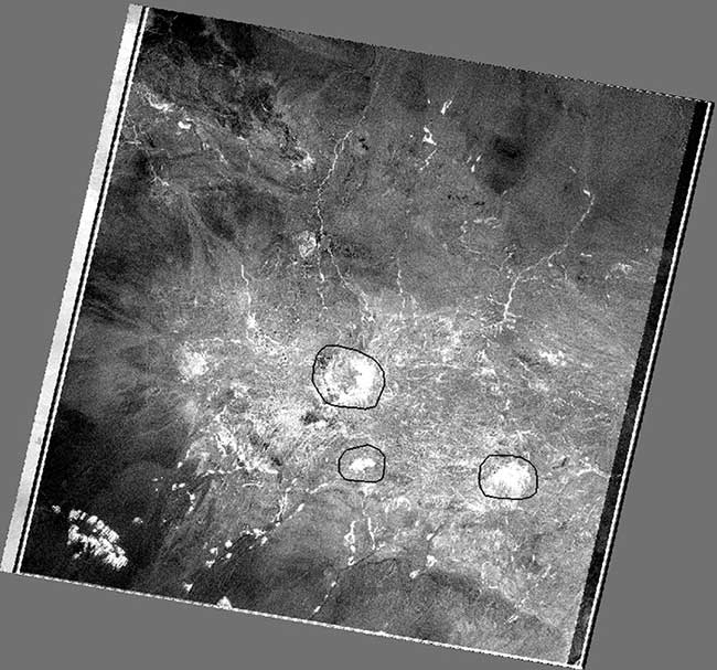
In our case, the first component contained 95.5% of the total variance of the data, since it contains general information about the albedo of the scene. In a further analysis of the statistics of the main components, it was possible to identify the component in which the minerals are well identified (Fig. 1) containing iron oxide - this is the 4th main component (PC4). Iron oxide containing minerals have a low reflection in channels 1 and 2 of ASTER and high in 4, which is displayed in PC4 statistics.

Figure1 – Image of the 4th principal component (PC4), where bright pixels correspond to minerals containing iron oxides.
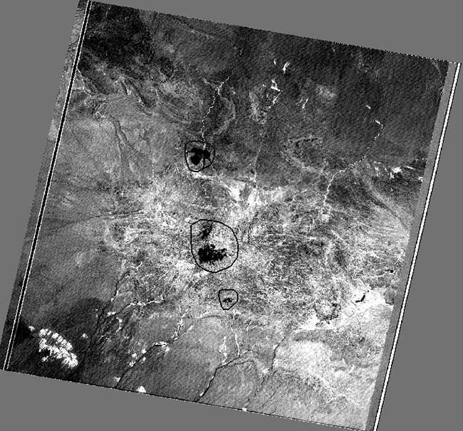
And the 6th principal component (PC6) allows identifying minerals containing aluminum hydroxide (kaolinite, alunite, etc.) in the form of black pixels (Fig. 2).

Figure2 – Image of the 6th principal component (PC6), where black pixels correspond to minerals containing aluminum hydroxide.
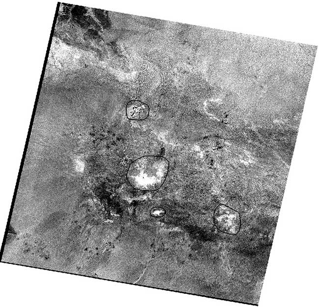
Spectral indices are combinations of spectral reflection from two or more channels, which indicate the relative abundance of the object of interest. The ratio of the 7th and 6th channels of ASTER band7 / band6 was calculated, which allows to identify the hydrothermal changes associated with muscovite, which has a high reflection in the 7th channel and a low in the 6th. In Fig. 3 areas of muscovite are displayed in white pixels.

Figure3 – Image band7 / band6, showing the hydrothermal changes (muscovite) in the form of white pixels.
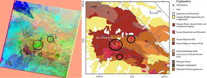
MNF transformation is a modification of the principal component method, the essence of which is to maximize the signal-to-noise ratio (S / N). In our work, the signal-to-noise ratio for the first MNF component was 94, for the second 3.5, for the thirds 1, and for the remaining ones less than one. Accordingly, components 1–3 are most suitable for the analysis of MNF. On the RGB composite 1–3 of the MNF component, hydrothermally modified rocks are shown in green. The hydrothermally altered rocks identified by the MNF are also recognizable on the geological map (Fig. 4).

Figure4 –Hydrothermally modified rocks on the RGB composite 1–3 MNF component (left) and a fragment of the geological map (right).
Results
The method for detecting hydrothermally modified rocks has been tested using PCA, spectral indices and MNF methods. The identified ranges of hydrothermal rocks are confirmed by a geological map. It is proved that remote sensing methods are effective for identifying porphyry copper deposits.
