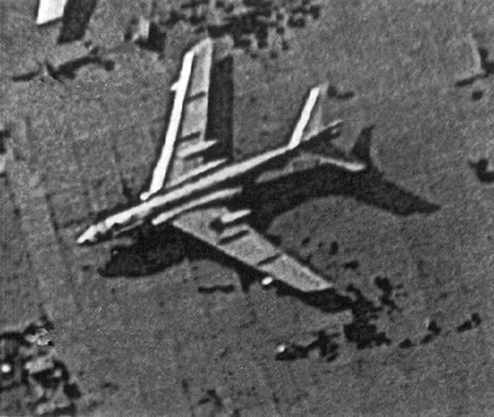
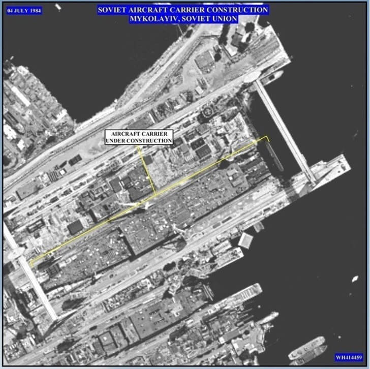
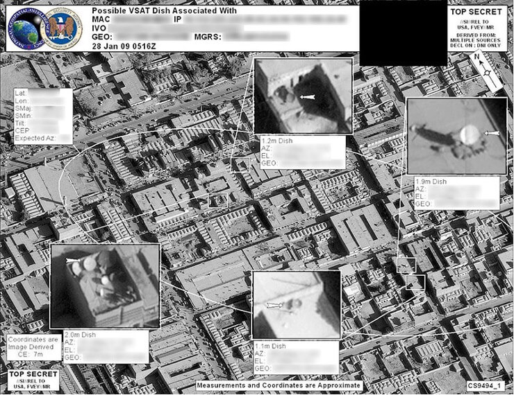
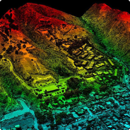
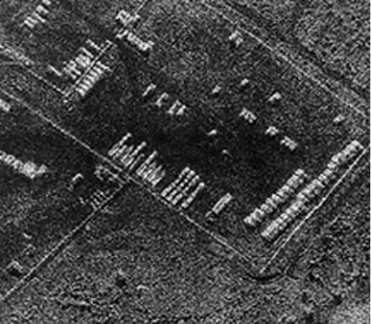
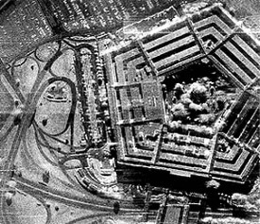
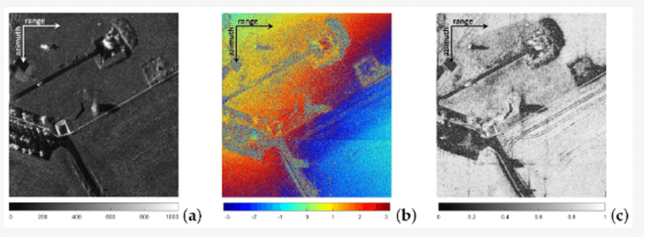
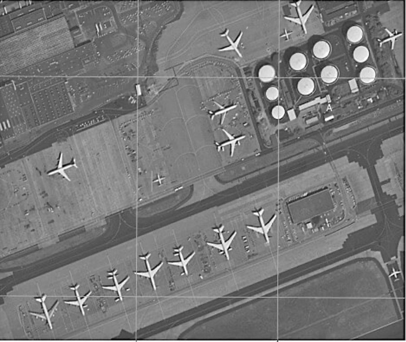
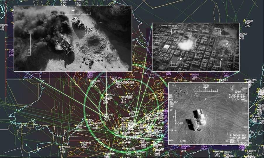
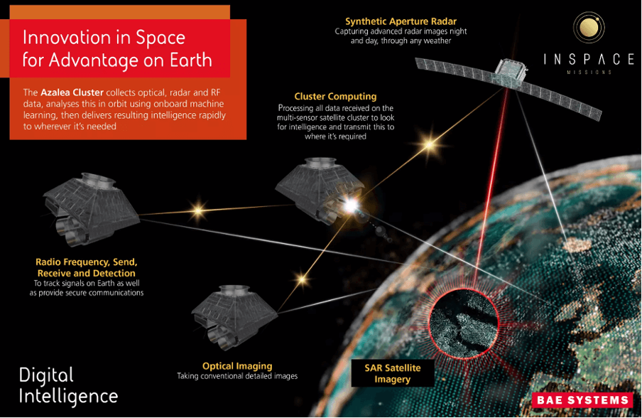
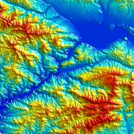
US ISR strategic military satellites in the optical range (panchromatic mode)
Tactical ISR Satellites
Historically, ISR was not the responsibility of the U.S. Space Command—now the U.S. Space Force. It was primarily the effort of the intelligence community. However, the new command needs to address this issue to support the battlefield, as demonstrated in the Project Convergence exercises, where data on targeting precision weapons based on satellite imagery was obtained within 20 seconds. Scenarios of SPACE FLAG, managing tactical battlefield operations by the U.S. Space Command ISR components, were practiced in Ukraine.
The head of the U.S. Space Force wants the new service to take on a new mission: providing tactical satellite imagery to the joint forces. He did not explain whether this means the service will attempt to build its own satellite constellation; however, the director of the Space Development Agency suggested that the idea might include creating space forces and launching a new satellite constellation for imagery. Currently, there is no clear plan for who in the U.S. Department of Defense will create these satellites. There is not even a definite plan for what this overall constellation will look like. There are many internal debates on this matter. But the military's vision remains the same: someone must create a layer that provides reliable tactical ISR during wartime.
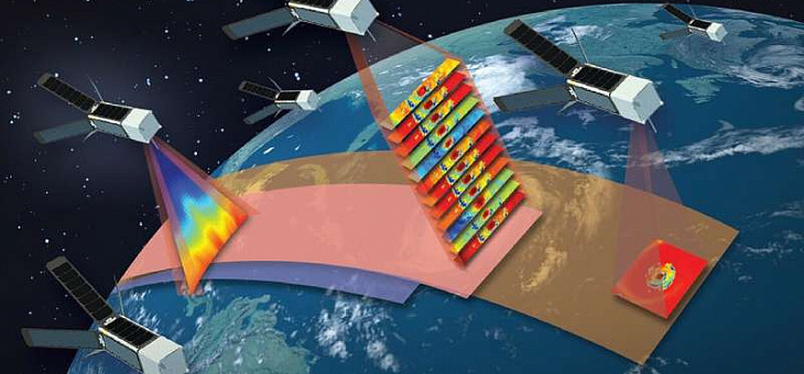
Other achievements, such as artificial intelligence that can instantly process images, and the development of new orbital mesh networks that can accelerate the delivery of satellite data to the battlefield, allow military personnel to access this data in seconds, not hours or days.
Additionally, efforts at the tactical space level promise to provide target designation for combat aviation beyond line of sight, significantly expanding the battlefield.
In addition, the Space Development Agency (SDA), which joined the U.S. Space Force in October 2022, is creating tactical geospatial intelligence (GEOINT) capabilities within its National Defense Space Architecture (NDSA). The basis of this architecture is a mesh network in orbit, called the transport layer, consisting of satellites in low Earth orbit, connected by optical intersatellite communication links. The agency wants to use the transport layer to connect commercial image satellites to the Tactical Intelligence Targeting Access Node, or TITAN, a new scalable portable ground station currently in development, which can process images using artificial intelligence and distribute this data across the battlefield. In other words, SDA will provide the network component of the army's tactical space level.
Experimental ISR Satellites
Over the past 10 years, the U.S. military (NRO, Air Force Research Laboratory, US Space Force, DARPA, US Air Force, US Navy, Northrop Grumman, Lockheed Martin, Blue Canyon Technologies, Millennium Space, Astro Digital, SA Photonics, Trident Systems, Blue Canyon Technologies) has conducted a significant cycle of launching small tactical ISR satellites (over 20 satellites) for experimental purposes in the future ISR development program and the Blackjack DARPA program (over 25 satellites). The space component was systematically integrated with the ground-based one. These small satellites had a lifespan of no more than 3 years in orbit. It is fair to say that the U.S. military ordered small satellites as early as 1990 (Northrop Grumman), and then launched a dozen experimental small satellites. However, in recent years, there has been a deceptive impression that they consciously ignored serial tactical space reconnaissance with small satellites in favor of the aviation component and the promotion of strategic and tactical UAVs. This is partially confirmed by the surge of European commercial companies in the radar range, both heavy satellites (Airbus Defence and Space) and small satellites (ICEYE). Moreover, China has overwhelmed all countries with reconnaissance satellite launches and Earth observation satellites (in China, it is difficult to distinguish pure military satellite reconnaissance from civilian Earth observation).
Therefore, it is expected that from 2023 to 2025, there will be a surge in launches of U.S. military serial small satellites with new developed ISR technologies, a lifespan of 7 to 10 years in orbit, and the ability to be deployed to any orbit within a week (modular payload assembly principle) on demand.
From 2005 to 2020, experimental test satellites with ISR payloads were launched to test the accuracy and speed of battlefield situational information transmission, with a short time factor for launching into orbit. There was some information about these satellites, including:
SeeMe Satellite
SeeMe (Space Enabled Effects for Military Engagements) — is a prototype small satellite created by Raytheon for DARPA for the timely and persistent delivery of on-demand satellite imagery for mission planning.
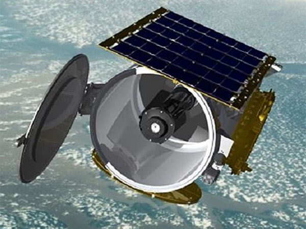
The DARPA SeeMe program aimed to provide U.S. mobile forces with on-demand access to tactical space information in remote and beyond-line-of-sight conditions. If successful, SeeMe would provide small squads and individual commanders the ability to receive timely images within 90 minutes of their specific location overseas directly from a small satellite by pressing a button on a tablet or mobile phone, which was impossible with military satellites in the mid-2000s. DARPA planned for SeeMe to complement drone technology, which provides local and regional high-resolution coverage but cannot cover extensive territories without frequent refueling. SeeMe, as designed, sought to support fighters in foreign territories simultaneously without any logistics or technical maintenance costs, except for the soldiers' handheld devices.
The SeeMe constellation could consist of several dozen satellites, each in very low Earth orbit for 60–90 days, after which it would deorbit and completely burn up, leaving no space debris and posing no risk of re-entry into the atmosphere.
The SeeMe satellite utilized the DARPA program Airborne Launch Assist Space Access (ALASA), which is developing an aviation platform for launching satellites with payloads of about 45 kg. ALASA provides a cost-effective and rapid launch of small satellites into any required orbit, which is currently impossible from stationary ground launch pads.
The first SeeMe satellite was launched aboard the eXCITe satellite (PTB 1), which initially manifested on the Falcon-9 v1.2 in 2016, then on the Indian rocket PSLV. The satellite was launched as part of the SSO-A Spaceflight Industry multi-satellite program on the Falcon-9 v1.2 (Block 5) rocket, but apparently did not separate from eXCITe.
TacSat -3
TacSat-3 (JWS D2) — a small technology mission of the Air Force Research Laboratory.
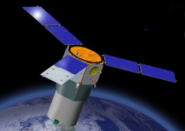
The project is funded by the U.S. Department of Defense's Defense Advanced Research Projects Agency (DARPA) as part of Phase II of a four-stage approach to developing modular platforms for satellites. The result of the TacSat 3 mission is used to support the sensor payload of the Advanced Responsive Tactically Effective Military Imaging Spectrometer (ARTEMIS), also being developed by the AFRL. The main payload of TacSat 3 was a hyperspectral sensor, and the satellite platform had a standardized avionics package developed by the Air Force Research Laboratory. The satellite achieved a ground resolution of 4 meters with HSI, allowing it to detect and identify tactical targets. It also featured the Navy Secondary Data-X payload for communication with IP-based buoys. Swales Aerospace designed, built, and tested the operationally responsive space modular bus (ORSMB) for the TacSat 3 mission. TacSat 3 was a prototype for the first satellite of the Operationally Responsive Space (ORS) program, ORS 1. TacSat 3 was deorbited on May 1, 2012, after almost three years of successful mission operations.
The tested parameters of this satellite are still considered the highest, both in terms of resolution for hyperspectral imagers (4 meters) and filtering (10 nm).
Currently, innovative military small satellites continue to operate, including those with ISR tasks:
U.S. Space Force (USSF)-12 Satellite
The U.S. Space Force Station (USSF)-12 was launched on 14.07.2022 from Cape Canaveral to a geosynchronous orbit (GEO) with a wide field of view (WFOV). The USSF-12 wide field of view and jointly operated ring is a Space Systems Command (SSC) space trials program that demonstrated the operation of an innovative infrared (IR) sensor and confirmed the ability to host multiple missions on one satellite structure.
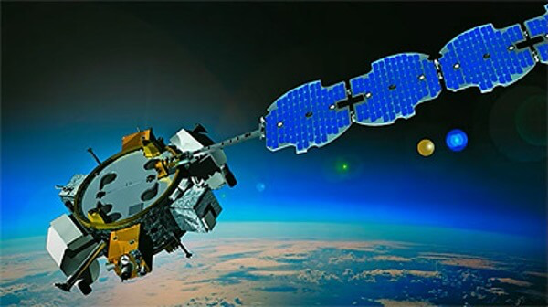
The effectiveness of new integrated space sensing technologies has been proven in combating emerging threats from Russia, Iran, China, and potentially India. This essentially serves as a testbed, a crucial technological component of the leading U.S. Department of Defense (DoD) program - "Missile Warning, Reconnaissance, and Defense (MW/MT/MD)," within which the Space Systems Command (SSC) collaborates with the Space Development Agency and the Space Research Agency.
EAGLE (ESPA Augmented Geostationary Laboratory Experiment)
EAGLE (ESPA Augmented Geostationary Laboratory Experiment) - an experimental satellite created by the Air Force Research Laboratory (AFRL) and operating under the Space Test Program (STP).
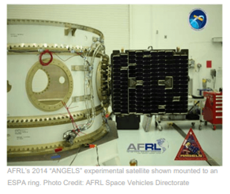
AFRL ordered the Eagle bus from Orbital in 2012. It consisted of an ESPA adapter equipped with an engine module and Moog Broad Reach avionics, software, and a GPS receiver. EAGLE carried no less than five payloads, with a total payload weight of up to 1086 kg. It existed in orbit for over a year. EAGLE carried the following payloads (it is known that three of them were fully deployed):
· HTI-SpX (Hypertemporal Imaging Space Experiment), provided by the Management of Space Vehicles of the AFRL, was designed to help improve understanding of hypertemporal visualization, involving the blending of images taken from various points on Earth at several different spectral wavelengths over regular intervals of time.
· Mycroft – a special, detachable additional satellite that drifts to a distance of approximately 35 km from EAGLE, carefully advancing over several months to a distance approaching 1 km.
· CEASE-III-RR - Compact sensor for environmental anomalies. Detection of nuclear radiation.
· ISAL (Inverse Synthetic Aperture Ladar) for obtaining high-resolution images, the resolution of which is not limited by the diffraction limit of a telescope collecting imaging data. This makes it an ideal method for obtaining images of space objects in geostationary orbit around Earth (GEO).
· ARMOR (AFRL-1201 Resilient Spacecraft Bus Development Experiment).
The first EAGLE satellite was launched in 2018 as a secondary payload in the AFSPC 11 mission on the Atlas-5 rocket. Shortly after reaching orbit above the geostationary belt, it deployed three subsatellites (Mycroft and two unidentified ones, USA 286 and USA 287). The second one (resulting from ARMOR) is scheduled to launch in 2023 - NTS-3, an experimental navigation satellite, will expand the boundaries of modern position, navigation, and timing (PNT) technologies to pave the way for a more flexible, reliable, and resilient architecture for satellite navigation technologies. The goal is accurate geopositioning of a fighter on the battlefield.
LM 400 Satellite
Lockheed Martin has introduced a new line of military tactical reconnaissance, observation, and surveillance (ISR) satellites designed to provide armed forces with long-range tracking of moving targets in a hostile environment in near-real-time.
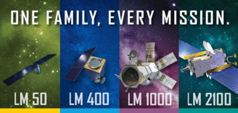
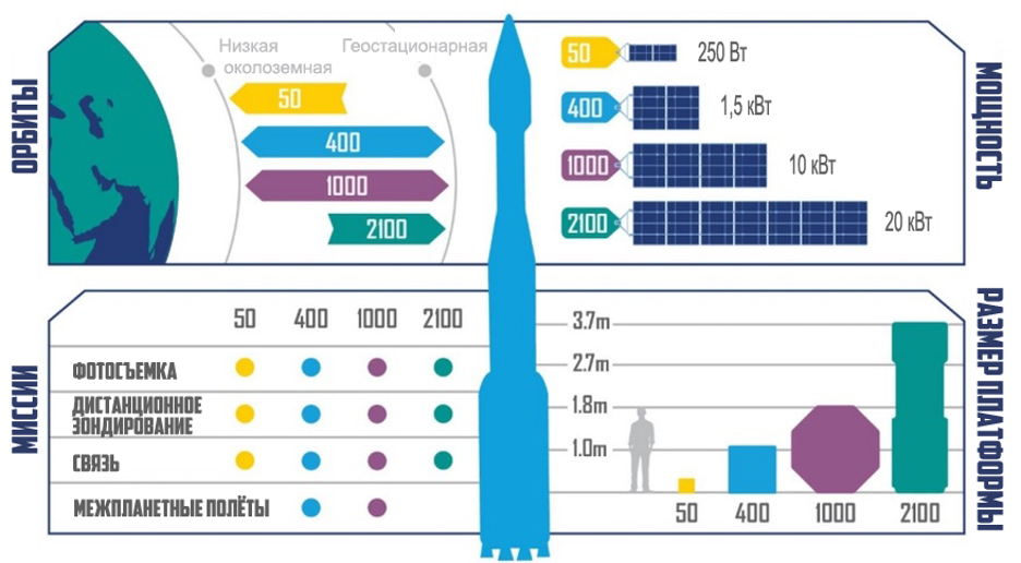
To achieve this goal, a constellation of satellites must be in orbit, providing the foundation for the entire U.S. DoD system. Lockheed's latest contribution to achieving this goal is a new lineup of ISR satellites. These refrigerator-sized spacecraft, powered by solar panels, are based on the medium-sized LM 400 satellite bus and have an open architecture that allows them to be produced in large quantities for increased availability. The goal is to create a constellation of satellites that can leverage various means for faster search-correct-finish. This satellite can be reprogrammed directly in orbit to perform new tasks.
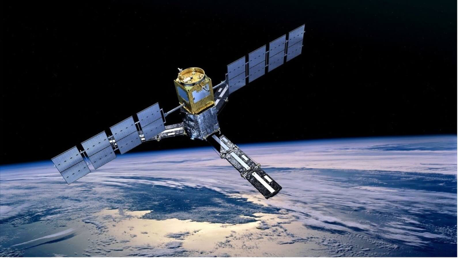
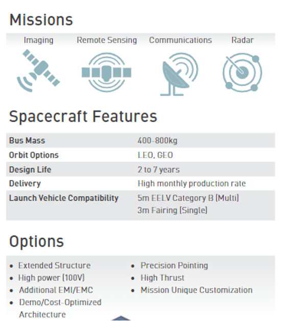
Tactical ISR satellites use an Open Mission System (OMS) and a Universal Command and Control Interface (UCI), allowing them to work with various combat platforms and systems. This is a software-defined platform. Additionally, it is equipped with a secure data processing system, supporting the tasking of low-latency air sensors, onboard data processing, secure communication, direct transmission of situational awareness data, and target information transmission.
Digital design and manufacturing accelerate the ability to deploy future-oriented, reliable constellations with advanced technologies to perform tactical tasks on the battlefield.
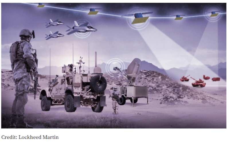
Tactical ISR satellites based on LM 400 have the following advantages:
· Compatibility: following open standards such as Open Mission System (OMS) and Universal Command and Control Interface (UCI), these tactical ISR satellites easily connect to other combat platforms and command and control systems of all services.
· Adaptability: Lockheed Martin's platform for programmable satellite capabilities, SmartSat™, offers the ability to rapidly develop and deploy new mission capabilities in orbit, outpacing the pace of threat development.
· Power: The high-powered LM 400 can also support a payload of up to 14 kilowatts and up to 1,500 kg mass, providing extended operation for a wide range of sensor technologies.
· Autonomy, resilience, combat readiness: This tactical ISR satellite line, operating on board data processing and fault-tolerant communication, provides the ability for real-time sensor management, mission data processing in orbit, secure and direct downlink communication with situational awareness.
ISR technology will enable the creation of larger satellite constellations, as well as their rapid production and deployment. Lockheed Martin's new satellite production facility, Gateway Center, supports accelerated production, assembly, and testing of spacecraft in a unified, flexibly configurable space, providing multiple levels of security classification. Tactical ISR satellites based on LM 400 will play a key role in Joint All-Domain Command and Control (JADC2), allowing, for example, U.S. Air Force tactical fighters to better utilize space-based capabilities. Lockheed Martin is also developing and building 10 spacecraft based on Tyvak Mavericks.
Pony Express 2
As part of its SAJE project in early 2023, Lockheed Martin plans to launch three small satellites, funded with its own funds - two Pony Express 2 satellites and one tactical Intelligence, Surveillance, and Reconnaissance (ISR) and communication satellite - to create the first-ever space testbed for JADO. This testbed will provide a variety of sensors, processors, and communication channels in space for live demonstrations and experiments in orbit.
The timing for the deployment of this new space test range in 2023 could not be better, as SAJE will be available to participate in U.S. Indo-Pacific Command exercises "Northern Edge." SAJE will also be available for JADO demonstrations to advance the U.S. Air Force's Advanced Battle Management System (ABMS), the U.S. Navy's Overmatch project, and the U.S. Army's Convergence project.
Space has played an increasingly important role in JADO demonstrations and exercises over the last five years, but repurposing already-launched satellites for demonstrations within a few weeks has proven challenging. SAJE will provide the government with a cost-free alternative to advance JADO.
This SAJE testbed will support experiments in:
· Real-time Battle Management and Command (BMC2)
· ISR tasking
· Mission data processing at the edge (SmartSat)
· Direct downlink channel.
The SAJE testbed in orbit is just one example of how Lockheed Martin quickly provides new capabilities to its client. The digital twin test network with mobile ground service capabilities allows rapid prototyping before hardware or software is put into operation. Thanks to SmartSat, satellites can adapt to changing mission needs through a simple application.
Two small Pony Express 2 satellites demonstrated a mesh network and tactical communication, as well as flexible Lockheed Martin SmartSatTM and HiveStarTM distributed application technologies. This mission combines four Lockheed Martin payloads on two small 12U Terran Orbital satellites, each the size of a shoebox. Pony Express 2 is part of Lockheed Martin's fast prototyping and technology certification mission in orbit. This is a continuation of the successful Pony Express 1 mission launched in 2019.
TacSat
Tactical ISR Sat ("TacSat") for hosting the first payload 5G.MIL
+ The third launched satellite - Tactical Satellite ("TacSat") - will demonstrate on-orbit processing, ISR detection, and communication capabilities.
+ TacSat will host Lockheed Martin's proven ISR sensor payload, allowing previously developed technologies to be used in space applications.
+ The mission will also host the first-ever 5G.MIL payload in orbit.
+ TacSat is based on the Space Development Agency's (SDA) Tranche 0 transport-level design, reducing risk for SDA in future tranches while providing flexibility to prototype new types of payloads.
+ The satellite is built on the Terran Orbital Zuma platform, the size of a mini-fridge.
Lockheed Martin's investments in the SAJE constellation are part of the company's commitment to advance the U.S. Department of Defense's vision for JADO. Without any cost to the government or diverting any existing space assets, SAJE is an innovative way to maximize ISR image transfer demonstration capabilities to U.S. Air Force fighters for target attack.
Acquisition of NRO ISR Satellites from Commercial Companies or Ready-made Images for NGA
In 2022, NRO/NGA took urgent steps to implement plans to acquire satellites (without waiting for the mass production of new satellites from the US MIC) and ISR images from commercial companies. This decision was largely influenced by the Russian Armed Forces' actions in Ukraine and the conclusions of US military officials presented to the US President in November 2022. Earlier (2019-2021), such plans had already been approved by the US Congress.
NRO Plans to Acquire Commercial Satellites for In-House Management
PredaSAR
PredaSAR, a subsidiary of Terran Orbital, plans to create a modern constellation of SAR satellites, initially 48 and later increased to 96, to provide high-resolution SAR images for military use. The satellites will feature C-band SAR and X-band SAR radars.
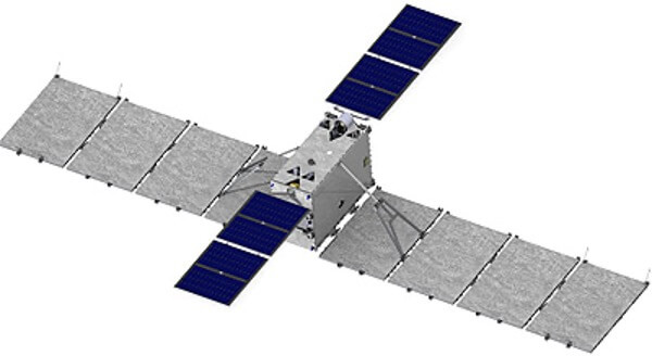
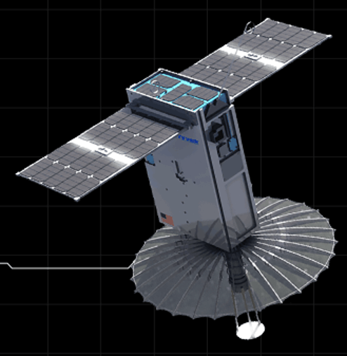
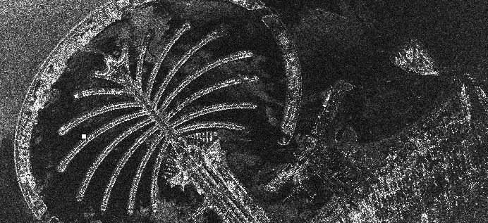
PredaSAR satellites use advanced patented radar payloads to create 2D radar images with synthetic aperture, 3D reconstructions of objects and Earth's surface, as well as specialized information products. SAR satellites provide high-resolution images day and night and in any weather conditions, overcoming the natural limitations of traditional optical satellites.
Tyvak Nano-Satellite Systems Inc., another subsidiary of Terran Orbital, provides launch integration services in addition to being a satellite manufacturer.
These satellites are tactical, flexible micro-radar satellites with synthetic aperture radar (SAR). Their payload consists of a large C-band or powerful spot and an X-band strip system.
In April 2022, Terran Orbital doubled the size of the constellation to 96 satellites and planned to use some of them for commercial purposes. Later in the fall of 2022, they announced that the PredaSAR program was paused, and only two satellites would be launched as prototypes, with the overall PredaSAR constellation plan changing without specifying a new number of satellites or schedule. The US military is deciding whether to buy the entire future constellation or terminate or modify the contract. However, the first launch is already planned for 2023.
In the fall of 2022, Terran Orbital announced the abandonment of plans to create a constellation of 96 synthetic aperture radar satellites called PredaSAR, in order to focus on manufacturing satellites for US defense and national security customers. The company also formed a new division that will produce electro-optical satellites for image formation.
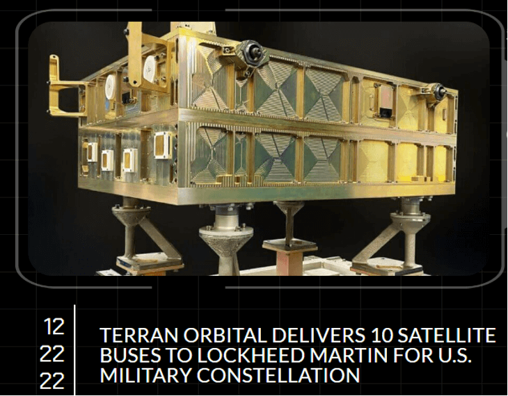
On December 22, 2022, Terran Orbital announced the completion of the delivery of 10 satellites ordered by Lockheed Martin for the Space Development Agency's mesh network in low Earth orbit. The company decided to manufacture radar, electro-optical, and communication (ISR geospatial information transfer) satellites exclusively for the US Department of Defense.
Umbra
The NRO chose Umbra as the first direction - commercial radar - within the framework of a new agency initiative for strategic commercial developments. Focused on commercial images and data, this initiative is specifically designed for the NRO to assess, utilize, and integrate new and emerging commercial phenomenologies, such as radar and radio frequency remote sensing.

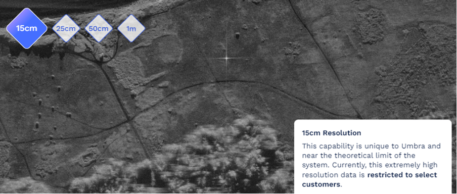
"The support of US national security has always been the core mission of Umbra, and we are very pleased to be included in NRO's ongoing shift toward a hybrid payload architecture. We are deeply convinced that American companies in the commercial ISR sector will make a significant contribution to the prosperity of the United States," said Jason Mallare, Vice President of Government Programs. Umbra fulfills this mission by creating advanced hardware and software products for NGA analysts, addressing complex security issues for the United States and its allies. Umbra's satellites are equipped with a powerful synthetic aperture radar (SAR) capable of seeing at night and through dense clouds to create the highest-resolution radar images (15 cm) ever sold on the commercial market.
Terran Orbital
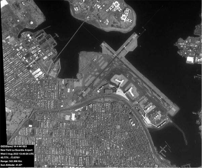
Corporation Terran Orbital completed a contract on January 09, 2023, with Lockheed Martin to provide commercial image transmission services. After processing, the company will present its considerations for the purchase of GEOStare SV2 NRO satellites or by the Space Force Command for tactical use. The main payload of GEOStare SV2 consists of two MonoTele telescopes developed by Lawrence Livermore National Laboratory and represents a dual-purpose system suitable for both Earth observation and space domain awareness (SDA). The goal of space domain awareness is to track satellites and debris in space to avoid collisions. Lawrence Livermore National Laboratory collaborates with Terran Orbital to partially meet the growing demand for commercial satellite images from the US Department of Defense. New methods for creating fast and accurate satellite images based on GEOStare satellites.
MonoTele is made from a single monolithic plate of fused quartz, optically shaped, and with reflective coatings on both ends. One MonoTele has a narrow field of view with high resolution for Earth observation, and the other has a medium field of view with high sensitivity for space domain awareness and astronomical applications. The compact payload is named GEOStare2 for optical imaging.
In addition to developing the payload for imaging and close collaboration with Terran Orbital on payload integration and nanosatellite, the Livermore team is responsible for analyzing images acquired in orbit.
ICEYE X4 Satellite
ICEYE X4 and its successors are satellites from the microsatellite constellation equipped with X-band Synthetic Aperture Radar (SAR), developed by the Finnish startup ICEYE.

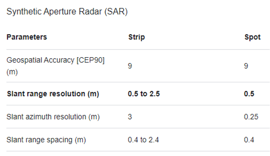
The Finnish startup ICEYE announced that it will provide images from one of its SAR (Synthetic Aperture Radar) satellites to the government of Ukraine, which is in a state of war, under a contract with the Ukrainian fund supporting the country's armed forces in the war with Russia.
"As part of the agreement, ICEYE will transfer all capabilities of one of its SAR satellites, already in orbit, for use by the government of Ukraine over the region," the company's statement from August 18, 2022 reads. "The SAR satellite will be operated by ICEYE. In addition, ICEYE will provide access to its SAR satellite constellation, allowing the Armed Forces of Ukraine to receive radar satellite images of critically important areas with high revisit frequency."
In addition, the company's US division is one of the five SAR satellite companies with contracts for research with NRO, valid until 2024, and plans to launch two ICEYE satellites in early 2023 and transfer them to NRO management. Satellites held by the US subsidiary have already been transferred to NRO.
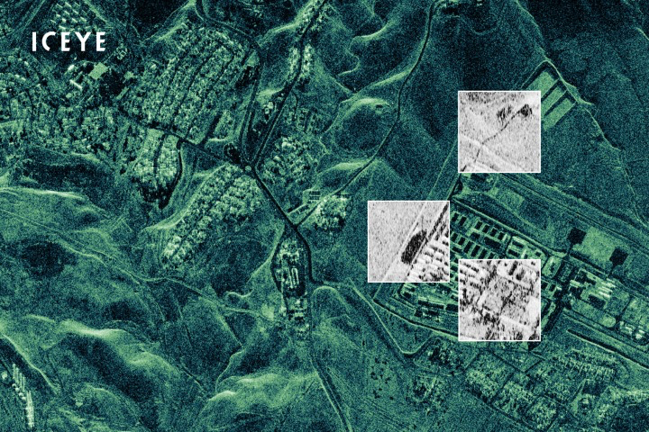
ICEYE is designed to provide SAR images in near real-time. Iceye is working on launching and operating a constellation of microsatellites with its own compact and efficient SAR sensor technology. The ICEYE radar instrument can display images through clouds, overcoming weather and darkness.
ICEYE X10, X17, and X24 are built and owned by ICEYE US.
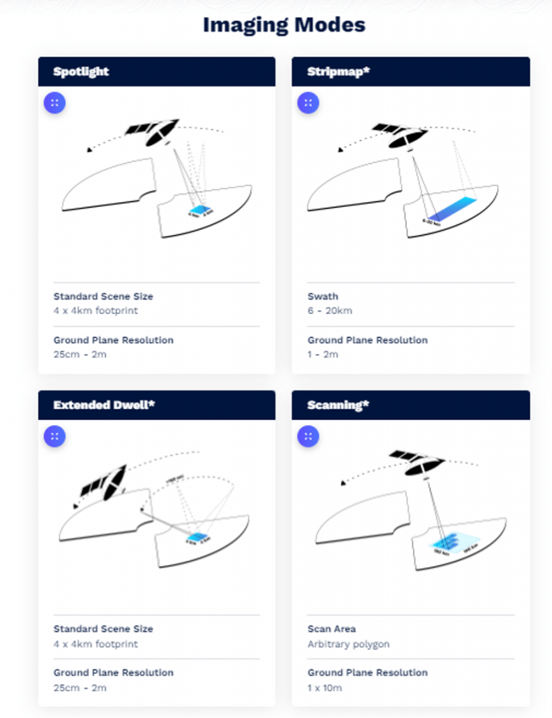
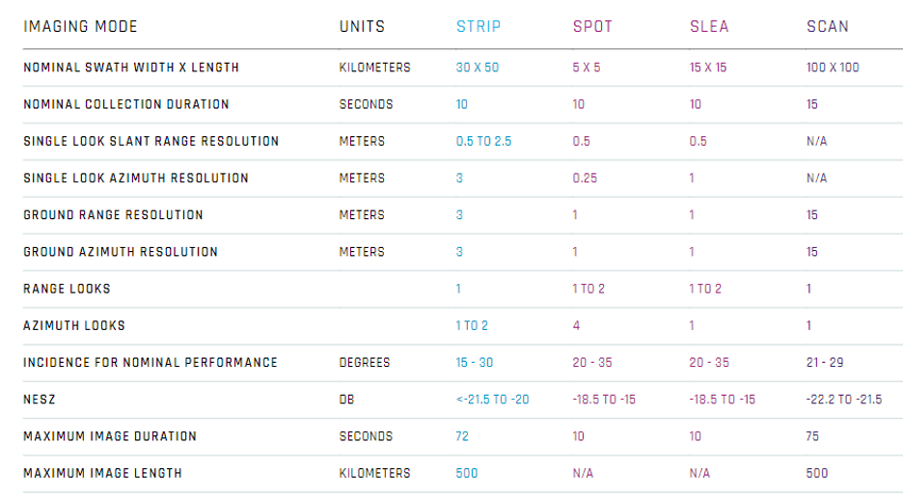
Several visualization modes provide unprecedented visibility and flexibility, allowing control over areas up to 50,000 km² in a single image and the ability to zoom into areas of interest with very high resolution to less than a meter—day or night, at any time, and under any weather conditions.
ICEYE satellite images provide reliable near-real-time data access anywhere on Earth. These data can be used to identify patterns of activity along borderlines and regions, expanding observation capabilities to ensure the security of any country. Images can be delivered on demand several times a day.
Spot Extended Dwell images illuminate the Earth for 25 seconds in one satellite pass. This allows capturing motion in the scene, which can be visualized through video.

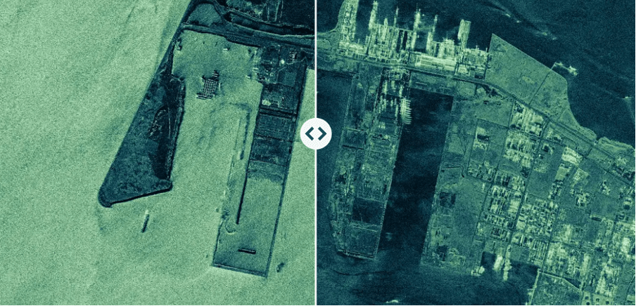
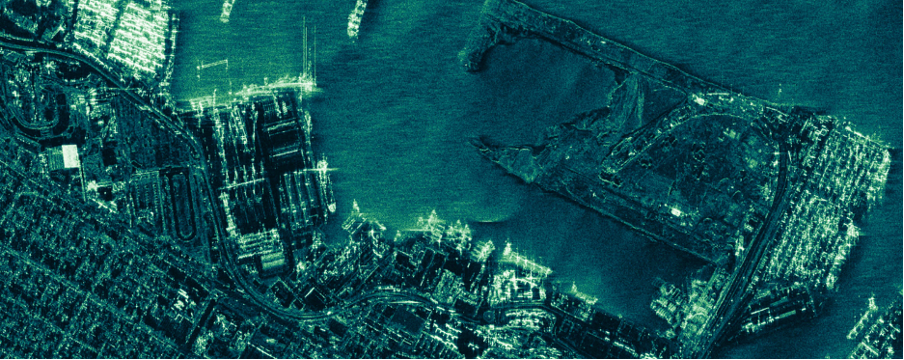
New constellations will be launched as a set of four satellites, each capable of capturing images with a resolution of less than 0.7–1.0 meter.
ICEYE US, a subsidiary of ICEYE, announced receiving a contract from the National Reconnaissance Office (NRO). This contract allows ICEYE US to participate in the NRO's assessment of commercial remote sensing companies operating synthetic aperture radar (SAR) satellites and take over their management.
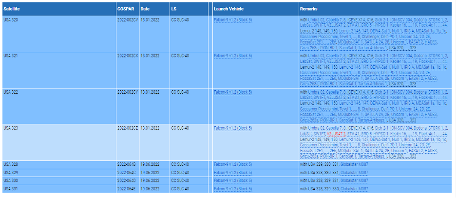



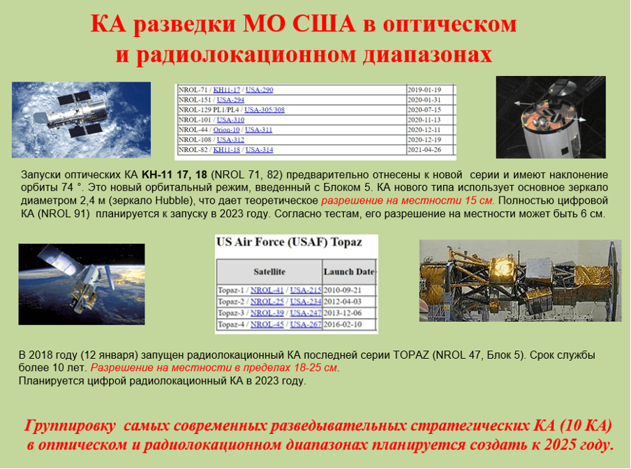
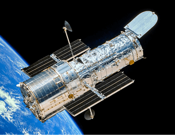
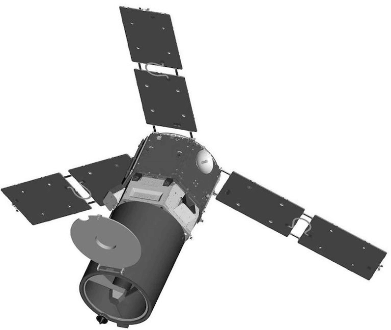
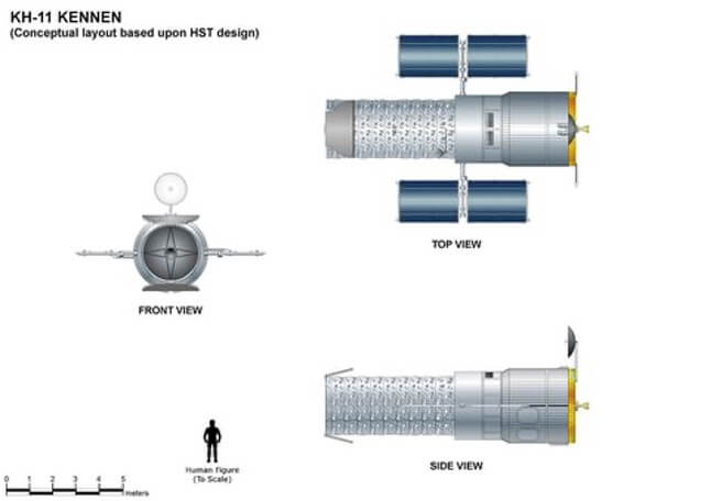
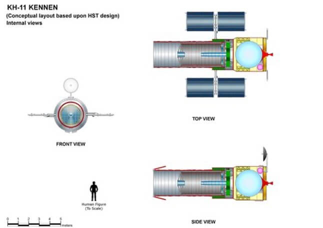

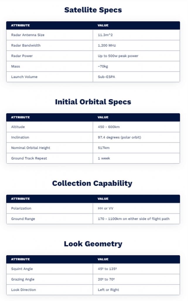
 Details are unknown. According to contract requirements for this launch, the orbit should be 512 km with an inclination of 97.4°. It is assumed that this could be a next-generation electro-optical reconnaissance satellite ISR.
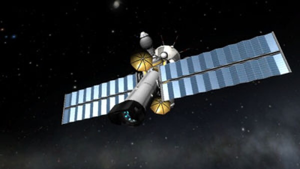 Thus, following the classic approach to satellite reconnaissance of the territories of Russia, Iran, and China, verified for about 40 years, there are currently 4 strategic optical satellites in orbit.
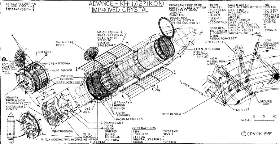
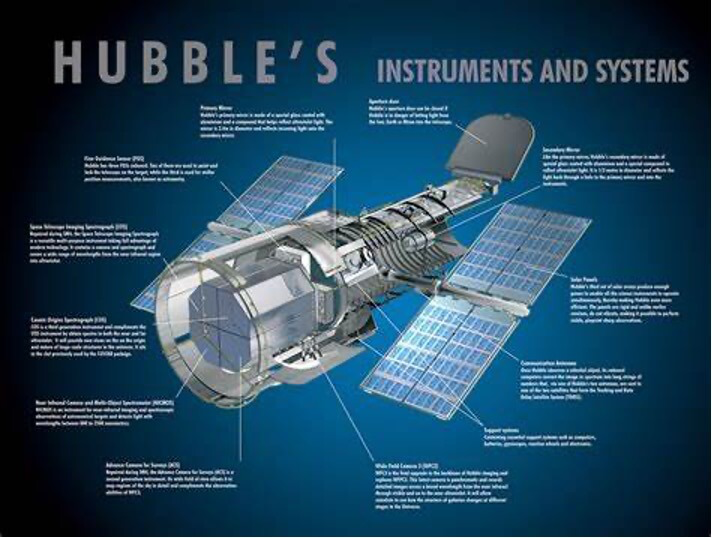 For a 2.4 m diameter mirror observing at a wavelength of 500 nm, the Rayleigh criterion imposes a diffraction-limited resolution of 0.05 arcseconds. At an altitude of 250 km, this translates to a resolution of 6 cm on the surface. It is worth noting that this maximum is theoretical, and in practice, the resolution will be less due to atmospheric distortions and because the satellite is unlikely to be precisely above the observed location. To achieve high-quality images, an optical system with high contrast and optimized signal-to-noise ratio is applied, as well as time-delay and integration (TDI) technology on multi-line CCD structures (6 accumulation modes from 8 to 64 times).
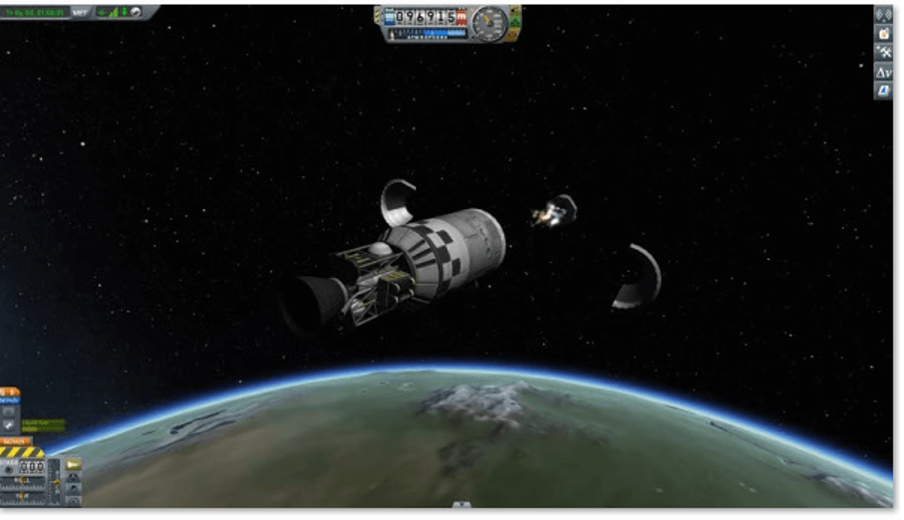
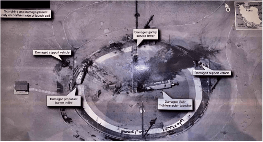
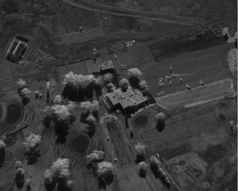
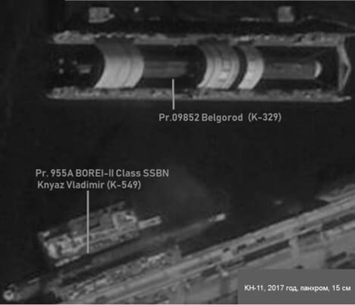 Fig. Severodvinsk city, Russia, 2017