of geospatial solutions
Sat-Sun: Non-working days
Customer
The basis for these works is a comprehensive program for the reconstruction and technical re-equipment of gas transportation facilities and UGS compressor stations for the period 2007-2010, approved by Resolution of the Gazprom Management Committee No. 40 of SeptemberProject's objective
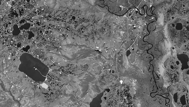
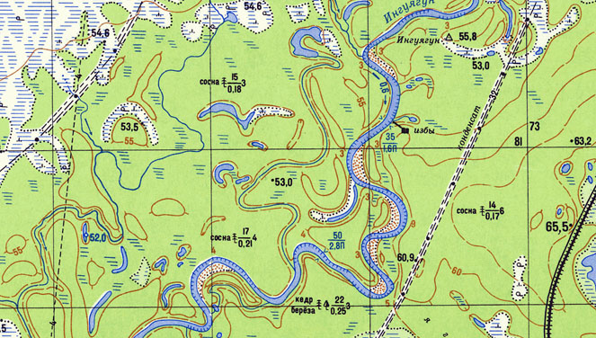
The purpose of these works is to create and update digital terrain models (DTM) of 1: 25000 scale in the corridor of the condensate line (km 0 – km 703), for the subsequent creation of thematic maps for the area to be mapped.
Completed work
Work description
-
Analysis of the availability and quality of the original cartographic and space photographic materials (year of creation / survey, cloudiness, haze, mutual overlap, etc.).
-
Creating a mosaic of images from materials of space imagery.
-
Build relief.
-
Topographic interpretation.
-
Formation of coordinated thematic layers.
-
Filling attribute tables to thematic layers.
-
Formation of CMM and cameral control of the model obtained.
-
Registration of reporting documentation.
Need for consultation?
Fill the form and we will contact you
Sat-Sun: Non-working days