Sat-Sun: Non-working days
Project's objective
Acquisition of remote sensing data on the territory of the Losiny Ostrov National Park.
Work description
For the area of interest determined by the coordinates of the vertices of its borders provided by the customer, images of the Pleiades satellite were selected and ordered, satisfying the conditions of the order:
-
spatial resolution: 0.5 m at nadir (for panchromatic image), 2.0 m in nadir (for multispectral);
-
processing level: Primary.
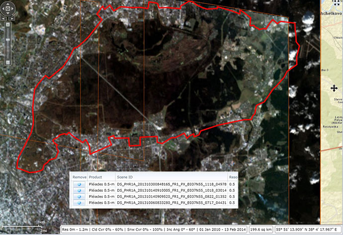
A total of 4 photographs were selected for the period from 10/06/2013 to 10/30. 2013, so that they fully cover the area of interest in the 200 sq. km.

The coverage scheme for the ordered pictures of the AOI (the territory of the Losiny Ostrov National Park), 200 sq. km.
Need for consultation?
Fill the form and we will contact you
