Sat-Sun: Non-working days
Project's objective
Delivery of the new Pleiades stereo satellite survey, creation of a digital elevation model and preparation of orthophotomaps cut into sheets of 1: 5000 scale in the SC-1942 coordinate system.
Work description
On the part of the territory located in the territory of the Zabaikalsky Krai, a new 2015 stereo survey from the Pleiades satellite was ordered. According to the terms of reference, the Pleiades stereo survey was set up in a panchromatic version, with cloudiness parameters of no more than 15% and a spatial resolution of 0.5 - 0.7 meters per pixel.
Basing on the obtained remote sensing data in the Photomod software, using the shutter glasses and special monitors, the Digital Terrain Model (DEM) was created. The reference points of points GHS in SC 1942 were provided by the customer. Orthorectification was also carried out on a total area of 100 sq. Km in SK-1942 with an average error in the planned position in the images of objects and clear contours of the area not exceeding 2.5 m. The finished orthophotomaps were cut into sheets of 1: 5000 scale in the system coordinates SC-1942 (zone 20).

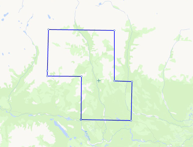
Scheme of the area near the river Chara (100 sq. km.)
Results
Within the framework of the project, Innoter delivered to the customer a package of geo-information products, including DTM and orthophotomaps of the areas of interest, as well as the initial remote sensing data obtained from the Pleiades satellite.
Need for consultation?
Fill the form and we will contact you
