Sat-Sun: Non-working days
Project's objective
Creation of orthophoto plans based on the obtained shooting from the WorldView-2 spacecraft in accordance with the customer’s specifications.Work description
According to the requirements of the technical specification, images from the WorldView-2 spacecraft with a spatial resolution of 0.5 m in nadir, the color version, ready for orthorectification (OrthoReady Standard) were selected for the customer's interest.
Basing on the data obtained, work on the creation of orthophotomaps with a root-mean-square error <15 meters was performed. The customer provided a planning and height basis and a matrix of heights.
The creation of orthophotomaps was carried out in the projection of UTM on the ellipsoid WGS84. Finished orthophotomaps with a bit depth - 8 Bit in natural colors, cutting of orthophotomaps was carried out into fragments of not more than 500 MB.

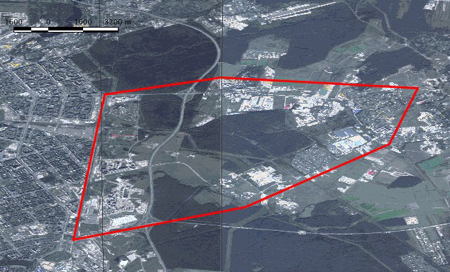
General scheme of the supplied data for the Yanino area
Results
As a result of the contract execution, the customer received a high-quality image for the territory indicated by him, as well as promptly (within four days) an orthophoto-plan made on its basis, which satisfies the accuracy of further work.
Need for consultation?
Fill the form and we will contact you
