Sat-Sun: Non-working days
Customer
Russian Institute of Urban Development and Investment Development
Project's objective
Implementation of topographic and geodetic works to update the cartographic material used in the preparation of the graphic part of the master plan for the city of Sochi.
Work description
The baseline data for fulfilling the project obligations were: a digital topographic map of the Krasnodar Territory on a scale of 1: 100000; public digital topographic maps for spatial planning and urban zoning on a scale of 1:25 000 – 1: 5 000, in the local coordinate system; orthophotomaps on the territory of the Sochi city district on a scale of 1:10 000 – 1: 2 000. In addition, a report on the availability of land, its distribution by categories and forms of ownership (as of January 1, 2017) applied objects of cadastral registration in relation to the territory of the city district of the city of Sochi.
Innoter LLC, under the terms of the contract, provided the relevant cartographic materials of 1:10 000 and 1: 2 000 scale used to prepare the graphic part of the master plan; as well as accurate, current, reliable materials and data (in graphic, digital and other forms) about the situation, existing structures and buildings and other planning elements.
The topographic and geodetic works on updating and creating cartographic material were carried out in the following order:
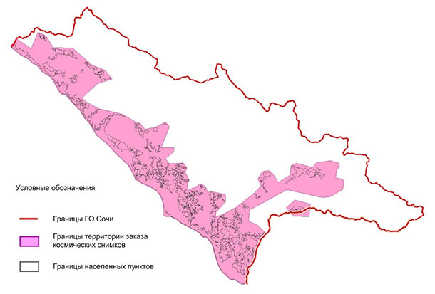
1. Selection and acquisition of space imagery over an area of 1312 sq. km. (fig. 1)
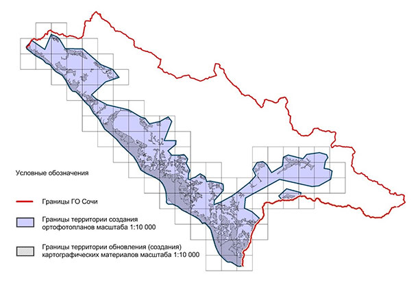
2. Creation of orthophotomaps at a scale of 1:10000 over an area of 1300 sq. km. (fig. 2)
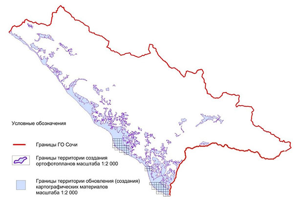
3. Creation of orthophotomaps on a scale of 1: 2000 over an area of 490 sq. km. (fig. 3)
4. Carrying out an update (creation) of cartographic materials on a scale of 1:10000 on an area of 490 sq. km. (fig. 2)
5. Conducting an update (creation) of cartographic materials on a scale of 1: 2000 over an area of 50 sq. km. (fig. 3)

Fig.1 – The boundaries for the space shooting order, the city of Sochi; 1312 sq. km

Fig.2 – The scheme of cartographic materials’ update (creation), 1:10000 scale

Fig.3 – The scheme of cartographic materials’ update (creation), 1:2000 scale
According to the results of the work carried out, a report was prepared with a description of the topographic and geodetic works carried out on updating and creating cartographic material.
Results
As a result of the implementation of the contract, Innoter LLC, within the timeframe specified by the customer, ensured the performance of topographic and geodetic works on updating the cartographic material used in the preparation of the graphic part of the city district master plan for the city of Sochi.
Need for consultation?
Fill the form and we will contact you
