of geospatial solutions
Sat-Sun: Non-working days
Project's objective
- Identification of possible causes of dam breach through geodynamic monitoring using radar interferometry data.
- Assessment of the potential for early warnings of emergencies in hydraulic structures through interferometric processing of satellite images.
- Prediction of emergency situations in other operational hydroenergy facilities.
- Experience in interferometric processing of radar satellite images for the study of energy-related objects.
- Availability of qualified personnel.
Due to budget limitations, a decision has been made to utilize free radar satellite images obtained from the Sentinel-1 satellite.
Deliverables to be Provided to the Customer:- Models of vertical displacements of the Earth's surface that occurred during the period of radar satellite imaging in raster format (GeoTIFF) and in vector format (SQLite) in the WGS-84 coordinate system.
- Base image transformed into the WGS-84 coordinate system.
- Technical report titled "Interferometric Processing of Radar Satellite Data," including information about identified geodynamic risk zones, as well as corresponding conclusions and recommendations.
Work description
Within the scope of the work, the following stages were implemented:
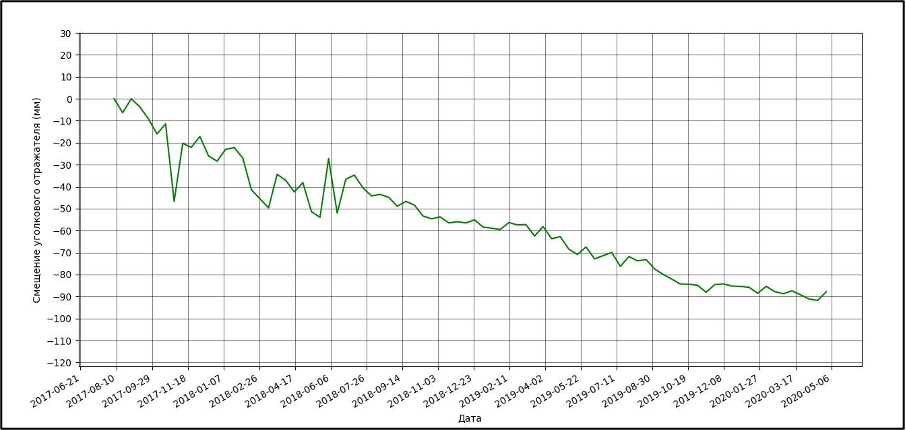
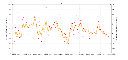
1. Investigation of the Sardobin Reservoir area (Uzbekistan) prior to the dam breach (August 2017 - May 2020). When processing satellite images from the Sentinel-1A/B satellite, acquired from the same orbit, the natural reflectance method was applied. A graph of ground surface displacement was obtained prior to the dam breach. As seen from the graph, the displacement amounted to 90 mm over three years.

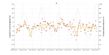
2. We also conducted research on displacements after the dam repair (May 2020 - June 2022). We obtained a graph of displacements, which indicates displacements of up to 30 mm over two years.
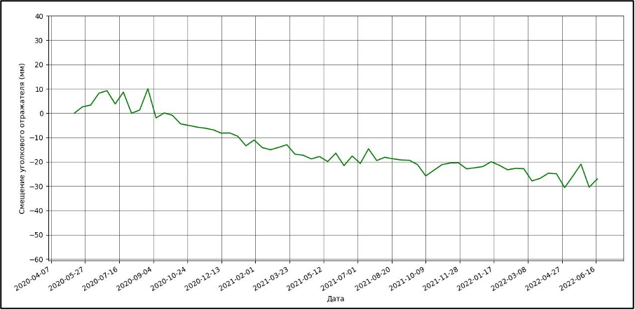
CONCLUSION: Critical ground surface displacement preceded the breach, and after the dam repair, the displacement persists but at lower values.
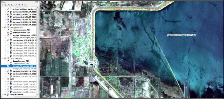
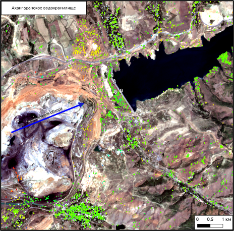
3. We conducted research on ground surface displacements in the area of the Akhangaran Reservoir (Uzbekistan) (November 2017 - June 2022) using the permanent reflectors method.
4. We obtained corresponding displacement graphs. Example graphs for selected points:
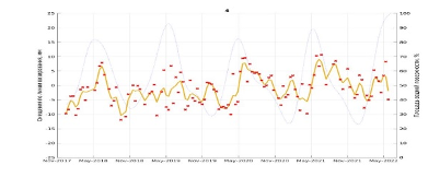
CONCLUSION: Displacements exhibit cyclic patterns depending on the water surface area (seasonal variations). Maximum amplitudes are observed in the upper part of the dam.
Results
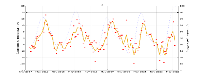
5. We conducted research on ground surface displacements in the area of the Charvak Reservoir (Uzbekistan) (November 2017 - June 2022) also using the permanent reflectors method.
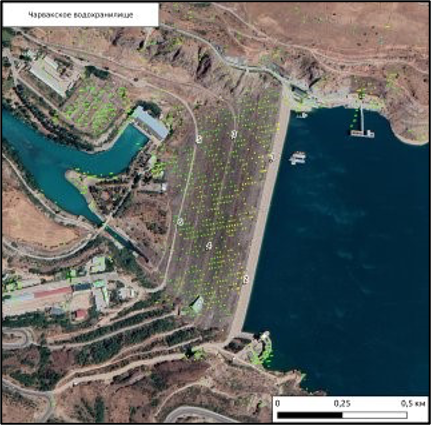
2. Example displacement graphs for selected points:
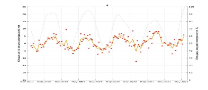
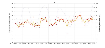
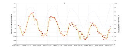
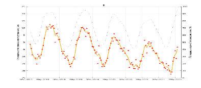
CONCLUSION: Displacements exhibit cyclic patterns, depending on the water surface area (seasonal variations). Maximum amplitudes occur in the upper part of the dam.
Expert Opinion:
"The presence and operation of a satellite-based monitoring system for deformations and ground surface displacements, including the condition of dams, will prevent the recurrence of a tragedy similar to the breach of the Sardobin Dam (Uzbekistan) on May 1, 2020.
Retrospective analysis using radar interferometry method showed dangerous displacements long before the breach of the Sardobin Dam, which could have been identified in advance."
Need for consultation?
Fill the form and we will contact you
Sat-Sun: Non-working days