of geospatial solutions
Sat-Sun: Non-working days
Project's objective
An assessment of the state of agricultural land was required, their classification by the type of agricultural land or a complex of landscapes and the compilation of a thematic map.
Completed work
Work description
Using satellite images of medium spatial resolution of the Landsat-8 spacecraft. Feature of the Landsat 8 imagery selection is its optoelectronic camera TM and an upgraded MSS (multispectral scanning device) scanner. The TM camera allows to form an image in 7 regions of the electromagnetic spectrum with a spatial resolution of 30 m in the visible and infrared range.
Completed work:
- Acquisition of Landsat-8 satellite images with cloudiness less than 10%.
- Processing of satellite images, including: - Orthorectification of satellite images to obtain the exact boundaries of agricultural land;
- Classification of cloudless mosaics into a fixed number of classes that are close in spectral signature.
- Vectorization of classification results for area assessment.
- Grouping of vector objects of the space image in accordance with the values in the attribute table, which appeared as a result of classification.
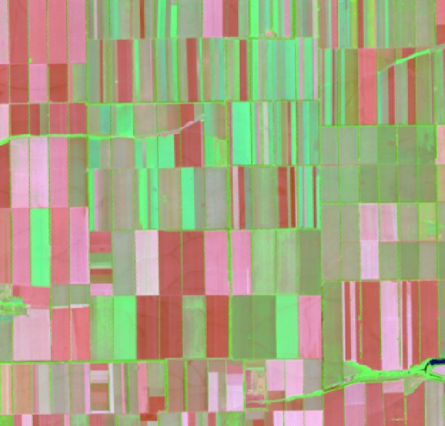
- objects were compared using the interpretation of the Landsat 8 channel combinations, which gives an image close to natural colors:
- dead vegetation - orange;
- open soil is bright pink;
- healthy vegetation - bright green;
- herbaceous communities are green;
- sparse vegetation - brown and orange tones.
- Classification according to the colors obtained by the combination of channels.
- Vectorization of the results of classification based on the combination of channels.
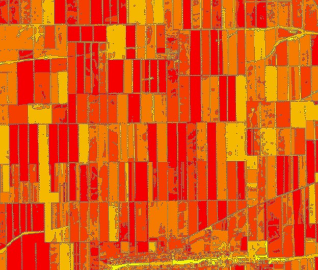
- Formation of NDVI, NDMI, ARI1 indices for assessing the state of vegetation using cloudless mosaic.
- Comparison of the value of the indices with the result of the vectorization performed in step 7
- Drawing up thematic maps.
- Formation of a cloudless mosaic.
NDVI (Normalized Difference Vegetation Index) is a simple quantitative measure of the amount of photosynthetically active biomass (commonly referred to as the vegetation index). One of the most common and used indices for solving problems using quantitative estimates of vegetation cover.
NDMI (Normalized Difference Moisture (Water) Index) - normalized relative humidity index. It is used to calculate the moisture content of vegetation cover, soil.
ARI1 (Anthocyanin Reflectance Index) - Anthocyanin index. An index used to assess the content of the anthocyanin pigment in plant canopy leaves in order to determine the level of vegetation stress.
Results
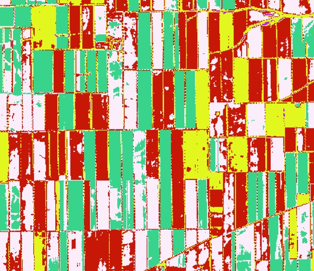
The result was:
- Thematic map with 6 classes:
- 1 - wet vegetation;
- 2 - areas with forb vegetation;
- 3 - open takyr-like areas;
- 4 - arable land;
- 5 - unused land;
- 6 - anthropogenic areas (bare areas).
- Vector layer with areas of each class.
- Thematic maps of vegetation status according to the NDVI, NDMI, ARI1 indices
Need for consultation?
Fill the form and we will contact you
Sat-Sun: Non-working days