of geospatial solutions
Sat-Sun: Non-working days
Project's objective
At the request of the customer, a complex cartographic-geodynamic examination was carried out, the purpose of which was to determine changes in the terrain objects, the appearance or disappearance of buildings, industrial facilities, roads, trees, power transmission towers.
Completed work
Work description
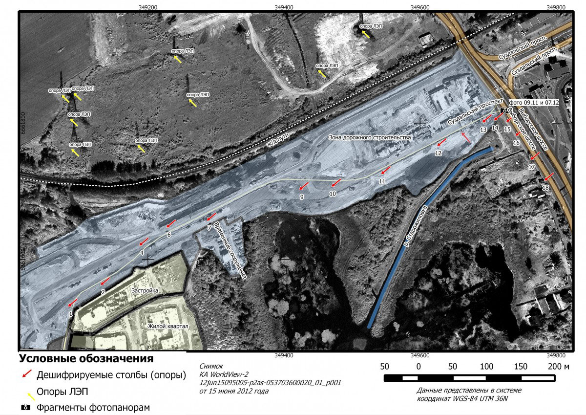
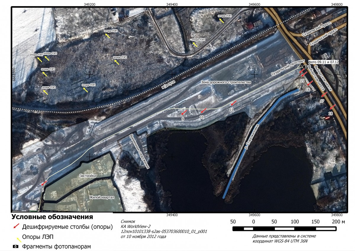
During the construction of a residential complex along Suzdalsky Avenue (the Vyborgsky district of the city of St. Petersburg), some of the power line pylons (LEPs) were moved and disappeared, which was confirmed by the examination.
For the cartographic-geodynamic examination, WorldView-1 and WorldView-2 satellite images with a resolution of 0.5 m were taken in March 2010, September 2011, June and November 2012 (four images). All images are of good quality and they clearly show the presence of buildings and power lines. As additional images, we used panoramic photos from the “Google Street View”, taken in September 2011 and July 2012.
The work was carried out in accordance with the requirements of regulatory and technical documents (manuals, instructions, guidelines) for interpretation.
Cartoscheme for the research area, based on the WorldView-1 image, 15 June 2012.
Cartoscheme for the research area, based on the WorldView-2 image, 10 November 2012.
Results
In the photo of November 10, 2012, there is no part of the power line poles along the extension of Suzdalsky Prospekt from the intersection of the Vyborgsky highway to the direction of Kamenka, which were previously confidently interpreted in the pictures of September 6, 2011 and June 15, 2012, allegedly could have been damaged because of road works during the construction of the Suzdalsky highway. This is indicated by the presence of construction equipment in the transmission line corridor in the picture dated June 15, 2012, as well as the presence of construction equipment on a fragment of the Google Street View panoramic photos at the survey site taken in July 2012.
Need for consultation?
Fill the form and we will contact you
Sat-Sun: Non-working days