of geospatial solutions
Sat-Sun: Non-working days
Project's objective
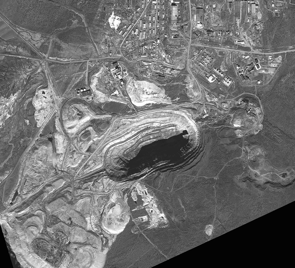
Creating an orthophotomap to the territory of Aikhal. Orthophoto pixel size was set to 0.5 m
Completed work
Work description
In this work we used materials from space imagery to the territory of the city of Aikhal, made by satellite - WorldView-1. Ground elevation points with coordinates up to 2 m in the WGS84, UTM 49 coordinate system were used for the planned vertical alignment. ASTER GDEMV2 was used as a DEM for the entire territory. The whole range of photogrammetric works on the creation of an orthophotomap was carried out by using the “PHOTOMOD version 5.2” software system and included:
-
Creating a project;
-
Creating a digital matrix of relief for a given territory;
-
Removal of reference and control points;
-
Determining the position of reference and control points in the image;
-
Adjusting the position of the picture;
-
Control of the accuracy of products;
-
Creating an orthorectified image (orthophotomap);
-
Control of the accuracy of the output.
Results
According to the results of the work, an orthophotomap was obtained for the territory of the Aikhal, Republic of Sakha (Yakutia). The orthophoto pixel size was set at 0.5 m.
In accordance with the photogrammetric work instruction, the adjustment accuracy corresponds to the adjustment accuracy of the planned coordinates of the reference points for creating maps of 1: 5000 scale.
Need for consultation?
Fill the form and we will contact you
Sat-Sun: Non-working days