Sat-Sun: Non-working days
Customer
Express Geo LLC
Project's objective
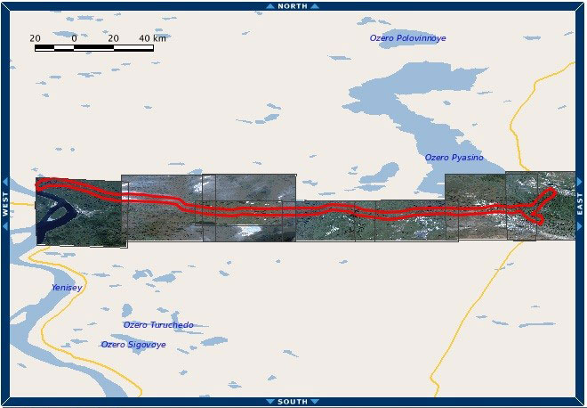
Creation of orthophotomaps using remote sensing data on the territory of the pipeline route with a total area of 320 sq. km., located in the Krasnoyarsk Territory.Work description
Digital information was viewed, compiled and processed from the WorldView-2, WorldView-3, GeoEye-1 spacecraft with a spatial resolution of 0.5 m at the nadir. Archive images were selected in compliance with the required shooting mode - a set of images - a panchromatic channel and 4 multispectral ranges (RGB + NIR). Projection - UTM, ellipsoid and WGS84 coordinate system.
Then, based on the data obtained, orthophotomaps were created in accordance with the requirements of the technical specifications. Orthorectification of space imagery was performed in the UTM, WGS-84 projection using RPC coefficients and the SRTM-90 public digital elevation model. The finished orthophotomap was provided with a single array (without cutting) with a bit width of 8 bits in natural colors (RGB).

Area coverage scheme, Krasnoyarsk Krai, Russia, area: 320 km2
Results
As a result of fulfilling its obligations under the contract, Innoter LLC provided the customer with the necessary data of remote sensing data, as well as orthophotomaps with a given accuracy to the territory of the pipeline route.
Need for consultation?
Fill the form and we will contact you
