of geospatial solutions
Sat-Sun: Non-working days
Customer
Cellular operator
Project's objective
Creation of a digital terrain model (city 3D-model) for St. Petersburg with a high level of network penetration of the latest technologies and high level of new construction for terrain assessment, terrain orientation, performing design and survey works, providing construction and reconstruction of telecommunications network infrastructure, determination of object coordinates, calculation of tracks, calculation of radio network coverage, displaying network elements, and for other tasks in the interests of the cellular communication Operator's activities.Completed work
Work description
Required composition of the DTM
For the city of. St. Petersburg requires the establishment of a CMC in the following composition:
-
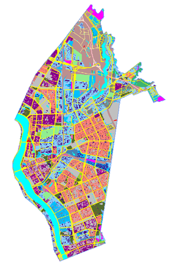
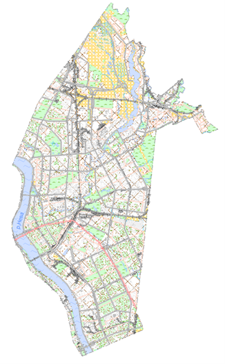
city vector 3D model;
-
urban clutter 3D model;
-
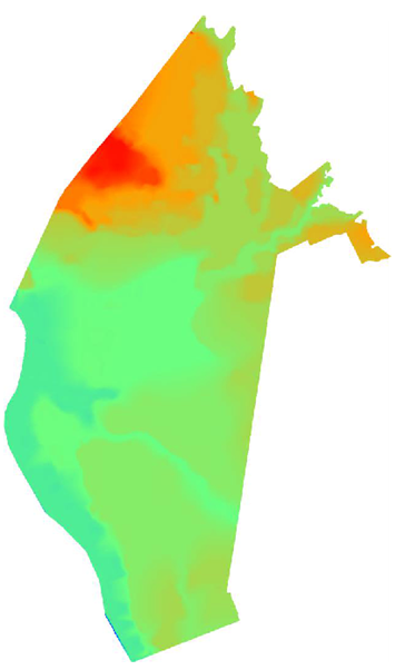
urban 3D digital terrain model;
-
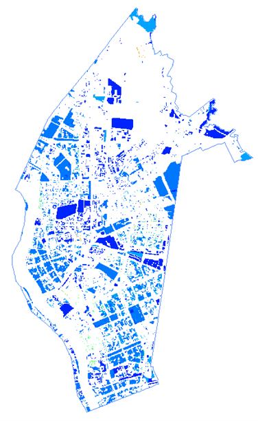
city digital 3D model of obstacle heights.
Required DEM accuracy parameters
| Name of errors | Values of average errors of DEM points position in meters |
|---|---|
|
In the plan position of structures and images of clear contours |
2 |
|
In the planned position of vegetation and soil contours (values in parentheses are given for mountain and desert areas) |
5 |
|
In the level position of points in the flat areas |
1 |
|
In the level position of points on rugged, hilly, sandy areas |
1,5 |
|
In the level position of the points in the low and mid¬mountain areas |
2 |
Creation of the DTM on the city of St. Petersburg.
1. To create DTM, as the initial cartographic material were used large scale cartographic materials available in the Center of Geodesy, Cartography and Spatial Data, materials of Rosreestr and materials of space stereo survey, received from foreign spacecrafts with a resolution of 0.5 m.
Digital elevation models (DEM) and ortho photomaps were created on the basis of the obtained satellite stereo images according to the accuracy parameters given in the table above. The created DEM, ortho photomaps, as well as the materials used to create DEM, provided the necessary accuracy, completeness and reliability of the mapping of terrain objects and their characteristics.
2. 2. The city vector 3D model was created in the WGS 84 coordinate system, modeling by the level position of DEM points was performed from the level surface of the Kronstadt Footstool zero and was delivered in the following formats:
- In the format of the radio network planning system Asset Enterprise - SC WGS 84, UTM projections;
- In the format of PAC "ONEGA RPLS" planning system - WGS 84 UTM projections;
- Vector base maps in Mapinfo GIS format - WGS 84, longitude/latitude (EPSG 4326).
The content of the city vector 3D-model corresponds to the description given in the Customer's Technical Requirements and the list of full composition of 25 types of vector objects.
3. City clutter 3D-model was created on the basis of the vector 3D-model, reduced to the required form and filled with necessary semantic information in accordance with the description given in the Customer's Technical Requirements and the list of full composition of 32 morphological types of vector objects.
4.4. The city digital 3D terrain model was created by photogrammetric processing of satellite stereo images with a spatial resolution of 0.5 m.
5. 5. The city digital 3D model of obstacle heights was determined in the process of photogrammetric processing of space stereo images and refined using images of single images and stereo images by counting the number of floors depicted on the sloping side of buildings and based on measuring the shadow length of buildings and structures on the ground.
Results
THE RESULT OF THE PROJECT
The created DEMs are successfully used in the ONEGA RPLS software package to solve the following tasks:
- radio frequency planning;
- optimization of GSM/GPRS/EDGE, UMTS/HSPA+, LTE, LTE-Advanced mobile networks;
- optimization of broadband access networks Wi-Fi, WiMAX;
- planning the placement of cellular base stations;
- redesigning existing cellular networks.
The accumulated experience of the GEO INNOTER team together with the ONEGA RPLS developers allows us to prepare an optimal technical specification for the creation of a DEM, including the possibility of delivering a software package for radio frequency planning and optimization of mobile networks with downloaded information about the area and training the customer's employees in its use.
Need for consultation?
Fill the form and we will contact you
Sat-Sun: Non-working days