Creation of an information system for the purposes of urban planning
Creation of an information system for the purposes of urban planning
01
About the project
Creation and maintenance of an information system for the provision of urban planning in the form of providing remote sensing data (high resolution satellite imagery).
Industry
Land use and territory management, Mapping
Customer
Department of Architecture and Urban Planning
End date
10/31/2017
02
Completed works
Innoter LLC carried out the selection and order of remote sensing data presented as a single color-balanced (in natural colors), ortho-corrected image, with a spatial resolution of not more than 0.6 m in pixel to the territory of the city of Rostov-on-Don, which is coordinate-linked to the local system coordinates of the city of Rostov-on-Don 1965
The following shooting requirements were followed:
the pictures were snowless and were taken during certain periods;
image – three-channel color-synthesized (in natural tones) orthorectified and with a radiometric resolution of at least 8 bits / per pixel per channel;
spatial resolution – not more than 0.6 m / pixel;
cloudiness – no more than 5%;
shooting angle (deviation from the nadir axis) – no more than 30°
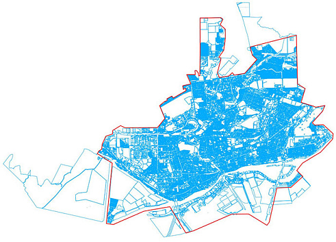
Scheme of the AOI, Rostov-on-Don, total area – 289 sq. km.
According to the results of work, the staff of Innoter LLC prepared an information report on the services provided.
Схема-территории-интереса,-г-Ростов-на-Дону.jpg
03
Result
As
part of the contract execution, Innoter LLC provided the Department of
Architecture and Urban Planning of the city of Rostov-on-Don with the necessary
Earth remote sensing data for urban planning activities.
Need satellite imagery or help choosing the right data?
Describe your task, area of interest, and desired outcome. We will check data
availability, assess new acquisition options, and propose the optimal solution in terms of timelines, cost,
and quality.
Fast feedback during business hours
We will select the best data for your task
Confidentiality guaranteed
Discuss the project
clients who trust us
25+ years in the geodata market
Мы используем Яндекс.Метрика и собственные Сookies для обеспечения наилучшего
опыта работы на нашем сайте, персонализации сайта для наших пользователей и аналитики.
Продолжая использовать сайт вы соглашаетесь с условиями
Пользовательского соглашения.
Request a call
Leave your contact details — we will get back to you during business hours, clarify the task and suggest suitable data or services.
Write to e-mail
Send a message, technical specification or task description. We will review your request and reply to the specified e-mail.
Fill in the order form
Describe the area, object and imagery requirements. We will check archive availability, the possibility of a new acquisition and offer a suitable option.