Operation mode:
Mon-Fri: 10:00 - 18:00
Sat-Sun: Non-working days
Project's objective
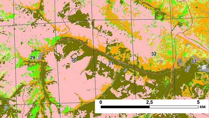
Creation of digital cartographic material at a scale of 1: 25000 (a schematic map of forests by dominant species) on the territory of the forestry of the Krasnoyarsk Territory
Work description
- With the help of visual interpretation, the boundaries of lands occupied by forests were determined.
- With the help of visual interpretation and the method of automatic classification with an accuracy corresponding to the spatial resolution of satellite images, the species composition of the forest was determined (larch, aspen, birch, fir, spruce, cedar, mixed forest, pine, open woodland).
- Made the selection of objects: hydrography (areal and polygonal), contours and quarters of settlements, lands unoccupied by woody vegetation, deforestation, clearings and cutting areas.
- Created a quarterly database in the form of a table indicating the area of the territory and indicating the breed composition.
 Classification of woody vegetation in the forest area
Results
List of materials provided to the customer:
- Digital cartographic material M 1:25 000 in JPEG format in electronic form.
- Quarterly database in EXL and Shape format, indicating the area of the territory and indicating the species composition (deciduous or coniferous trees).
- Shape-files of polygonal and linear objects, made in the course of compiling digital cartographic material.
- Coordinate system - WGS 84, projection - UTM.
Need for consultation?
Fill the form and we will contact you
