Sat-Sun: Non-working days
Customer
commercial secretProject's objective
PROJECT OBJECTIVE:
- Performance of earth surface displacement monitoring in compliance with the requirements of the Russian legislation;
- Determination of the impact field development by deformations of the earth's surface;
- Identification of hazardous geodynamic areas to ensure industrial safety, protection of subsoil, buildings and structures from the harmful effects of mining.
DATES: 2022.03 - 2022.05
CUSTOMER: trade secret.
INITIAL MATERIALS from the Customer:
- Projects geodynamic polygons.
- Contours of the license area and the contour of the field.
- Location of the pads.
- Map of faults (surface projection).
- Information on selections and injections for the previous 5 years with distribution by clusters/wells.
WHAT HAS BEEN DONE IN THIS AREA:
Over a hundred radar images (over the last 5 years) from the Sentinel-1A/B satellite the same orbit were choose and analyzed for the territory oil and gas condensate field. The use of exclusively free Sentinel-1A/B images is due to the Customer’s limited budget.
The digital terrain model of the field is the base on interferometric processing of a pair Sentinel-1B satellite radar images.
Work description
WHAT HAS BEEN DONE IN THIS AREA:
Over a hundred radar images (over the last 5 years) from the Sentinel-1A/B satellite the same orbit were choose and analyzed for the territory oil and gas condensate field. The use of exclusively free Sentinel-1A/B images is due to the Customer’s limited budget.
The digital terrain model of the field is the base on interferometric processing of a pair Sentinel-1B satellite radar images.
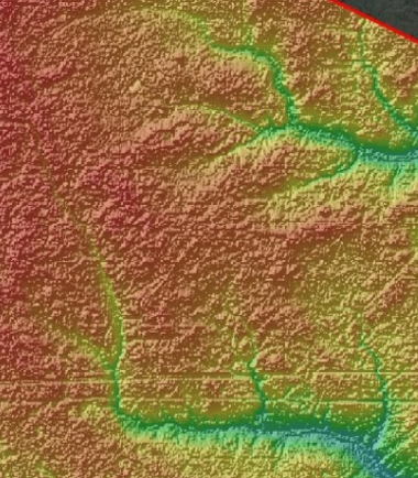
DSM within the boundaries of the licensed area (fragment).
Interferometric processing of the obtained series of radar images was perform using the method of permanent scatterers (or permanent reflectors)
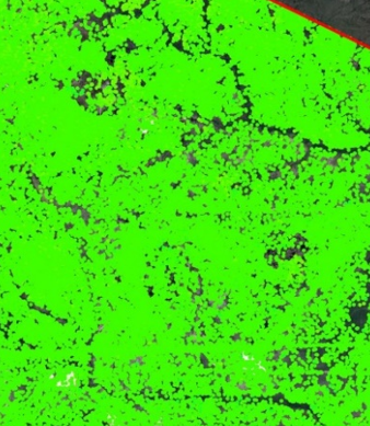
Map of the average annual displacement velocities using the results of interferometric processing of radar images
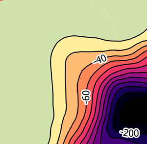
Map of average annual displacement rates (fragment)
The vertical displacements measured by the high-precision leveling method are compared with the displacements towards the satellite ( LOS ) obtained by the radar interferometry method.
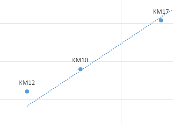
Cross plot: on the horizontal axis (values of displacements in the direction to the satellite) on the vertical axis - values of vertical displacements at the same points. Fragment.
We are proceeded to the calculation of deformations after obtaining the vertical displacements of the earth's surface.
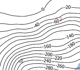
Average annual curvature of the surface of the displacement trough in the field (fragment).
Среднегодовая кривизна поверхности мульды смещения на месторождении (фрагмент).
Results
- A digital terrain the model was built.
- Potential geodynamic risks are assessed.
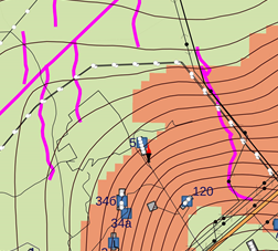
Map geodynamic dangers (fragment)
- The nature of the connection between hydrocarbon production and the sinking of the earth's surface has been analyzed.
- General conclusions are drawn:
- Significant displacements of the earth's surface, reaching 30 cm per year in the epicenter of the displacement trough are record in the field.
- From the analysis of the obtained data, it follows that there is no linear dependence of the displacements of the earth's surface on the amount of produced fluid. However, it should be note that all well pads are located within the displacement trough, which may indicate that the distribution of reservoir pressure reduction in the development targets does not occur in the areas where the well pads are concentrated in a more complex way.
- Significant displacements of the earth's surface, reaching 30 cm per year in the epicenter of the displacement trough are record in the field.
- Appropriate recommendations are made:
- Carry out additional studies involving the results of reservoir pressure measurements, data on the structural characteristics of deposits, etc.
- Conduct geomechanical modeling of the earth's surface of the field,
- Continue annual observations at the geodynamic polygon of the license area using satellite radar interferometry using the method of permanent reflectors.
- Carry out additional studies involving the results of reservoir pressure measurements, data on the structural characteristics of deposits, etc.
A KEY SUCCESS FACTOR:
Highly qualified team of specialists of INNOTER Geospatial Agency LLC, participation in the team of experienced cartographers, remote sensing specialists, geologists, geomorphologists and geophysicists using the best software.
Need for consultation?
Fill the form and we will contact you
