your companion in the world
of geospatial solutions
Operation mode:
Mon-Fri: 10:00 - 18:00
Sat-Sun: Non-working days

Customer

Private construction company

Project's objective

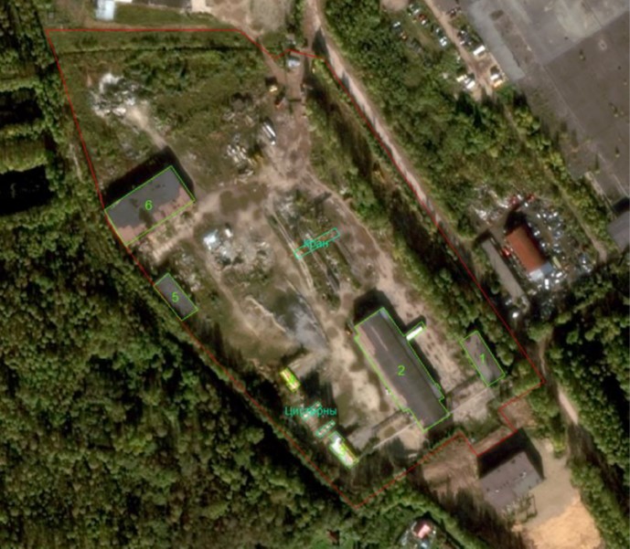
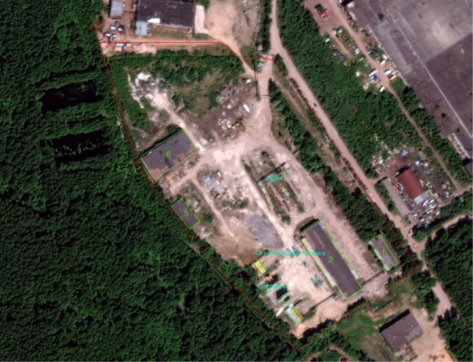
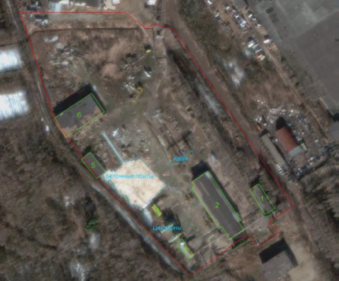
Creation of orthophotoplans based on space survey materials and conducting a forensic examination to determine the presence/absence of anthropogenic objects in the study area for different dates.

Completed work

Figure 1. Orthophotoplan of October 1, 2018 with the boundaries of the plot, buildings and other objects. Scale 1:2000
Fig. 2. Orthophotoplan of June 23, 2019 with the boundaries of the plot, buildings and other objects plotted. Scale 1:2000
Fig. 3. Orthophotoplan of March 16, 2020 with the boundaries of the plot, buildings and other objects plotted. Scale 1:2000

Work description

1) Ordering and initial processing of space survey materials for three different dates;

2) Creation of orthophotoplanes based on space survey materials;

3) Decoding of anthropogenic objects at the research site;

4) Creation and execution of a forensic examination;

5) Transfer of materials to the customer in the form of originals of the examination and copies of supporting documents and licenses.

Need for consultation?

Fill the form and we will contact you

By clicking the «Send» button, you give your consent to the processing of your personal data, in accordance with Federal Law No. 152-FZ of July 27, 2006 «On Personal Data», on the conditions and for the purposes specified in the Consent to the processing of personal data.
Request a call back
Back to page top