of geospatial solutions
Sat-Sun: Non-working days
Project's objective
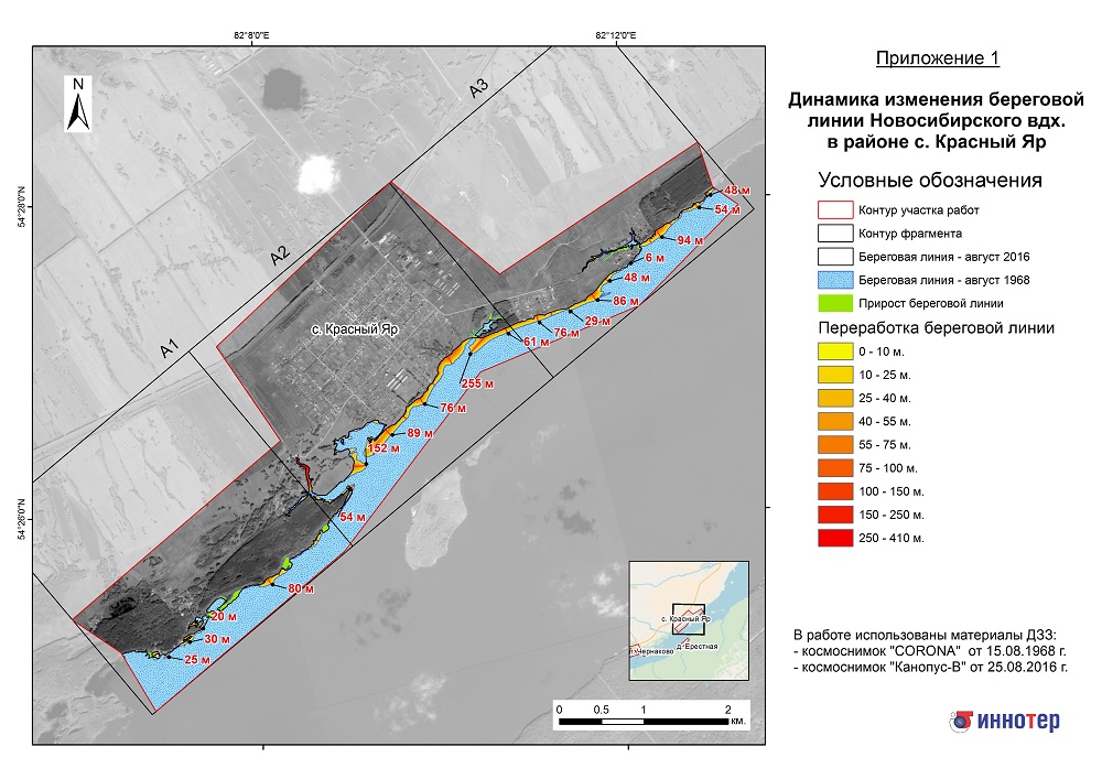
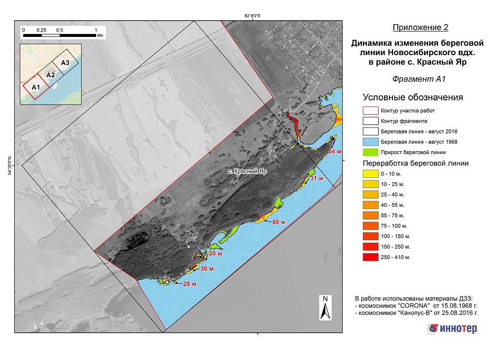
The purpose of the work performed is the study of changes in the coastline of the Novosibirsk reservoir in a number of settlements by comparing digital models of coastal contours reconstructed from satellite images.Completed work
Work description
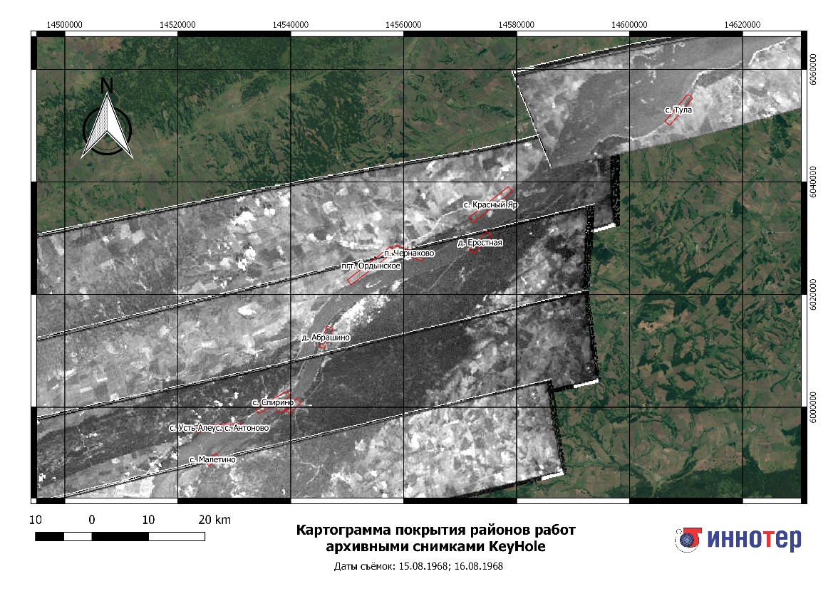
The following materials for remote sensing were used to assess changes in the coastline:
-
“CORONA” satellite images (spatial resolution 2 m) for the 1960s
-
satellite images “Kanopus-V” (spatial resolution 2.5 m) for 2016
To obtain related measurements and exclude different scales, historical satellite images underwent the procedure of geospatial coordination and transformation into a target cartographic projection.
The vectorization of the boundary of the water surface was performed in a semi-automatic mode using the ERDAS Imagine package. The vector data were recorded in a geospatial database, where they compared the water levels of the reservoir recorded at the hydrological posts on the date of the satellite image.
The coordinates of digital models of the coast on satellite images for various dates were used to estimate the dynamics of the coastline retreat and the development of a ravine-gully network with obtaining relevant statistics.
Results
The result of the execution of the contract were maps based on satellite imagery with an indication of the processing of the shores for each section, namely, the width and area of the processed shore. In addition, the accompanying documentation was compiled in the form of technical reports. This work provided relevant water management organizations with the information necessary for carrying out shore protection, flood control and other measures to control the shoreline of the reservoir and adjacent territories.Need for consultation?
Fill the form and we will contact you
Sat-Sun: Non-working days